Anchor is a village in McLean County, Illinois, United States. The population was 163 at the 2020 census. It is part of the Bloomington–Normal Metropolitan Statistical Area.
| Name: | Anchor village |
|---|---|
| LSAD Code: | 47 |
| LSAD Description: | village (suffix) |
| State: | Illinois |
| County: | McLean County |
| Elevation: | 774 ft (236 m) |
| Total Area: | 0.17 sq mi (0.44 km²) |
| Land Area: | 0.17 sq mi (0.44 km²) |
| Water Area: | 0.00 sq mi (0.00 km²) |
| Total Population: | 163 |
| Population Density: | 953.22/sq mi (368.44/km²) |
| ZIP code: | 61720 |
| Area code: | 309 |
| FIPS code: | 1701361 |
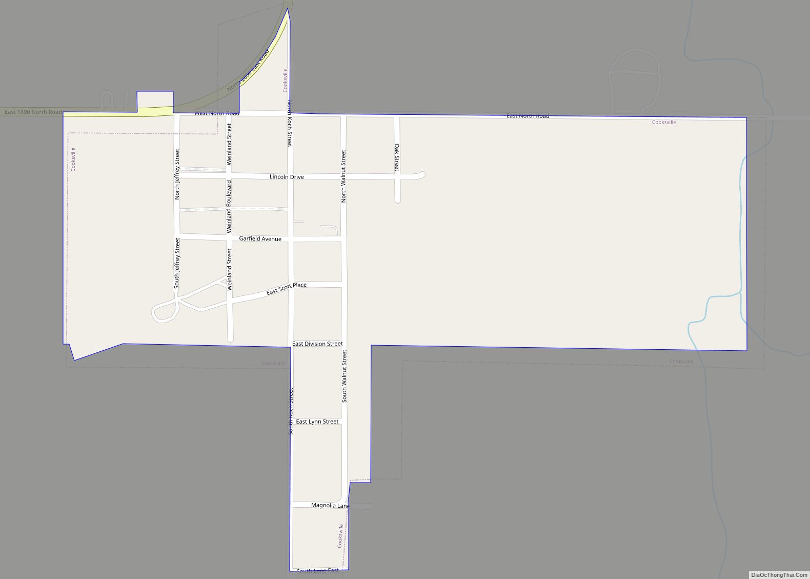
Online Interactive Map
Click on ![]() to view map in "full screen" mode.
to view map in "full screen" mode.
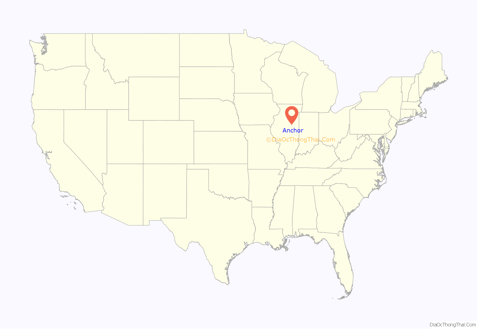
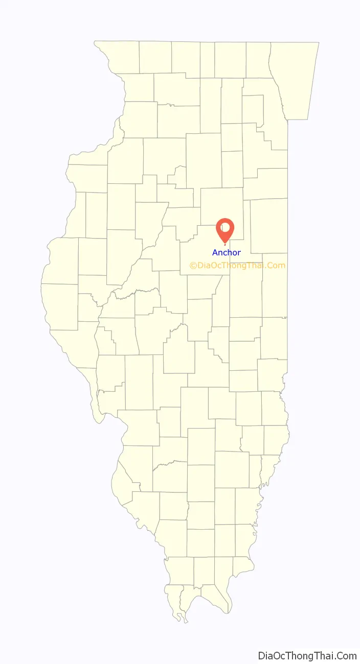
Anchor location map. Where is Anchor village?
History
Anchor was laid out on April 28, 1880, by Daniel B. Stewart (1837 – 1920). Stewart was a large landowner in the area. He was born in New York and had come to Illinois in the early 1860s. With others Stewart donated $10,000 to build ten miles of the railroad. The town was created when the Clinton Bloomington and Northeastern Railroad was built. Colfax, Cropsey and Cooksville were laid out at the same time. This railroad was soon absorbed by the Illinois Central. The first trains passed through the town on July 4, 1880. The town takes its name from Anchor Township; early McLean County historians wrote that they did not know the source of the name Anchor.
The original town of Anchor was a rectangle extending on both sides of a diagonal track with no widening of the track as was commonly found at such towns. A small triangular block north of the railroad was designated as Depot Park. The depot itself was on the north side of the tracks, and the two elevators were on the south side. Most of the early commercial buildings were on the north side of Second Street, which was north of the tracks. By 1895 there was a brickyard on the southwest edge of the town and next to it was a coal shaft, but it is not clear if the shaft was ever finished. There were also a handful of stores and the Morris Hotel.
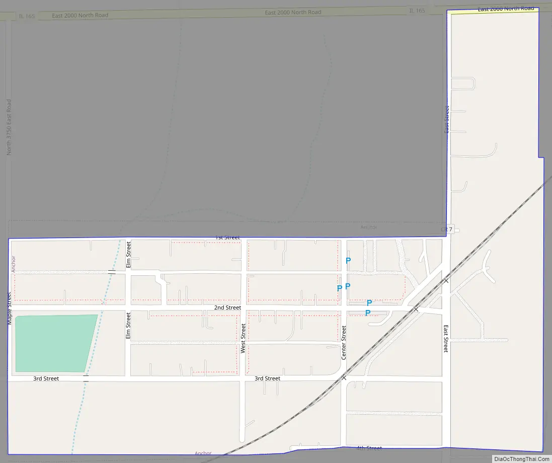
Anchor Road Map
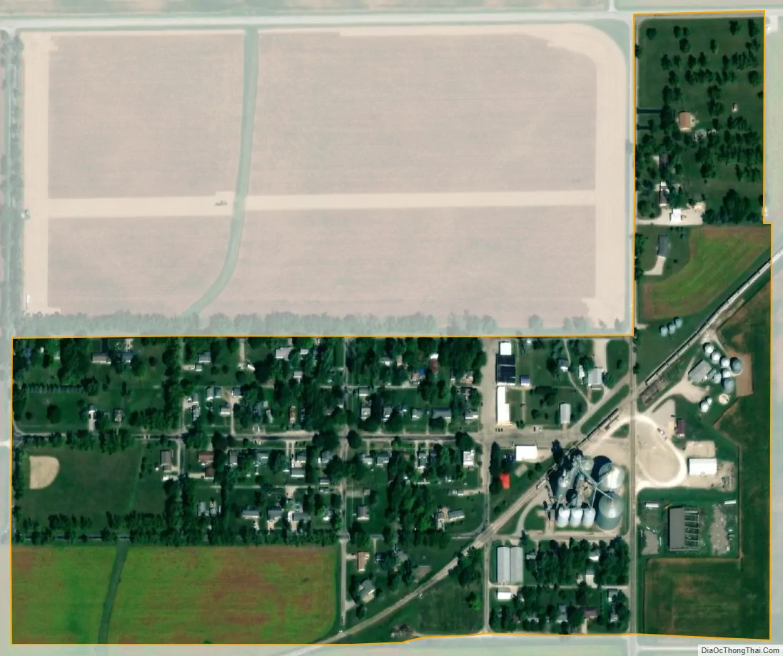
Anchor city Satellite Map
Geography
Anchor is in eastern McLean County, south of Illinois Route 165. Bloomington, the county seat, is 28 miles (45 km) to the west, and Sibley is 9 miles (14 km) to the east in Ford County.
According to the U.S. Census Bureau, Anchor has a total area of 0.17 square miles (0.44 km), all land. The village drains south toward the Mackinaw River, a west-flowing tributary of the Illinois River.
See also
Map of Illinois State and its subdivision:- Adams
- Alexander
- Bond
- Boone
- Brown
- Bureau
- Calhoun
- Carroll
- Cass
- Champaign
- Christian
- Clark
- Clay
- Clinton
- Coles
- Cook
- Crawford
- Cumberland
- De Kalb
- De Witt
- Douglas
- Dupage
- Edgar
- Edwards
- Effingham
- Fayette
- Ford
- Franklin
- Fulton
- Gallatin
- Greene
- Grundy
- Hamilton
- Hancock
- Hardin
- Henderson
- Henry
- Iroquois
- Jackson
- Jasper
- Jefferson
- Jersey
- Jo Daviess
- Johnson
- Kane
- Kankakee
- Kendall
- Knox
- La Salle
- Lake
- Lake Michigan
- Lawrence
- Lee
- Livingston
- Logan
- Macon
- Macoupin
- Madison
- Marion
- Marshall
- Mason
- Massac
- McDonough
- McHenry
- McLean
- Menard
- Mercer
- Monroe
- Montgomery
- Morgan
- Moultrie
- Ogle
- Peoria
- Perry
- Piatt
- Pike
- Pope
- Pulaski
- Putnam
- Randolph
- Richland
- Rock Island
- Saint Clair
- Saline
- Sangamon
- Schuyler
- Scott
- Shelby
- Stark
- Stephenson
- Tazewell
- Union
- Vermilion
- Wabash
- Warren
- Washington
- Wayne
- White
- Whiteside
- Will
- Williamson
- Winnebago
- Woodford
- Alabama
- Alaska
- Arizona
- Arkansas
- California
- Colorado
- Connecticut
- Delaware
- District of Columbia
- Florida
- Georgia
- Hawaii
- Idaho
- Illinois
- Indiana
- Iowa
- Kansas
- Kentucky
- Louisiana
- Maine
- Maryland
- Massachusetts
- Michigan
- Minnesota
- Mississippi
- Missouri
- Montana
- Nebraska
- Nevada
- New Hampshire
- New Jersey
- New Mexico
- New York
- North Carolina
- North Dakota
- Ohio
- Oklahoma
- Oregon
- Pennsylvania
- Rhode Island
- South Carolina
- South Dakota
- Tennessee
- Texas
- Utah
- Vermont
- Virginia
- Washington
- West Virginia
- Wisconsin
- Wyoming