Arcola is a city in Douglas County, Illinois, United States. The population was 2,927 at the 2020 census. The city was founded in 1855, when the Illinois Central Railroad was built through the county. The railroad itself was responsible for surveying, platting and founding the town.
| Name: | Arcola city |
|---|---|
| LSAD Code: | 25 |
| LSAD Description: | city (suffix) |
| State: | Illinois |
| County: | Douglas County |
| Elevation: | 676 ft (206 m) |
| Total Area: | 2.04 sq mi (5.29 km²) |
| Land Area: | 2.02 sq mi (5.24 km²) |
| Water Area: | 0.02 sq mi (0.06 km²) |
| Total Population: | 2,927 |
| Population Density: | 1,446.86/sq mi (558.67/km²) |
| Area code: | 217 |
| FIPS code: | 1701881 |
| Website: | http://www.arcolaillinois.org/ |
Online Interactive Map
Click on ![]() to view map in "full screen" mode.
to view map in "full screen" mode.
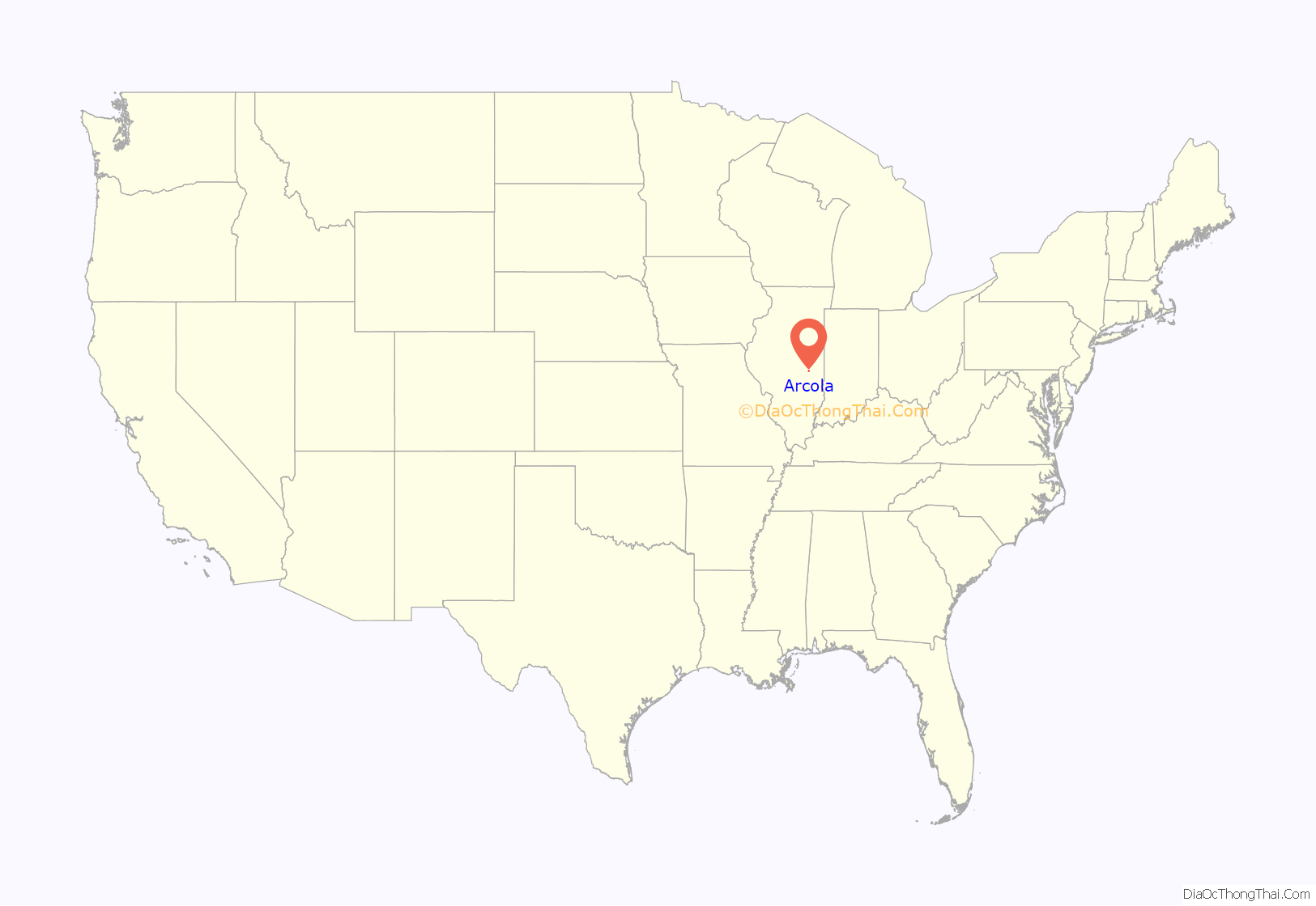
Arcola location map. Where is Arcola city?
History
Arcola was the birthplace in 1880 of John Barton Gruelle, or “Johnny” Gruelle, who created Raggedy Ann and Raggedy Andy, the loveable American dolls and storybook characters. He used artistic skills learned from his painter father, Richard Buckner Gruelle, combined with his self-taught writing skills to create stories expressing regional values and aesthetic images. His artistic granddaughter, Joni Gruelle Wannamaker, manages the Raggedy Ann Museum in Arcola.
A nationally known tourist attraction, Rockome Gardens, which featured large formal gardens, concrete fencing and architecture, and many Amish-influenced attractions was located just outside of Arcola. Rockome Gardens was built in 1937 and was operated for nearly 80 years by members of the local Old Order Amish community. In 2015, the Rockome Gardens property was sold to a local developer and has since been converted into Aikman Wildlife Adventure, a drive-through wildlife park which officially launched in 2016.
Arcola is also known for housing the world’s only Hippie Memorial, created by Bob Moomaw, who died in 1998. He worked as a railroad clerk and tax assessor, but did not like either job. As an eccentric, independent artist with strong beliefs, he was able to give voice to his feelings, passions and opinions through his art and the writing on the sides of his buildings. He created the 62-foot-long artwork starting in 1992 to say something about his life and the era during which he lived. A nearby marker gives an interpretation of his work.
In the countryside surrounding nearby Arthur, Illinois, is a prominent community of Old Order Amish, the largest in Illinois. Amish farms occupy much of the farmland west of Arcola, with the highest concentration of Amish businesses around Arthur and the unincorporated communities of Chesterville, Bourbon, and Cadwell. Arcola is home to the Illinois Amish Interpretive Center. The Old Order Amish Museum opened in 1996 and features exhibits on most aspects of Amish life, as well as an introductory video about the Central Illinois Amish. Through the museum, tours can be scheduled of the Amish countryside, Amish homes, farms, and businesses; meals in Amish homes can be scheduled as well.
Arcola is somewhat known for the Lawn Rangers, a “precision lawn mower drill team” that marches in formation with brooms and lawn mowers while wearing cowboy hats. Every year since 1980, the Lawn Rangers have marched in the Arcola Broom Corn Festival Parade. The event, held the weekend after Labor Day, honors Arcola’s position in the late 19th century as a center of broom corn production. The Grand Marshal of the Parade in 1980 was Clayton Moore, famous as the Lone Ranger, and the team was named in his honor. This unique custom was publicized by humor columnist Dave Barry, who marched with the Lawn Rangers in 1995.
Arcola is also home to Libman Company. This mop and broom making company can boast to be the only major cleaning product company that manufactures their mops and brooms in America. The nickname “broomtown” was given to Arcola because William Libman is a major employer of the city employing 600 people.
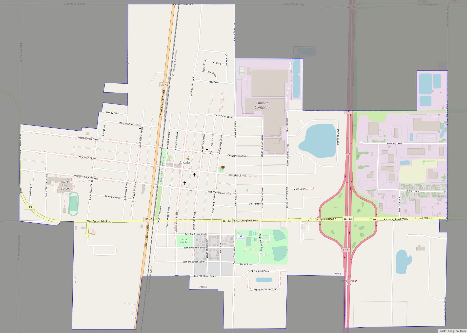
Arcola Road Map
Arcola city Satellite Map
Geography
Arcola is located at 39°41′1″N 88°18′21″W / 39.68361°N 88.30583°W / 39.68361; -88.30583 (39.683545, -88.305844). US Route 45 & Illinois Route 133 run through the town.
According to the 2021 census gazetteer files, Arcola has a total area of 2.04 square miles (5.28 km), of which 2.02 square miles (5.23 km) (or 98.97%) is land and 0.02 square miles (0.05 km) (or 1.03%) is water.
See also
Map of Illinois State and its subdivision:- Adams
- Alexander
- Bond
- Boone
- Brown
- Bureau
- Calhoun
- Carroll
- Cass
- Champaign
- Christian
- Clark
- Clay
- Clinton
- Coles
- Cook
- Crawford
- Cumberland
- De Kalb
- De Witt
- Douglas
- Dupage
- Edgar
- Edwards
- Effingham
- Fayette
- Ford
- Franklin
- Fulton
- Gallatin
- Greene
- Grundy
- Hamilton
- Hancock
- Hardin
- Henderson
- Henry
- Iroquois
- Jackson
- Jasper
- Jefferson
- Jersey
- Jo Daviess
- Johnson
- Kane
- Kankakee
- Kendall
- Knox
- La Salle
- Lake
- Lake Michigan
- Lawrence
- Lee
- Livingston
- Logan
- Macon
- Macoupin
- Madison
- Marion
- Marshall
- Mason
- Massac
- McDonough
- McHenry
- McLean
- Menard
- Mercer
- Monroe
- Montgomery
- Morgan
- Moultrie
- Ogle
- Peoria
- Perry
- Piatt
- Pike
- Pope
- Pulaski
- Putnam
- Randolph
- Richland
- Rock Island
- Saint Clair
- Saline
- Sangamon
- Schuyler
- Scott
- Shelby
- Stark
- Stephenson
- Tazewell
- Union
- Vermilion
- Wabash
- Warren
- Washington
- Wayne
- White
- Whiteside
- Will
- Williamson
- Winnebago
- Woodford
- Alabama
- Alaska
- Arizona
- Arkansas
- California
- Colorado
- Connecticut
- Delaware
- District of Columbia
- Florida
- Georgia
- Hawaii
- Idaho
- Illinois
- Indiana
- Iowa
- Kansas
- Kentucky
- Louisiana
- Maine
- Maryland
- Massachusetts
- Michigan
- Minnesota
- Mississippi
- Missouri
- Montana
- Nebraska
- Nevada
- New Hampshire
- New Jersey
- New Mexico
- New York
- North Carolina
- North Dakota
- Ohio
- Oklahoma
- Oregon
- Pennsylvania
- Rhode Island
- South Carolina
- South Dakota
- Tennessee
- Texas
- Utah
- Vermont
- Virginia
- Washington
- West Virginia
- Wisconsin
- Wyoming
