Batavia (/bəˈteɪviə/) is a city mainly in Kane County and partly in DuPage County in the U.S. state of Illinois. Located in the Chicago metropolitan area, it was founded in 1833 and is the oldest city in Kane County. Per the 2020 census, the population was 26,098.
During the latter part of the 19th century, Batavia, home to six American-style windmill manufacturing companies, became known as “The Windmill City.” Fermi National Accelerator Laboratory, a federal government-sponsored high-energy physics laboratory, where both the bottom quark and the top quark were first detected, is located just east of the city limits.
Batavia is part of a vernacular region known as the Tri-City area, along with St. Charles and Geneva, all western suburbs of similar size and relative socioeconomic condition.
| Name: | Batavia city |
|---|---|
| LSAD Code: | 25 |
| LSAD Description: | city (suffix) |
| State: | Illinois |
| County: | DuPage County, Kane County |
| Incorporated: | July 27, 1872 |
| Elevation: | 666 ft (203 m) |
| Total Area: | 10.84 sq mi (28.06 km²) |
| Land Area: | 10.65 sq mi (27.58 km²) |
| Water Area: | 0.19 sq mi (0.48 km²) |
| Total Population: | 26,098 |
| Population Density: | 2,450.52/sq mi (946.15/km²) |
| FIPS code: | 1704078 |
| GNISfeature ID: | 2394077 |
| Website: | www.cityofbatavia.net |
Online Interactive Map
Click on ![]() to view map in "full screen" mode.
to view map in "full screen" mode.
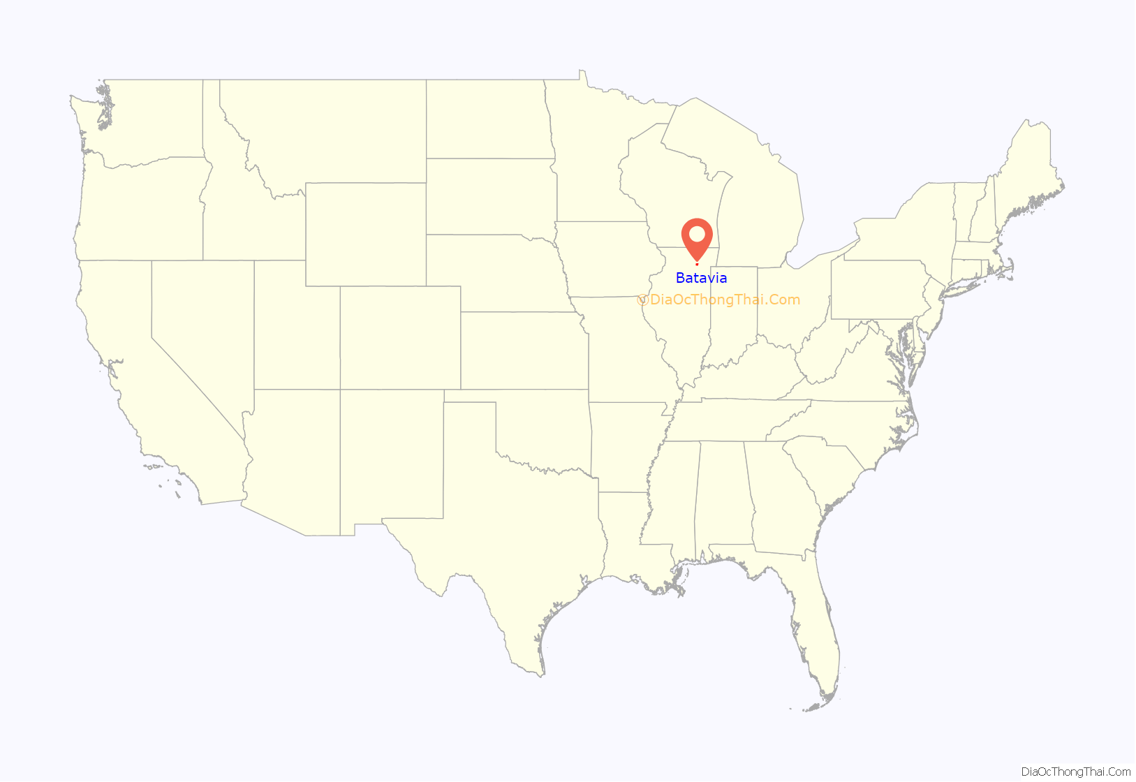
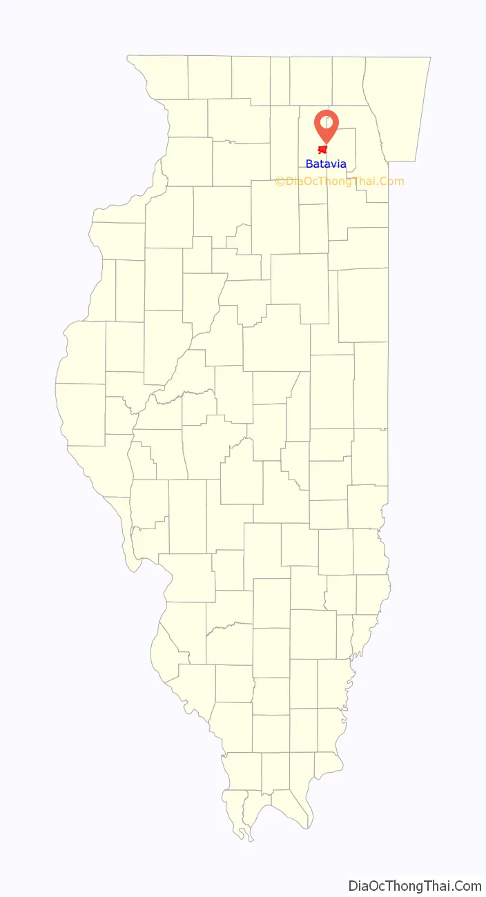
Batavia location map. Where is Batavia city?
History
Batavia was settled in 1833 by Christopher Payne and his family. Originally called Big Woods for the wild growth throughout the settlement, the town was renamed by local judge and former Congressman Isaac Wilson in 1840 after his former home of Batavia, New York. Because Judge Wilson owned the majority of the town, he was given permission to rename it.
Batavia’s settlement was delayed one year by the Black Hawk War, in which Abraham Lincoln was a citizen soldier, and Zachary Taylor and Jefferson Davis were Army officers. Although there is no direct evidence that Lincoln, Taylor, or Davis visited the future site of Batavia, there are writings by Lincoln that refer to “Head of the Big Woods,” Batavia’s original name. The city was incorporated on July 27, 1872.
After the death of her husband, Mary Todd Lincoln was an involuntary resident of the Batavia Institute on May 20, 1875. At the time the institute was known as Bellevue Place, a sanitarium for women. Mrs. Lincoln was released four months later on September 11, 1875. In the late 19th century, Batavia was a major manufacturer of the Conestoga wagons used in the country’s westward expansion. Into the early 20th century, most of the windmill operated waterpumps in use by America’s farms were made at one of three windmill manufacturing companies in Batavia. Many of the limestone buildings of these factories remain in use as government and commercial offices, and storefronts. The Aurora Elgin and Chicago Railway constructed a power plant in southern Batavia and added a branch to the city in 1902. The Campana Factory was built in 1936 to manufacture cosmetics for The Campana Company, particularly Italian Balm, the nation’s best-selling hand lotion at the time.
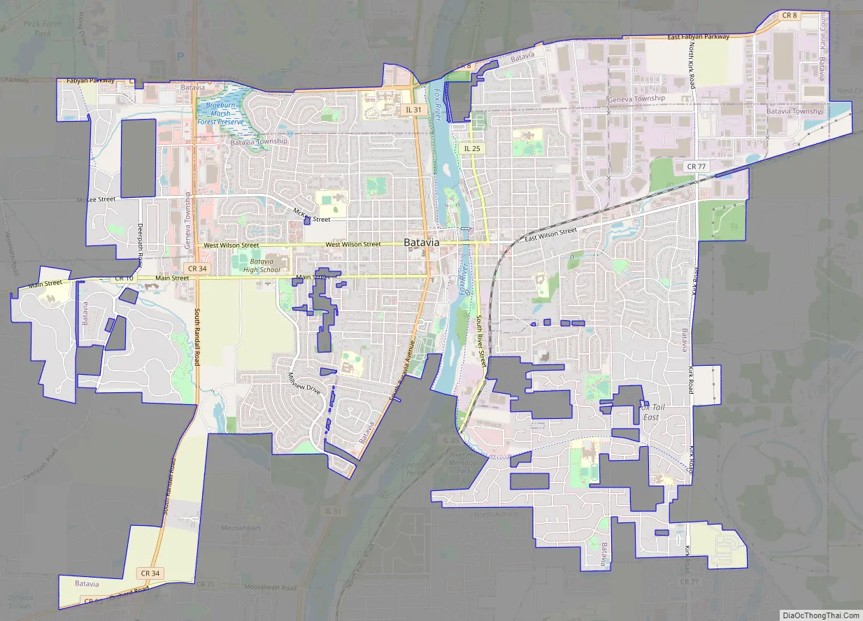
Batavia Road Map
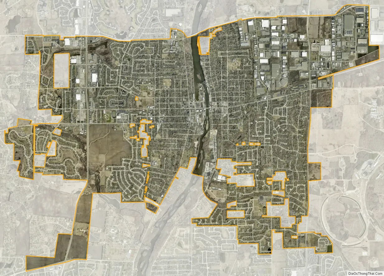
Batavia city Satellite Map
Geography
Batavia is located on the Fox River at 41°50′56″N 88°18′30″W / 41.84889°N 88.30833°W / 41.84889; -88.30833 (41.8488583, −88.3084400).
According to the 2021 census gazetteer files, Batavia has a total area of 10.84 square miles (28.08 km), of which 10.65 square miles (27.58 km) (or 98.28%) is land and 0.19 square miles (0.49 km) (or 1.72%) is water.
See also
Map of Illinois State and its subdivision:- Adams
- Alexander
- Bond
- Boone
- Brown
- Bureau
- Calhoun
- Carroll
- Cass
- Champaign
- Christian
- Clark
- Clay
- Clinton
- Coles
- Cook
- Crawford
- Cumberland
- De Kalb
- De Witt
- Douglas
- Dupage
- Edgar
- Edwards
- Effingham
- Fayette
- Ford
- Franklin
- Fulton
- Gallatin
- Greene
- Grundy
- Hamilton
- Hancock
- Hardin
- Henderson
- Henry
- Iroquois
- Jackson
- Jasper
- Jefferson
- Jersey
- Jo Daviess
- Johnson
- Kane
- Kankakee
- Kendall
- Knox
- La Salle
- Lake
- Lake Michigan
- Lawrence
- Lee
- Livingston
- Logan
- Macon
- Macoupin
- Madison
- Marion
- Marshall
- Mason
- Massac
- McDonough
- McHenry
- McLean
- Menard
- Mercer
- Monroe
- Montgomery
- Morgan
- Moultrie
- Ogle
- Peoria
- Perry
- Piatt
- Pike
- Pope
- Pulaski
- Putnam
- Randolph
- Richland
- Rock Island
- Saint Clair
- Saline
- Sangamon
- Schuyler
- Scott
- Shelby
- Stark
- Stephenson
- Tazewell
- Union
- Vermilion
- Wabash
- Warren
- Washington
- Wayne
- White
- Whiteside
- Will
- Williamson
- Winnebago
- Woodford
- Alabama
- Alaska
- Arizona
- Arkansas
- California
- Colorado
- Connecticut
- Delaware
- District of Columbia
- Florida
- Georgia
- Hawaii
- Idaho
- Illinois
- Indiana
- Iowa
- Kansas
- Kentucky
- Louisiana
- Maine
- Maryland
- Massachusetts
- Michigan
- Minnesota
- Mississippi
- Missouri
- Montana
- Nebraska
- Nevada
- New Hampshire
- New Jersey
- New Mexico
- New York
- North Carolina
- North Dakota
- Ohio
- Oklahoma
- Oregon
- Pennsylvania
- Rhode Island
- South Carolina
- South Dakota
- Tennessee
- Texas
- Utah
- Vermont
- Virginia
- Washington
- West Virginia
- Wisconsin
- Wyoming


