Beaverville (formerly St. Marie) is a village in Beaverville Township, Iroquois County, Illinois, United States. The population was 362 at the 2010 census.
| Name: | Beaverville village |
|---|---|
| LSAD Code: | 47 |
| LSAD Description: | village (suffix) |
| State: | Illinois |
| County: | Iroquois County |
| Elevation: | 676 ft (206 m) |
| Total Area: | 0.28 sq mi (0.72 km²) |
| Land Area: | 0.28 sq mi (0.71 km²) |
| Water Area: | 0.00 sq mi (0.01 km²) |
| Total Population: | 306 |
| Population Density: | 1,112.73/sq mi (429.33/km²) |
| ZIP code: | 60912 |
| Area code: | 815 |
| FIPS code: | 1704507 |
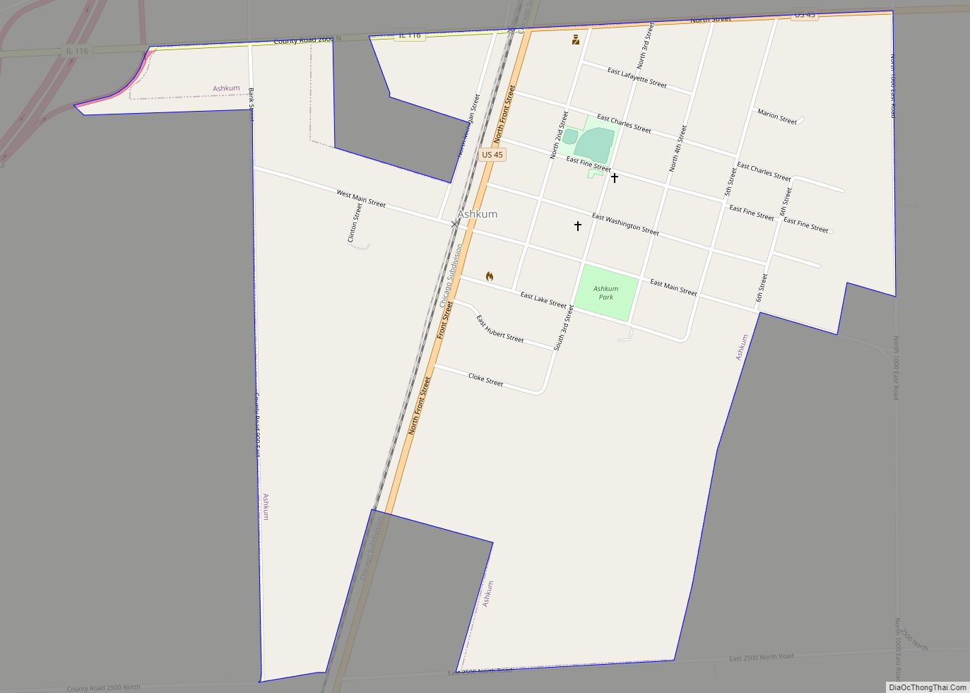
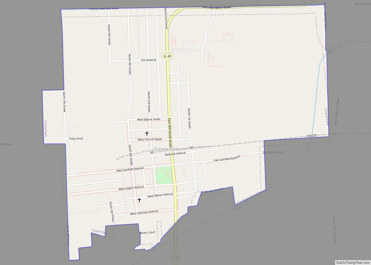
Online Interactive Map
Click on ![]() to view map in "full screen" mode.
to view map in "full screen" mode.
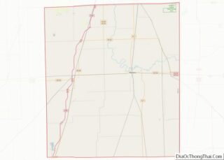
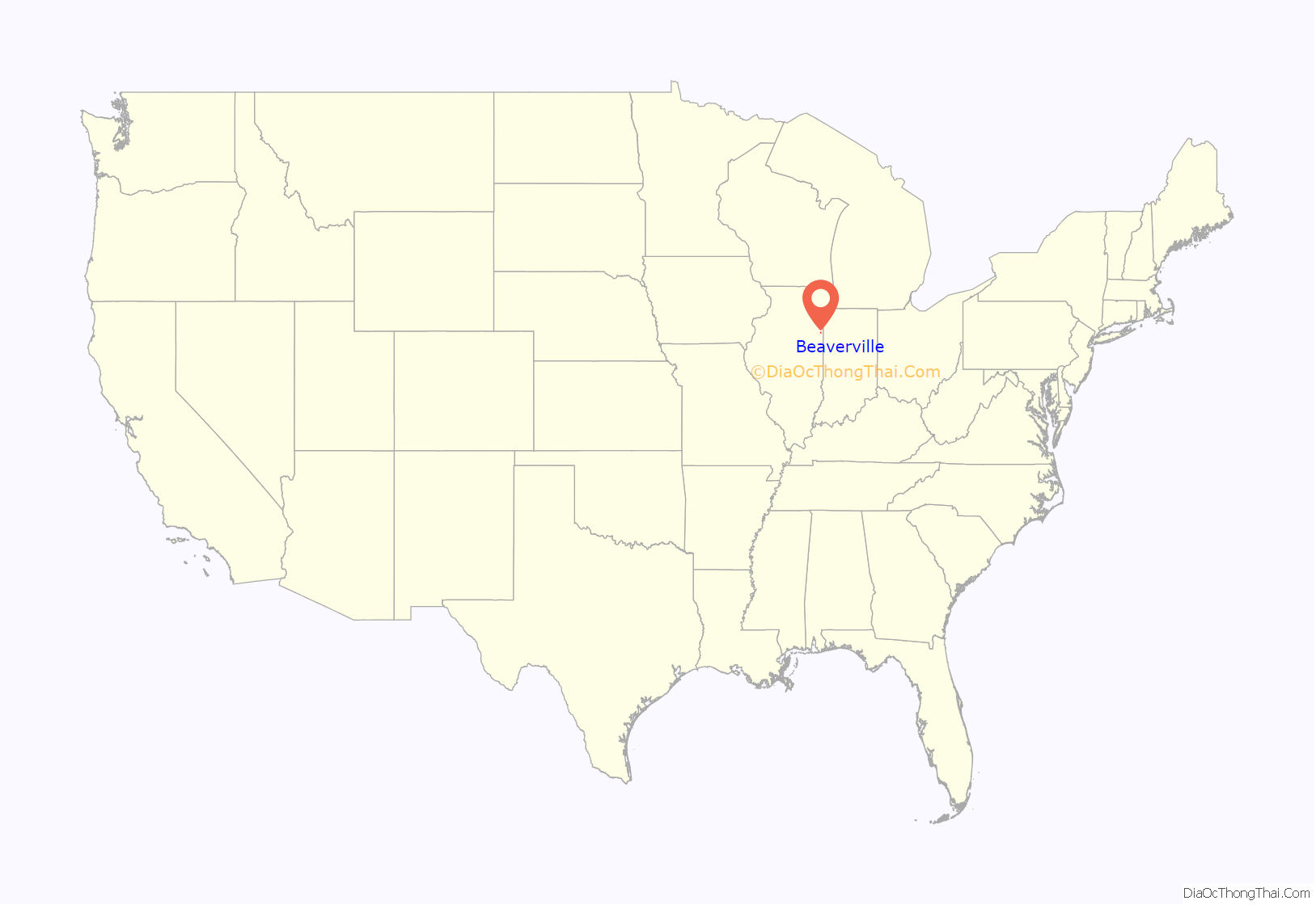
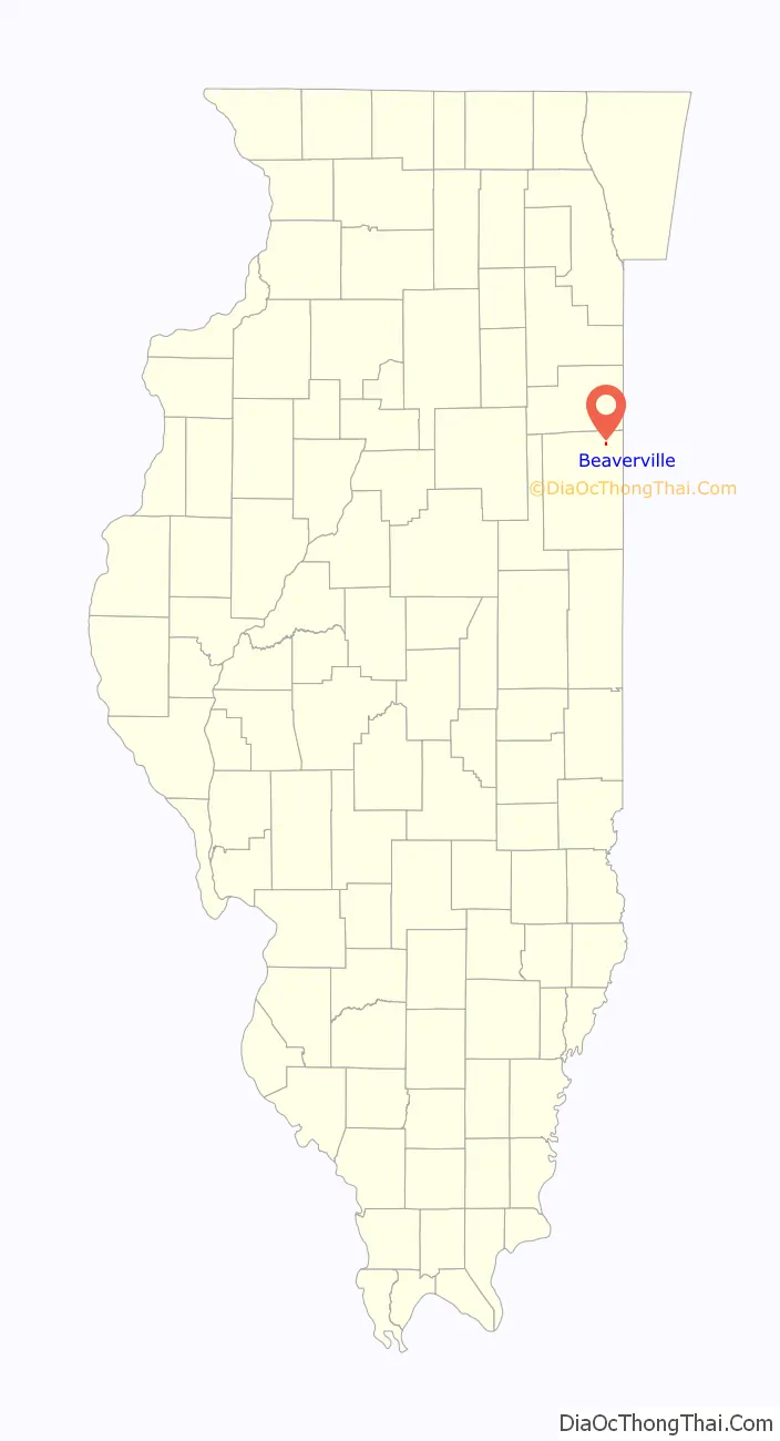
Beaverville location map. Where is Beaverville village?
History
In 1851, 32 families from the area of Montreal, Canada, mostly newlywed or single, came up the St. Lawrence River in search of farmland on the prairie. They traveled across the Great Lakes and stopped at Fort Dearborn (Chicago). Then they pushed south through the swamps and frontier until they reached the area that is now Beaverville. The settlement, named “St. Marie,” was led by Francis Besse, who became a general merchant. The group consisted of families with names such as Fortin, Dionne, Boudreau, Benoit, Nourie, Lafond, Lemna, and at least six Arseneau families. They settled here because of the good land and the many creeks.
In 1905, the village name was changed to “Beaverville”, when the village founders realized that there was another town in Illinois named St. Mary. The new name was inspired by the profusion of beavers in the area in the early 19th century, when Beaver Lake right across the border in Indiana still existed.
Beaverville Road Map
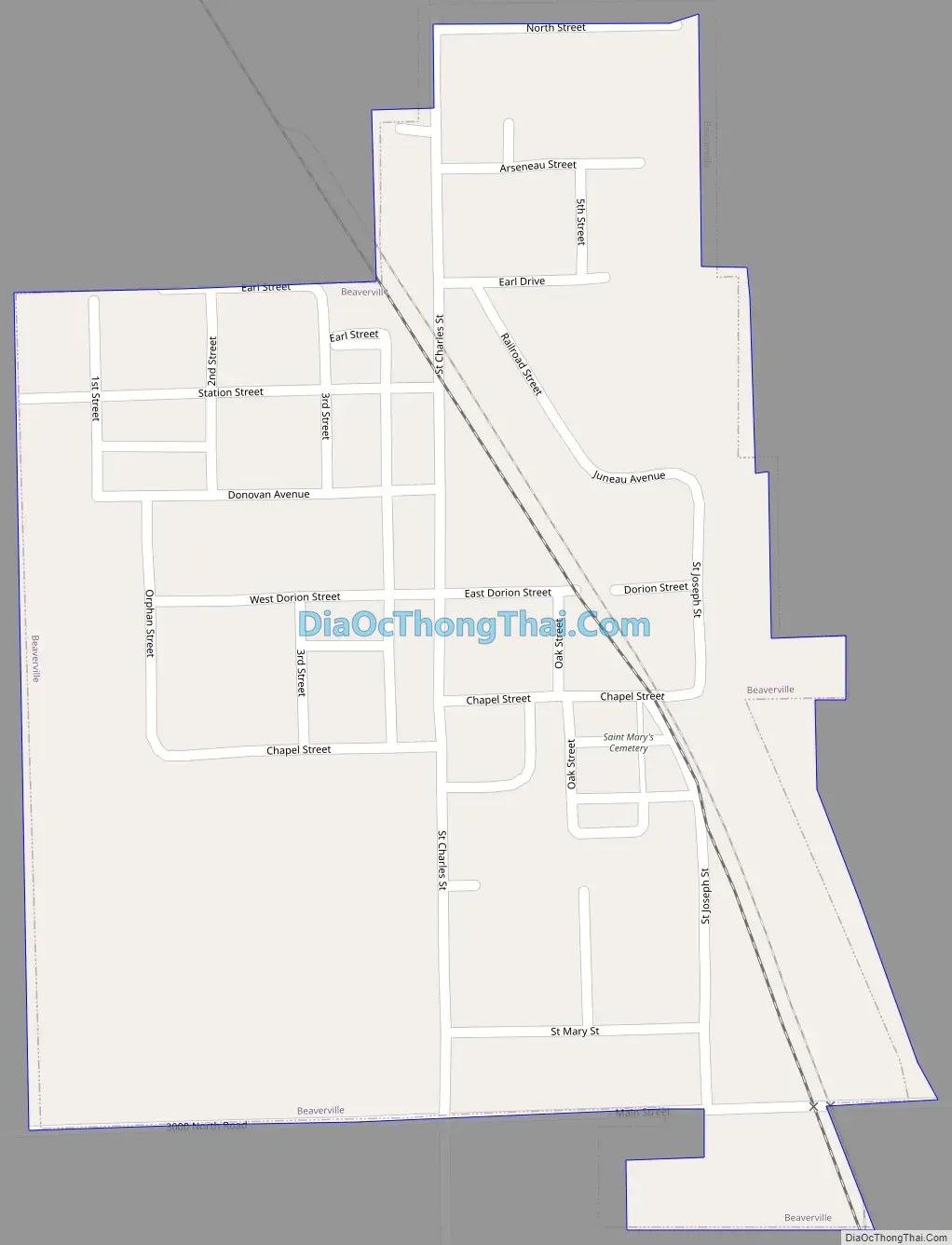
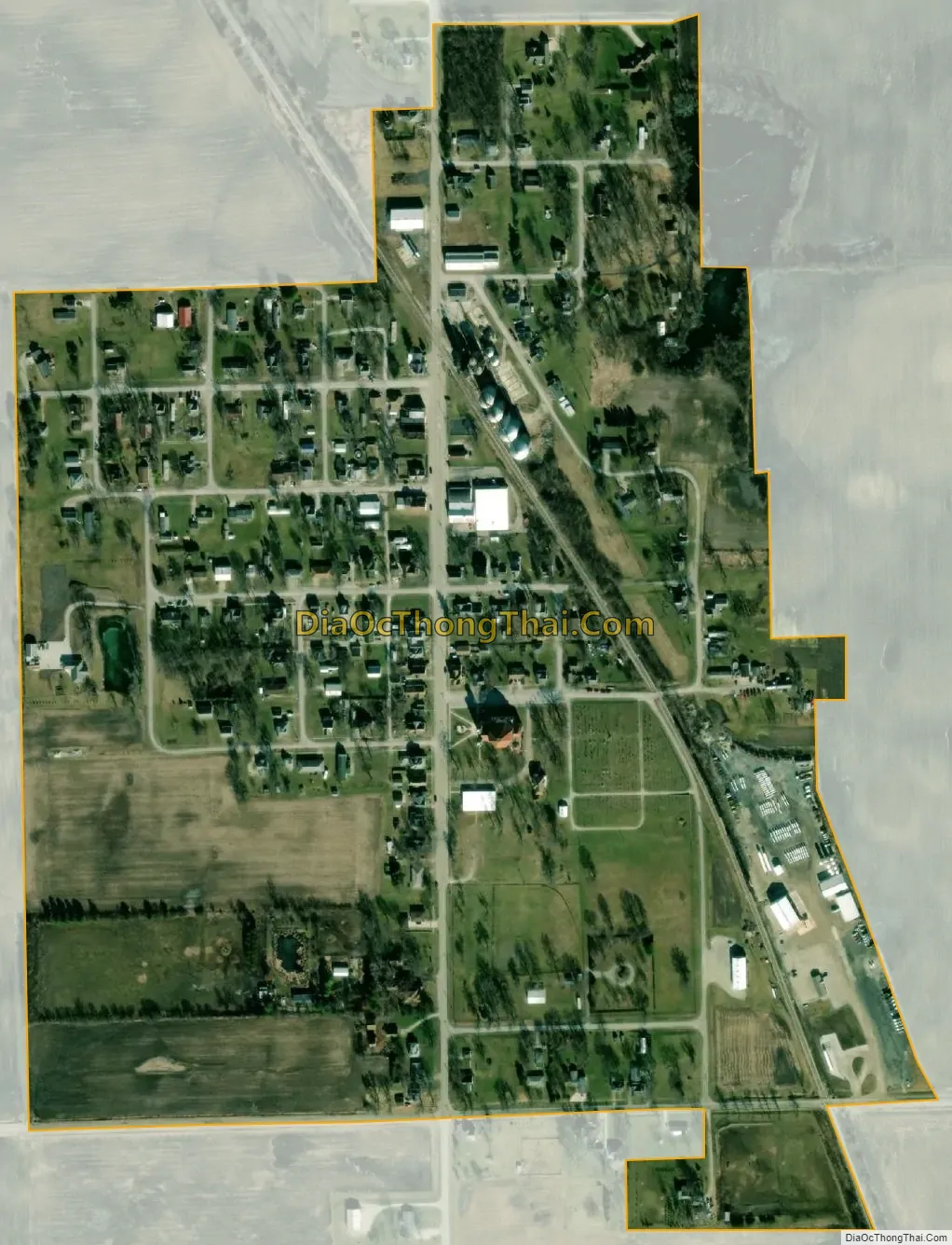
Beaverville city Satellite Map
Geography
Beaverville is located in northeastern Iroquois County at 40°57′16″N 87°39′14″W / 40.95444°N 87.65389°W / 40.95444; -87.65389 (40.954567, -87.654016). It is 16 miles (26 km) northeast of Watseka, the county seat; 20 miles (32 km) southeast of Kankakee; and 7 miles (11 km) west of the Indiana border. Under Quick Facts, above, in the map of Iroquois County, Beaverville is the northeastern-most town that is colored red, not the northwestern town that (for some reason) is encircled in red.
According to the 2010 census, Beaverville has a total area of 0.265 square miles (0.69 km), of which 0.26 square miles (0.67 km) (or 98.11%) is land and 0.005 square miles (0.01 km) (or 1.89%) is water.
See also
Map of Illinois State and its subdivision:- Adams
- Alexander
- Bond
- Boone
- Brown
- Bureau
- Calhoun
- Carroll
- Cass
- Champaign
- Christian
- Clark
- Clay
- Clinton
- Coles
- Cook
- Crawford
- Cumberland
- De Kalb
- De Witt
- Douglas
- Dupage
- Edgar
- Edwards
- Effingham
- Fayette
- Ford
- Franklin
- Fulton
- Gallatin
- Greene
- Grundy
- Hamilton
- Hancock
- Hardin
- Henderson
- Henry
- Iroquois
- Jackson
- Jasper
- Jefferson
- Jersey
- Jo Daviess
- Johnson
- Kane
- Kankakee
- Kendall
- Knox
- La Salle
- Lake
- Lake Michigan
- Lawrence
- Lee
- Livingston
- Logan
- Macon
- Macoupin
- Madison
- Marion
- Marshall
- Mason
- Massac
- McDonough
- McHenry
- McLean
- Menard
- Mercer
- Monroe
- Montgomery
- Morgan
- Moultrie
- Ogle
- Peoria
- Perry
- Piatt
- Pike
- Pope
- Pulaski
- Putnam
- Randolph
- Richland
- Rock Island
- Saint Clair
- Saline
- Sangamon
- Schuyler
- Scott
- Shelby
- Stark
- Stephenson
- Tazewell
- Union
- Vermilion
- Wabash
- Warren
- Washington
- Wayne
- White
- Whiteside
- Will
- Williamson
- Winnebago
- Woodford
- Alabama
- Alaska
- Arizona
- Arkansas
- California
- Colorado
- Connecticut
- Delaware
- District of Columbia
- Florida
- Georgia
- Hawaii
- Idaho
- Illinois
- Indiana
- Iowa
- Kansas
- Kentucky
- Louisiana
- Maine
- Maryland
- Massachusetts
- Michigan
- Minnesota
- Mississippi
- Missouri
- Montana
- Nebraska
- Nevada
- New Hampshire
- New Jersey
- New Mexico
- New York
- North Carolina
- North Dakota
- Ohio
- Oklahoma
- Oregon
- Pennsylvania
- Rhode Island
- South Carolina
- South Dakota
- Tennessee
- Texas
- Utah
- Vermont
- Virginia
- Washington
- West Virginia
- Wisconsin
- Wyoming