Bensenville is a village located near O’Hare International Airport in DuPage County, Illinois, with a portion of the town in Cook County. As of the 2020 census, the village population was 18,813.
First known as Tioga, it was formally established as Bensenville in 1873 along the Milwaukee Road (now Canadian Pacific) right-of-way. The community is named after Bensen, Germany, a village in the municipality of Sudwalde. A post office was established in 1873, but because there was an existing “Benson”, the suffix “ville” was added.
The Edge Ice Arena is located in Bensenville, former home of the Chicago Steel junior ice hockey team.
The Churchville School in Bensenville is listed on the National Register of Historic Places.
| Name: | Bensenville village |
|---|---|
| LSAD Code: | 47 |
| LSAD Description: | village (suffix) |
| State: | Illinois |
| County: | Cook County, DuPage County |
| Elevation: | 679 ft (207 m) |
| Total Area: | 5.58 sq mi (14.46 km²) |
| Land Area: | 5.53 sq mi (14.33 km²) |
| Water Area: | 0.05 sq mi (0.13 km²) |
| Total Population: | 18,813 |
| Population Density: | 3,401.37/sq mi (1,313.23/km²) |
| ZIP code: | 60106 |
| Area code: | 630 |
| FIPS code: | 1705248 |
| Website: | www.bensenville.il.us |
Online Interactive Map
Click on ![]() to view map in "full screen" mode.
to view map in "full screen" mode.
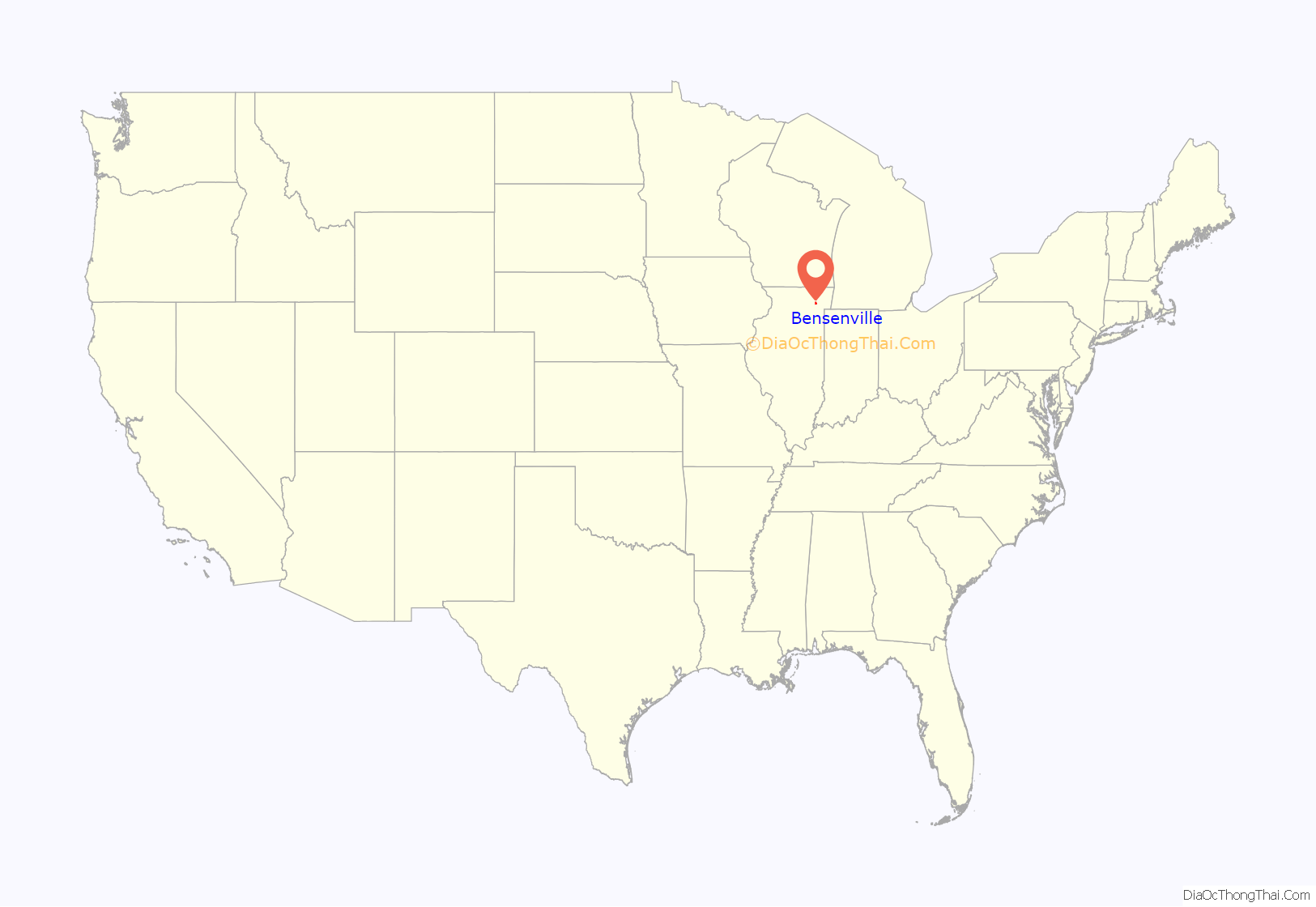
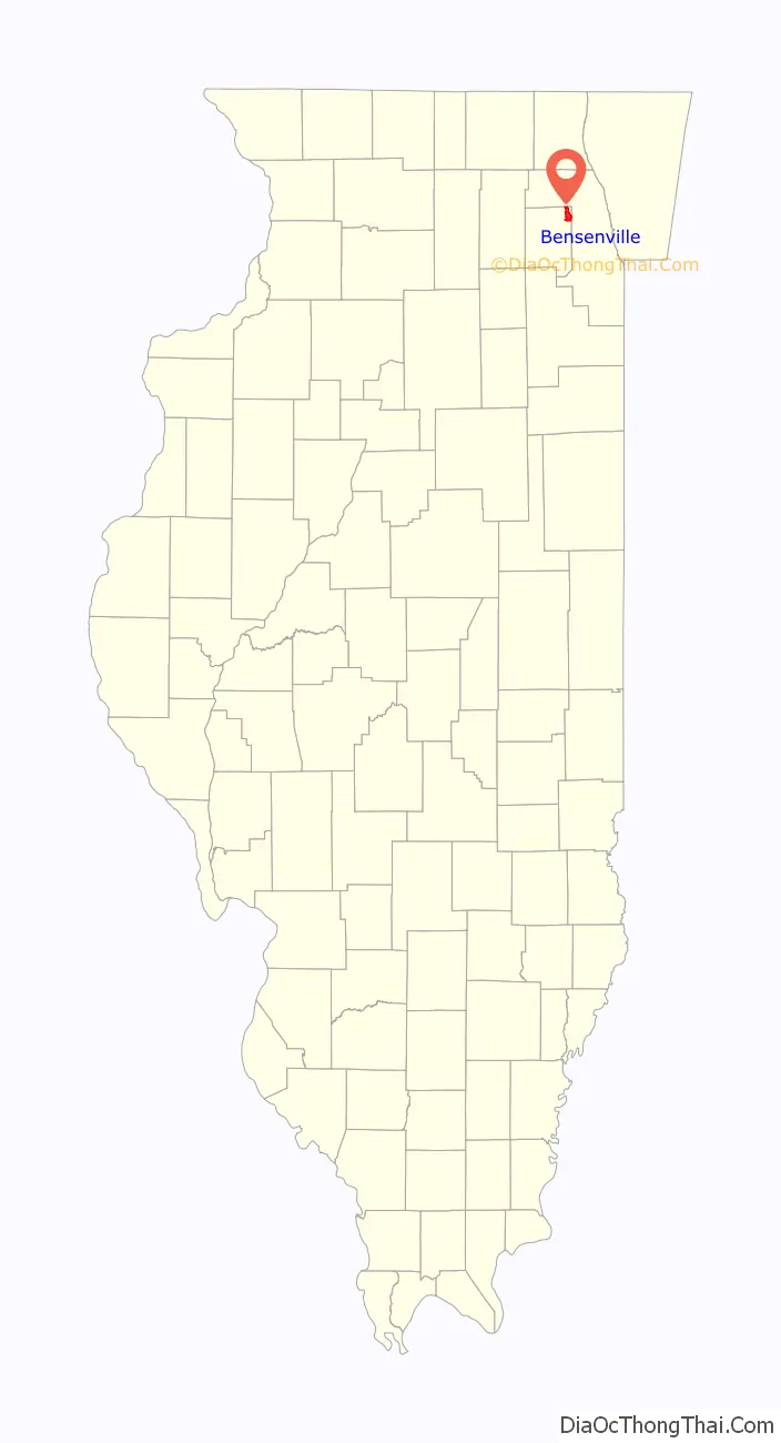
Bensenville location map. Where is Bensenville village?
History
The Barker-Karpis Gang used a house on May Street to hide kidnap victims William Hamm, Jr in 1933 and Edward Bremer in 1934, who they had kidnapped from Saint Paul, Minnesota.
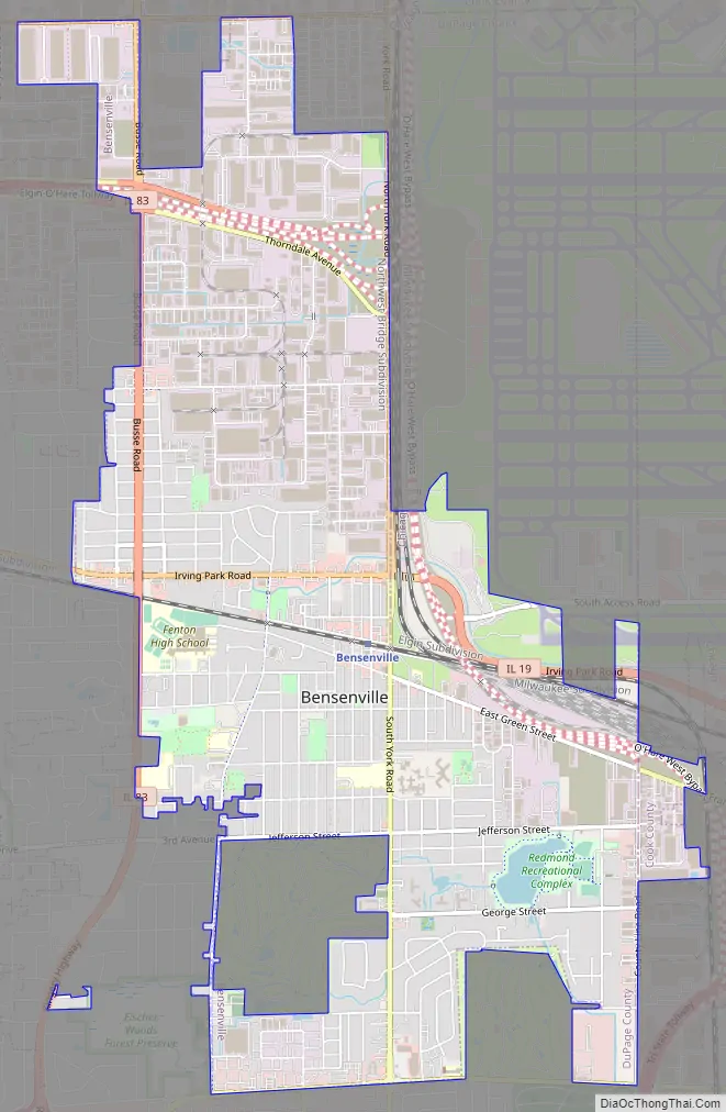
Bensenville Road Map
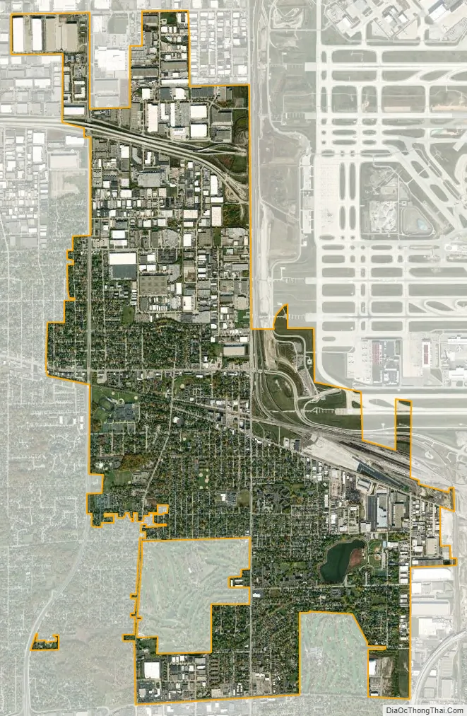
Bensenville city Satellite Map
Geography
According to the 2021 census gazetteer files, Bensenville has a total area of 5.58 square miles (14.45 km), of which 5.53 square miles (14.32 km) (or 99.09%) is land and 0.05 square miles (0.13 km) (or 0.91%) is water.
See also
Map of Illinois State and its subdivision:- Adams
- Alexander
- Bond
- Boone
- Brown
- Bureau
- Calhoun
- Carroll
- Cass
- Champaign
- Christian
- Clark
- Clay
- Clinton
- Coles
- Cook
- Crawford
- Cumberland
- De Kalb
- De Witt
- Douglas
- Dupage
- Edgar
- Edwards
- Effingham
- Fayette
- Ford
- Franklin
- Fulton
- Gallatin
- Greene
- Grundy
- Hamilton
- Hancock
- Hardin
- Henderson
- Henry
- Iroquois
- Jackson
- Jasper
- Jefferson
- Jersey
- Jo Daviess
- Johnson
- Kane
- Kankakee
- Kendall
- Knox
- La Salle
- Lake
- Lake Michigan
- Lawrence
- Lee
- Livingston
- Logan
- Macon
- Macoupin
- Madison
- Marion
- Marshall
- Mason
- Massac
- McDonough
- McHenry
- McLean
- Menard
- Mercer
- Monroe
- Montgomery
- Morgan
- Moultrie
- Ogle
- Peoria
- Perry
- Piatt
- Pike
- Pope
- Pulaski
- Putnam
- Randolph
- Richland
- Rock Island
- Saint Clair
- Saline
- Sangamon
- Schuyler
- Scott
- Shelby
- Stark
- Stephenson
- Tazewell
- Union
- Vermilion
- Wabash
- Warren
- Washington
- Wayne
- White
- Whiteside
- Will
- Williamson
- Winnebago
- Woodford
- Alabama
- Alaska
- Arizona
- Arkansas
- California
- Colorado
- Connecticut
- Delaware
- District of Columbia
- Florida
- Georgia
- Hawaii
- Idaho
- Illinois
- Indiana
- Iowa
- Kansas
- Kentucky
- Louisiana
- Maine
- Maryland
- Massachusetts
- Michigan
- Minnesota
- Mississippi
- Missouri
- Montana
- Nebraska
- Nevada
- New Hampshire
- New Jersey
- New Mexico
- New York
- North Carolina
- North Dakota
- Ohio
- Oklahoma
- Oregon
- Pennsylvania
- Rhode Island
- South Carolina
- South Dakota
- Tennessee
- Texas
- Utah
- Vermont
- Virginia
- Washington
- West Virginia
- Wisconsin
- Wyoming


