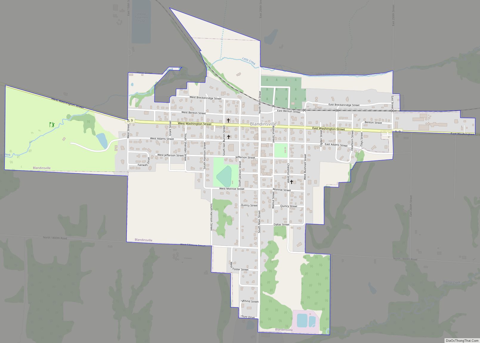
Blandinsville is a village in McDonough County, Illinois, United States. The population was 569 at the 2020 census, down from 651 in 2010.
| Name: | Blandinsville village |
|---|---|
| LSAD Code: | 47 |
| LSAD Description: | village (suffix) |
| State: | Illinois |
| County: | McDonough County |
| Elevation: | 729 ft (222 m) |
| Total Area: | 0.88 sq mi (2.27 km²) |
| Land Area: | 0.88 sq mi (2.27 km²) |
| Water Area: | 0.00 sq mi (0.00 km²) |
| Total Population: | 569 |
| Population Density: | 650.29/sq mi (251.03/km²) |
| ZIP code: | 61420 |
| Area code: | 309 |
| FIPS code: | 1706470 |
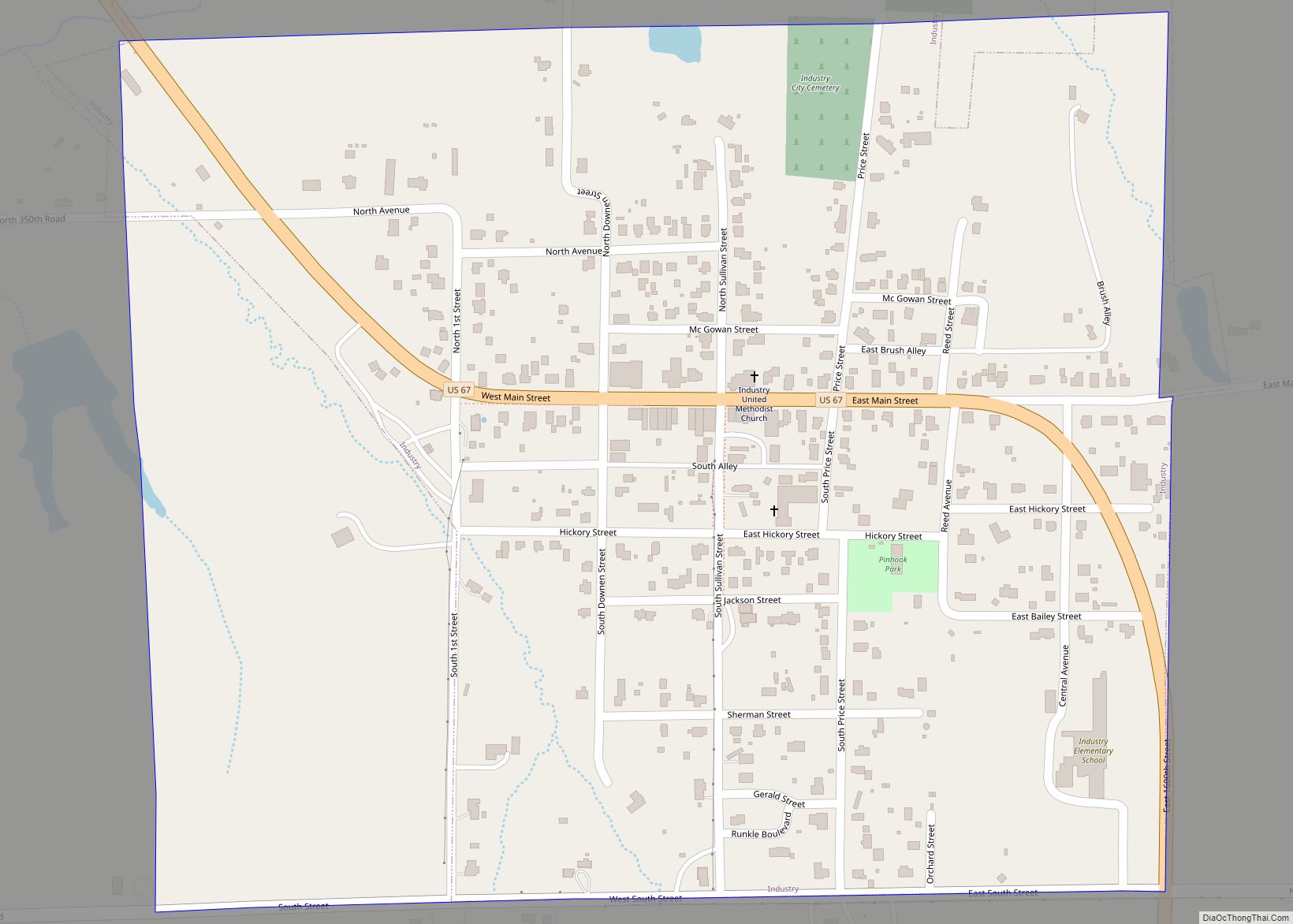
Online Interactive Map
Click on ![]() to view map in "full screen" mode.
to view map in "full screen" mode.
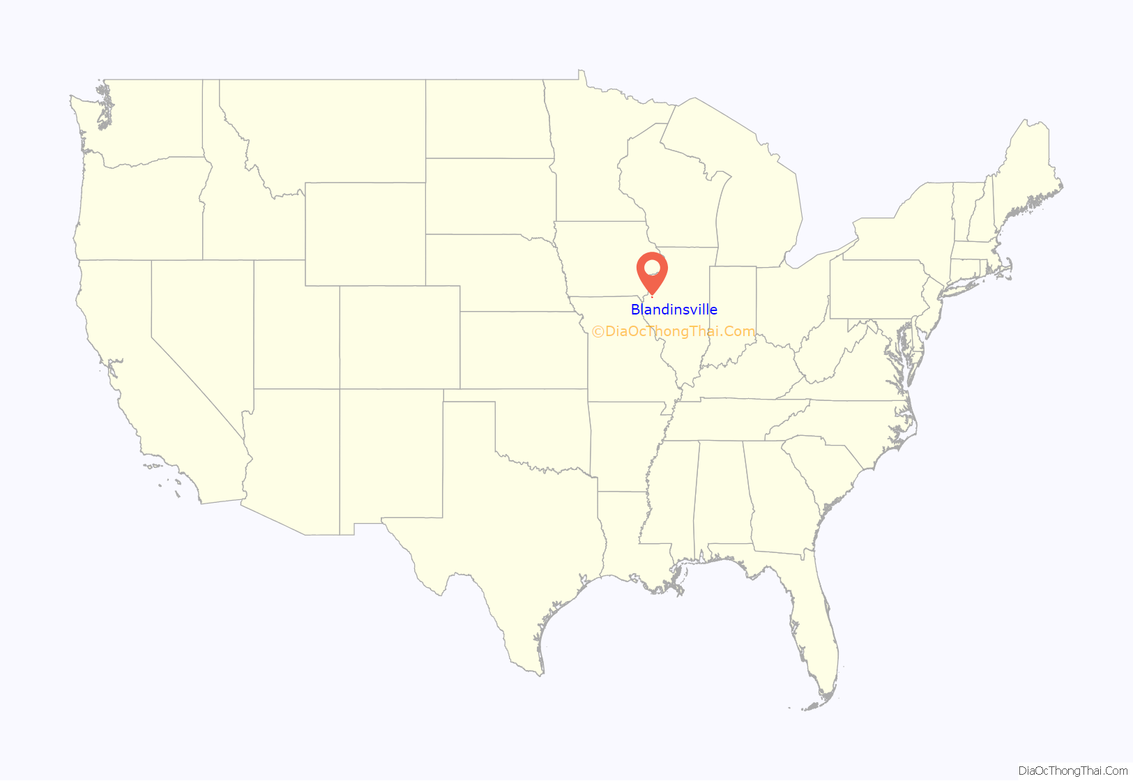
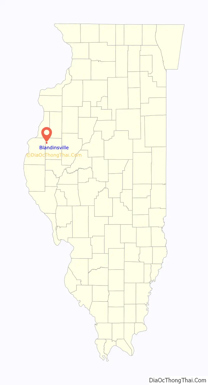
Blandinsville location map. Where is Blandinsville village?
History
The town is named for Joseph L. Blandin, owner of the first general store. In 1842, the town was platted on a tract known as Job’s Settlement, named after early settlers William and Ira Job. A post office was established in 1843. The Frank Hicks House in Blandinsville was constructed by architect George Franklin Barber in 1895.
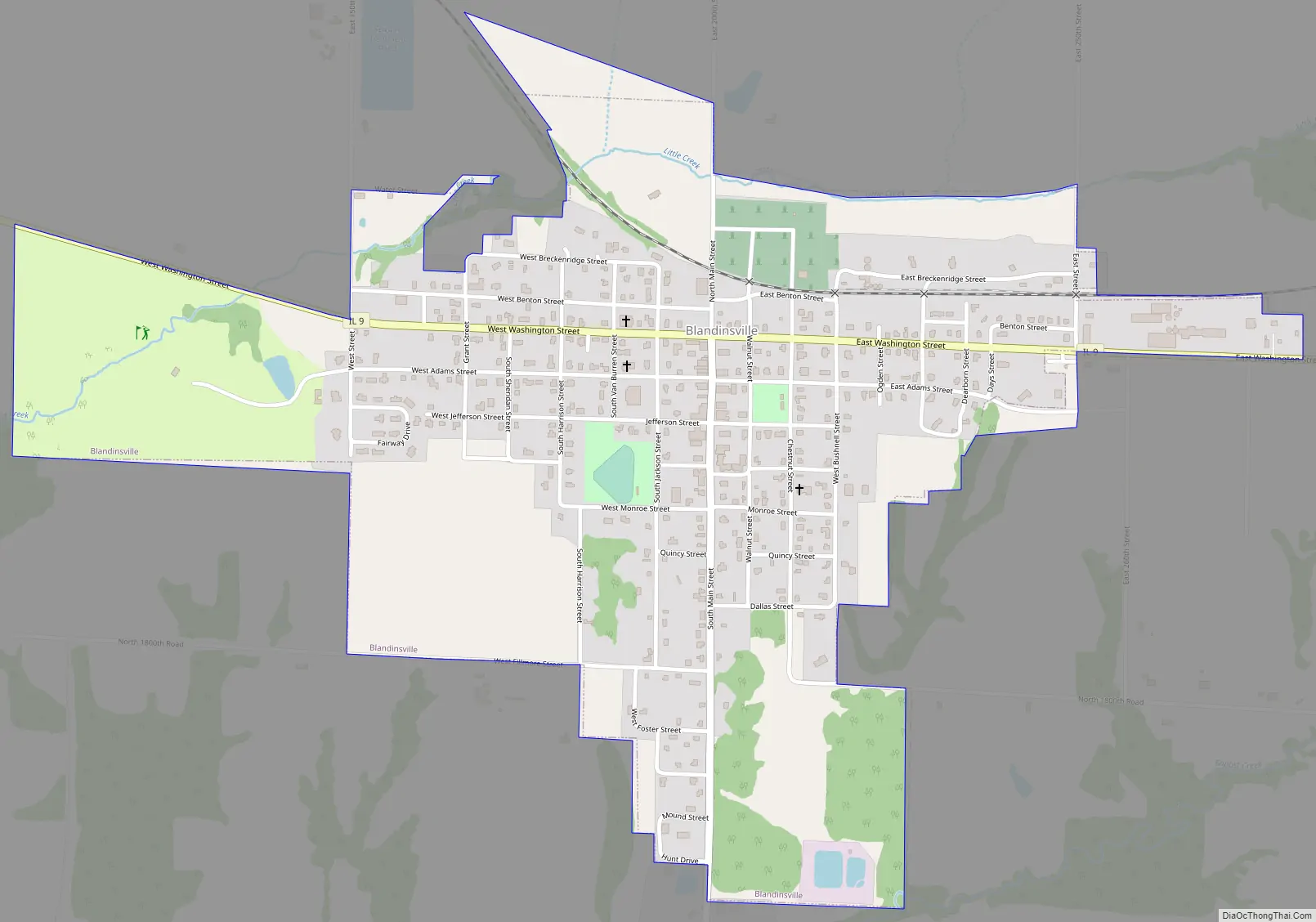
Blandinsville Road Map
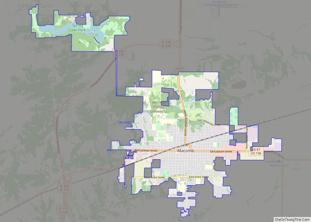
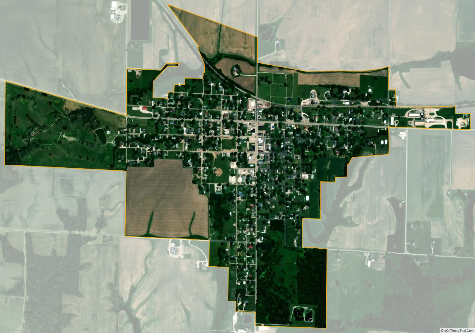
Blandinsville city Satellite Map
Geography
Blandinsville is in northwestern McDonough County. Illinois Route 9 passes through the village as Washington Street, leading northwest 6 miles (10 km) to La Harpe and east 19 miles (31 km) to Bushnell. Macomb, the McDonough county seat, is 16 miles (26 km) to the southeast via IL-9 and U.S. Route 67.
According to the U.S. Census Bureau, Blandinsville has a total area of 0.88 square miles (2.28 km), all land. The village sits on a low ridge bordered by Little Creek to the north and Baptist Creek to the south. Both are west-flowing tributaries of La Harpe Creek, a tributary of the La Moine River and part of the Illinois River watershed.
The town currently features on main street two bars on main street 2 Doors Down, and Slup’s Bar and Grill, and a restaurant called Tink’s cafe. There are active churches operating in the town. The town also features the Blandinsville Golf & Country golf course, and the Blandin House Museum.
See also
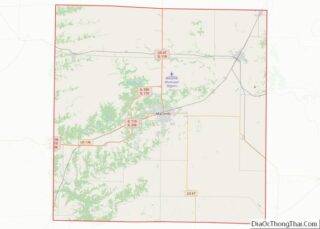
Map of Illinois State and its subdivision:- Adams
- Alexander
- Bond
- Boone
- Brown
- Bureau
- Calhoun
- Carroll
- Cass
- Champaign
- Christian
- Clark
- Clay
- Clinton
- Coles
- Cook
- Crawford
- Cumberland
- De Kalb
- De Witt
- Douglas
- Dupage
- Edgar
- Edwards
- Effingham
- Fayette
- Ford
- Franklin
- Fulton
- Gallatin
- Greene
- Grundy
- Hamilton
- Hancock
- Hardin
- Henderson
- Henry
- Iroquois
- Jackson
- Jasper
- Jefferson
- Jersey
- Jo Daviess
- Johnson
- Kane
- Kankakee
- Kendall
- Knox
- La Salle
- Lake
- Lake Michigan
- Lawrence
- Lee
- Livingston
- Logan
- Macon
- Macoupin
- Madison
- Marion
- Marshall
- Mason
- Massac
- McDonough
- McHenry
- McLean
- Menard
- Mercer
- Monroe
- Montgomery
- Morgan
- Moultrie
- Ogle
- Peoria
- Perry
- Piatt
- Pike
- Pope
- Pulaski
- Putnam
- Randolph
- Richland
- Rock Island
- Saint Clair
- Saline
- Sangamon
- Schuyler
- Scott
- Shelby
- Stark
- Stephenson
- Tazewell
- Union
- Vermilion
- Wabash
- Warren
- Washington
- Wayne
- White
- Whiteside
- Will
- Williamson
- Winnebago
- Woodford
- Alabama
- Alaska
- Arizona
- Arkansas
- California
- Colorado
- Connecticut
- Delaware
- District of Columbia
- Florida
- Georgia
- Hawaii
- Idaho
- Illinois
- Indiana
- Iowa
- Kansas
- Kentucky
- Louisiana
- Maine
- Maryland
- Massachusetts
- Michigan
- Minnesota
- Mississippi
- Missouri
- Montana
- Nebraska
- Nevada
- New Hampshire
- New Jersey
- New Mexico
- New York
- North Carolina
- North Dakota
- Ohio
- Oklahoma
- Oregon
- Pennsylvania
- Rhode Island
- South Carolina
- South Dakota
- Tennessee
- Texas
- Utah
- Vermont
- Virginia
- Washington
- West Virginia
- Wisconsin
- Wyoming