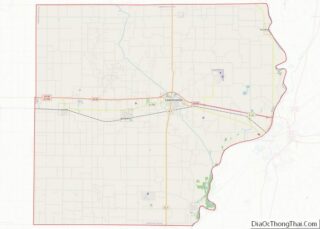
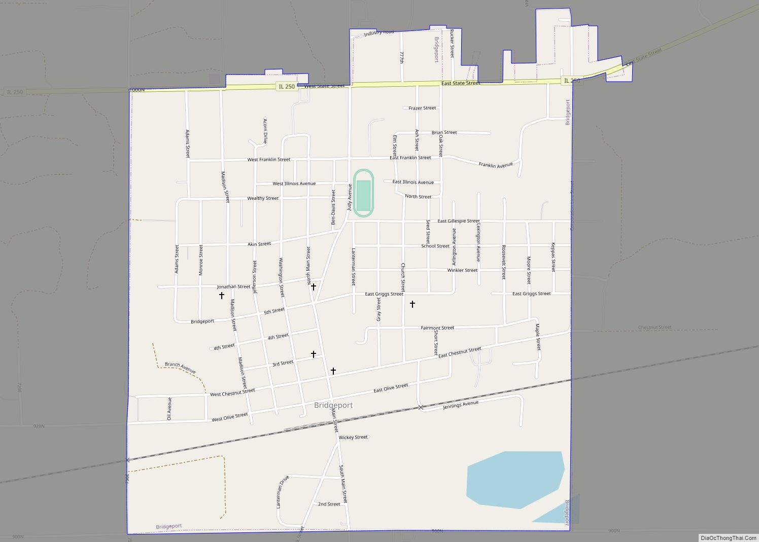
Bridgeport is a city in Lawrence County, Illinois, United States. The population was 1,886 at the 2010 census.
| Name: | Bridgeport city |
|---|---|
| LSAD Code: | 25 |
| LSAD Description: | city (suffix) |
| State: | Illinois |
| County: | Lawrence County |
| Incorporated: | 1896 |
| Elevation: | 449 ft (137 m) |
| Total Area: | 1.10 sq mi (2.84 km²) |
| Land Area: | 1.07 sq mi (2.78 km²) |
| Water Area: | 0.03 sq mi (0.07 km²) |
| Total Population: | 1,800 |
| Population Density: | 1,679.10/sq mi (648.22/km²) |
| Area code: | 618 |
| FIPS code: | 1708186 |
| GNISfeature ID: | 2393415 |
Online Interactive Map
Click on ![]() to view map in "full screen" mode.
to view map in "full screen" mode.
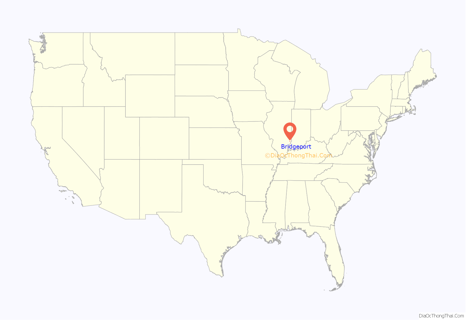
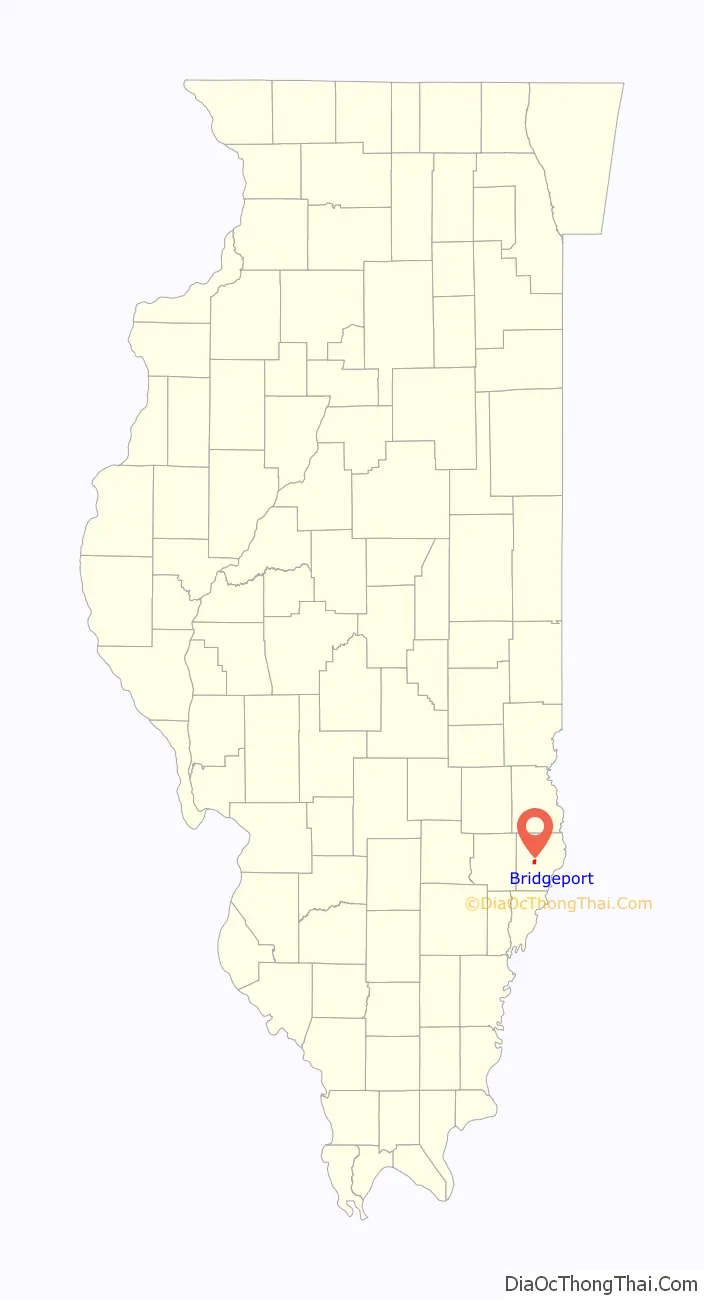
Bridgeport location map. Where is Bridgeport city?
History
Bridgeport was established in the mid-1850s as a stop along the Ohio and Mississippi Railway. It was named by a railroad official for the bridge that spanned Indian Creek, in the southern part of the city. Bridgeport incorporated in 1896.
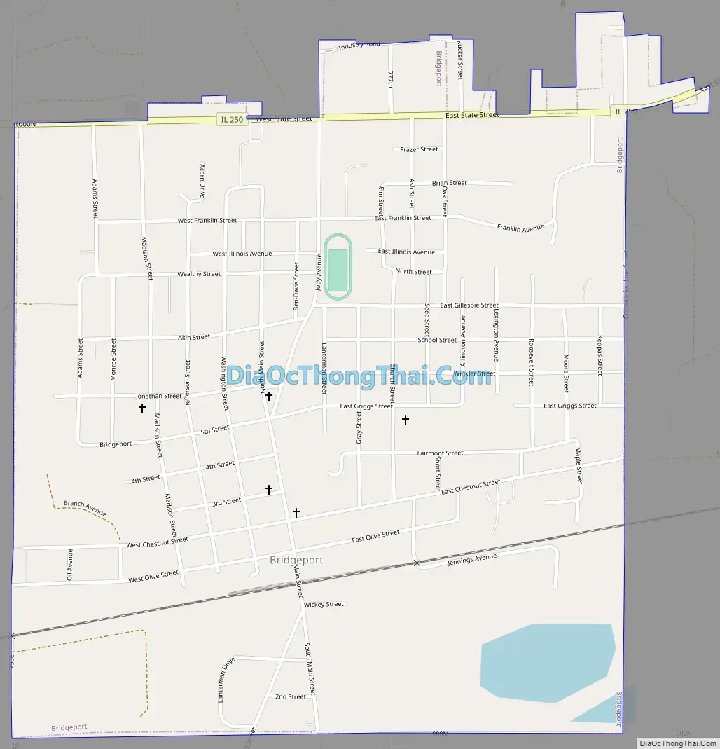
Bridgeport Road Map
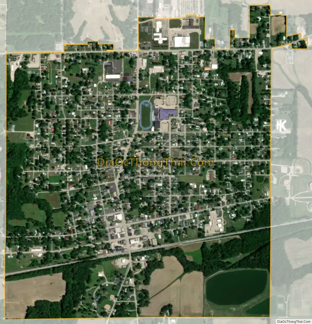
Bridgeport city Satellite Map
Geography
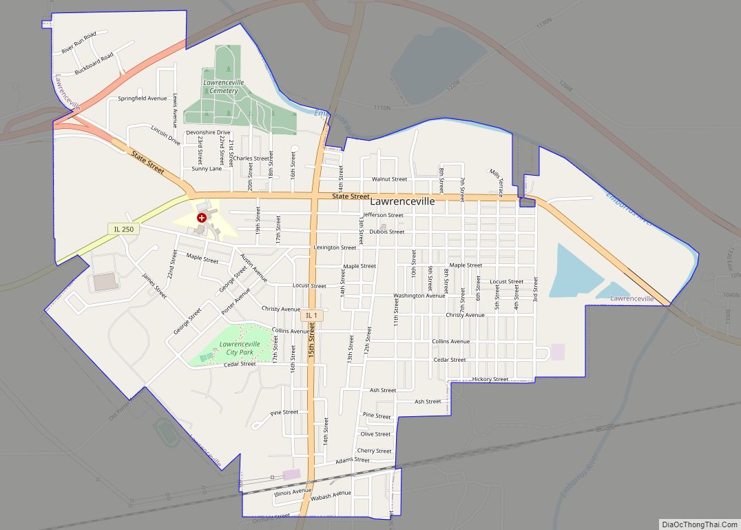
Bridgeport lies southwest of Lawrenceville along Illinois State Route 250.
According to the 2010 census, Bridgeport has a total area of 1.075 square miles (2.78 km), of which 1.05 square miles (2.72 km) (or 97.67%) is land and 0.025 square miles (0.06 km) (or 2.33%) is water.
See also
Map of Illinois State and its subdivision:- Adams
- Alexander
- Bond
- Boone
- Brown
- Bureau
- Calhoun
- Carroll
- Cass
- Champaign
- Christian
- Clark
- Clay
- Clinton
- Coles
- Cook
- Crawford
- Cumberland
- De Kalb
- De Witt
- Douglas
- Dupage
- Edgar
- Edwards
- Effingham
- Fayette
- Ford
- Franklin
- Fulton
- Gallatin
- Greene
- Grundy
- Hamilton
- Hancock
- Hardin
- Henderson
- Henry
- Iroquois
- Jackson
- Jasper
- Jefferson
- Jersey
- Jo Daviess
- Johnson
- Kane
- Kankakee
- Kendall
- Knox
- La Salle
- Lake
- Lake Michigan
- Lawrence
- Lee
- Livingston
- Logan
- Macon
- Macoupin
- Madison
- Marion
- Marshall
- Mason
- Massac
- McDonough
- McHenry
- McLean
- Menard
- Mercer
- Monroe
- Montgomery
- Morgan
- Moultrie
- Ogle
- Peoria
- Perry
- Piatt
- Pike
- Pope
- Pulaski
- Putnam
- Randolph
- Richland
- Rock Island
- Saint Clair
- Saline
- Sangamon
- Schuyler
- Scott
- Shelby
- Stark
- Stephenson
- Tazewell
- Union
- Vermilion
- Wabash
- Warren
- Washington
- Wayne
- White
- Whiteside
- Will
- Williamson
- Winnebago
- Woodford
- Alabama
- Alaska
- Arizona
- Arkansas
- California
- Colorado
- Connecticut
- Delaware
- District of Columbia
- Florida
- Georgia
- Hawaii
- Idaho
- Illinois
- Indiana
- Iowa
- Kansas
- Kentucky
- Louisiana
- Maine
- Maryland
- Massachusetts
- Michigan
- Minnesota
- Mississippi
- Missouri
- Montana
- Nebraska
- Nevada
- New Hampshire
- New Jersey
- New Mexico
- New York
- North Carolina
- North Dakota
- Ohio
- Oklahoma
- Oregon
- Pennsylvania
- Rhode Island
- South Carolina
- South Dakota
- Tennessee
- Texas
- Utah
- Vermont
- Virginia
- Washington
- West Virginia
- Wisconsin
- Wyoming