Buda is a village in Bureau County, Illinois, United States. The population was 482 at the 2020 census. It is part of the Ottawa Micropolitan Statistical Area.
| Name: | Buda village |
|---|---|
| LSAD Code: | 47 |
| LSAD Description: | village (suffix) |
| State: | Illinois |
| County: | Bureau County |
| Total Area: | 1.01 sq mi (2.63 km²) |
| Land Area: | 1.01 sq mi (2.63 km²) |
| Water Area: | 0.00 sq mi (0.00 km²) 0% |
| Total Population: | 482 |
| Population Density: | 475.35/sq mi (183.46/km²) |
| Area code: | 309 |
| FIPS code: | 1709356 |
Online Interactive Map
Click on ![]() to view map in "full screen" mode.
to view map in "full screen" mode.
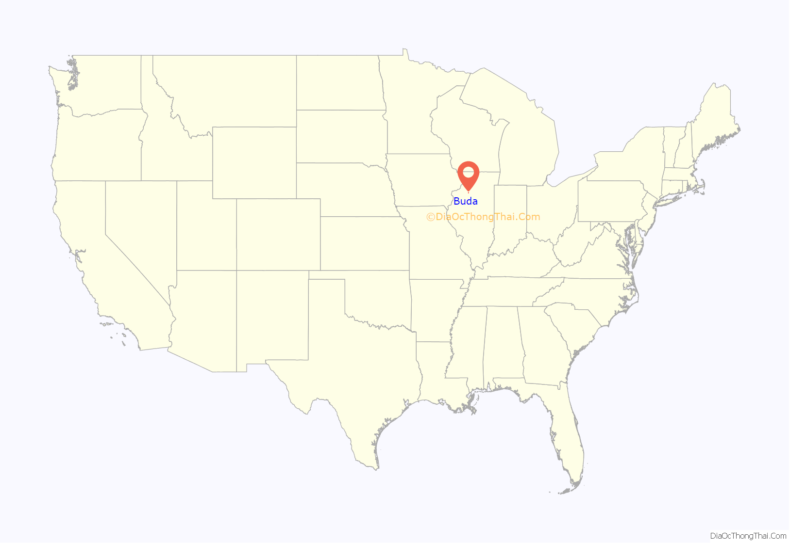
Buda location map. Where is Buda village?
History
The village was named after Buda, now a part of Budapest, in Hungary. Buda was chosen in honor of the hometown of exiled Hungarian politician Louis Kossuth.
Buda was established in 1854 to serve the Chicago, Burlington & Quincy Railroad. It displaced French Grove, Illinois which had been the post office in the area before the establishment of Buda. Judge Jesse Emmerson and W. H. Bloom opened the first and second stores respectively in Buda. In 1955 Dr. Holoton became of the first doctor in the community.
An industrialist named George Chalender founded the Buda Engine Co. in Buda Illinois in 1910. The company relocated to Harvey, Illinois before being acquired by Allis-Chalmers in 1953.
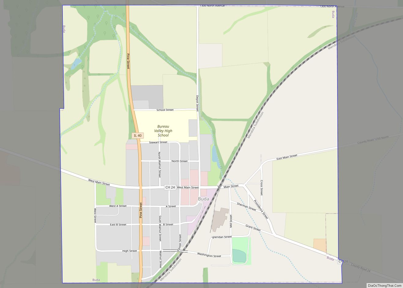
Buda Road Map
Buda city Satellite Map
Geography
Buda is located at 41°19′35″N 89°40′48″W / 41.32639°N 89.68000°W / 41.32639; -89.68000 (41.326297, -89.680131).
According to the 2021 census gazetteer files, Buda has a total area of 1.01 square miles (2.62 km), of which 1.01 square miles (2.62 km) (or 100.00%) is land and 0.00 square miles (0.00 km) (or 0.00%) is water.
See also
Map of Illinois State and its subdivision:- Adams
- Alexander
- Bond
- Boone
- Brown
- Bureau
- Calhoun
- Carroll
- Cass
- Champaign
- Christian
- Clark
- Clay
- Clinton
- Coles
- Cook
- Crawford
- Cumberland
- De Kalb
- De Witt
- Douglas
- Dupage
- Edgar
- Edwards
- Effingham
- Fayette
- Ford
- Franklin
- Fulton
- Gallatin
- Greene
- Grundy
- Hamilton
- Hancock
- Hardin
- Henderson
- Henry
- Iroquois
- Jackson
- Jasper
- Jefferson
- Jersey
- Jo Daviess
- Johnson
- Kane
- Kankakee
- Kendall
- Knox
- La Salle
- Lake
- Lake Michigan
- Lawrence
- Lee
- Livingston
- Logan
- Macon
- Macoupin
- Madison
- Marion
- Marshall
- Mason
- Massac
- McDonough
- McHenry
- McLean
- Menard
- Mercer
- Monroe
- Montgomery
- Morgan
- Moultrie
- Ogle
- Peoria
- Perry
- Piatt
- Pike
- Pope
- Pulaski
- Putnam
- Randolph
- Richland
- Rock Island
- Saint Clair
- Saline
- Sangamon
- Schuyler
- Scott
- Shelby
- Stark
- Stephenson
- Tazewell
- Union
- Vermilion
- Wabash
- Warren
- Washington
- Wayne
- White
- Whiteside
- Will
- Williamson
- Winnebago
- Woodford
- Alabama
- Alaska
- Arizona
- Arkansas
- California
- Colorado
- Connecticut
- Delaware
- District of Columbia
- Florida
- Georgia
- Hawaii
- Idaho
- Illinois
- Indiana
- Iowa
- Kansas
- Kentucky
- Louisiana
- Maine
- Maryland
- Massachusetts
- Michigan
- Minnesota
- Mississippi
- Missouri
- Montana
- Nebraska
- Nevada
- New Hampshire
- New Jersey
- New Mexico
- New York
- North Carolina
- North Dakota
- Ohio
- Oklahoma
- Oregon
- Pennsylvania
- Rhode Island
- South Carolina
- South Dakota
- Tennessee
- Texas
- Utah
- Vermont
- Virginia
- Washington
- West Virginia
- Wisconsin
- Wyoming
