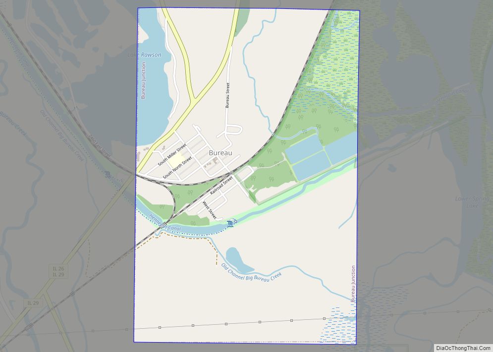
Bureau Junction, usually called Bureau, is a village in Bureau County, Illinois, United States. The population was 281 at the 2020 census. The village name is shown as both “Bureau Junction” and “Bureau” on federal maps, and is commonly called “Bureau”, including by phone companies and the United States Post Office. It is part of the Ottawa Micropolitan Statistical Area. Bureau Junction was the point where the Rock Island Line railroad’s branch line to Peoria split. Track west and south of Bureau is operated by Iowa Interstate, while tracks east to Chicago were formerly operated by CSX but are currently leased to Iowa Interstate.
| Name: | Bureau Junction village |
|---|---|
| LSAD Code: | 47 |
| LSAD Description: | village (suffix) |
| State: | Illinois |
| County: | Bureau County |
| Total Area: | 1.51 sq mi (3.9 km²) |
| Land Area: | 1.45 sq mi (3.8 km²) |
| Water Area: | 0.07 sq mi (0.2 km²) |
| Total Population: | 281 |
| Population Density: | 190/sq mi (72/km²) |
| Area code: | 815 |
| FIPS code: | 1709681 |
Online Interactive Map
Click on ![]() to view map in "full screen" mode.
to view map in "full screen" mode.
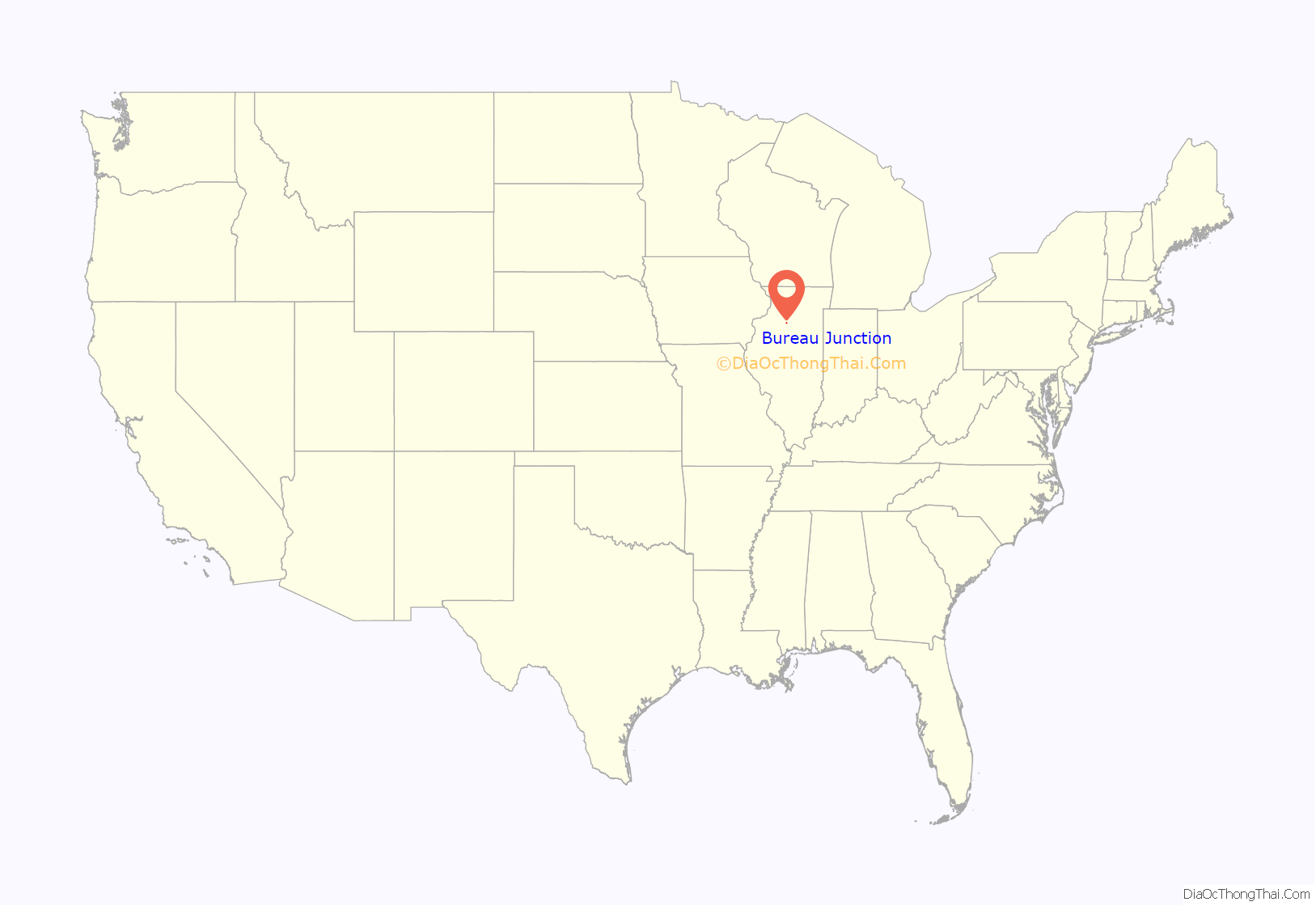
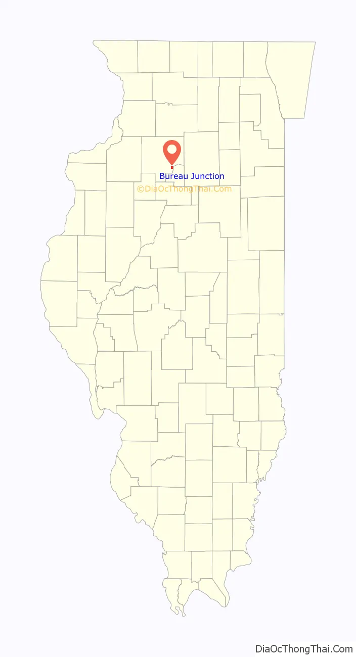
Bureau Junction location map. Where is Bureau Junction village?
History
The village is named for Michel or Pierre Bureau. Their original surname was probably Belleau, but local aboriginals may have had difficulty pronouncing the “l” sound. One or both of the brothers ran a trading post near where Big Bureau Creek empties into the Illinois River from 1776 until 1780 or 1790. A man named Buero, of mixed French and Native American descent, and possibly a descendant of one of the earlier Bureau brothers, was operating in this area as a fur trader in 1821.
In the 1870s Bureau Junction had a sizeable railroad operation as the halfway point on the railroad between Chicago and Rock Island.
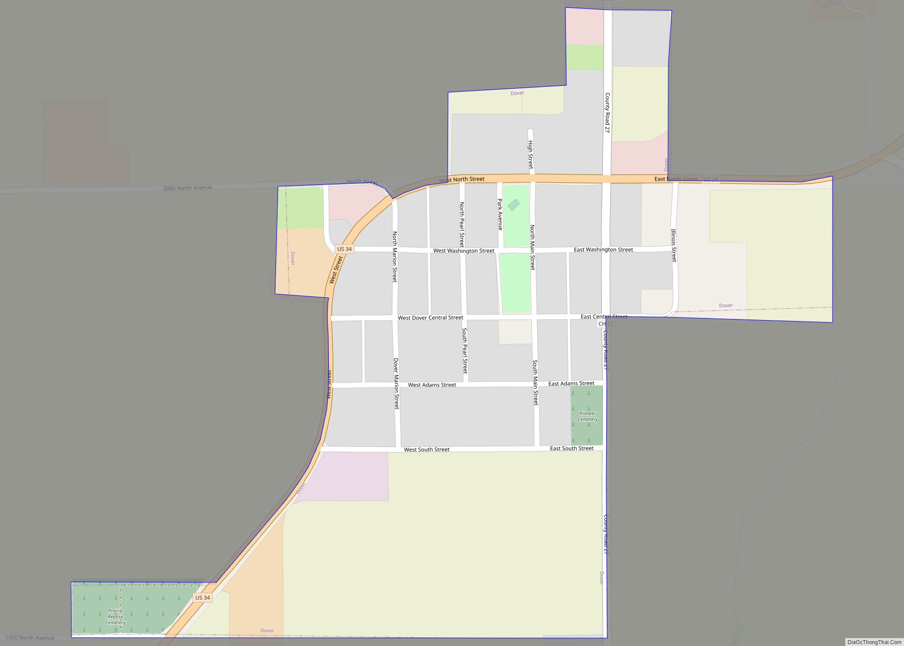
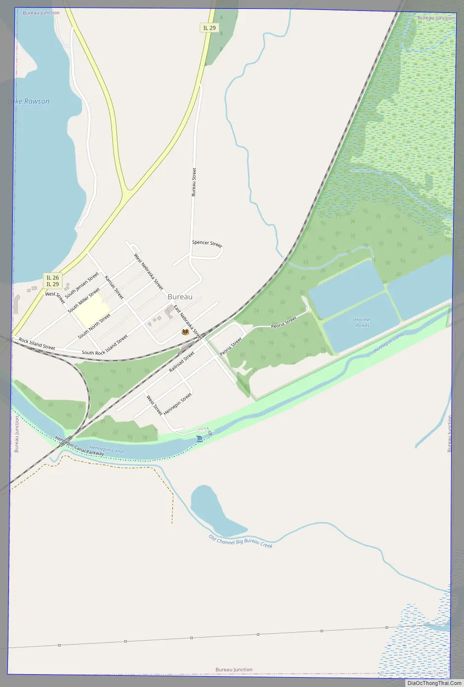
Bureau Junction Road Map
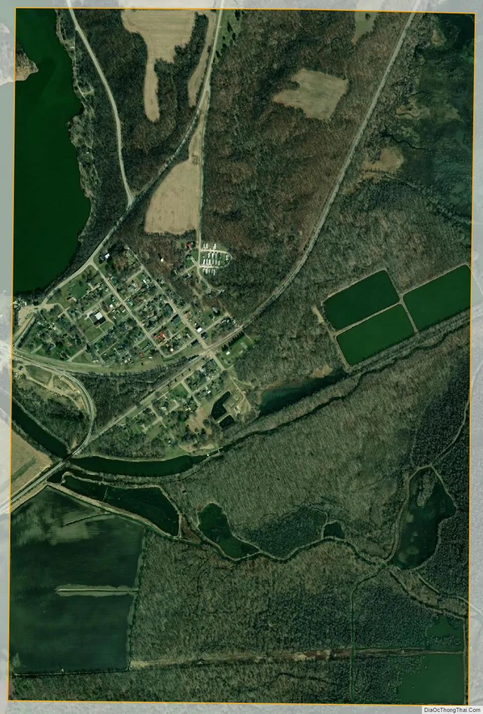
Bureau Junction city Satellite Map
Geography
Bureau Junction is located at 41°17′21″N 89°22′4″W / 41.28917°N 89.36778°W / 41.28917; -89.36778 (41.289155, -89.367837).
According to the 2021 census gazetteer files, Bureau Junction has a total area of 1.51 square miles (3.91 km), of which 1.45 square miles (3.76 km) (or 95.51%) is land and 0.07 square miles (0.18 km) (or 4.49%) is water.
See also
Map of Illinois State and its subdivision:- Adams
- Alexander
- Bond
- Boone
- Brown
- Bureau
- Calhoun
- Carroll
- Cass
- Champaign
- Christian
- Clark
- Clay
- Clinton
- Coles
- Cook
- Crawford
- Cumberland
- De Kalb
- De Witt
- Douglas
- Dupage
- Edgar
- Edwards
- Effingham
- Fayette
- Ford
- Franklin
- Fulton
- Gallatin
- Greene
- Grundy
- Hamilton
- Hancock
- Hardin
- Henderson
- Henry
- Iroquois
- Jackson
- Jasper
- Jefferson
- Jersey
- Jo Daviess
- Johnson
- Kane
- Kankakee
- Kendall
- Knox
- La Salle
- Lake
- Lake Michigan
- Lawrence
- Lee
- Livingston
- Logan
- Macon
- Macoupin
- Madison
- Marion
- Marshall
- Mason
- Massac
- McDonough
- McHenry
- McLean
- Menard
- Mercer
- Monroe
- Montgomery
- Morgan
- Moultrie
- Ogle
- Peoria
- Perry
- Piatt
- Pike
- Pope
- Pulaski
- Putnam
- Randolph
- Richland
- Rock Island
- Saint Clair
- Saline
- Sangamon
- Schuyler
- Scott
- Shelby
- Stark
- Stephenson
- Tazewell
- Union
- Vermilion
- Wabash
- Warren
- Washington
- Wayne
- White
- Whiteside
- Will
- Williamson
- Winnebago
- Woodford
- Alabama
- Alaska
- Arizona
- Arkansas
- California
- Colorado
- Connecticut
- Delaware
- District of Columbia
- Florida
- Georgia
- Hawaii
- Idaho
- Illinois
- Indiana
- Iowa
- Kansas
- Kentucky
- Louisiana
- Maine
- Maryland
- Massachusetts
- Michigan
- Minnesota
- Mississippi
- Missouri
- Montana
- Nebraska
- Nevada
- New Hampshire
- New Jersey
- New Mexico
- New York
- North Carolina
- North Dakota
- Ohio
- Oklahoma
- Oregon
- Pennsylvania
- Rhode Island
- South Carolina
- South Dakota
- Tennessee
- Texas
- Utah
- Vermont
- Virginia
- Washington
- West Virginia
- Wisconsin
- Wyoming