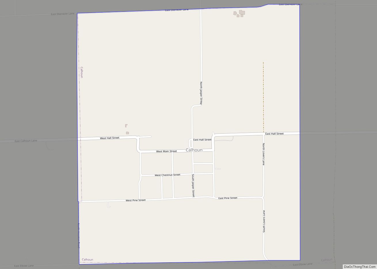
Calhoun is a village in Richland County, Illinois, United States. The population was 222 at the 2000 census.
| Name: | Calhoun village |
|---|---|
| LSAD Code: | 47 |
| LSAD Description: | village (suffix) |
| State: | Illinois |
| County: | Richland County |
| Elevation: | 545 ft (166 m) |
| Total Area: | 0.91 sq mi (2.36 km²) |
| Land Area: | 0.91 sq mi (2.36 km²) |
| Water Area: | 0.00 sq mi (0.00 km²) |
| Total Population: | 164 |
| Population Density: | 179.82/sq mi (69.42/km²) |
| Area code: | 618 |
| FIPS code: | 1710448 |
| GNISfeature ID: | 2397531 |
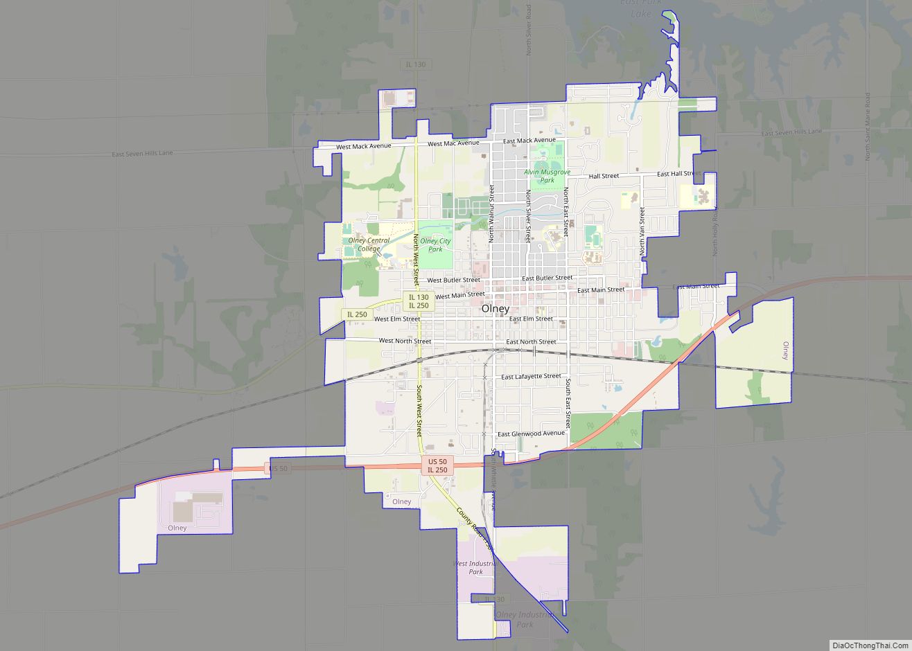
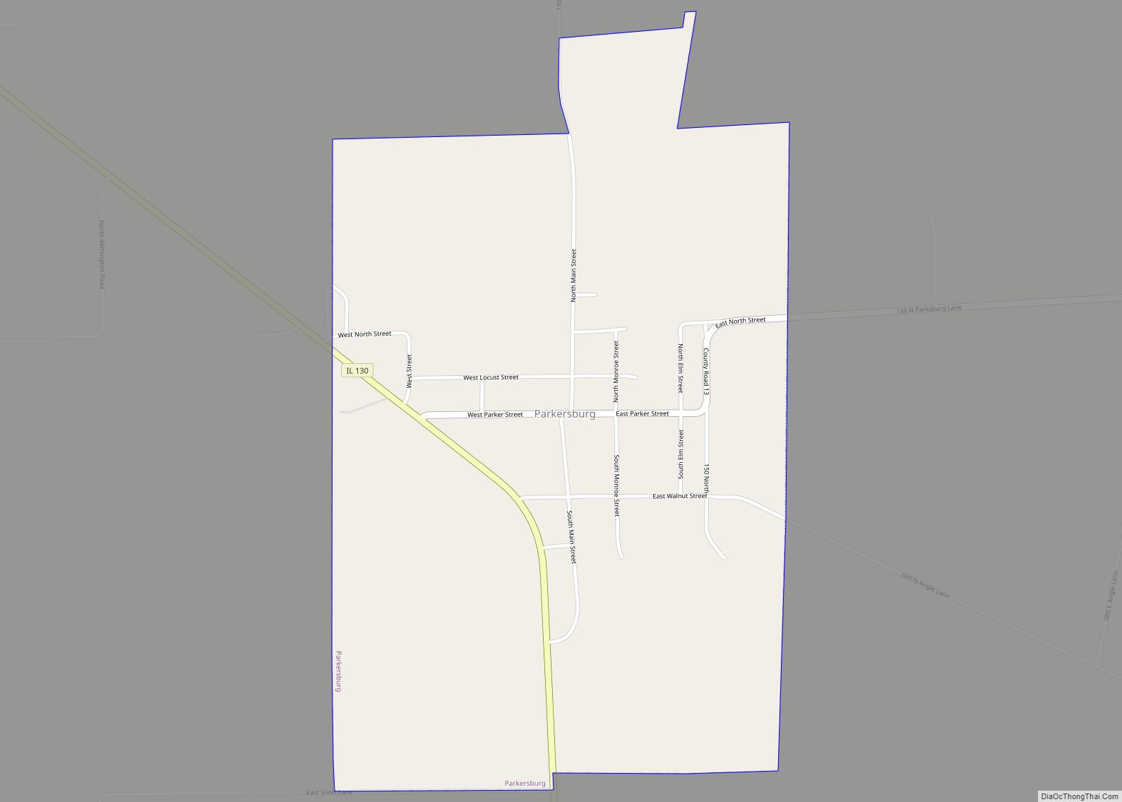
Online Interactive Map
Click on ![]() to view map in "full screen" mode.
to view map in "full screen" mode.
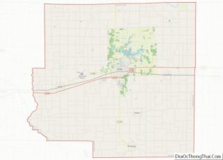
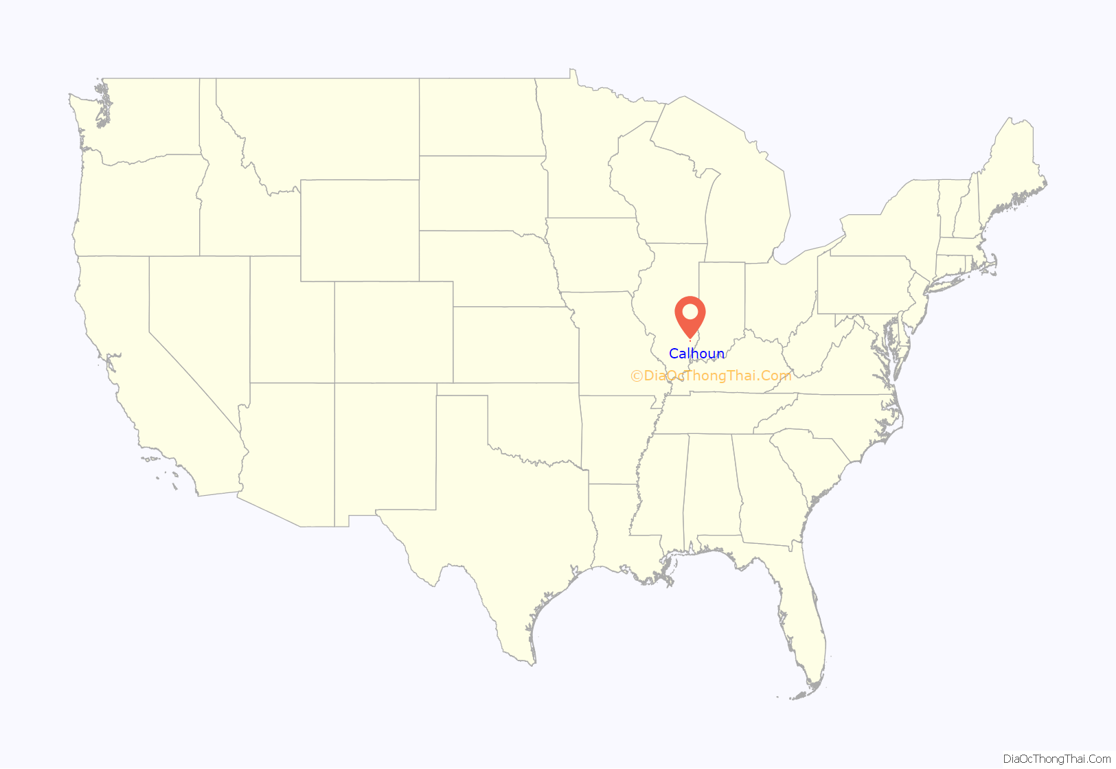
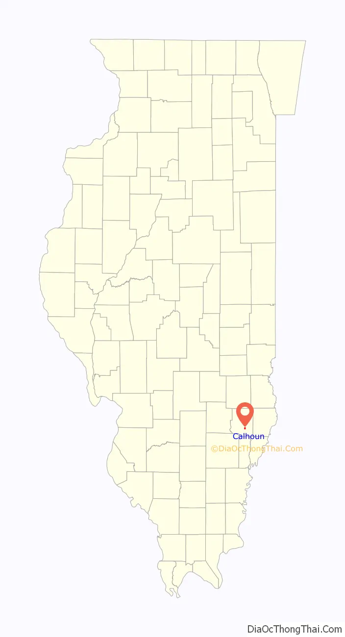
Calhoun location map. Where is Calhoun village?
History
The community of Fairview, now Calhoun, is one of the oldest communities in Richland County. While it was not officially organized under village government, the community of that name was known in the early 1830s. It was originally platted into lots by Shadrach Ruark. Reverend Ruark was an early Methodist who performed the first wedding in Richland County on October 20, 1841, when Ebeneezer Waker and Abigail Reed were united. The original plat was lost and it was replatted in 1848. When the post office was established, it took the name Calhoun, after Hugh Calhoun, the original settler of what was known as Calhoun Prairie.
Calhoun School was built in 1912 and was only one story. The upper floor was added in 1920 when a two-year high school was added. In 1922, it became a three-year high school. The high school used two classrooms in the basement in addition to the upper floor. Grades 1 through 8 were taught on the first floor. Calhoun had one of the first three-year high schools in Richland County.
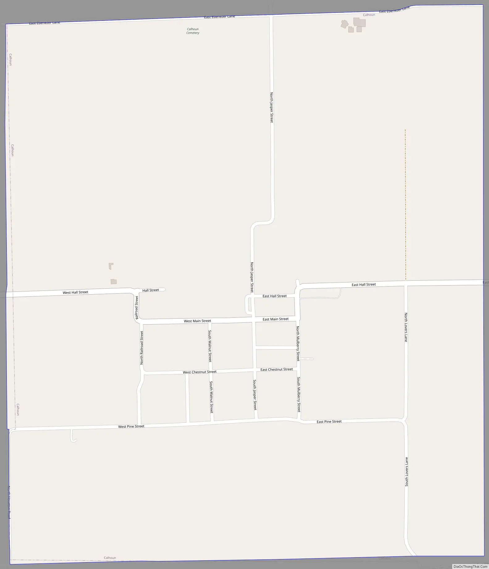
Calhoun Road Map
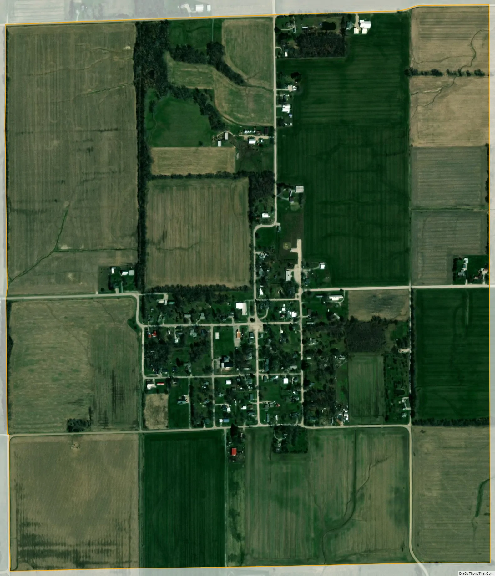
Calhoun city Satellite Map
Geography
Calhoun lies just east of Illinois State Route 130, southeast of Olney.
According to the 2010 census, Calhoun has a total area of 1.06 square miles (2.75 km), all land.
See also
Map of Illinois State and its subdivision:- Adams
- Alexander
- Bond
- Boone
- Brown
- Bureau
- Calhoun
- Carroll
- Cass
- Champaign
- Christian
- Clark
- Clay
- Clinton
- Coles
- Cook
- Crawford
- Cumberland
- De Kalb
- De Witt
- Douglas
- Dupage
- Edgar
- Edwards
- Effingham
- Fayette
- Ford
- Franklin
- Fulton
- Gallatin
- Greene
- Grundy
- Hamilton
- Hancock
- Hardin
- Henderson
- Henry
- Iroquois
- Jackson
- Jasper
- Jefferson
- Jersey
- Jo Daviess
- Johnson
- Kane
- Kankakee
- Kendall
- Knox
- La Salle
- Lake
- Lake Michigan
- Lawrence
- Lee
- Livingston
- Logan
- Macon
- Macoupin
- Madison
- Marion
- Marshall
- Mason
- Massac
- McDonough
- McHenry
- McLean
- Menard
- Mercer
- Monroe
- Montgomery
- Morgan
- Moultrie
- Ogle
- Peoria
- Perry
- Piatt
- Pike
- Pope
- Pulaski
- Putnam
- Randolph
- Richland
- Rock Island
- Saint Clair
- Saline
- Sangamon
- Schuyler
- Scott
- Shelby
- Stark
- Stephenson
- Tazewell
- Union
- Vermilion
- Wabash
- Warren
- Washington
- Wayne
- White
- Whiteside
- Will
- Williamson
- Winnebago
- Woodford
- Alabama
- Alaska
- Arizona
- Arkansas
- California
- Colorado
- Connecticut
- Delaware
- District of Columbia
- Florida
- Georgia
- Hawaii
- Idaho
- Illinois
- Indiana
- Iowa
- Kansas
- Kentucky
- Louisiana
- Maine
- Maryland
- Massachusetts
- Michigan
- Minnesota
- Mississippi
- Missouri
- Montana
- Nebraska
- Nevada
- New Hampshire
- New Jersey
- New Mexico
- New York
- North Carolina
- North Dakota
- Ohio
- Oklahoma
- Oregon
- Pennsylvania
- Rhode Island
- South Carolina
- South Dakota
- Tennessee
- Texas
- Utah
- Vermont
- Virginia
- Washington
- West Virginia
- Wisconsin
- Wyoming