Olney (/ˈɔːlni/ AWL-nee) is the county seat in Richland County, Illinois. The population was 9,115 at the time of the 2010 census.
| Name: | Olney city |
|---|---|
| LSAD Code: | 25 |
| LSAD Description: | city (suffix) |
| State: | Illinois |
| County: | Richland County |
| Founded: | 1848 |
| Elevation: | 489 ft (149 m) |
| Total Area: | 6.93 sq mi (17.95 km²) |
| Land Area: | 6.93 sq mi (17.95 km²) |
| Water Area: | 0.00 sq mi (0.00 km²) |
| Total Population: | 8,701 |
| Population Density: | 1,255.37/sq mi (484.70/km²) |
| Area code: | 618 |
| FIPS code: | 1755912 |
| GNISfeature ID: | 2396060 |
| Website: | www.ci.olney.il.us |
Online Interactive Map
Click on ![]() to view map in "full screen" mode.
to view map in "full screen" mode.
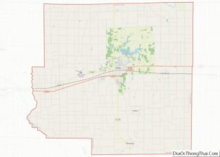
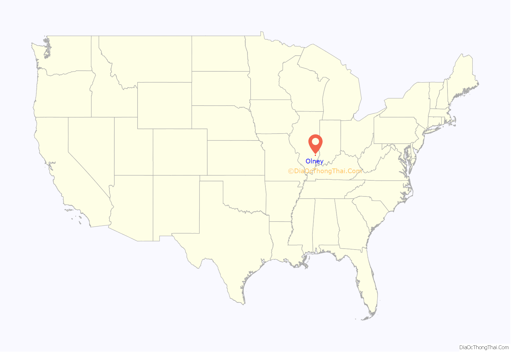
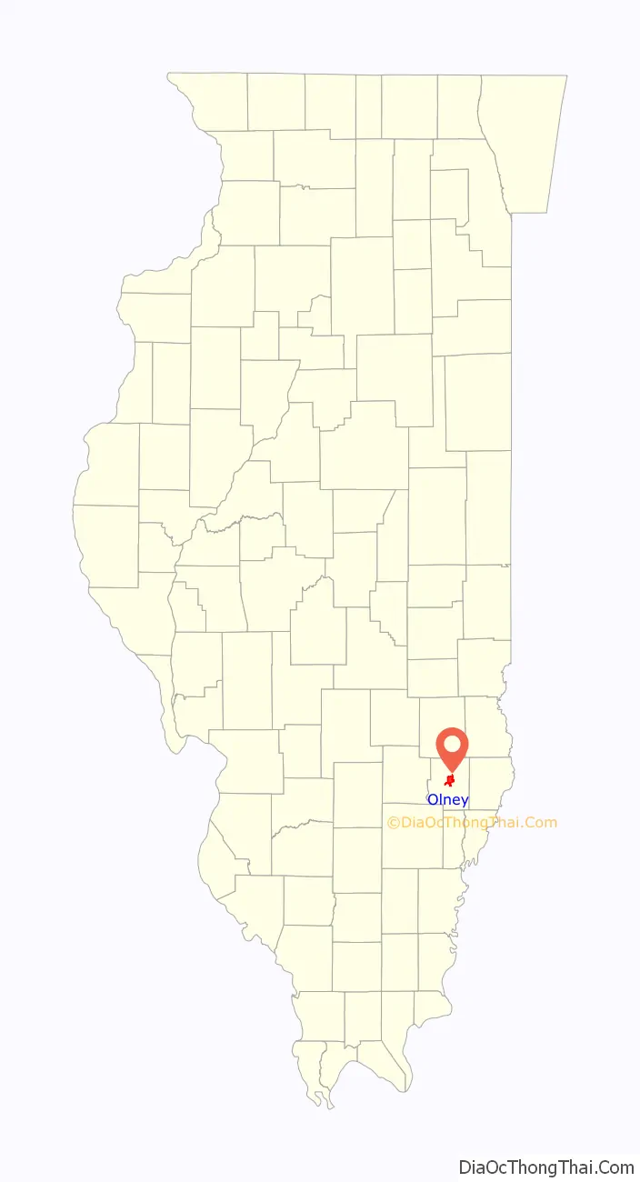
Olney location map. Where is Olney city?
History
Settlement of the Richland County area began around 1815 when Thaddeus Morehouse, a native of Vermont, arrived by wagon and built a log cabin along a stagecoach route that ran from Vincennes, Indiana to St. Louis. This log cabin operated as a hotel and tavern.
Richland County was organized as a county in 1841, when it was formed by a partitioning of Clay and Lawrence counties. There was some controversy regarding the location of the county seat; however, Olney was determined as the choice based on a donation of land and the central location. The name of the town Olney was suggested by Judge Aaron Shaw who desired to honor a friend, Nathan Olney. It was not until 1848 that Olney was incorporated as a village.
The Civil War brought a great deal of turmoil to the county as there were sympathies for both sides. While most citizens rallied around the Union it was necessary to have troops stationed in Olney to enforce the draft as union deserters found refuge among local citizens. Overall, the county was pro-Union and an estimated 1,700 Richland County citizens fought for the Union in the Civil war. Nearly 1,000 Olney residents served in World War I, and during World War II, Richland County may have been the only Illinois county outside of Cook that provided four generals for the war effort.
Among the mayors of Olney was J. B. Porter, noted as an ex-mayor in a 1912 note about his being wounded by gunfire after whipping a man over some unresolved quarrel.
The first census of Richland County was in 1850 at which time 4,012 people resided in the county. One hundred years later the 1950 census found a spot north of Olney near Dundas to be the population center of the United States.
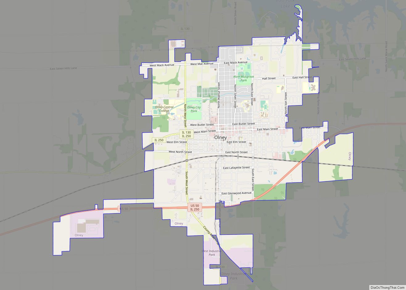
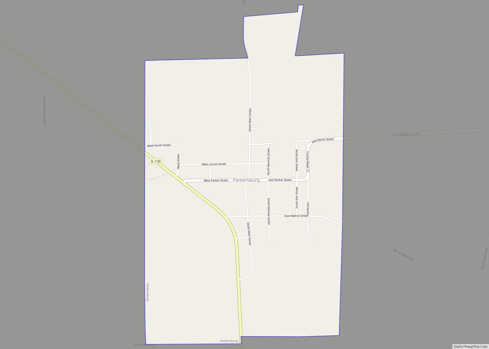
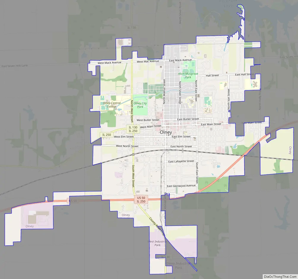
Olney Road Map
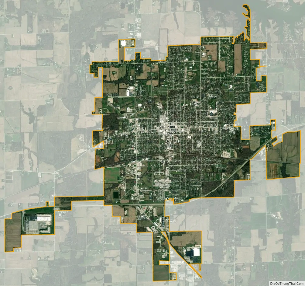
Olney city Satellite Map
Geography
Olney is located at 38°44′N 88°5′W / 38.733°N 88.083°W / 38.733; -88.083 (38.7306, -88.0819).
According to the 2010 census, Olney has a total area of 6.664 square miles (17.26 km), of which 6.66 square miles (17.25 km) (or 99.94%) is land and 0.004 square miles (0.01 km) (or 0.06%) is water.
Climate
See also
Map of Illinois State and its subdivision:- Adams
- Alexander
- Bond
- Boone
- Brown
- Bureau
- Calhoun
- Carroll
- Cass
- Champaign
- Christian
- Clark
- Clay
- Clinton
- Coles
- Cook
- Crawford
- Cumberland
- De Kalb
- De Witt
- Douglas
- Dupage
- Edgar
- Edwards
- Effingham
- Fayette
- Ford
- Franklin
- Fulton
- Gallatin
- Greene
- Grundy
- Hamilton
- Hancock
- Hardin
- Henderson
- Henry
- Iroquois
- Jackson
- Jasper
- Jefferson
- Jersey
- Jo Daviess
- Johnson
- Kane
- Kankakee
- Kendall
- Knox
- La Salle
- Lake
- Lake Michigan
- Lawrence
- Lee
- Livingston
- Logan
- Macon
- Macoupin
- Madison
- Marion
- Marshall
- Mason
- Massac
- McDonough
- McHenry
- McLean
- Menard
- Mercer
- Monroe
- Montgomery
- Morgan
- Moultrie
- Ogle
- Peoria
- Perry
- Piatt
- Pike
- Pope
- Pulaski
- Putnam
- Randolph
- Richland
- Rock Island
- Saint Clair
- Saline
- Sangamon
- Schuyler
- Scott
- Shelby
- Stark
- Stephenson
- Tazewell
- Union
- Vermilion
- Wabash
- Warren
- Washington
- Wayne
- White
- Whiteside
- Will
- Williamson
- Winnebago
- Woodford
- Alabama
- Alaska
- Arizona
- Arkansas
- California
- Colorado
- Connecticut
- Delaware
- District of Columbia
- Florida
- Georgia
- Hawaii
- Idaho
- Illinois
- Indiana
- Iowa
- Kansas
- Kentucky
- Louisiana
- Maine
- Maryland
- Massachusetts
- Michigan
- Minnesota
- Mississippi
- Missouri
- Montana
- Nebraska
- Nevada
- New Hampshire
- New Jersey
- New Mexico
- New York
- North Carolina
- North Dakota
- Ohio
- Oklahoma
- Oregon
- Pennsylvania
- Rhode Island
- South Carolina
- South Dakota
- Tennessee
- Texas
- Utah
- Vermont
- Virginia
- Washington
- West Virginia
- Wisconsin
- Wyoming