Carpentersville is a village in Kane County, Illinois, United States. The population was 37,983 at the 2020 census.
| Name: | Carpentersville village |
|---|---|
| LSAD Code: | 47 |
| LSAD Description: | village (suffix) |
| State: | Illinois |
| County: | Kane County |
| Total Area: | 8.08 sq mi (20.93 km²) |
| Land Area: | 7.87 sq mi (20.39 km²) |
| Water Area: | 0.21 sq mi (0.54 km²) |
| Total Population: | 37,983 |
| Population Density: | 4,824.46/sq mi (1,862.82/km²) |
| FIPS code: | 1711358 |
| Website: | www.cville.org |
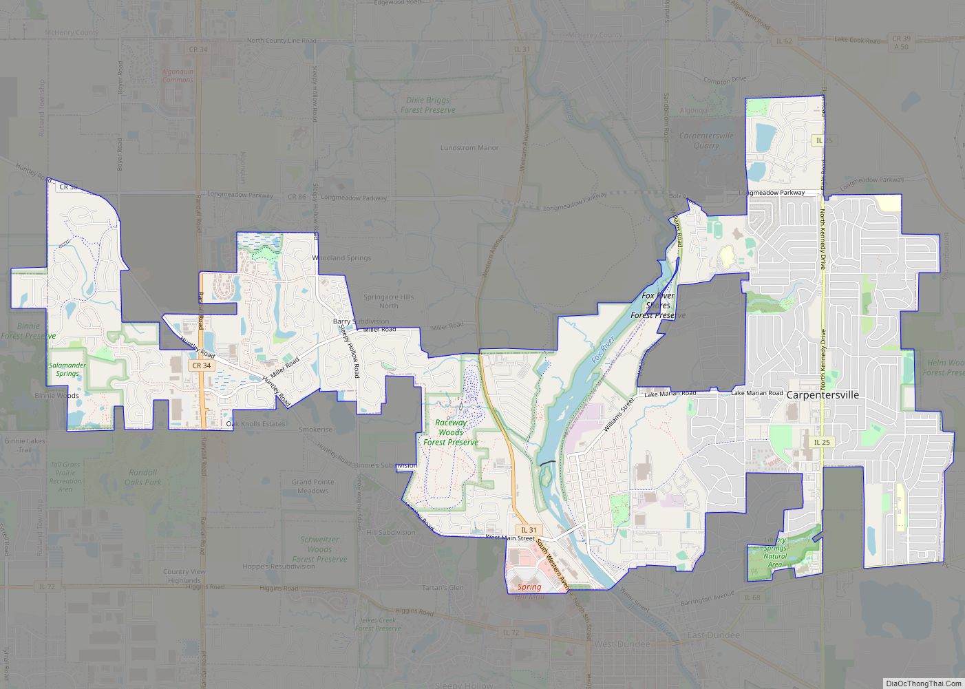
Online Interactive Map
Click on ![]() to view map in "full screen" mode.
to view map in "full screen" mode.
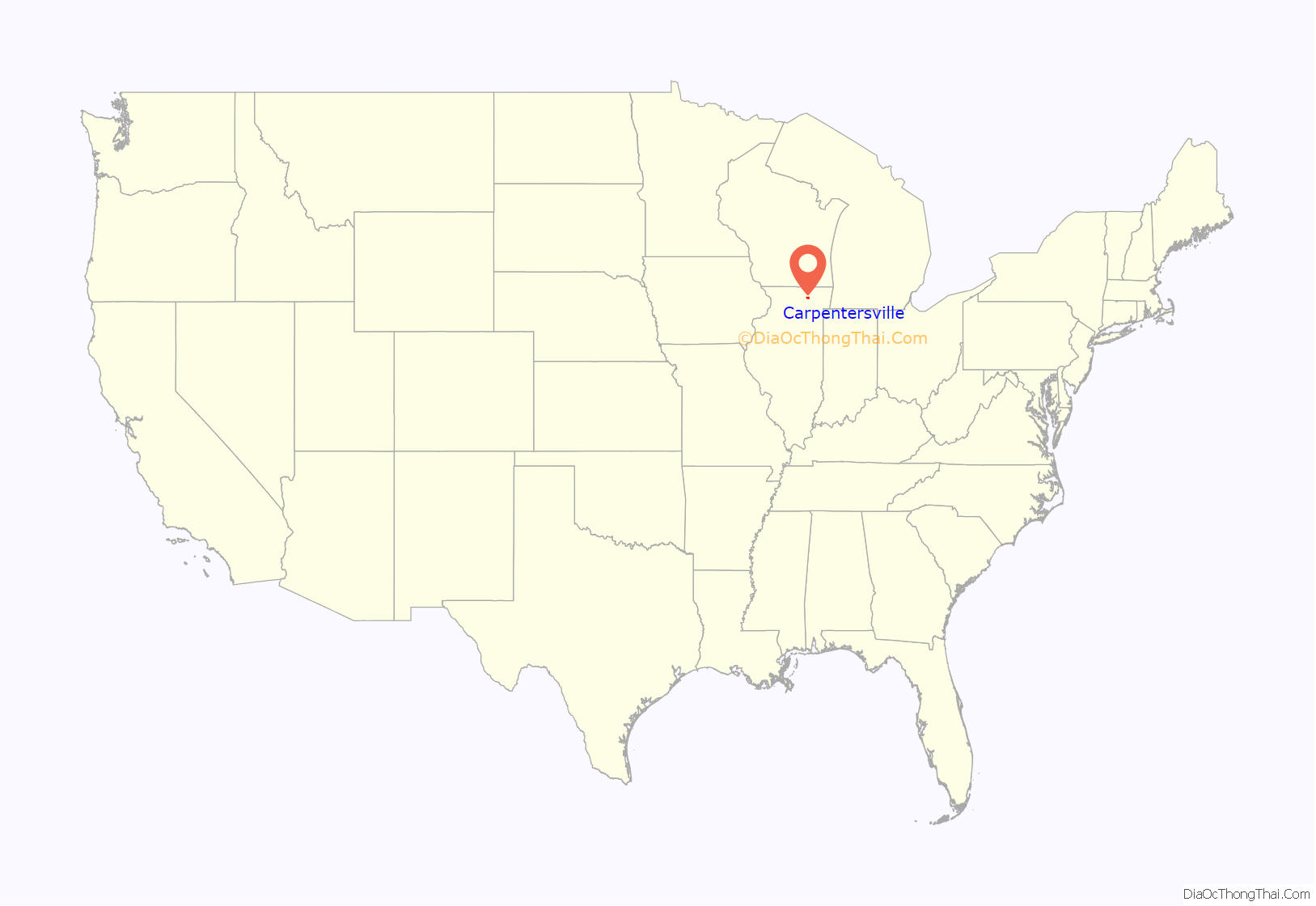
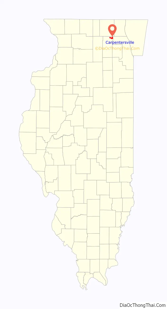
Carpentersville location map. Where is Carpentersville village?
History
Julius Angelo Carpenter (August 19, 1827 – March 30, 1880) was the founder of Carpentersville, Illinois and its first prominent citizen. Carpenter came with his family from Uxbridge, Massachusetts and settled near the Fox River, along with his father Charles Valentine Carpenter and his uncle Daniel. Angelo was the first person to settle Carpentersville. Carpenter built the settlement’s first store, bridge, and factory. He served two consecutive terms in the Illinois House of Representatives. In 1837, the brothers, en route to the Rock River, made camp along the east bank of the Fox River to wait out the spring floods that made continuing their oxcart journey impossible. They ended up staying in the area to settle what was then called Carpenters’ Grove.
For the next hundred years, Carpentersville did not grow as rapidly as other Fox River communities which had more direct rail connections to Chicago. The electric interurban railroad came to Carpentersville in 1896. The line was built by the Carpentersville, Elgin and Aurora Railway from a connection with the streetcar system in Elgin, Illinois and ran for four miles, terminating at the Illinois Iron and Bolt foundry on Main Street. This company changed ownership several times, including the Aurora, Elgin and Chicago Railway. It ended up being owned by the Aurora, Elgin and Fox River Electric Company in 1924. This line was always operated separately from the rest of the system, which included all traction lines between Carpentersville and Yorkville. This was a great convenience to factory workers who traveled to Elgin and for Elgin workers to come to Carpentersville. The line was used by everyone to enjoy Elgin’s Trout Park and to enjoy the “summer cars” for a cool ride. The line started to fail with the onset of the Great Depression and the establishment and paving of Illinois Route 31, which encouraged automobile use and the creation of a bus route. The final blow came in 1933, when a tornado destroyed the bridge over the Fox River just south of West Dundee.
Until the 1950s, Carpentersville consisted of a street grid along the Fox River centered on Main Street, which was the only highway bridge across the Fox River between Algonquin and Dundee. The Meadowdale Shopping Center, which was anchored by Wieboldt’s, Carson Pirie Scott, Cook’s and W.T. Grant; it also featured an indoor ice skating rink, overshadowed the commercial district along the River. A large section of the shopping mall on the north side was torn down in the 1990s and a new post office building was built.
In 1956, to reflect this population shift, Dundee Community High School relocated from its former site on Illinois Route 31 to Cleveland Avenue (now Carpentersville Middle School). In 1964, a second high school, named for Irving Crown, opened on Kings Road on the northern edge of Meadowdale. The two schools have now merged. DeLacey (one of the schools built on Kings Road) was closed and demolished, and was remade on Cleveland Ave.
From 1958 to 1969, Carpentersville was home to the Meadowdale International Raceway, a 3.27 miles (5.26 km) long automobile race track located west of Illinois Route 31 which was also started by Besinger. The site is now a Township Park and County Forest Preserve.
In the 1990s and 2000s, Carpentersville began to expand is development further west along Randall Road with the construction of many new subdivisions and shopping centers that including Woodman’s Markets and Menards.
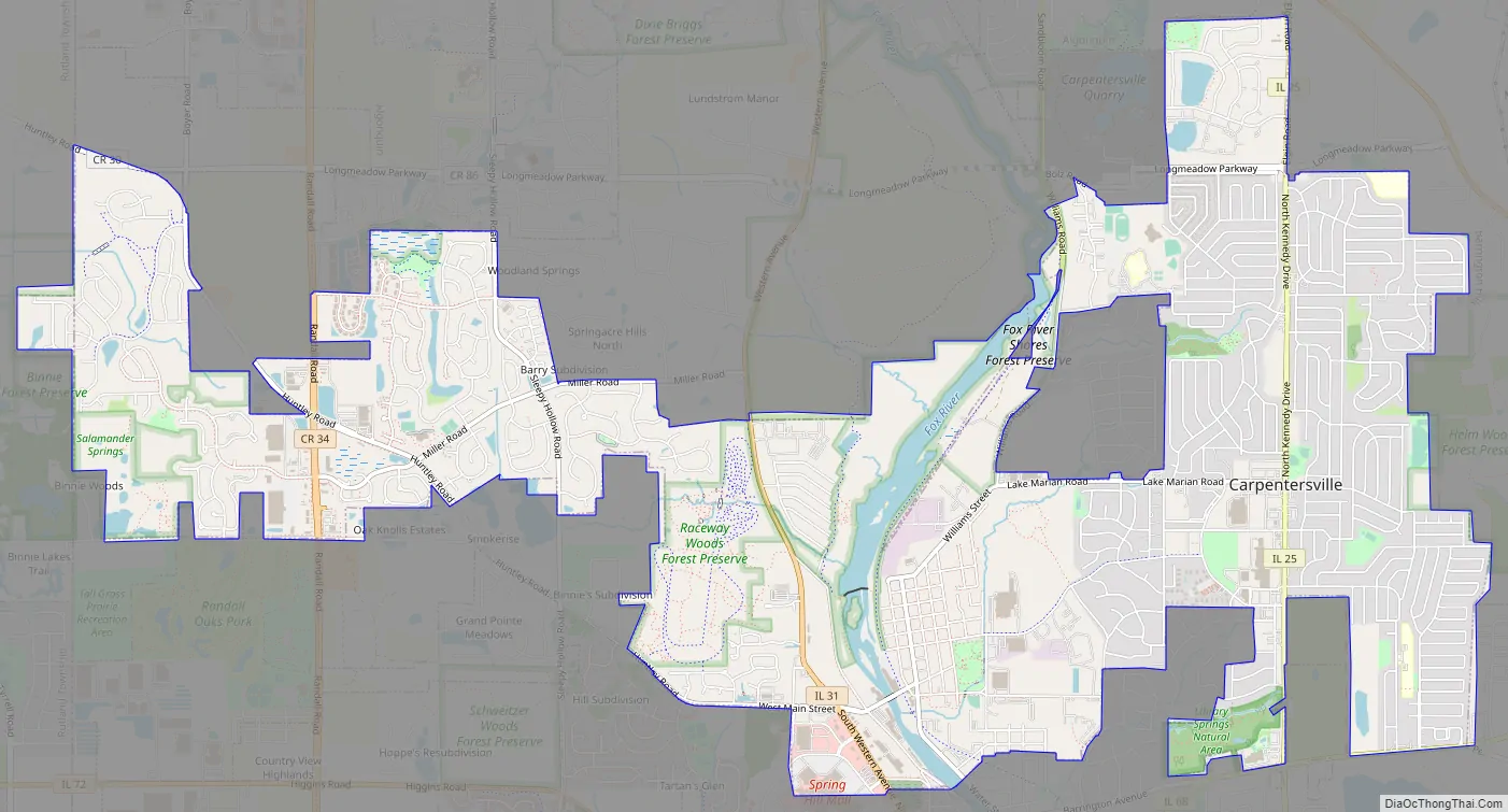
Carpentersville Road Map
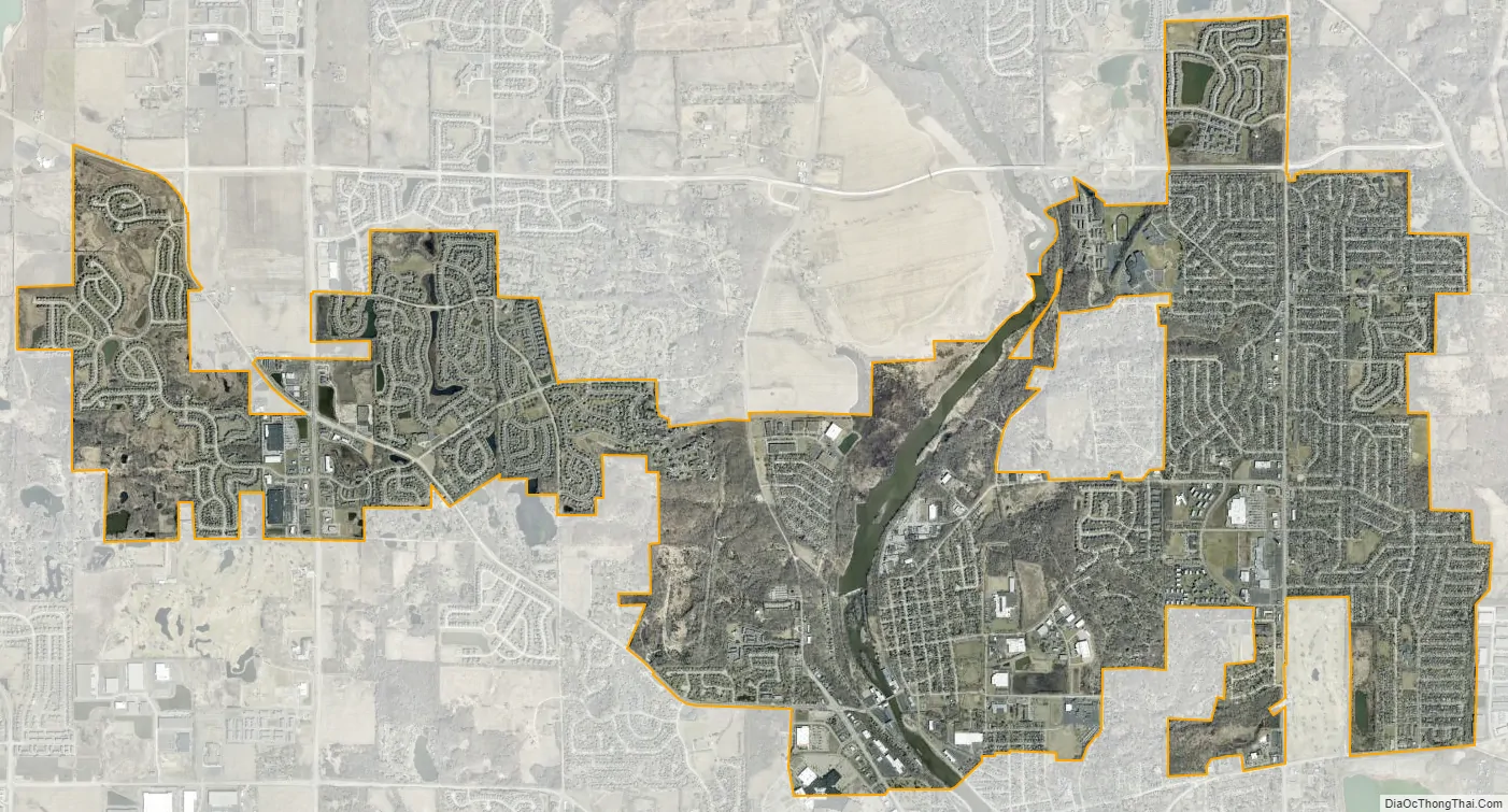
Carpentersville city Satellite Map
Geography
Carpentersville is located at 42°7′16″N 88°16′29″W / 42.12111°N 88.27472°W / 42.12111; -88.27472 (42.121156, -88.274679).
According to the 2010 census, Carpentersville has a total area of 8.097 square miles (20.97 km), of which 7.9 square miles (20.46 km) (or 97.57%) is land and 0.197 square miles (0.51 km) (or 2.43%) is water.
See also
Map of Illinois State and its subdivision:- Adams
- Alexander
- Bond
- Boone
- Brown
- Bureau
- Calhoun
- Carroll
- Cass
- Champaign
- Christian
- Clark
- Clay
- Clinton
- Coles
- Cook
- Crawford
- Cumberland
- De Kalb
- De Witt
- Douglas
- Dupage
- Edgar
- Edwards
- Effingham
- Fayette
- Ford
- Franklin
- Fulton
- Gallatin
- Greene
- Grundy
- Hamilton
- Hancock
- Hardin
- Henderson
- Henry
- Iroquois
- Jackson
- Jasper
- Jefferson
- Jersey
- Jo Daviess
- Johnson
- Kane
- Kankakee
- Kendall
- Knox
- La Salle
- Lake
- Lake Michigan
- Lawrence
- Lee
- Livingston
- Logan
- Macon
- Macoupin
- Madison
- Marion
- Marshall
- Mason
- Massac
- McDonough
- McHenry
- McLean
- Menard
- Mercer
- Monroe
- Montgomery
- Morgan
- Moultrie
- Ogle
- Peoria
- Perry
- Piatt
- Pike
- Pope
- Pulaski
- Putnam
- Randolph
- Richland
- Rock Island
- Saint Clair
- Saline
- Sangamon
- Schuyler
- Scott
- Shelby
- Stark
- Stephenson
- Tazewell
- Union
- Vermilion
- Wabash
- Warren
- Washington
- Wayne
- White
- Whiteside
- Will
- Williamson
- Winnebago
- Woodford
- Alabama
- Alaska
- Arizona
- Arkansas
- California
- Colorado
- Connecticut
- Delaware
- District of Columbia
- Florida
- Georgia
- Hawaii
- Idaho
- Illinois
- Indiana
- Iowa
- Kansas
- Kentucky
- Louisiana
- Maine
- Maryland
- Massachusetts
- Michigan
- Minnesota
- Mississippi
- Missouri
- Montana
- Nebraska
- Nevada
- New Hampshire
- New Jersey
- New Mexico
- New York
- North Carolina
- North Dakota
- Ohio
- Oklahoma
- Oregon
- Pennsylvania
- Rhode Island
- South Carolina
- South Dakota
- Tennessee
- Texas
- Utah
- Vermont
- Virginia
- Washington
- West Virginia
- Wisconsin
- Wyoming