Chemung, elevation 896 feet (273 meters), is an unincorporated census-designated place in McHenry County, Illinois, United States. Per the 2020 census, the population was 276.
| Name: | Chemung CDP |
|---|---|
| LSAD Code: | 57 |
| LSAD Description: | CDP (suffix) |
| State: | Illinois |
| County: | McHenry County |
| Elevation: | 896 ft (273 m) |
| Total Area: | 0.28 sq mi (0.73 km²) |
| Land Area: | 0.28 sq mi (0.73 km²) |
| Water Area: | 0.00 sq mi (0.00 km²) |
| Total Population: | 276 |
| Population Density: | 982.21/sq mi (379.10/km²) |
| FIPS code: | 1712879 |
Online Interactive Map
Click on ![]() to view map in "full screen" mode.
to view map in "full screen" mode.
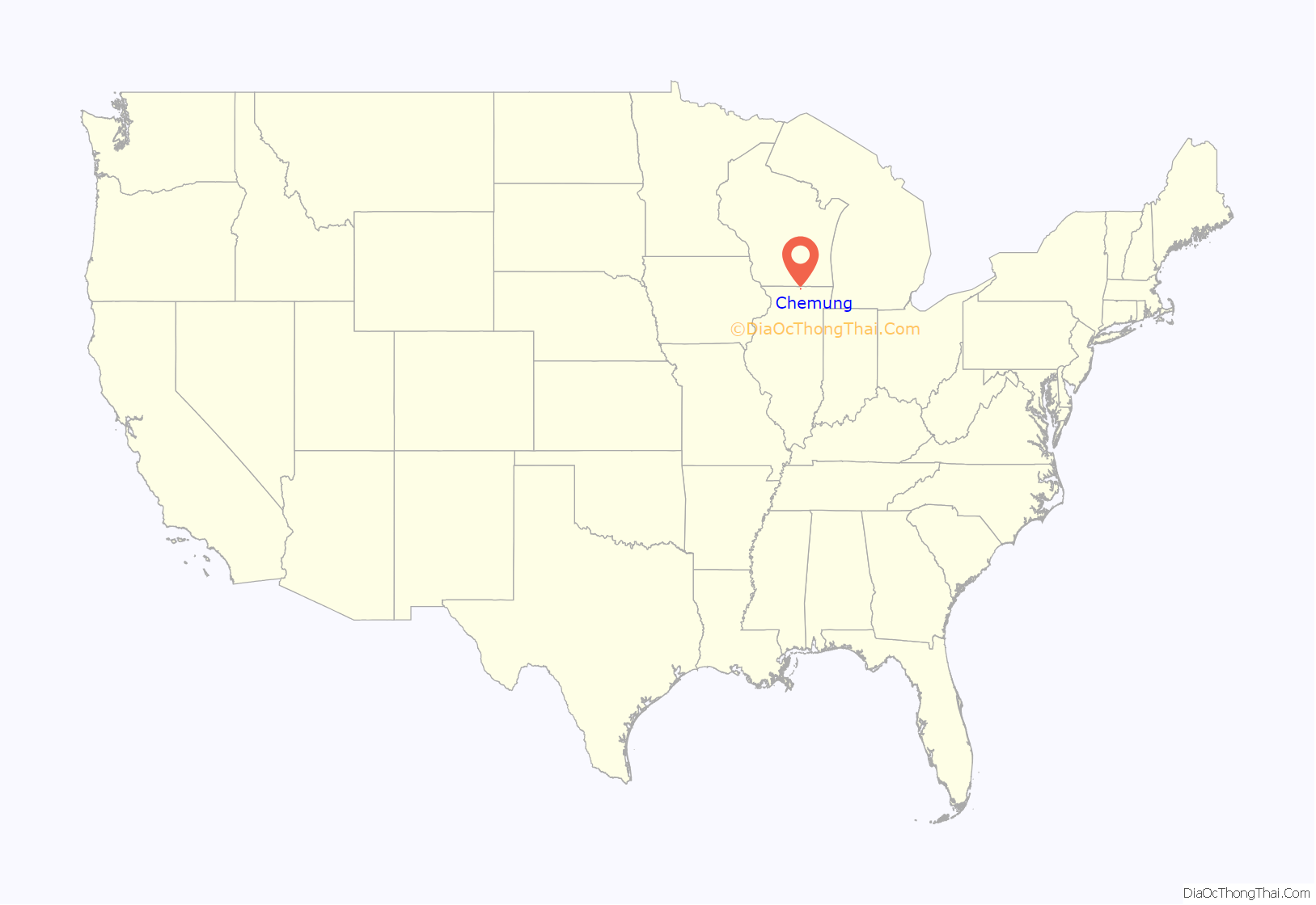
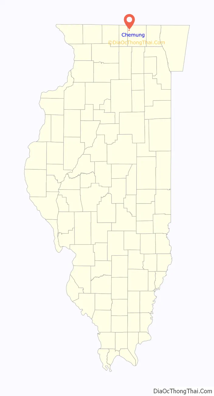
Chemung location map. Where is Chemung CDP?
History
A post office called Chemung was established in 1845, and remained in operation until it was discontinued in 1943. The name Chemung is said to be a Native American word meaning “big horn” after a large horned fossil was discovered in a nearby river.
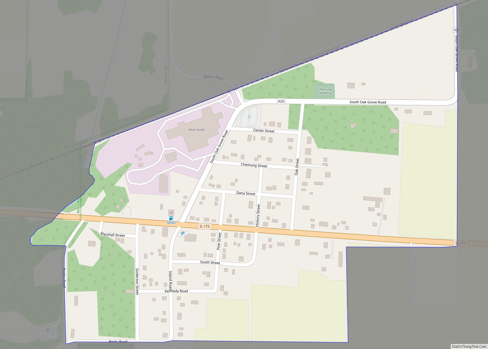
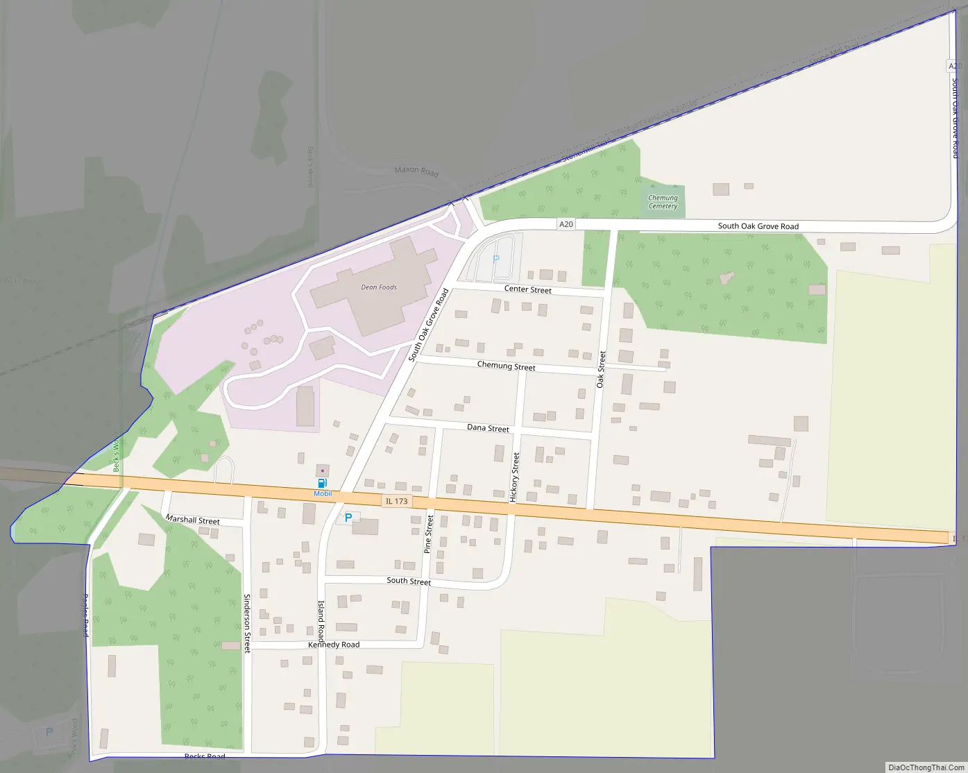
Chemung Road Map
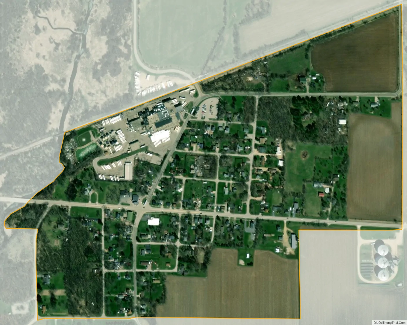
Chemung city Satellite Map
Geography
The small, unincorporated town is located approximately 3.14 miles west of downtown Harvard, Illinois at the junction of Illinois Route 173, Oak Grove Road (County Highway A-20) and Island Road (the continuation of Oak Grove Road south of Route 173). The town straddles the boundary shared by Chemung Township and Dunham Township. In terms of geographic coordinates, Chemung is located at 42°24′55″N 88°40′00″W / 42.41528°N 88.66667°W / 42.41528; -88.66667 (42.4152964, -88.6667668) In terms of the Public Land Survey System, Chemung is found in Sections 4 and 5, Township 45 North, Range 5 East; and Sections 32 and 33, Township 46 North, Range 5 East of the Third Principal Meridian. Piscasaw Creek flows along the west side of Chemung in a generally northeast to southwest direction, and a freight branch line of the Union Pacific Railroad traverses the town in an east-northeast to west-southwest direction. Chemung is served by the Harvard post office. Chemung has an area of 0.280 square miles (0.73 km), all land.
See also
Map of Illinois State and its subdivision:- Adams
- Alexander
- Bond
- Boone
- Brown
- Bureau
- Calhoun
- Carroll
- Cass
- Champaign
- Christian
- Clark
- Clay
- Clinton
- Coles
- Cook
- Crawford
- Cumberland
- De Kalb
- De Witt
- Douglas
- Dupage
- Edgar
- Edwards
- Effingham
- Fayette
- Ford
- Franklin
- Fulton
- Gallatin
- Greene
- Grundy
- Hamilton
- Hancock
- Hardin
- Henderson
- Henry
- Iroquois
- Jackson
- Jasper
- Jefferson
- Jersey
- Jo Daviess
- Johnson
- Kane
- Kankakee
- Kendall
- Knox
- La Salle
- Lake
- Lake Michigan
- Lawrence
- Lee
- Livingston
- Logan
- Macon
- Macoupin
- Madison
- Marion
- Marshall
- Mason
- Massac
- McDonough
- McHenry
- McLean
- Menard
- Mercer
- Monroe
- Montgomery
- Morgan
- Moultrie
- Ogle
- Peoria
- Perry
- Piatt
- Pike
- Pope
- Pulaski
- Putnam
- Randolph
- Richland
- Rock Island
- Saint Clair
- Saline
- Sangamon
- Schuyler
- Scott
- Shelby
- Stark
- Stephenson
- Tazewell
- Union
- Vermilion
- Wabash
- Warren
- Washington
- Wayne
- White
- Whiteside
- Will
- Williamson
- Winnebago
- Woodford
- Alabama
- Alaska
- Arizona
- Arkansas
- California
- Colorado
- Connecticut
- Delaware
- District of Columbia
- Florida
- Georgia
- Hawaii
- Idaho
- Illinois
- Indiana
- Iowa
- Kansas
- Kentucky
- Louisiana
- Maine
- Maryland
- Massachusetts
- Michigan
- Minnesota
- Mississippi
- Missouri
- Montana
- Nebraska
- Nevada
- New Hampshire
- New Jersey
- New Mexico
- New York
- North Carolina
- North Dakota
- Ohio
- Oklahoma
- Oregon
- Pennsylvania
- Rhode Island
- South Carolina
- South Dakota
- Tennessee
- Texas
- Utah
- Vermont
- Virginia
- Washington
- West Virginia
- Wisconsin
- Wyoming