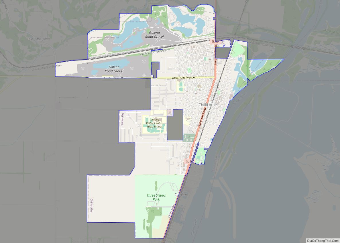
Chillicothe is a city on the Illinois River in Peoria County, Illinois, United States. The population was 6,097 at the 2010 census. Chillicothe is just north of the city of Peoria and is part of the Peoria Metropolitan Statistical Area.
| Name: | Chillicothe city |
|---|---|
| LSAD Code: | 25 |
| LSAD Description: | city (suffix) |
| State: | Illinois |
| County: | Peoria County |
| Total Area: | 5.54 sq mi (14.34 km²) |
| Land Area: | 5.27 sq mi (13.66 km²) |
| Water Area: | 0.26 sq mi (0.68 km²) |
| Total Population: | 6,128 |
| Population Density: | 1,161.93/sq mi (448.62/km²) |
| Area code: | 309 |
| FIPS code: | 1714117 |
| Website: | www.cityofchillicotheil.com |
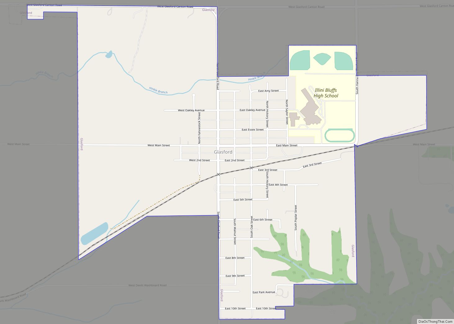
Online Interactive Map
Click on ![]() to view map in "full screen" mode.
to view map in "full screen" mode.
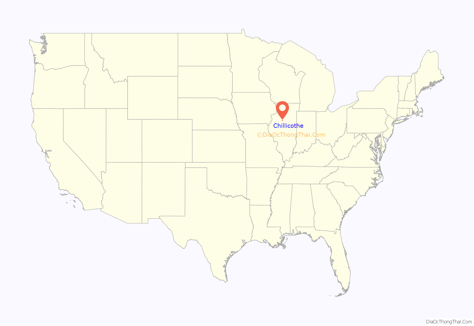
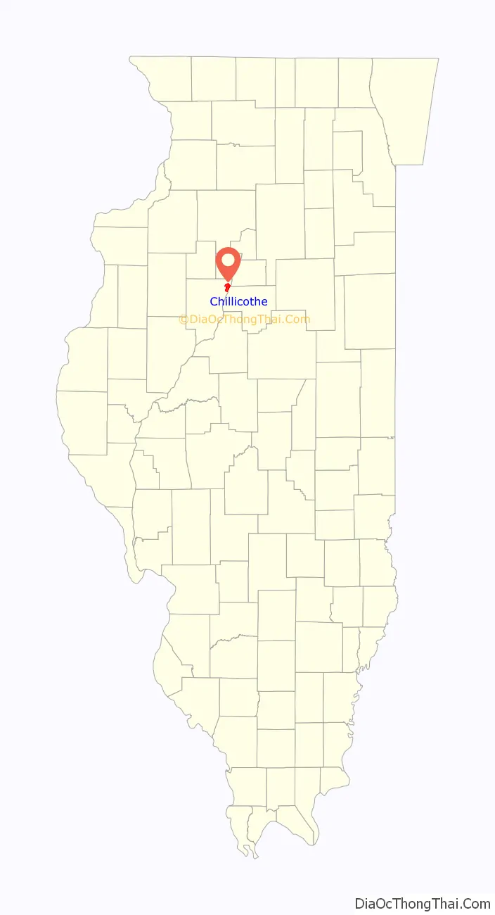
Chillicothe location map. Where is Chillicothe city?
History
The name Chillicothe comes from the name of the Chalagawtha sept of the Shawnee nation.
Along with Peoria, Chillicothe grew due to river traffic and quickly became a stop for barge and railroad traffic traveling to and from Chicago and St. Louis.
In the late 1800s, the Atchison, Topeka and Santa Fe Railway was building its mainline from Chicago to Kansas City and selected Chillicothe as its crossing point of the Illinois River. The railroad quickly became an establishment in Chillicothe as a crew change point and a notable stop in Central Illinois. Chillicothe today still remains a key point on the Southern Transcon route between Chicago and Los Angeles with high frequency intermodal freight trains moving through daily.
Chillicothe is the host to The Summer Camp Music Festival, a multi-day music festival created by Jay Goldberg Events & Entertainment that is held annually at Three Sisters Park. As of 2018, this will mark the 18th straight year that event has been held in Chillicothe.
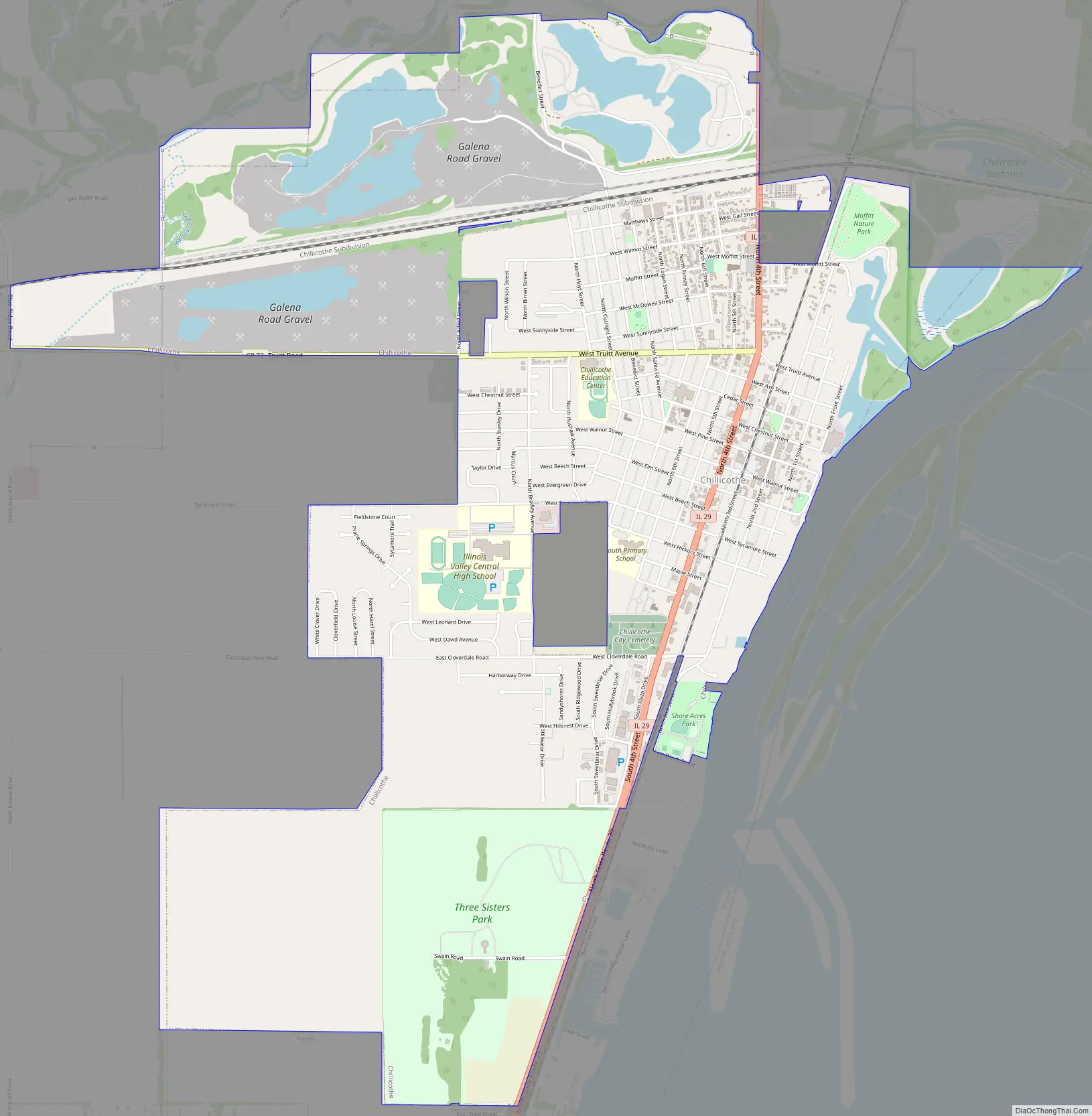
Chillicothe Road Map
Chillicothe city Satellite Map
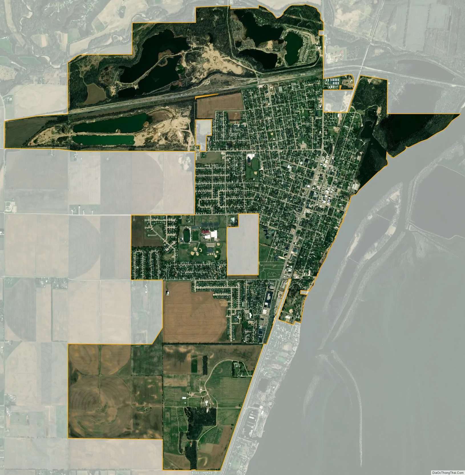
Geography
Chillicothe is located at 40°55′11″N 89°29′34″W / 40.919792°N 89.492848°W / 40.919792; -89.492848.
According to the 2010 census, Chillicothe has a total area of 5.415 square miles (14.02 km), of which 5.13 square miles (13.29 km) (or 94.74%) is land and 0.285 square miles (0.74 km) (or 5.26%) is water.
Chillicothe is located on the Illinois River and on the parallel Iowa Interstate Railroad (IAIS) branch, from Bureau to Peoria, which was formerly the Rock Island Railroad. Crossing the IAIS and the Illinois River at Chillicothe is the former Santa Fe Railroad, now owned by BNSF Railway. Almost 4 miles outside of town the BNSF Railway operates one of the most notable civil engineering points on the Chillicothe Subdivision. Edelstein Hill is one of the steepest climbs on the railway system and attracts many railfans to see locomotives pulling intermodal trains up the hill.
The Illinois River runs both north and south connecting Chicago with St. Louis. Barge traffic is occasional as it is an efficient means of transportation for some bulk products. Eight miles to the north is Sparland and three miles to the south is Rome. Peoria is 20 miles to the south.
Chillicothe sits along the Illinois River Valley where gravel and sand from prehistoric river development sits. It is currently being dug up and is sold for construction and roadbeds. In Chillicothe there are relatively large service facilities and connections to the BNSF Railway.
Even though Chillicothe sits along a river valley, forests are very common. Marshall State Refuge sits to the north and Atchison Waterfowl Refuge in Woodford County. The bluffs that surround it are full of hunting spots and locations where deer are common. Duck hunting as well is popular in the waterfront sloughs and swamps to the north.
See also
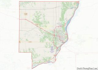
Map of Illinois State and its subdivision:- Adams
- Alexander
- Bond
- Boone
- Brown
- Bureau
- Calhoun
- Carroll
- Cass
- Champaign
- Christian
- Clark
- Clay
- Clinton
- Coles
- Cook
- Crawford
- Cumberland
- De Kalb
- De Witt
- Douglas
- Dupage
- Edgar
- Edwards
- Effingham
- Fayette
- Ford
- Franklin
- Fulton
- Gallatin
- Greene
- Grundy
- Hamilton
- Hancock
- Hardin
- Henderson
- Henry
- Iroquois
- Jackson
- Jasper
- Jefferson
- Jersey
- Jo Daviess
- Johnson
- Kane
- Kankakee
- Kendall
- Knox
- La Salle
- Lake
- Lake Michigan
- Lawrence
- Lee
- Livingston
- Logan
- Macon
- Macoupin
- Madison
- Marion
- Marshall
- Mason
- Massac
- McDonough
- McHenry
- McLean
- Menard
- Mercer
- Monroe
- Montgomery
- Morgan
- Moultrie
- Ogle
- Peoria
- Perry
- Piatt
- Pike
- Pope
- Pulaski
- Putnam
- Randolph
- Richland
- Rock Island
- Saint Clair
- Saline
- Sangamon
- Schuyler
- Scott
- Shelby
- Stark
- Stephenson
- Tazewell
- Union
- Vermilion
- Wabash
- Warren
- Washington
- Wayne
- White
- Whiteside
- Will
- Williamson
- Winnebago
- Woodford
- Alabama
- Alaska
- Arizona
- Arkansas
- California
- Colorado
- Connecticut
- Delaware
- District of Columbia
- Florida
- Georgia
- Hawaii
- Idaho
- Illinois
- Indiana
- Iowa
- Kansas
- Kentucky
- Louisiana
- Maine
- Maryland
- Massachusetts
- Michigan
- Minnesota
- Mississippi
- Missouri
- Montana
- Nebraska
- Nevada
- New Hampshire
- New Jersey
- New Mexico
- New York
- North Carolina
- North Dakota
- Ohio
- Oklahoma
- Oregon
- Pennsylvania
- Rhode Island
- South Carolina
- South Dakota
- Tennessee
- Texas
- Utah
- Vermont
- Virginia
- Washington
- West Virginia
- Wisconsin
- Wyoming