Claremont is a village in Richland County, Illinois, United States. The population was 212 at the 2000 census.
| Name: | Claremont village |
|---|---|
| LSAD Code: | 47 |
| LSAD Description: | village (suffix) |
| State: | Illinois |
| County: | Richland County |
| Elevation: | 509 ft (155 m) |
| Total Area: | 0.79 sq mi (2.05 km²) |
| Land Area: | 0.79 sq mi (2.05 km²) |
| Water Area: | 0.00 sq mi (0.00 km²) |
| Total Population: | 161 |
| Population Density: | 203.03/sq mi (78.36/km²) |
| Area code: | 618 |
| FIPS code: | 1714533 |
| GNISfeature ID: | 2397628 |
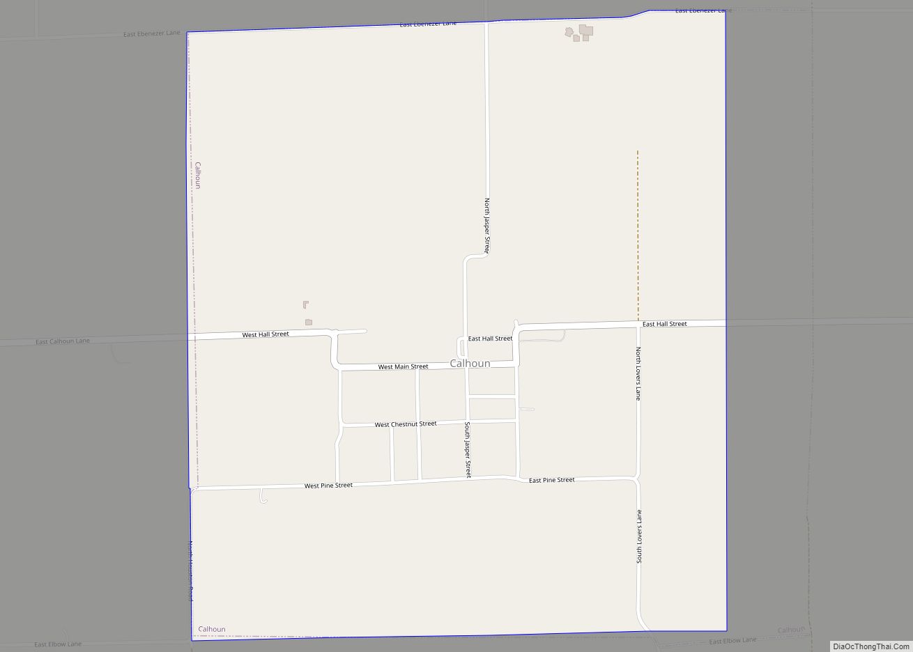
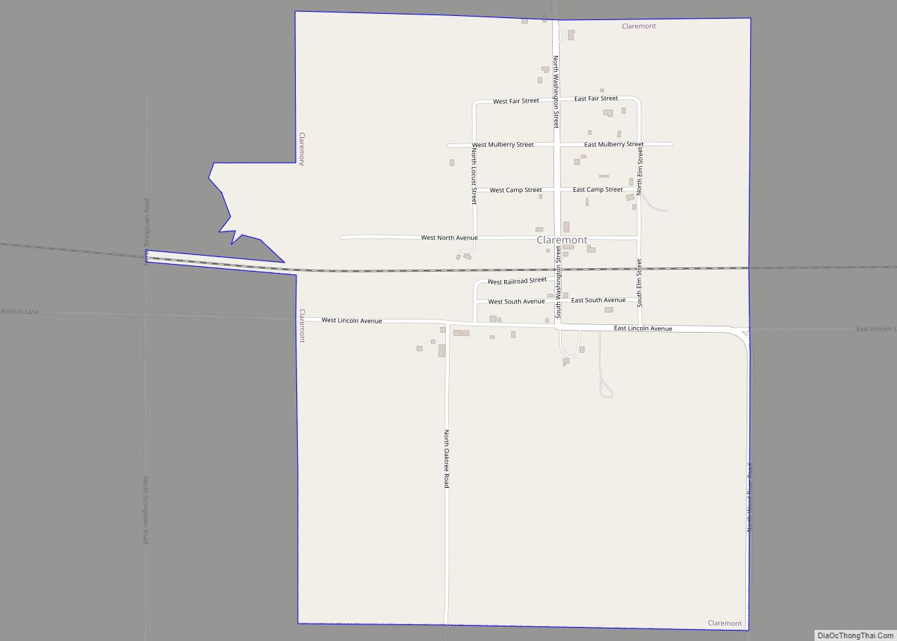
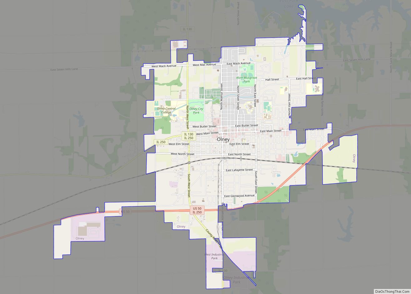
Online Interactive Map
Click on ![]() to view map in "full screen" mode.
to view map in "full screen" mode.
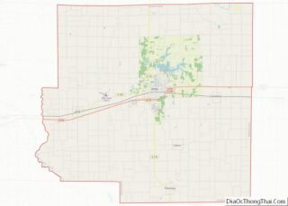
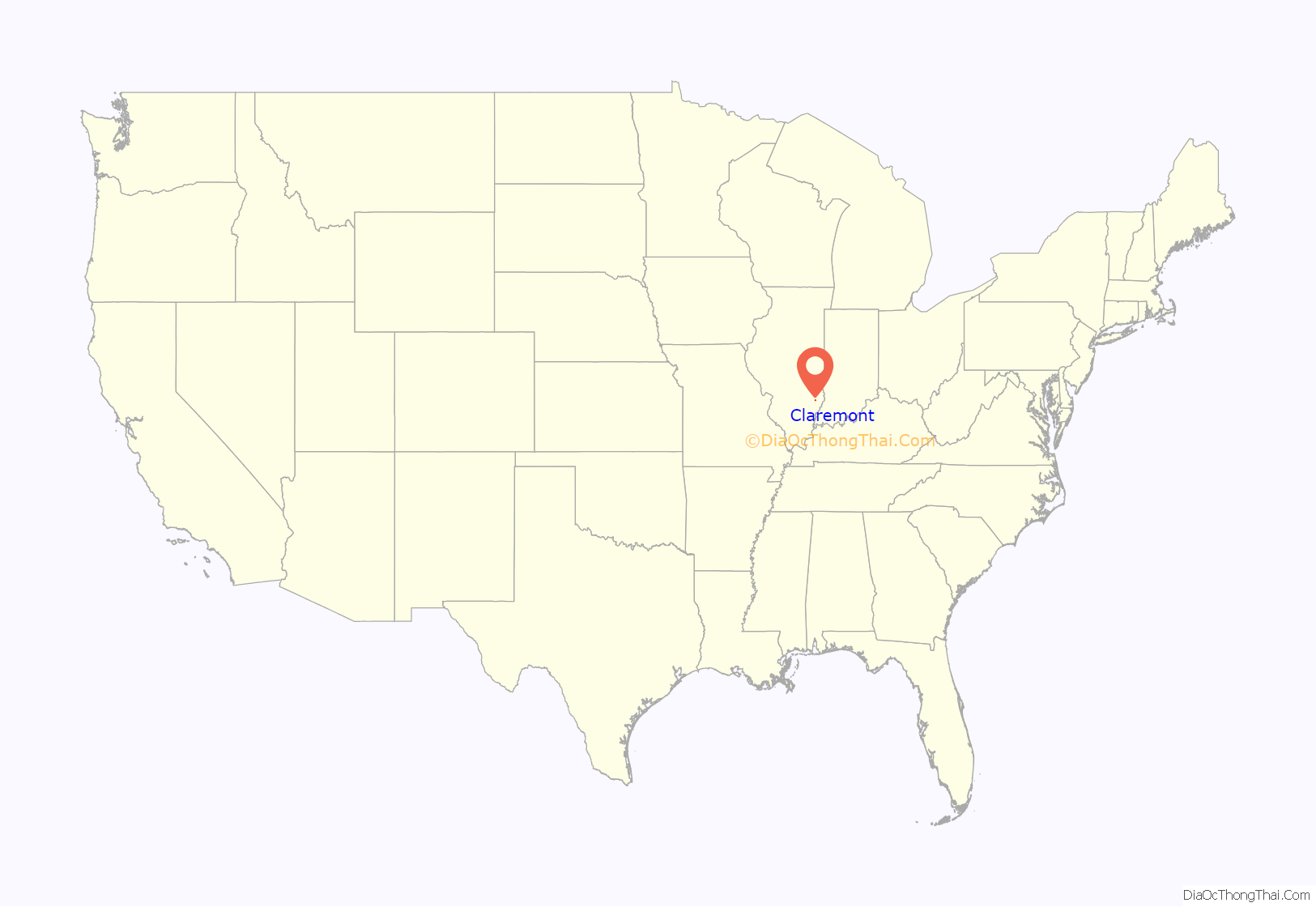
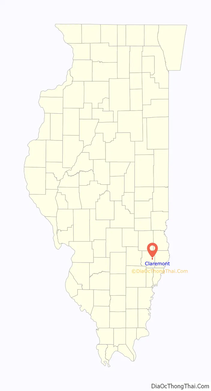
Claremont location map. Where is Claremont village?
History
Though Claremont (the town) was founded in 1853, people first settled in Claremont Township in 1818, the year Illinois was admitted to the union. In December 1852 Claremont precinct was formed.
The first settlers in Claremont Township included Lot Basden, who helped plat Olney, James Elliott, who owned land here, Thomas L. Stewart, an early constable and sheriff of Richland County, and Martin Utterback, who reportedly hauled logs to build the first county courthouse. Others included William Laws, Willis Blanchard, Bryant Bullard, Richard Brinkley, Jacob and William Coanour, and the Calhouns.
Claremont was laid out by Jacob May. In 1853 he moved his store to a point along the Trace Road. In 1855, when the O & M Railroad was built, he moved his store to a site along the railroad, and the present village of Claremont came into existence.
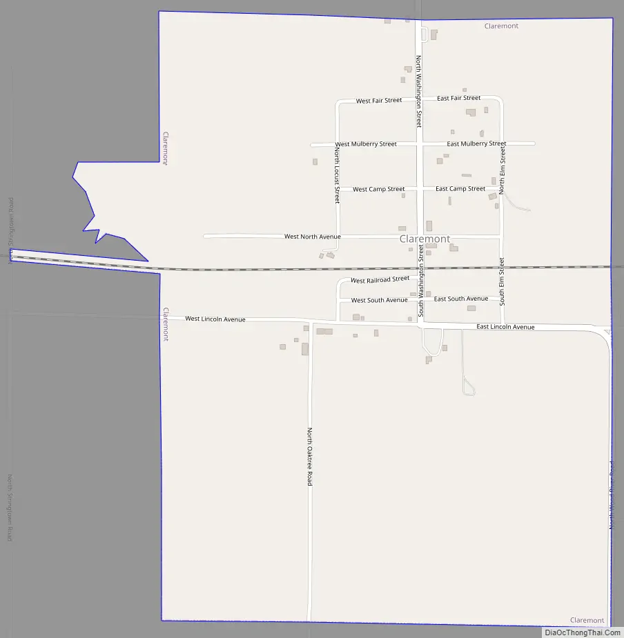
Claremont Road Map
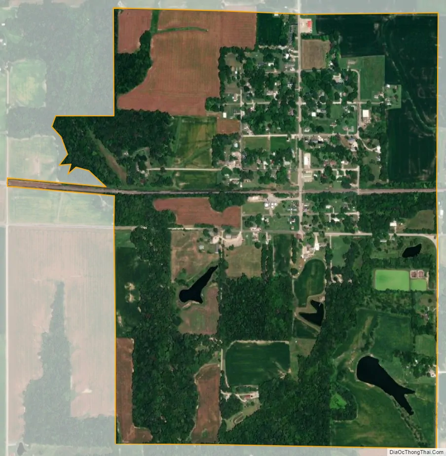
Claremont city Satellite Map
Geography
Claremont is located just southeast of Olney, and just south of U.S. Route 150.
According to the 2010 census, Claremont has a total area of 1.14 square miles (2.95 km), all land.
See also
Map of Illinois State and its subdivision:- Adams
- Alexander
- Bond
- Boone
- Brown
- Bureau
- Calhoun
- Carroll
- Cass
- Champaign
- Christian
- Clark
- Clay
- Clinton
- Coles
- Cook
- Crawford
- Cumberland
- De Kalb
- De Witt
- Douglas
- Dupage
- Edgar
- Edwards
- Effingham
- Fayette
- Ford
- Franklin
- Fulton
- Gallatin
- Greene
- Grundy
- Hamilton
- Hancock
- Hardin
- Henderson
- Henry
- Iroquois
- Jackson
- Jasper
- Jefferson
- Jersey
- Jo Daviess
- Johnson
- Kane
- Kankakee
- Kendall
- Knox
- La Salle
- Lake
- Lake Michigan
- Lawrence
- Lee
- Livingston
- Logan
- Macon
- Macoupin
- Madison
- Marion
- Marshall
- Mason
- Massac
- McDonough
- McHenry
- McLean
- Menard
- Mercer
- Monroe
- Montgomery
- Morgan
- Moultrie
- Ogle
- Peoria
- Perry
- Piatt
- Pike
- Pope
- Pulaski
- Putnam
- Randolph
- Richland
- Rock Island
- Saint Clair
- Saline
- Sangamon
- Schuyler
- Scott
- Shelby
- Stark
- Stephenson
- Tazewell
- Union
- Vermilion
- Wabash
- Warren
- Washington
- Wayne
- White
- Whiteside
- Will
- Williamson
- Winnebago
- Woodford
- Alabama
- Alaska
- Arizona
- Arkansas
- California
- Colorado
- Connecticut
- Delaware
- District of Columbia
- Florida
- Georgia
- Hawaii
- Idaho
- Illinois
- Indiana
- Iowa
- Kansas
- Kentucky
- Louisiana
- Maine
- Maryland
- Massachusetts
- Michigan
- Minnesota
- Mississippi
- Missouri
- Montana
- Nebraska
- Nevada
- New Hampshire
- New Jersey
- New Mexico
- New York
- North Carolina
- North Dakota
- Ohio
- Oklahoma
- Oregon
- Pennsylvania
- Rhode Island
- South Carolina
- South Dakota
- Tennessee
- Texas
- Utah
- Vermont
- Virginia
- Washington
- West Virginia
- Wisconsin
- Wyoming