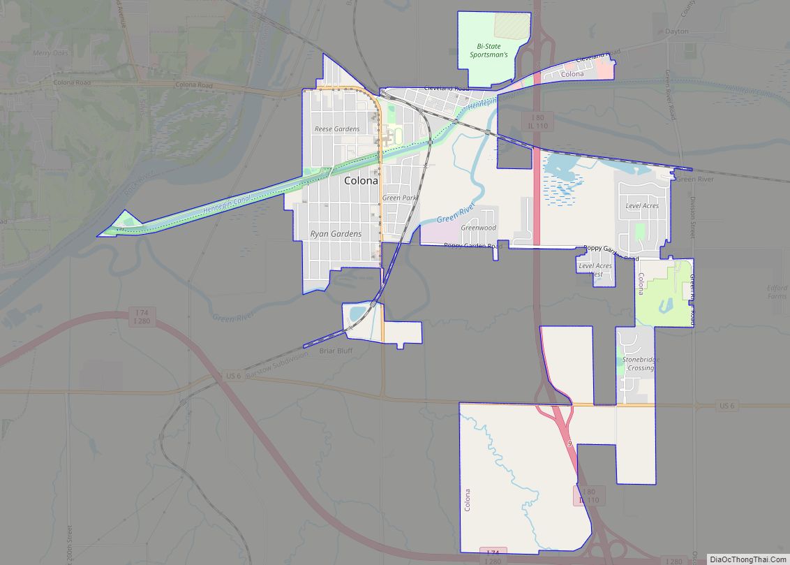
Colona is a city in Henry County, Illinois, along the Green River. It is part of the Quad Cities metropolitan area. The population was 5,307 at the 2020 census, up from 5,099 at the 2010 census.
The City of Colona was created in 1997 by the merger of the former City of Green Rock and the former Village of Colona. It was the first community in Illinois to merge by popular vote.
| Name: | Colona city |
|---|---|
| LSAD Code: | 25 |
| LSAD Description: | city (suffix) |
| State: | Illinois |
| County: | Henry County |
| Land Area: | 3.82 sq mi (9.89 km²) |
| Water Area: | 0.10 sq mi (0.27 km²) |
| Population Density: | 1,321.37/sq mi (510.18/km²) |
| Area code: | 309 |
| FIPS code: | 1715664 |
| Website: | www.ColonaIL.com |
Online Interactive Map
Click on ![]() to view map in "full screen" mode.
to view map in "full screen" mode.
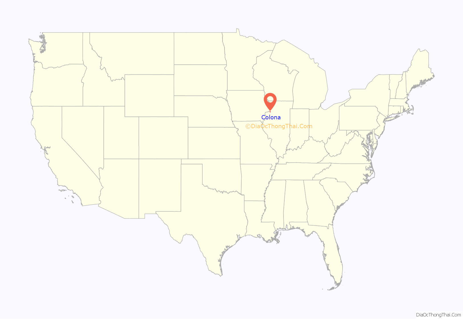
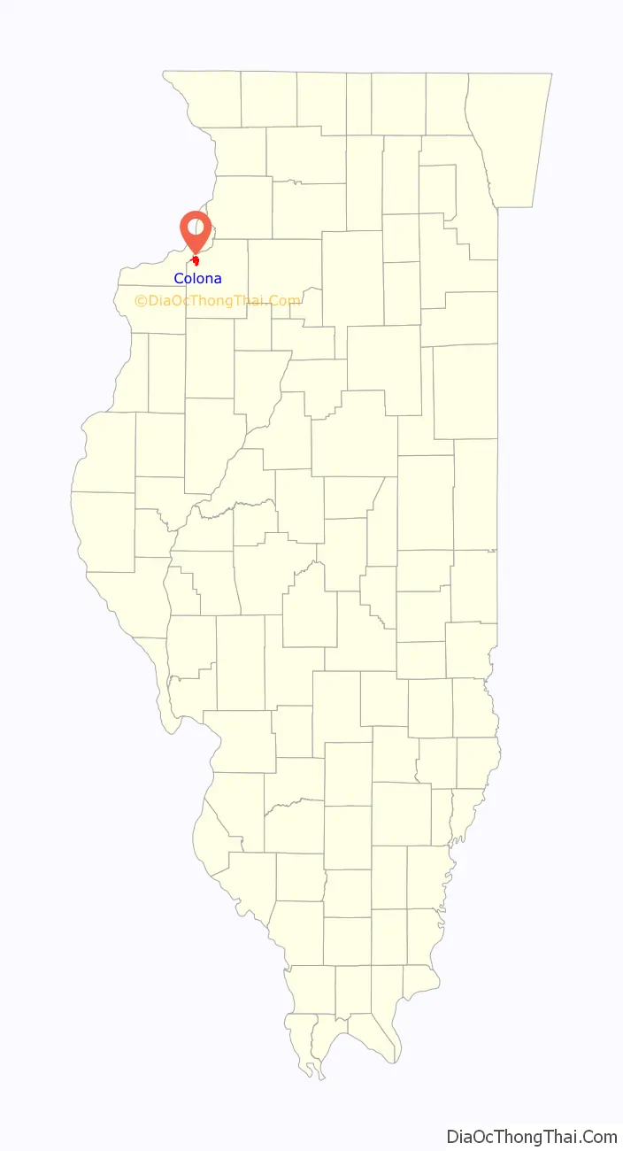
Colona location map. Where is Colona city?
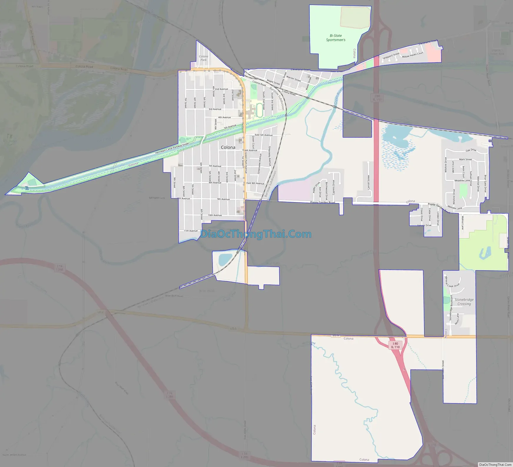
Colona Road Map
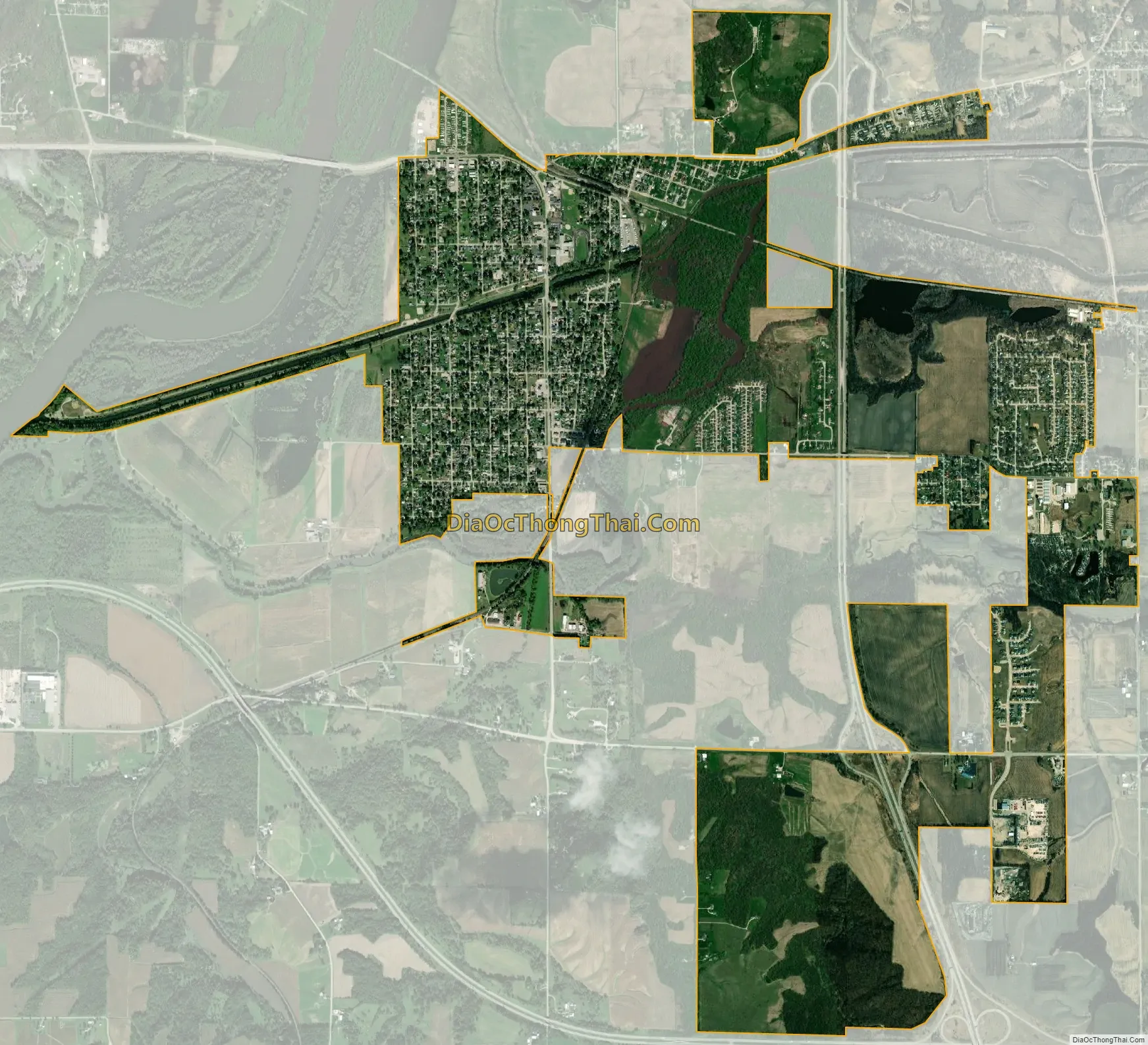
Colona city Satellite Map
Geography
Colona is located at 41°28′32″N 90°20′56″W / 41.47556°N 90.34889°W / 41.47556; -90.34889 (41.475684, -90.348787). Colona lies near the Rock River in a valley, and is surrounded by higher land. This is where the Green River and Hennepin Canal flow into the Rock River (Mississippi River).
According to the 2010 census, Colona has a total area of 4.126 square miles (10.69 km), of which 4.02 square miles (10.41 km) (or 97.43%) is land and 0.106 square miles (0.27 km) (or 2.57%) is water.
See also
Map of Illinois State and its subdivision:- Adams
- Alexander
- Bond
- Boone
- Brown
- Bureau
- Calhoun
- Carroll
- Cass
- Champaign
- Christian
- Clark
- Clay
- Clinton
- Coles
- Cook
- Crawford
- Cumberland
- De Kalb
- De Witt
- Douglas
- Dupage
- Edgar
- Edwards
- Effingham
- Fayette
- Ford
- Franklin
- Fulton
- Gallatin
- Greene
- Grundy
- Hamilton
- Hancock
- Hardin
- Henderson
- Henry
- Iroquois
- Jackson
- Jasper
- Jefferson
- Jersey
- Jo Daviess
- Johnson
- Kane
- Kankakee
- Kendall
- Knox
- La Salle
- Lake
- Lake Michigan
- Lawrence
- Lee
- Livingston
- Logan
- Macon
- Macoupin
- Madison
- Marion
- Marshall
- Mason
- Massac
- McDonough
- McHenry
- McLean
- Menard
- Mercer
- Monroe
- Montgomery
- Morgan
- Moultrie
- Ogle
- Peoria
- Perry
- Piatt
- Pike
- Pope
- Pulaski
- Putnam
- Randolph
- Richland
- Rock Island
- Saint Clair
- Saline
- Sangamon
- Schuyler
- Scott
- Shelby
- Stark
- Stephenson
- Tazewell
- Union
- Vermilion
- Wabash
- Warren
- Washington
- Wayne
- White
- Whiteside
- Will
- Williamson
- Winnebago
- Woodford
- Alabama
- Alaska
- Arizona
- Arkansas
- California
- Colorado
- Connecticut
- Delaware
- District of Columbia
- Florida
- Georgia
- Hawaii
- Idaho
- Illinois
- Indiana
- Iowa
- Kansas
- Kentucky
- Louisiana
- Maine
- Maryland
- Massachusetts
- Michigan
- Minnesota
- Mississippi
- Missouri
- Montana
- Nebraska
- Nevada
- New Hampshire
- New Jersey
- New Mexico
- New York
- North Carolina
- North Dakota
- Ohio
- Oklahoma
- Oregon
- Pennsylvania
- Rhode Island
- South Carolina
- South Dakota
- Tennessee
- Texas
- Utah
- Vermont
- Virginia
- Washington
- West Virginia
- Wisconsin
- Wyoming