Dunlap is a village in Peoria County, Illinois, United States. Its population was 1,386 people as of the 2010 census. Dunlap is part of the Peoria metropolitan area and growth in the city of Peoria is extending towards the village. There are only a handful of businesses in the village’s 16 blocks.
| Name: | Dunlap village |
|---|---|
| LSAD Code: | 47 |
| LSAD Description: | village (suffix) |
| State: | Illinois |
| County: | Peoria County |
| Founded: | June 12, 1871 |
| Elevation: | 699 ft (213 m) |
| Total Area: | 2.78 sq mi (7.21 km²) |
| Land Area: | 2.78 sq mi (7.21 km²) |
| Water Area: | 0.00 sq mi (0.00 km²) |
| Total Population: | 1,603 |
| Population Density: | 575.79/sq mi (222.29/km²) |
| ZIP code: | 61525 |
| Area code: | 309 |
| FIPS code: | 1721176 |
| Website: | www.villageofdunlap-il.gov |
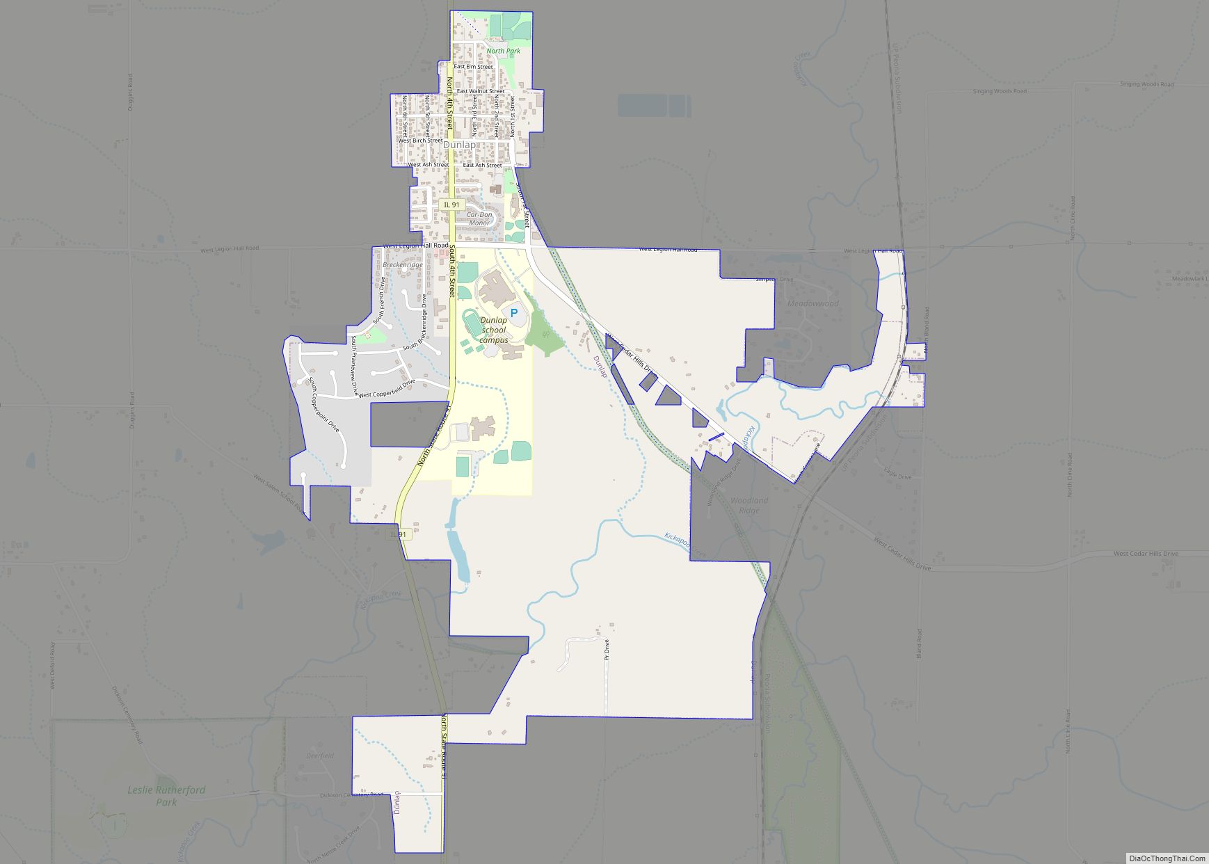
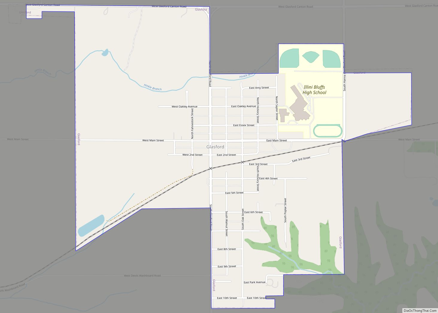
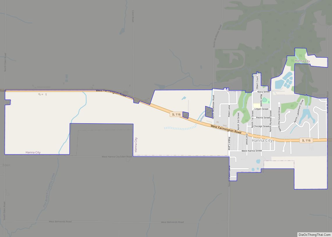
Online Interactive Map
Click on ![]() to view map in "full screen" mode.
to view map in "full screen" mode.
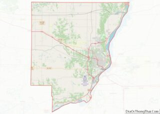
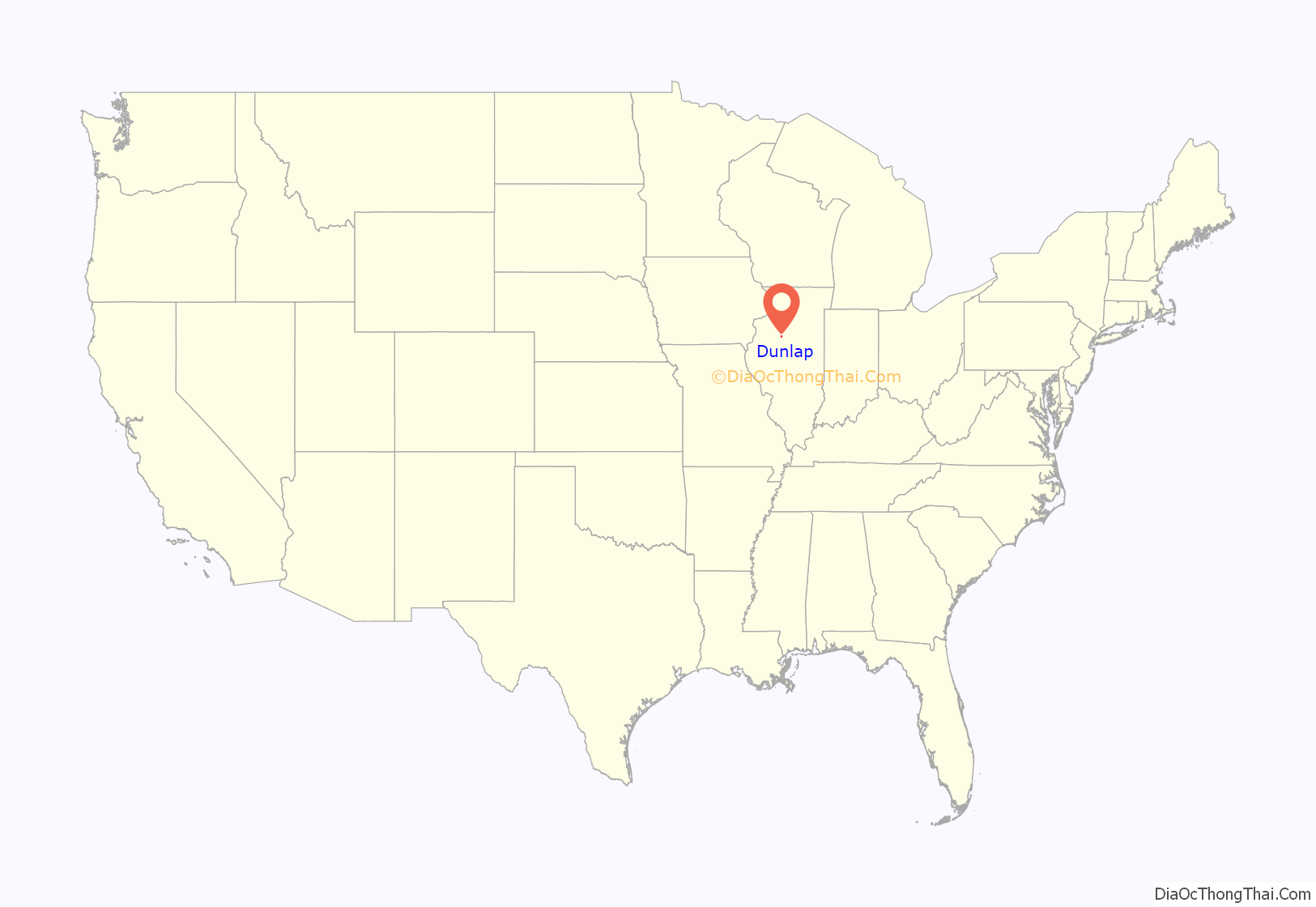
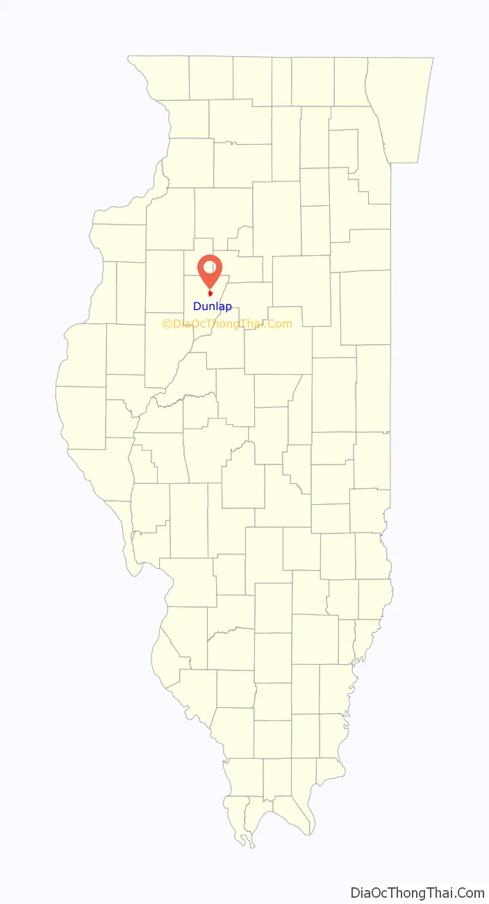
Dunlap location map. Where is Dunlap village?
History
The town of Dunlap was officially established on June 12, 1871 on 40 acres of land owned by Alva Dunlap. The site of his former home is now occupied by the Prospect United Methodist Church. The town was originally located along the Rock Island Railroad. A post office has been in operation at Dunlap since 1871.
The Dunlap Volunteer Fire Department and Rescue Squad was established in 1899. Police services are provided by the Peoria County Sheriff’s Office. The meeting of the first Dunlap Village Council was on January 7, 1952, and the town petitioned for incorporation on February 19, 1952. The current Village Hall was built in 1995.
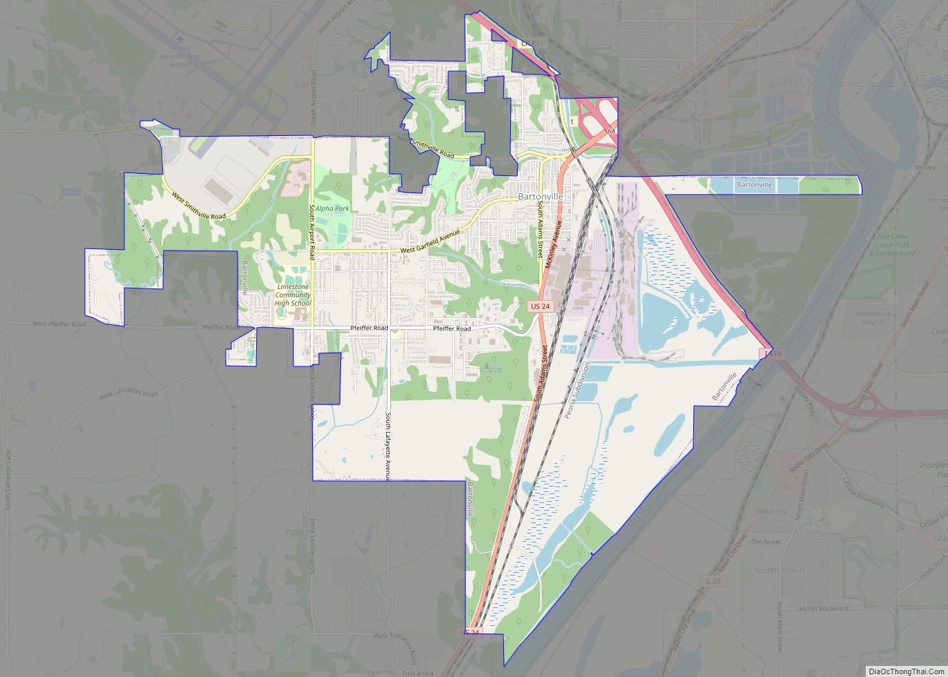
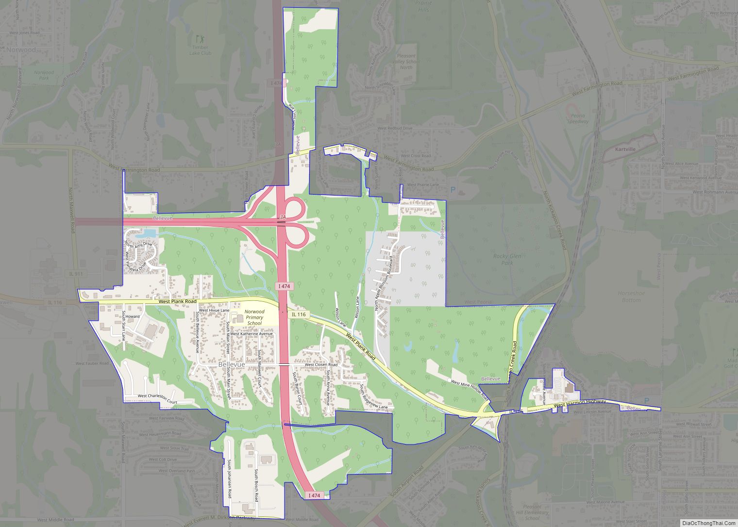
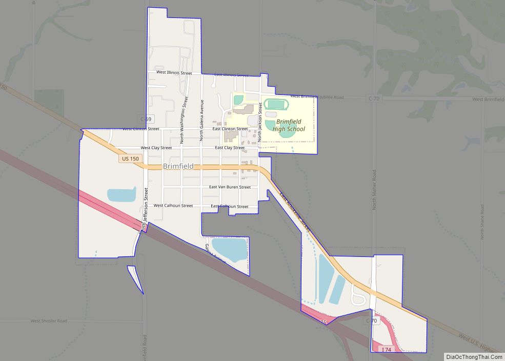
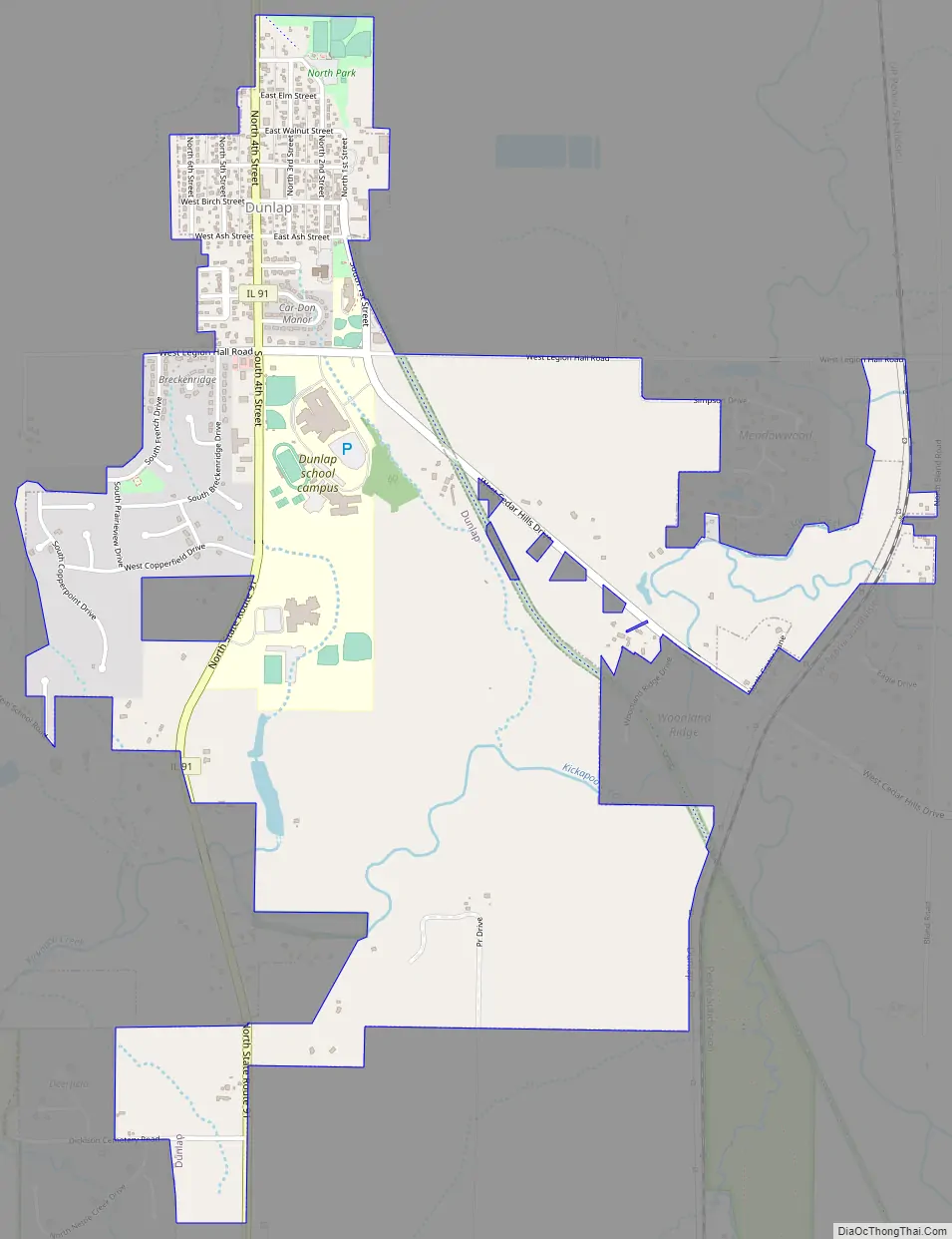
Dunlap Road Map
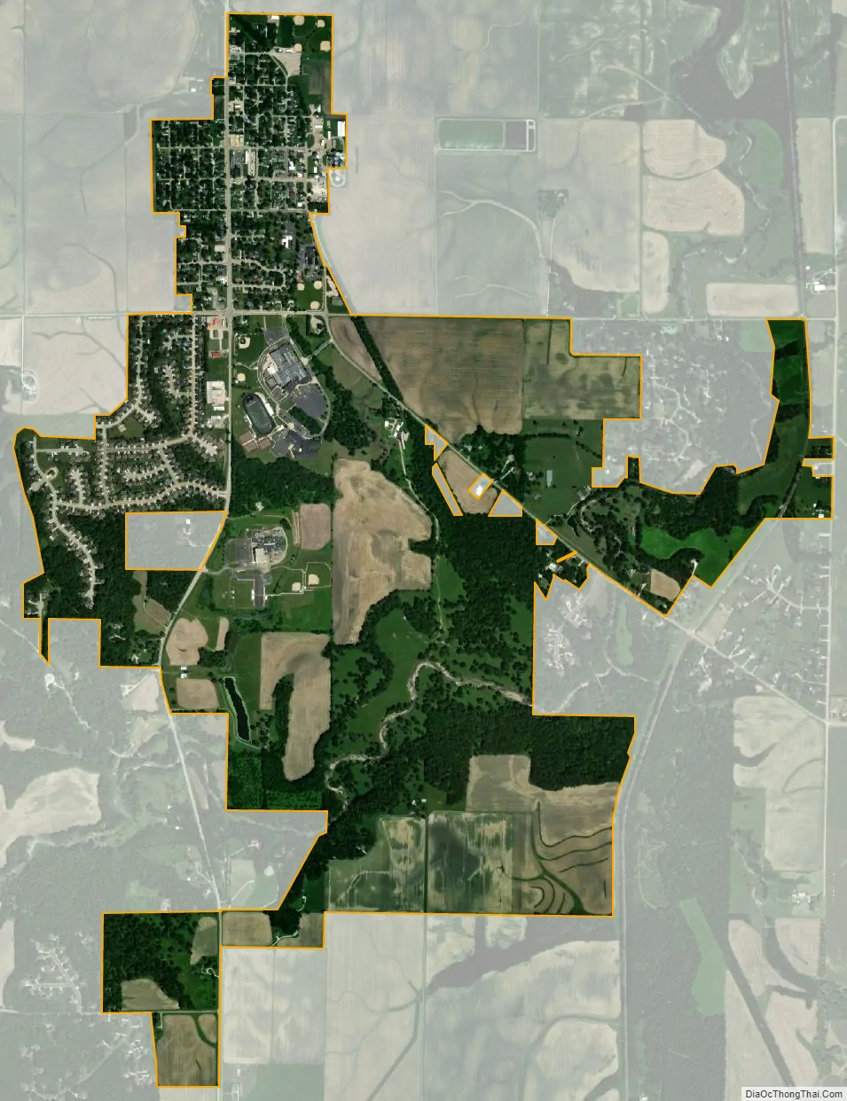
Dunlap city Satellite Map
Geography
According to the 2010 census, Dunlap has a total area of 0.54 square miles (1.40 km), all land.
See also
Map of Illinois State and its subdivision:- Adams
- Alexander
- Bond
- Boone
- Brown
- Bureau
- Calhoun
- Carroll
- Cass
- Champaign
- Christian
- Clark
- Clay
- Clinton
- Coles
- Cook
- Crawford
- Cumberland
- De Kalb
- De Witt
- Douglas
- Dupage
- Edgar
- Edwards
- Effingham
- Fayette
- Ford
- Franklin
- Fulton
- Gallatin
- Greene
- Grundy
- Hamilton
- Hancock
- Hardin
- Henderson
- Henry
- Iroquois
- Jackson
- Jasper
- Jefferson
- Jersey
- Jo Daviess
- Johnson
- Kane
- Kankakee
- Kendall
- Knox
- La Salle
- Lake
- Lake Michigan
- Lawrence
- Lee
- Livingston
- Logan
- Macon
- Macoupin
- Madison
- Marion
- Marshall
- Mason
- Massac
- McDonough
- McHenry
- McLean
- Menard
- Mercer
- Monroe
- Montgomery
- Morgan
- Moultrie
- Ogle
- Peoria
- Perry
- Piatt
- Pike
- Pope
- Pulaski
- Putnam
- Randolph
- Richland
- Rock Island
- Saint Clair
- Saline
- Sangamon
- Schuyler
- Scott
- Shelby
- Stark
- Stephenson
- Tazewell
- Union
- Vermilion
- Wabash
- Warren
- Washington
- Wayne
- White
- Whiteside
- Will
- Williamson
- Winnebago
- Woodford
- Alabama
- Alaska
- Arizona
- Arkansas
- California
- Colorado
- Connecticut
- Delaware
- District of Columbia
- Florida
- Georgia
- Hawaii
- Idaho
- Illinois
- Indiana
- Iowa
- Kansas
- Kentucky
- Louisiana
- Maine
- Maryland
- Massachusetts
- Michigan
- Minnesota
- Mississippi
- Missouri
- Montana
- Nebraska
- Nevada
- New Hampshire
- New Jersey
- New Mexico
- New York
- North Carolina
- North Dakota
- Ohio
- Oklahoma
- Oregon
- Pennsylvania
- Rhode Island
- South Carolina
- South Dakota
- Tennessee
- Texas
- Utah
- Vermont
- Virginia
- Washington
- West Virginia
- Wisconsin
- Wyoming