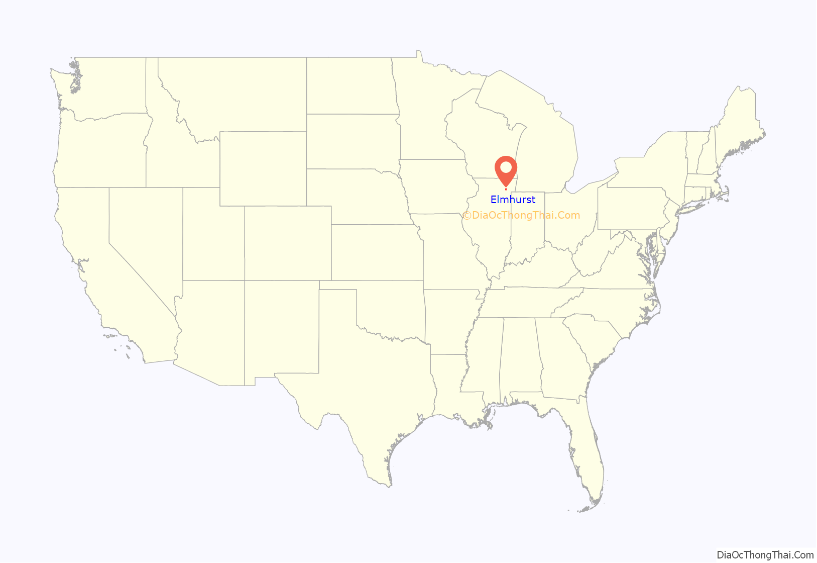
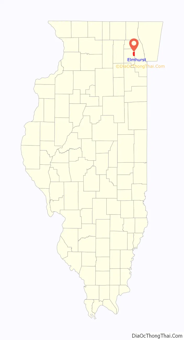
Elmhurst is a city mostly in DuPage County and overlapping into Cook County in the U.S. state of Illinois, and a western suburb of Chicago.
| Name: | Elmhurst city |
|---|---|
| LSAD Code: | 25 |
| LSAD Description: | city (suffix) |
| State: | Illinois |
| County: | Cook County, DuPage County |
| Incorporated: | June 5, 1882 (1882-06-05) |
| Elevation: | 686 ft (209 m) |
| Total Area: | 10.28 sq mi (26.62 km²) |
| Land Area: | 10.22 sq mi (26.47 km²) |
| Water Area: | 0.06 sq mi (0.15 km²) 0.58% |
| Total Population: | 45,786 |
| Population Density: | 4,480.92/sq mi (1,730.02/km²) |
| ZIP code: | 60126, 60127 |
| FIPS code: | 1723620 |
| Website: | www.elmhurst.org |
Online Interactive Map
Click on ![]() to view map in "full screen" mode.
to view map in "full screen" mode.
Elmhurst location map. Where is Elmhurst city?
History
Members of the Potawatomi Native American people, who settled along Salt Creek just south of where the city would develop, are the earliest known settlers of the Elmhurst area. Around 1836, European-American immigrants settled on tracts of land along the same creek. At what would become Elmhurst City Centre, a native of Ohio named Gerry Bates established a community on a tract of “treeless land” in 1842.
The following year, Hill Cottage Tavern opened where St. Charles Road and Cottage Hill Avenue presently intersect. In 1845, the community was officially named Cottage Hill when a post office was established. Four years later, the Galena and Chicago Union Railroad was given right-of-way through Cottage Hill giving farmers easier access to Chicago. The first Elmhurst railroad station was built in 1894. The community changed its name to Elmhurst in 1869. In 1871, Elmhurst University was organized and currently has 3,500 undergraduates and about 300 graduate students. Elmhurst was incorporated as a village in 1882, with a population between 723 and 1,050, and legal boundaries of St. Charles Road to North Avenue, and one half mile west and one quarter mile east of York Street. Elmhurst Memorial Hospital was founded in 1926 as the first hospital in DuPage County.
The Memorial Parade has run every Memorial Day since 1918. The annual Elmhurst St. Patrick’s Day Parade continues to be the third largest parade of that sort in the Chicago area, following the more famous parades downtown and on the city’s South Side.
Since 1964, it has been home to Elmhurst CRC, one of the largest congregations of the Christian Reformed Church in North America.
The Keebler Company’s corporate headquarters was in Elmhurst until 2001, when the Kellogg Company purchased the company. The city is home to the headquarters of Sunshine Biscuits and McMaster-Carr Supply Co.
In 2014, Family Circle magazine ranked Elmhurst as one of the “Ten Best U.S. Towns for Families”.
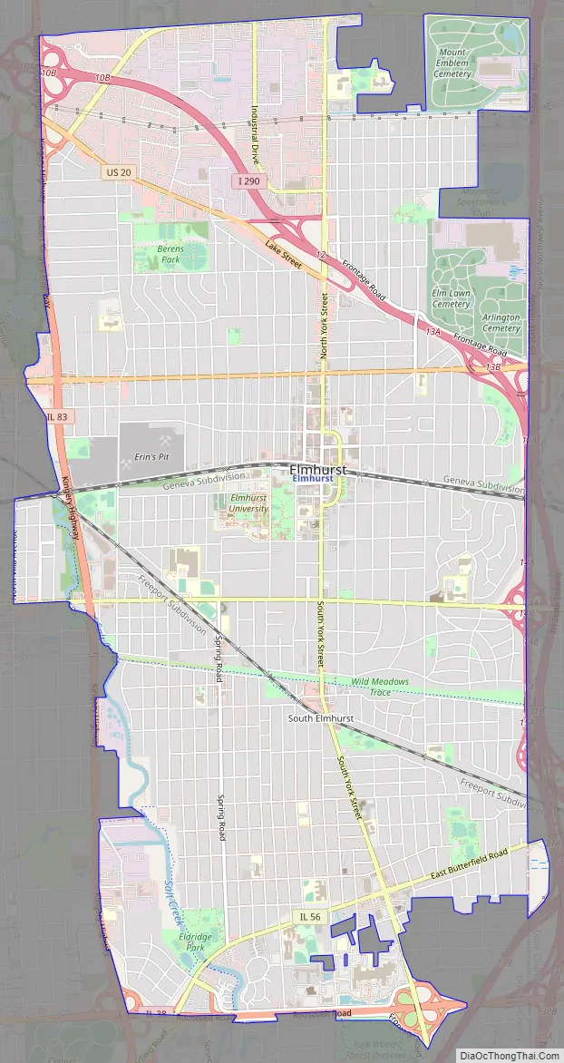
Elmhurst Road Map
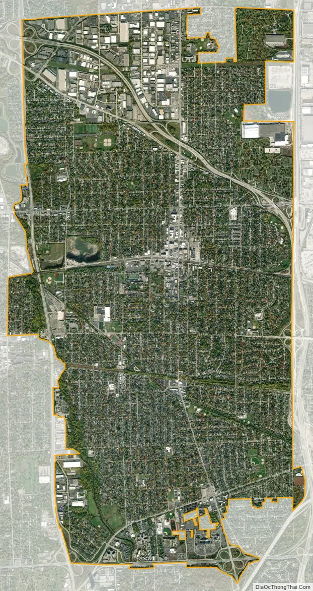
Elmhurst city Satellite Map
Geography
According to the 2021 census gazetteer files, Elmhurst has a total area of 10.28 square miles (26.63 km), of which 10.22 square miles (26.47 km) (or 99.42%) is land and 0.06 square miles (0.16 km) (or 0.58%) is water.
The town also has a tendency to flood, and the city has tried preventing or suppressing this for the future.
See also
Map of Illinois State and its subdivision:- Adams
- Alexander
- Bond
- Boone
- Brown
- Bureau
- Calhoun
- Carroll
- Cass
- Champaign
- Christian
- Clark
- Clay
- Clinton
- Coles
- Cook
- Crawford
- Cumberland
- De Kalb
- De Witt
- Douglas
- Dupage
- Edgar
- Edwards
- Effingham
- Fayette
- Ford
- Franklin
- Fulton
- Gallatin
- Greene
- Grundy
- Hamilton
- Hancock
- Hardin
- Henderson
- Henry
- Iroquois
- Jackson
- Jasper
- Jefferson
- Jersey
- Jo Daviess
- Johnson
- Kane
- Kankakee
- Kendall
- Knox
- La Salle
- Lake
- Lake Michigan
- Lawrence
- Lee
- Livingston
- Logan
- Macon
- Macoupin
- Madison
- Marion
- Marshall
- Mason
- Massac
- McDonough
- McHenry
- McLean
- Menard
- Mercer
- Monroe
- Montgomery
- Morgan
- Moultrie
- Ogle
- Peoria
- Perry
- Piatt
- Pike
- Pope
- Pulaski
- Putnam
- Randolph
- Richland
- Rock Island
- Saint Clair
- Saline
- Sangamon
- Schuyler
- Scott
- Shelby
- Stark
- Stephenson
- Tazewell
- Union
- Vermilion
- Wabash
- Warren
- Washington
- Wayne
- White
- Whiteside
- Will
- Williamson
- Winnebago
- Woodford
- Alabama
- Alaska
- Arizona
- Arkansas
- California
- Colorado
- Connecticut
- Delaware
- District of Columbia
- Florida
- Georgia
- Hawaii
- Idaho
- Illinois
- Indiana
- Iowa
- Kansas
- Kentucky
- Louisiana
- Maine
- Maryland
- Massachusetts
- Michigan
- Minnesota
- Mississippi
- Missouri
- Montana
- Nebraska
- Nevada
- New Hampshire
- New Jersey
- New Mexico
- New York
- North Carolina
- North Dakota
- Ohio
- Oklahoma
- Oregon
- Pennsylvania
- Rhode Island
- South Carolina
- South Dakota
- Tennessee
- Texas
- Utah
- Vermont
- Virginia
- Washington
- West Virginia
- Wisconsin
- Wyoming


