Gladstone is a village in Henderson County, Illinois, United States. The population was 281 at the 2010 census, down from 284 in 2000. It is part of the Burlington, IA–IL Micropolitan Statistical Area.
| Name: | Gladstone village |
|---|---|
| LSAD Code: | 47 |
| LSAD Description: | village (suffix) |
| State: | Illinois |
| County: | Henderson County |
| Elevation: | 558 ft (170 m) |
| Total Area: | 0.36 sq mi (0.93 km²) |
| Land Area: | 0.36 sq mi (0.93 km²) |
| Water Area: | 0.00 sq mi (0.00 km²) |
| Total Population: | 234 |
| Population Density: | 650.00/sq mi (251.13/km²) |
| Area code: | 309 |
| FIPS code: | 1729431 |
| GNISfeature ID: | 2398966 |
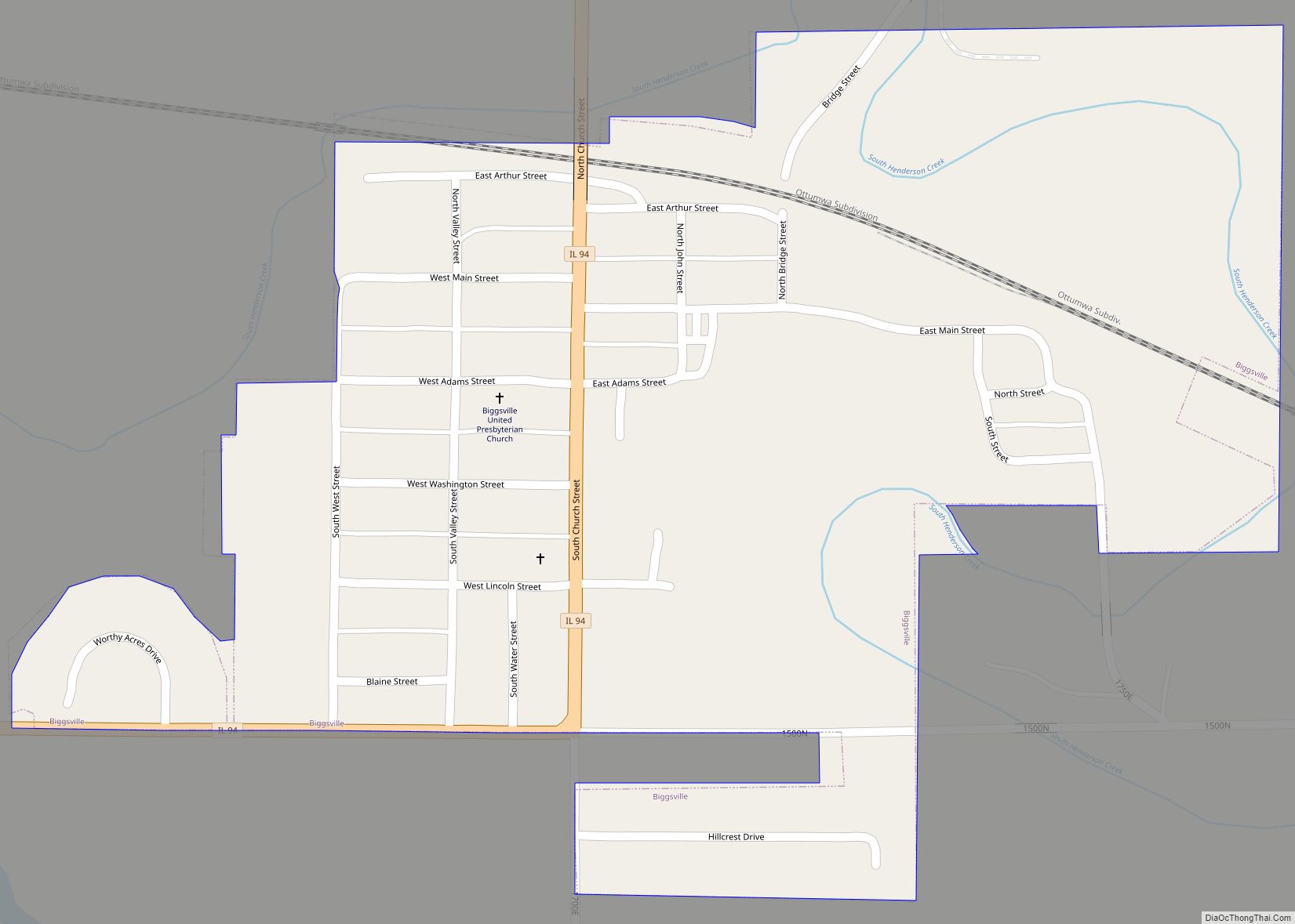
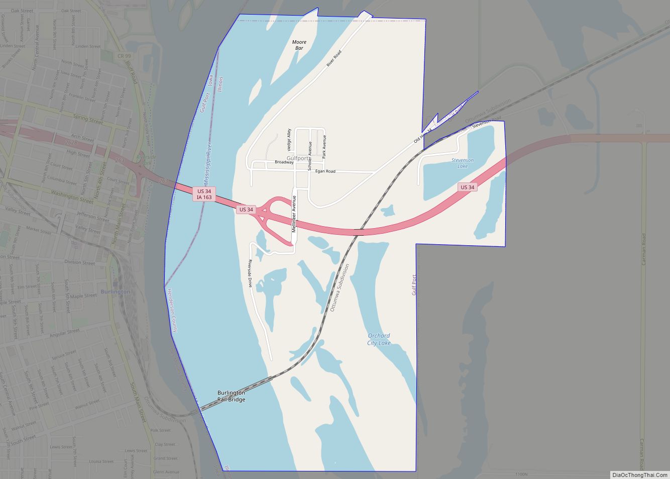
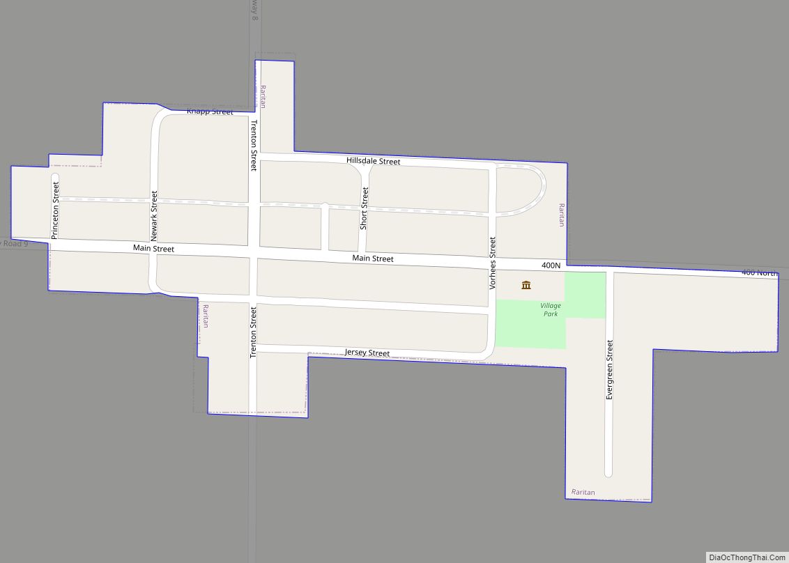
Online Interactive Map
Click on ![]() to view map in "full screen" mode.
to view map in "full screen" mode.
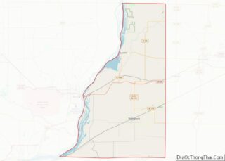
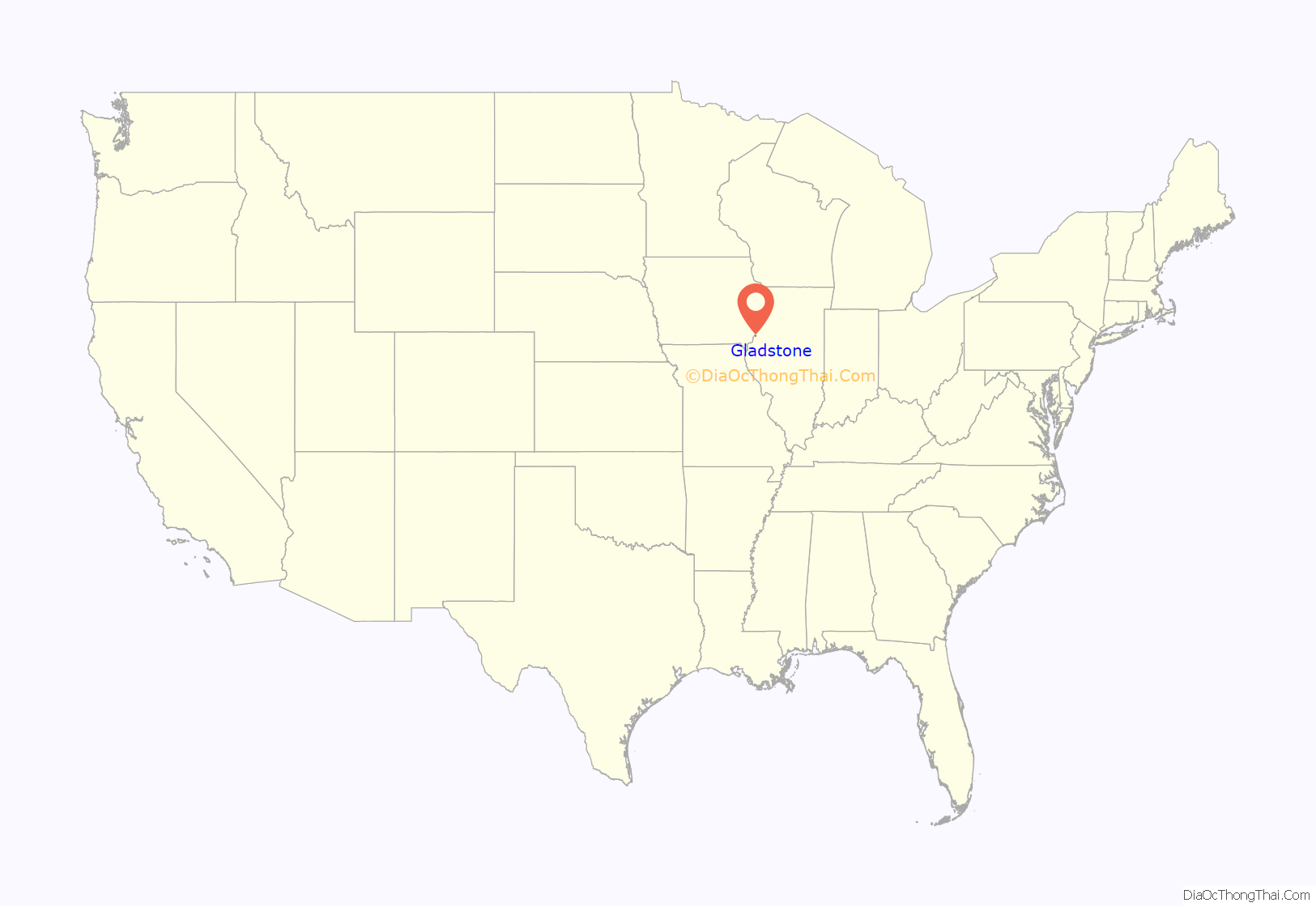
Gladstone location map. Where is Gladstone village?
History
Gladstone grew from a Meskwaki village that was led by Taimah in the 1820s. Gladstone was originally named “Sagetown”, after Gideon Sage upon whose land the town was platted. Gladstone is named after the English statesman William Ewart Gladstone.
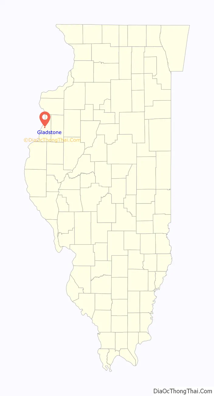
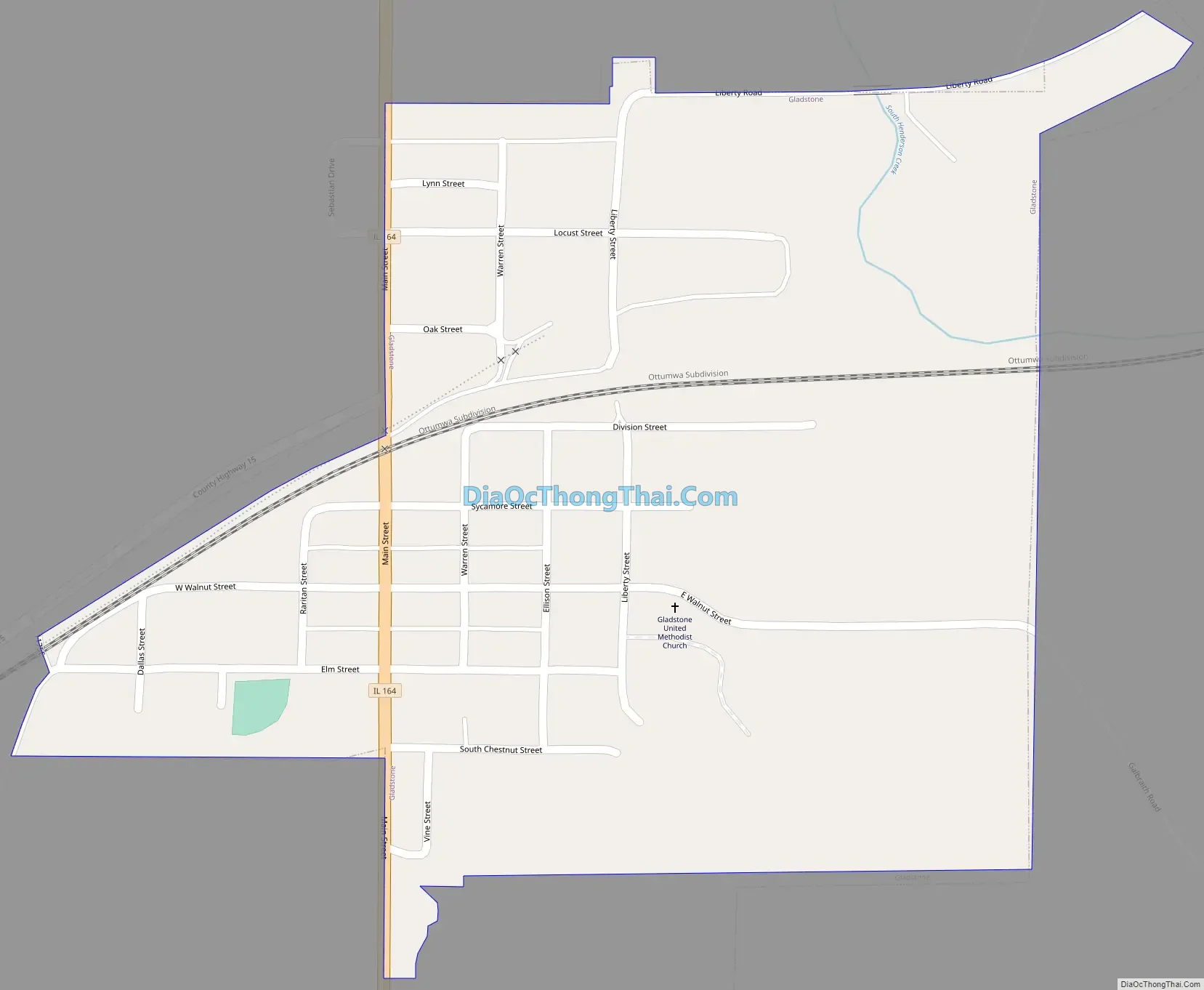
Gladstone Road Map
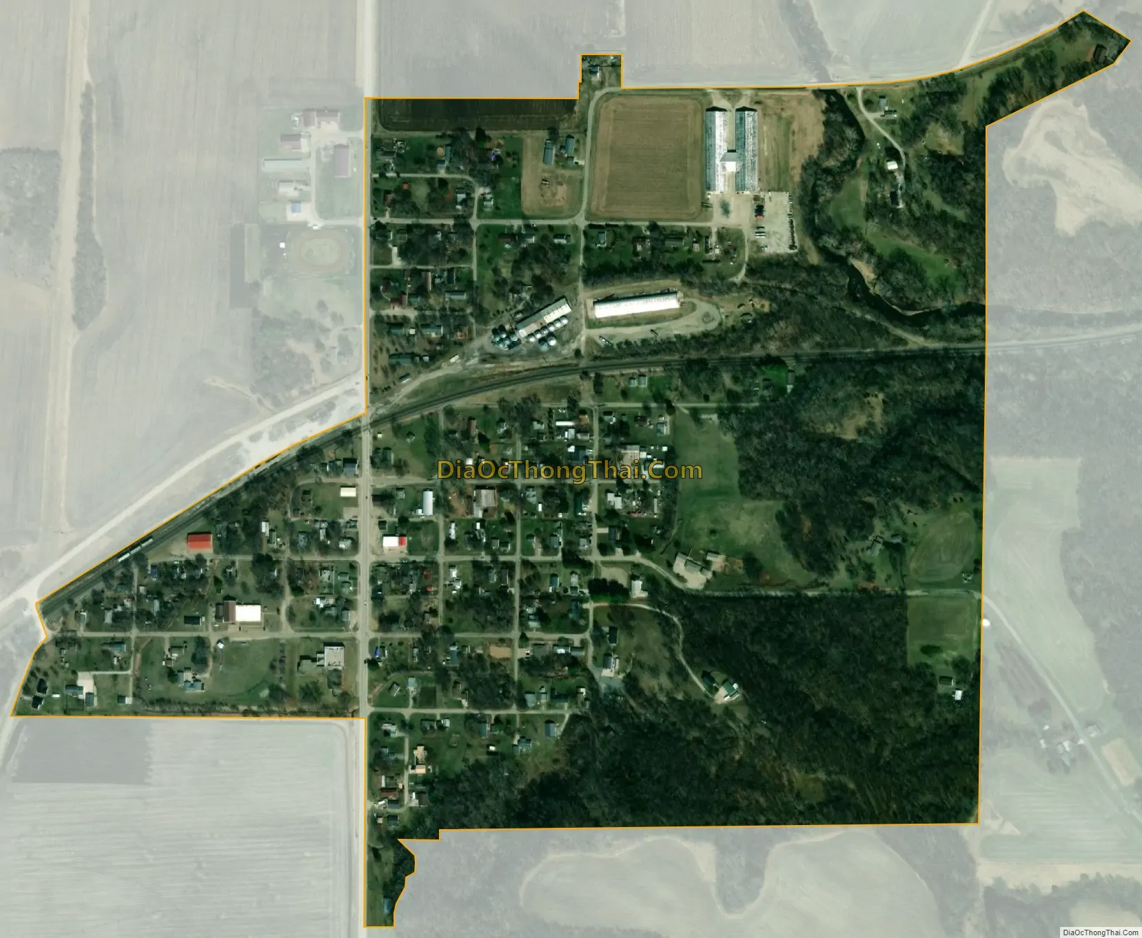
Gladstone city Satellite Map
Geography
Gladstone is located in west-central Henderson County. Illinois Route 164 passes through the village, leading north 5 miles (8 km) to Oquawka, the county seat, and south 1 mile (1.6 km) to U.S. Route 34. Burlington, Iowa, is 10 miles (16 km) southwest of Gladstone via IL-164 and US-34.
According to the 2010 census, Gladstone has a total area of 0.39 square miles (1.01 km), all land.
See also
Map of Illinois State and its subdivision:- Adams
- Alexander
- Bond
- Boone
- Brown
- Bureau
- Calhoun
- Carroll
- Cass
- Champaign
- Christian
- Clark
- Clay
- Clinton
- Coles
- Cook
- Crawford
- Cumberland
- De Kalb
- De Witt
- Douglas
- Dupage
- Edgar
- Edwards
- Effingham
- Fayette
- Ford
- Franklin
- Fulton
- Gallatin
- Greene
- Grundy
- Hamilton
- Hancock
- Hardin
- Henderson
- Henry
- Iroquois
- Jackson
- Jasper
- Jefferson
- Jersey
- Jo Daviess
- Johnson
- Kane
- Kankakee
- Kendall
- Knox
- La Salle
- Lake
- Lake Michigan
- Lawrence
- Lee
- Livingston
- Logan
- Macon
- Macoupin
- Madison
- Marion
- Marshall
- Mason
- Massac
- McDonough
- McHenry
- McLean
- Menard
- Mercer
- Monroe
- Montgomery
- Morgan
- Moultrie
- Ogle
- Peoria
- Perry
- Piatt
- Pike
- Pope
- Pulaski
- Putnam
- Randolph
- Richland
- Rock Island
- Saint Clair
- Saline
- Sangamon
- Schuyler
- Scott
- Shelby
- Stark
- Stephenson
- Tazewell
- Union
- Vermilion
- Wabash
- Warren
- Washington
- Wayne
- White
- Whiteside
- Will
- Williamson
- Winnebago
- Woodford
- Alabama
- Alaska
- Arizona
- Arkansas
- California
- Colorado
- Connecticut
- Delaware
- District of Columbia
- Florida
- Georgia
- Hawaii
- Idaho
- Illinois
- Indiana
- Iowa
- Kansas
- Kentucky
- Louisiana
- Maine
- Maryland
- Massachusetts
- Michigan
- Minnesota
- Mississippi
- Missouri
- Montana
- Nebraska
- Nevada
- New Hampshire
- New Jersey
- New Mexico
- New York
- North Carolina
- North Dakota
- Ohio
- Oklahoma
- Oregon
- Pennsylvania
- Rhode Island
- South Carolina
- South Dakota
- Tennessee
- Texas
- Utah
- Vermont
- Virginia
- Washington
- West Virginia
- Wisconsin
- Wyoming