Glasford is a village in Peoria County, Illinois, United States. The population was 1,022 at the 2010 census. Glasford is part of the Peoria, Illinois Metropolitan Statistical Area.
| Name: | Glasford village |
|---|---|
| LSAD Code: | 47 |
| LSAD Description: | village (suffix) |
| State: | Illinois |
| County: | Peoria County |
| Total Area: | 0.91 sq mi (2.35 km²) |
| Land Area: | 0.91 sq mi (2.35 km²) |
| Water Area: | 0.00 sq mi (0.00 km²) |
| Total Population: | 866 |
| Population Density: | 953.74/sq mi (368.22/km²) |
| Area code: | 309 |
| FIPS code: | 1729483 |
| Website: | www.glasfordil.com |
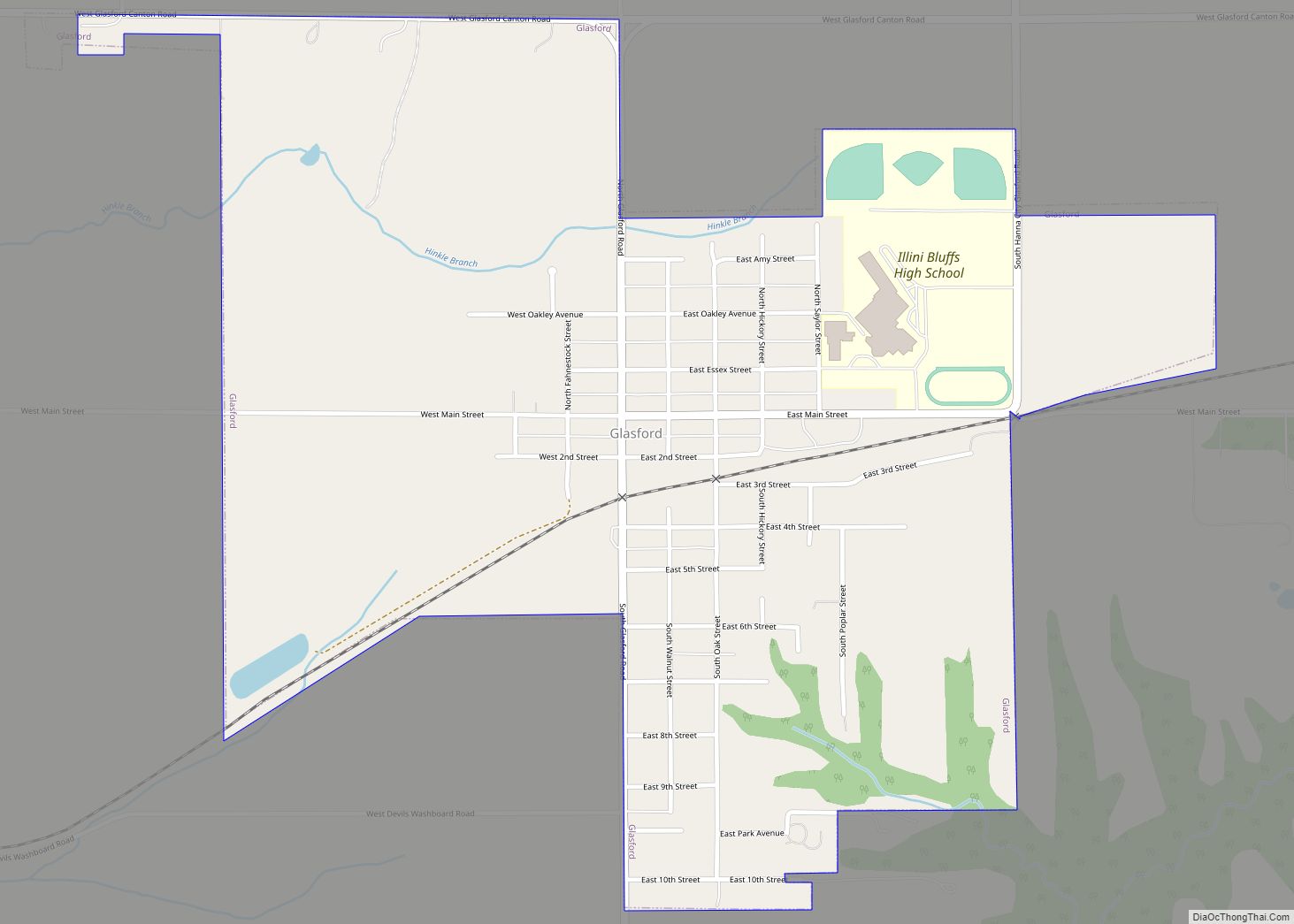
Online Interactive Map
Click on ![]() to view map in "full screen" mode.
to view map in "full screen" mode.
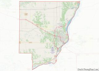
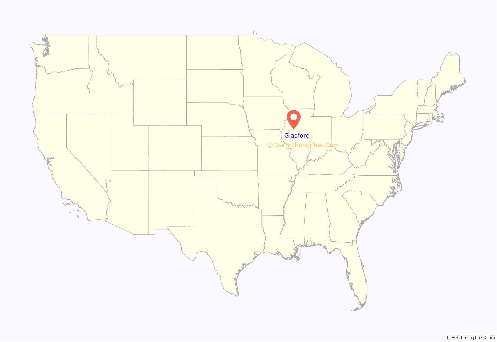
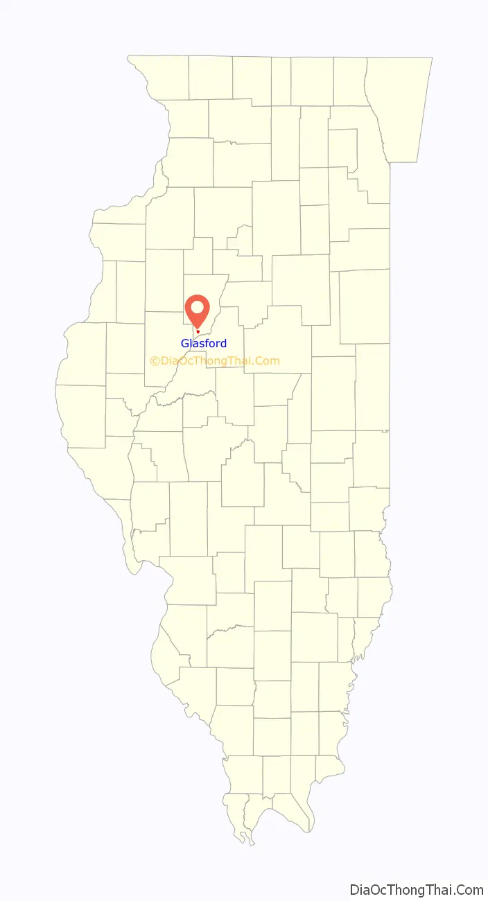
Glasford location map. Where is Glasford village?
History
Glasford or Glasco as it was called in 1868, was named for its founder, Samual Alexander Glasford/Glassford (1824-1896).
Samuel A. Glasford whom arrived in Peoria County in 1842 from Ohio and was one of the early settlers of Timber Twp., had the foresight to off lots where cornfields once stood. When the railroad was built by his farm residence, Mr. Glasford had the hindsight to realize Lancaster, IL would seek the railroad and laid out the town December 9, 1868 which became incorporated as a village in 1889. Glasco would become a center of trade and population along the new route of the Toledo, Peoria and Warsaw Railroad, bringing many new settlers and stores to Glasco in 1868.
The town has been called by many names in different publications; Glasford, Glassford, Glasco, and Glasgow, just as his name in Scotland where is father, Lord William Glasford was born, is Glassford but in America it was written as Glasford.
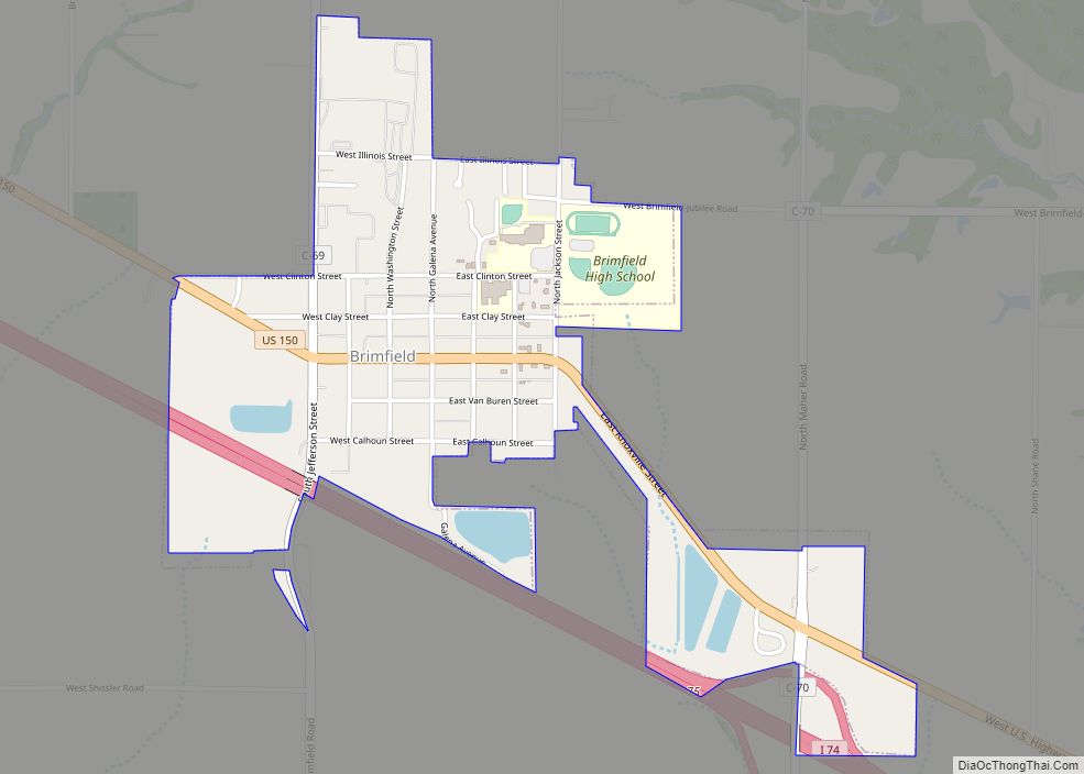
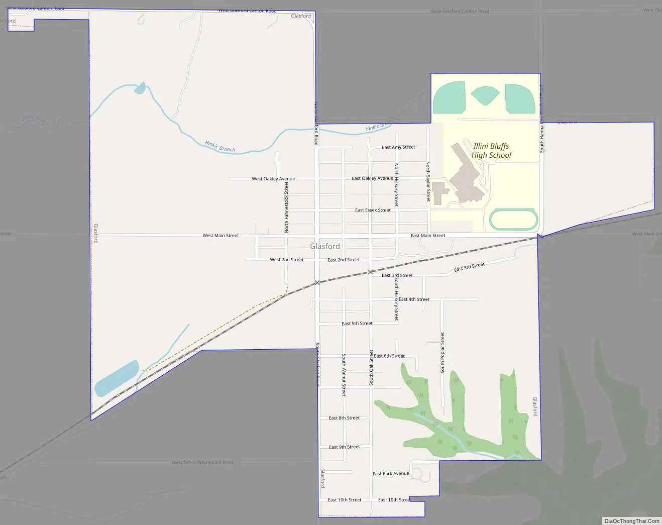
Glasford Road Map
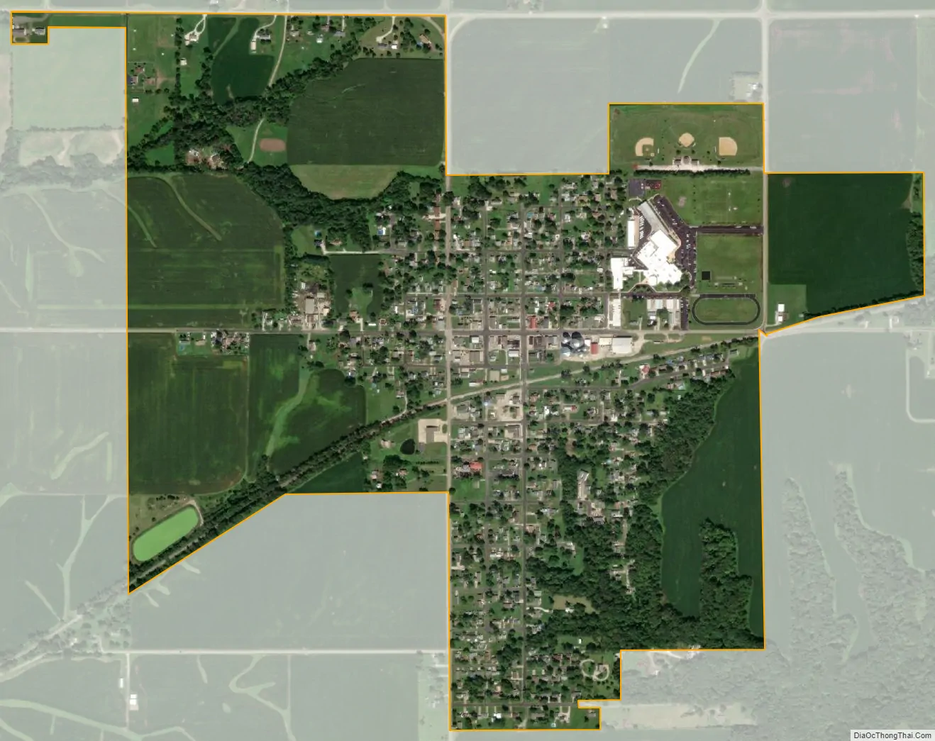
Glasford city Satellite Map
Geography
Glasford is located at 40°34′18″N 89°48′46″W / 40.57167°N 89.81278°W / 40.57167; -89.81278 (40.571714, -89.812707).
According to the 2010 census, Glasford has a total area of 0.9 square miles (2.33 km), all land.
Glasford is located near the “Glasford Disturbance”, an area in which the normal layering of the bedrock has been highly disturbed. This is believed to be an ancient meteor crater known as the Glasford crater. The impact fractured the bedrock, and upended large blocks of sedimentary rocks. The crater has been completely filled by glacial action, so that no trace appears on the surface.
See also
Map of Illinois State and its subdivision:- Adams
- Alexander
- Bond
- Boone
- Brown
- Bureau
- Calhoun
- Carroll
- Cass
- Champaign
- Christian
- Clark
- Clay
- Clinton
- Coles
- Cook
- Crawford
- Cumberland
- De Kalb
- De Witt
- Douglas
- Dupage
- Edgar
- Edwards
- Effingham
- Fayette
- Ford
- Franklin
- Fulton
- Gallatin
- Greene
- Grundy
- Hamilton
- Hancock
- Hardin
- Henderson
- Henry
- Iroquois
- Jackson
- Jasper
- Jefferson
- Jersey
- Jo Daviess
- Johnson
- Kane
- Kankakee
- Kendall
- Knox
- La Salle
- Lake
- Lake Michigan
- Lawrence
- Lee
- Livingston
- Logan
- Macon
- Macoupin
- Madison
- Marion
- Marshall
- Mason
- Massac
- McDonough
- McHenry
- McLean
- Menard
- Mercer
- Monroe
- Montgomery
- Morgan
- Moultrie
- Ogle
- Peoria
- Perry
- Piatt
- Pike
- Pope
- Pulaski
- Putnam
- Randolph
- Richland
- Rock Island
- Saint Clair
- Saline
- Sangamon
- Schuyler
- Scott
- Shelby
- Stark
- Stephenson
- Tazewell
- Union
- Vermilion
- Wabash
- Warren
- Washington
- Wayne
- White
- Whiteside
- Will
- Williamson
- Winnebago
- Woodford
- Alabama
- Alaska
- Arizona
- Arkansas
- California
- Colorado
- Connecticut
- Delaware
- District of Columbia
- Florida
- Georgia
- Hawaii
- Idaho
- Illinois
- Indiana
- Iowa
- Kansas
- Kentucky
- Louisiana
- Maine
- Maryland
- Massachusetts
- Michigan
- Minnesota
- Mississippi
- Missouri
- Montana
- Nebraska
- Nevada
- New Hampshire
- New Jersey
- New Mexico
- New York
- North Carolina
- North Dakota
- Ohio
- Oklahoma
- Oregon
- Pennsylvania
- Rhode Island
- South Carolina
- South Dakota
- Tennessee
- Texas
- Utah
- Vermont
- Virginia
- Washington
- West Virginia
- Wisconsin
- Wyoming