Glen Ellyn is a village in DuPage County, Illinois, United States. A suburb located 24 miles (39 km) due west of downtown Chicago, the village has a population of 28,846 as of the 2020 Census.
| Name: | Glen Ellyn village |
|---|---|
| LSAD Code: | 47 |
| LSAD Description: | village (suffix) |
| State: | Illinois |
| County: | DuPage County |
| Incorporated: | May 10, 1896 |
| Total Area: | 7.05 sq mi (18.26 km²) |
| Land Area: | 6.89 sq mi (17.84 km²) |
| Water Area: | 0.16 sq mi (0.42 km²) 2.36% |
| Total Population: | 28,846 |
| Population Density: | 4,187.26/sq mi (1,616.73/km²) |
| FIPS code: | 1729756 |
| Website: | www.glenellyn.org |
Online Interactive Map
Click on ![]() to view map in "full screen" mode.
to view map in "full screen" mode.
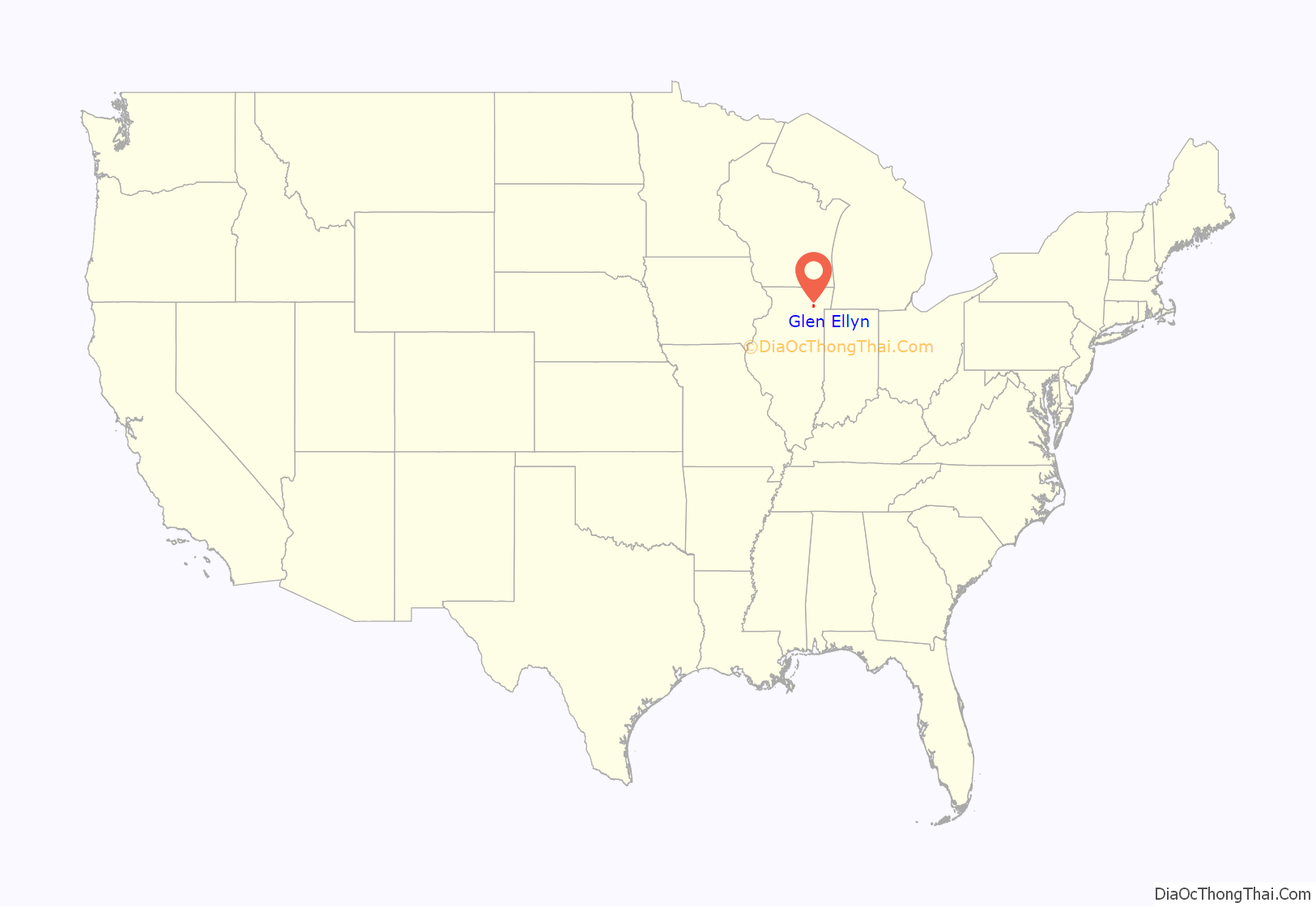
Glen Ellyn location map. Where is Glen Ellyn village?
History
Glen Ellyn, like the neighboring town to the east, Lombard, had its genesis in an 1833 claim by two brothers from the Finger Lakes region of New York, Morgan and Ralph Babcock. The two claimed property in a large stand of timber near present-day St. Charles Road and the East Branch of the DuPage River. The brothers also arranged for a claim for their New York neighbor Deacon Winslow Churchill, who arrived in 1834 along with some of his adult children and their families. The nascent settlement became known as Babcock’s Grove, and it included property currently part of both Glen Ellyn and Lombard.
Up the trail from the river to the west was a five-cornered intersection. In 1835, Daniel Fish built a cabin there, and other settlers followed. By the 1840s the intersection was called Fish’s Corners and held a general store, blacksmith’s forge, shops selling or repairing wagons and harnesses, and a Baptist church.
Moses Stacy, a soldier in the War of 1812, arrived in 1835 and build a house south of Fish’s Corners. In 1846, Stacy built at the five corners an inn, Stacy’s Tavern, to serve as a halfway stop between Chicago and the Fox River Valley and a probable stop for Galena, Illinois stagecoaches on their way to Rockford, Illinois. Stacy’s Tavern, now a historical monument, stands at what is now the intersection of Geneva Road and Main Street.
In 1849, construction of the Galena and Chicago Union Railroad through Glen Ellyn was finished. The railroad was about a mile south of the corners. At first, trains running through the town on the railway did not stop there. A local landowner, Dr. Lewey Quitterfield Newton, made an offer to the railroad company: Newton would provide land for a right-of-way and build a depot and water tank if the railroad would require trains to stop there. The depot that Newton built became known as Newton Station, and the locus of the community shifted to the area around the station.
The first church, a Congregational church, was built in 1862. Many Protestant churches were built in the village in the years to come. It was not until 60 years later that the first Catholic church was built.
The growing settlement went through several names, including Babcock’s Grove, DuPage Center, Stacy’s Corners, Newton’s Station, Danby (after Danby, Vermont, a local landowner’s birthplace) and Prospect Park. The current Glen Ellyn is based on the Welsh version of the name of the then–village president Thomas E. Hill’s wife Ellen, preceded by glen, referring to the local geography.
The name Glen Ellyn had been adopted by 1889, when village president Hill and businessman Philo Stacy spearheaded a project to create a new lake, called Lake Glen Ellyn (today’s Lake Ellyn), by having a dam built in a nearby stream.
In 1890, residents discovered mineral springs near the village. This contributed to Glen Ellyn advertising itself as Chicago’s newest suburb and health resort, soon followed by the Village of Glen Ellyn being officially incorporated on May 10, 1892. The large Lake Glen Ellyn Hotel opened in 1892, the same year much of the business district was destroyed by fire. Fourteen years later, the hotel was struck by lightning and burned to the ground.
The village’s all-volunteer fire department was created in 1907. By the end of the 20th century, it was the last all-volunteer fire department in DuPage County.
By World War I, Glen Oak Country Club served the Oak Park and Glen Ellyn communities, and in 1922 the first Glenbard high school was built.
Glen Ellyn Road Map
Glen Ellyn city Satellite Map
Geography
The Village of Glen Ellyn is a suburb of Chicago, and it lies about 24 miles (39 km) due west of downtown Chicago.
According to the 2021 census gazetteer files, Glen Ellyn has a total area of 7.01 square miles (18.16 km), of which 6.85 square miles (17.74 km) (or 97.70%) is land and 0.16 square miles (0.41 km) (or 2.30%) is water.
See also
Map of Illinois State and its subdivision:- Adams
- Alexander
- Bond
- Boone
- Brown
- Bureau
- Calhoun
- Carroll
- Cass
- Champaign
- Christian
- Clark
- Clay
- Clinton
- Coles
- Cook
- Crawford
- Cumberland
- De Kalb
- De Witt
- Douglas
- Dupage
- Edgar
- Edwards
- Effingham
- Fayette
- Ford
- Franklin
- Fulton
- Gallatin
- Greene
- Grundy
- Hamilton
- Hancock
- Hardin
- Henderson
- Henry
- Iroquois
- Jackson
- Jasper
- Jefferson
- Jersey
- Jo Daviess
- Johnson
- Kane
- Kankakee
- Kendall
- Knox
- La Salle
- Lake
- Lake Michigan
- Lawrence
- Lee
- Livingston
- Logan
- Macon
- Macoupin
- Madison
- Marion
- Marshall
- Mason
- Massac
- McDonough
- McHenry
- McLean
- Menard
- Mercer
- Monroe
- Montgomery
- Morgan
- Moultrie
- Ogle
- Peoria
- Perry
- Piatt
- Pike
- Pope
- Pulaski
- Putnam
- Randolph
- Richland
- Rock Island
- Saint Clair
- Saline
- Sangamon
- Schuyler
- Scott
- Shelby
- Stark
- Stephenson
- Tazewell
- Union
- Vermilion
- Wabash
- Warren
- Washington
- Wayne
- White
- Whiteside
- Will
- Williamson
- Winnebago
- Woodford
- Alabama
- Alaska
- Arizona
- Arkansas
- California
- Colorado
- Connecticut
- Delaware
- District of Columbia
- Florida
- Georgia
- Hawaii
- Idaho
- Illinois
- Indiana
- Iowa
- Kansas
- Kentucky
- Louisiana
- Maine
- Maryland
- Massachusetts
- Michigan
- Minnesota
- Mississippi
- Missouri
- Montana
- Nebraska
- Nevada
- New Hampshire
- New Jersey
- New Mexico
- New York
- North Carolina
- North Dakota
- Ohio
- Oklahoma
- Oregon
- Pennsylvania
- Rhode Island
- South Carolina
- South Dakota
- Tennessee
- Texas
- Utah
- Vermont
- Virginia
- Washington
- West Virginia
- Wisconsin
- Wyoming
