Hanover Park is a village in Cook and DuPage counties in the U.S. state of Illinois, a suburb of Chicago. The population was 37,470 at the 2020 census. Ontarioville is a neighborhood within the village.
| Name: | Hanover Park village |
|---|---|
| LSAD Code: | 47 |
| LSAD Description: | village (suffix) |
| State: | Illinois |
| County: | Cook County, DuPage County |
| Incorporated: | 1958 |
| Total Area: | 6.52 sq mi (16.90 km²) |
| Land Area: | 6.42 sq mi (16.63 km²) |
| Water Area: | 0.10 sq mi (0.27 km²) 1.56% |
| Total Population: | 37,470 |
| Population Density: | 5,834.63/sq mi (2,252.75/km²) |
| Area code: | 630 and 331 |
| FIPS code: | 1732746 |
| Website: | hanoverparkillinois.org |
Online Interactive Map
Click on ![]() to view map in "full screen" mode.
to view map in "full screen" mode.
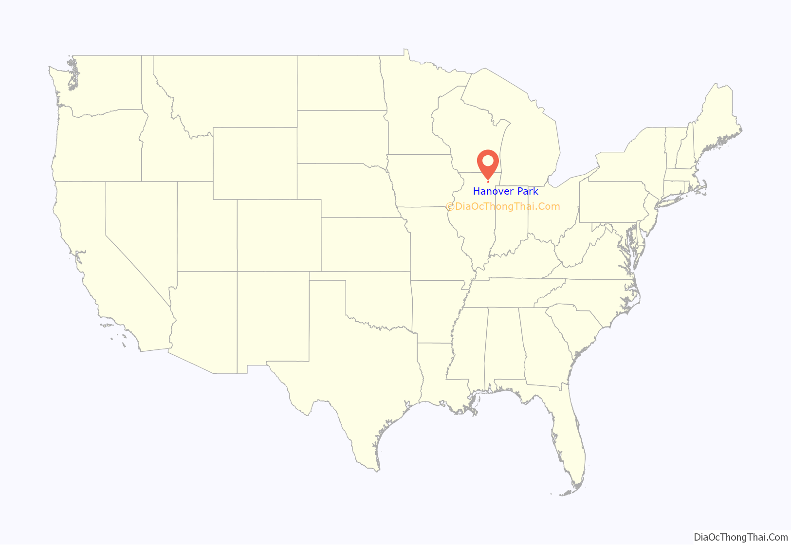
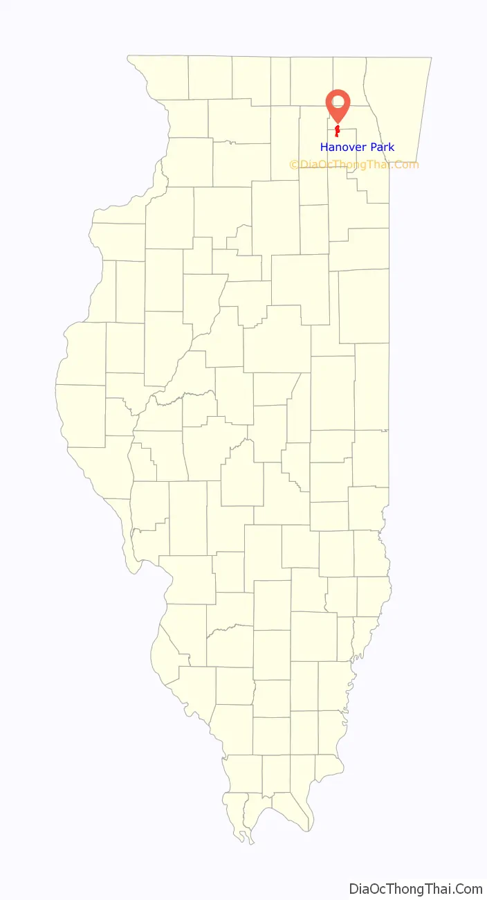
Hanover Park location map. Where is Hanover Park village?
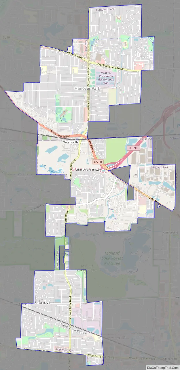
Hanover Park Road Map
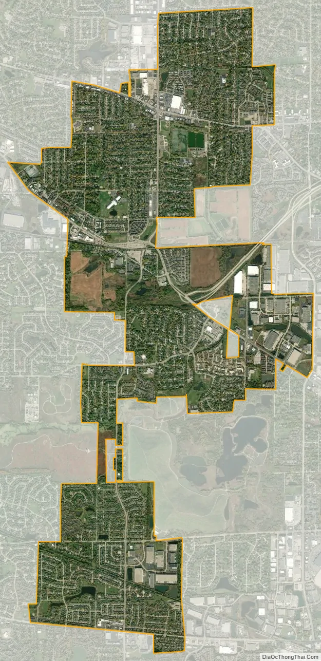
Hanover Park city Satellite Map
Geography
Hanover Park is located at 41°58′44″N 88°8′46″W / 41.97889°N 88.14611°W / 41.97889; -88.14611 (41.978827, −88.146109).
According to the 2021 census gazetteer files, Hanover Park has a total area of 6.53 square miles (16.91 km), of which 6.42 square miles (16.63 km) (or 98.42%) is land and 0.10 square miles (0.26 km) (or 1.58%) is water.
See also
Map of Illinois State and its subdivision:- Adams
- Alexander
- Bond
- Boone
- Brown
- Bureau
- Calhoun
- Carroll
- Cass
- Champaign
- Christian
- Clark
- Clay
- Clinton
- Coles
- Cook
- Crawford
- Cumberland
- De Kalb
- De Witt
- Douglas
- Dupage
- Edgar
- Edwards
- Effingham
- Fayette
- Ford
- Franklin
- Fulton
- Gallatin
- Greene
- Grundy
- Hamilton
- Hancock
- Hardin
- Henderson
- Henry
- Iroquois
- Jackson
- Jasper
- Jefferson
- Jersey
- Jo Daviess
- Johnson
- Kane
- Kankakee
- Kendall
- Knox
- La Salle
- Lake
- Lake Michigan
- Lawrence
- Lee
- Livingston
- Logan
- Macon
- Macoupin
- Madison
- Marion
- Marshall
- Mason
- Massac
- McDonough
- McHenry
- McLean
- Menard
- Mercer
- Monroe
- Montgomery
- Morgan
- Moultrie
- Ogle
- Peoria
- Perry
- Piatt
- Pike
- Pope
- Pulaski
- Putnam
- Randolph
- Richland
- Rock Island
- Saint Clair
- Saline
- Sangamon
- Schuyler
- Scott
- Shelby
- Stark
- Stephenson
- Tazewell
- Union
- Vermilion
- Wabash
- Warren
- Washington
- Wayne
- White
- Whiteside
- Will
- Williamson
- Winnebago
- Woodford
- Alabama
- Alaska
- Arizona
- Arkansas
- California
- Colorado
- Connecticut
- Delaware
- District of Columbia
- Florida
- Georgia
- Hawaii
- Idaho
- Illinois
- Indiana
- Iowa
- Kansas
- Kentucky
- Louisiana
- Maine
- Maryland
- Massachusetts
- Michigan
- Minnesota
- Mississippi
- Missouri
- Montana
- Nebraska
- Nevada
- New Hampshire
- New Jersey
- New Mexico
- New York
- North Carolina
- North Dakota
- Ohio
- Oklahoma
- Oregon
- Pennsylvania
- Rhode Island
- South Carolina
- South Dakota
- Tennessee
- Texas
- Utah
- Vermont
- Virginia
- Washington
- West Virginia
- Wisconsin
- Wyoming


