Hoffman Estates is a village in Illinois, United States. The village is located in Cook County. It is a suburb of Chicago. Per the 2020 census, the population was 52,530.
The village now serves as the headquarters for Sears and the American headquarters for Mori Seiki. The village owns Now Arena, home of the Windy City Bulls of the NBA G League.
In 2009, the village hosted the Heartland International Tattoo, one of the largest music and dance festivals of its kind in the Midwest.
| Name: | Hoffman Estates village |
|---|---|
| LSAD Code: | 47 |
| LSAD Description: | village (suffix) |
| State: | Illinois |
| County: | Cook County, Kane County |
| Incorporated: | 1959 (village) |
| Total Area: | 21.25 sq mi (55.03 km²) |
| Land Area: | 21.07 sq mi (54.56 km²) |
| Water Area: | 0.18 sq mi (0.47 km²) 0.86% |
| Total Population: | 52,530 |
| Population Density: | 2,493.71/sq mi (962.82/km²) |
| Area code: | 847 / 224 |
| FIPS code: | 1735411 |
| Website: | www.hoffmanestates.org |
Online Interactive Map
Click on ![]() to view map in "full screen" mode.
to view map in "full screen" mode.
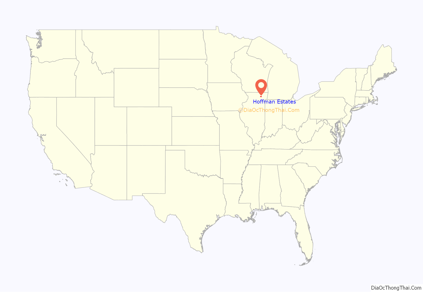
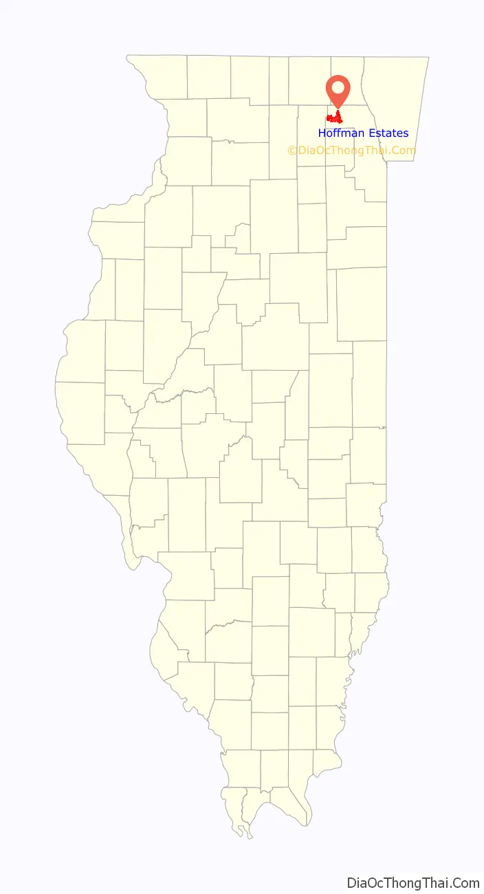
Hoffman Estates location map. Where is Hoffman Estates village?
History
Prior to the 1940s, German settlers moved into the area west of Roselle Road and north of Golf Road, then known as Wildcat Grove. The area was sparsely populated until farmers purchased land in the area in the 1940s.
In 1954, Sam and Jack Hoffman, owners of a father-son owned construction company, bought 160 acres of land in the area. The pair constructed homes and began the development of the region which now bears their name. As residents moved in, they voted to incorporate the area, and the Village of Hoffman Estates was incorporated on September 23, 1959. In 1973, six former town officials, including mayors Edward F. Pinger (1959−1965) and Roy L. Jenkins (1965−1969) were indicted on bribery and tax charges.
Once the Northwest Tollway opened, Schaumburg Township became more attractive to Chicago commuters. In the early 1960s, land annexations north of the tollway and in other neighboring regions more than doubled Hoffman Estates’s land area.
The opening of the Woodfield Mall in Schaumburg to the east in 1971 made the area a major business center. An attempt to change the name of the village to East Barrington, among other names, was made in the early 1980s but failed upon a residential vote.
In the 1990s, the Prairie Stone Business Park began development. This 750-acre (3.0 km) planned multi-purpose business park is bounded by Illinois Route 59 on the east, Interstate 90 on the south, Illinois Route 72 on the north, and Beverly Road on the west. The business park came to fruition in 1993 when Sears, Roebuck and Company relocated from the Sears Tower in Chicago to a sprawling headquarters in the northwest part of Prairie Stone. That was followed in by Indramat and Quest International, which in 1995 also opened facilities in the park. Throughout the 1990s, a health and wellness center and child care facility were developed, as well as other smaller office buildings, and a branch of Northern Illinois University. Development of the business park is still ongoing, and recent additions in the 2000s include the 11,000-seat Now Arena; office buildings for Serta, WT Engineering, I-CAR, and Mary Kay; a Cabela’s outdoor outfitters store; a 295-room Marriott hotel; and the 400,000-square-foot (37,000 m) Poplar Creek Crossing Retail Center, which is anchored by Target and numerous other big-box retailers. Future development will include further office buildings and retail development, Sun Island Hotel and Water Park, an amphitheater, and restaurants.
In 2011, the Village of Hoffman Estates took over ownership of the Now Arena. On June 23, 2020, the Village of Hoffman Estates approved an $11.5 million deal to rename the Sears Centre Arena to the “NOW Arena”.
In the fall of 2016, papers and artifacts from President Barack Obama’s administration began to arrive in town, where they are being stored in a building on Golf Road. The site is their temporary home while construction takes place on the Barack Obama Presidential Center in Jackson Park, Chicago, and is not open to the public.
In January 2020, the Centers for Disease Control and Prevention (CDC) confirmed the second U.S. case of COVID-19 in a Hoffman Estates resident. The patient, a woman in her 60s returning from Wuhan, China, was treated at St. Alexius Medical Center. Her husband was later infected in the first case of human-to-human transmission of the SARS-CoV-2 virus in the United States.
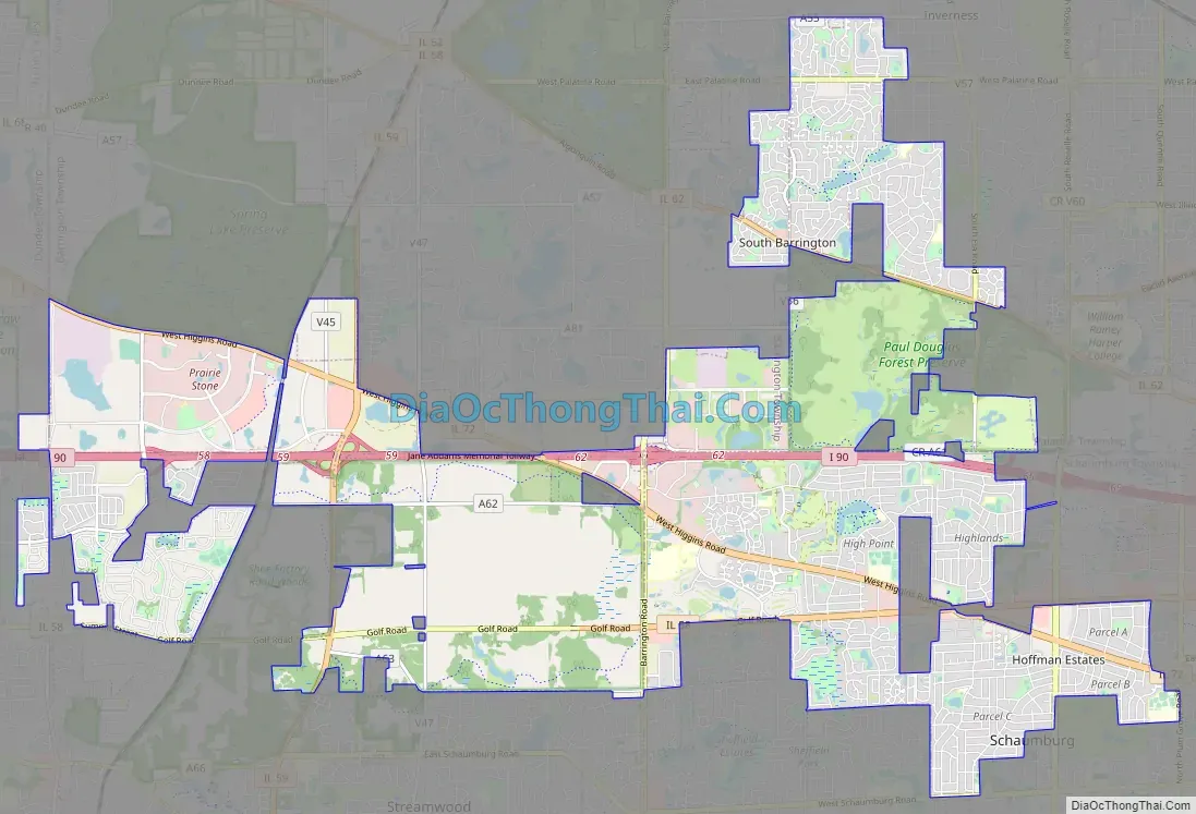
Hoffman Estates Road Map
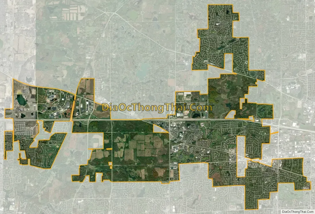
Hoffman Estates city Satellite Map
Geography
Hoffman Estates is located at 42°3′47″N 88°7′9″W / 42.06306°N 88.11917°W / 42.06306; -88.11917 (42.063173, -88.119256).
According to the 2021 census gazetteer files, Hoffman Estates has a total area of 21.25 square miles (55.04 km), of which 21.07 square miles (54.57 km) (or 99.15%) is land and 0.18 square miles (0.47 km) (or 0.85%) is water.
See also
Map of Illinois State and its subdivision:- Adams
- Alexander
- Bond
- Boone
- Brown
- Bureau
- Calhoun
- Carroll
- Cass
- Champaign
- Christian
- Clark
- Clay
- Clinton
- Coles
- Cook
- Crawford
- Cumberland
- De Kalb
- De Witt
- Douglas
- Dupage
- Edgar
- Edwards
- Effingham
- Fayette
- Ford
- Franklin
- Fulton
- Gallatin
- Greene
- Grundy
- Hamilton
- Hancock
- Hardin
- Henderson
- Henry
- Iroquois
- Jackson
- Jasper
- Jefferson
- Jersey
- Jo Daviess
- Johnson
- Kane
- Kankakee
- Kendall
- Knox
- La Salle
- Lake
- Lake Michigan
- Lawrence
- Lee
- Livingston
- Logan
- Macon
- Macoupin
- Madison
- Marion
- Marshall
- Mason
- Massac
- McDonough
- McHenry
- McLean
- Menard
- Mercer
- Monroe
- Montgomery
- Morgan
- Moultrie
- Ogle
- Peoria
- Perry
- Piatt
- Pike
- Pope
- Pulaski
- Putnam
- Randolph
- Richland
- Rock Island
- Saint Clair
- Saline
- Sangamon
- Schuyler
- Scott
- Shelby
- Stark
- Stephenson
- Tazewell
- Union
- Vermilion
- Wabash
- Warren
- Washington
- Wayne
- White
- Whiteside
- Will
- Williamson
- Winnebago
- Woodford
- Alabama
- Alaska
- Arizona
- Arkansas
- California
- Colorado
- Connecticut
- Delaware
- District of Columbia
- Florida
- Georgia
- Hawaii
- Idaho
- Illinois
- Indiana
- Iowa
- Kansas
- Kentucky
- Louisiana
- Maine
- Maryland
- Massachusetts
- Michigan
- Minnesota
- Mississippi
- Missouri
- Montana
- Nebraska
- Nevada
- New Hampshire
- New Jersey
- New Mexico
- New York
- North Carolina
- North Dakota
- Ohio
- Oklahoma
- Oregon
- Pennsylvania
- Rhode Island
- South Carolina
- South Dakota
- Tennessee
- Texas
- Utah
- Vermont
- Virginia
- Washington
- West Virginia
- Wisconsin
- Wyoming


