Lake in the Hills (often abbreviated L.I.T.H. or LITH) is a village in McHenry County, Illinois, United States. As of the 2020 census, the population was 28,982.
The village is most known for its rampant residential growth which occurred most heavily in the 1990s. Once a sleepy lakeside village of cottages and small ranches, its population skyrocketed as developers flocked to the area in the 1990s. Its population increased by 17,000 people (a nearly 400% increase) over this period, making it one of the most rapidly growing suburbs of Chicago and in the United States at that time. At the height of its building boom, the village issued over 1,000 residential building permits in 1995.
In the late 1990s, the village faced the challenge of providing adequate services and infrastructure as well as establishing an identity and community unity, since many community services (libraries, schools, fire districts) were pre-delegated to neighboring communities such as Huntley, Algonquin and Crystal Lake. However, the village continues to expand its resources and community offerings and is also endeavoring to diversify its tax base and provide more commercial and industrial businesses.
| Name: | Lake in the Hills village |
|---|---|
| LSAD Code: | 47 |
| LSAD Description: | village (suffix) |
| State: | Illinois |
| County: | McHenry County |
| Incorporated: | 1952 |
| Total Area: | 10.44 sq mi (27.03 km²) |
| Land Area: | 10.20 sq mi (26.43 km²) |
| Water Area: | 0.23 sq mi (0.61 km²) 2.17% |
| Total Population: | 28,982 |
| Population Density: | 2,840.54/sq mi (1,096.72/km²) |
| Area code: | 847 & 224 |
| FIPS code: | 1741183 |
| Website: | www.lith.org |
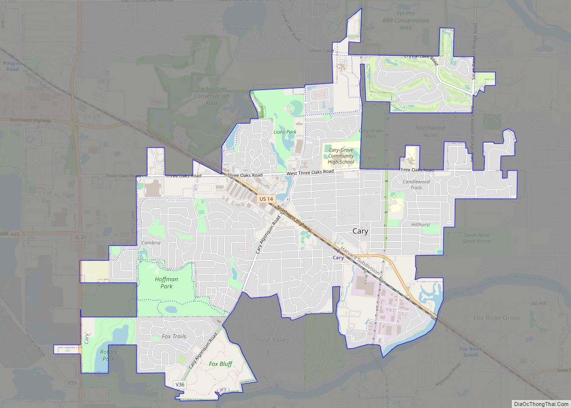
Online Interactive Map
Click on ![]() to view map in "full screen" mode.
to view map in "full screen" mode.
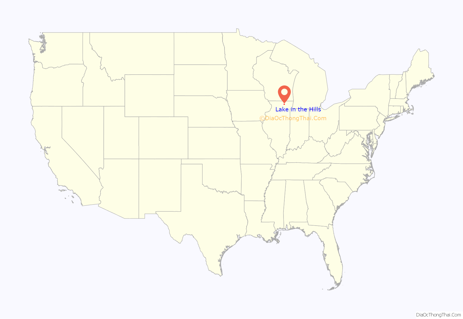
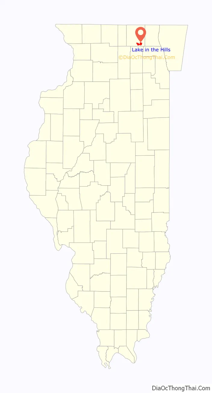
Lake in the Hills location map. Where is Lake in the Hills village?
History
Lake in the Hills was started in 1923 by Federal Judge Walter J. La Buy around Woods Creek Lake, which is the main lake in Lake in the Hills. By the year 1926, La Buy bought 472 acres (1.91 km) of land which is currently Indian Trail. On this land, he built five stucco homes; only one stands in its original state, which is currently owned by the Village of Lake in the Hills. The other four original stucco homes have been altered in some way, but all still stand in the original spot by Woods Creek Lake.
The early days of Lake in the Hills saw vacationers from the Chicago area, who wanted to spend some time away from the hustle and bustle of the city. By 1950, some of the vacationers became year-round residents of Lake in the Hills. On November 29, 1952, the Village of Lake in the Hills was formed.
The village of Lake in the Hills remained a small, close-knit lakeside residential community for much of the 20th Century, relying on nearby towns like Algonquin and Crystal Lake for services. In 1987, the Village’s first shopping center was constructed; it was built at the intersection of Algonquin Road and Oakleaf Road±. In the late 1980s and early 1990s, the Village made a series of large annexations extending west of Randall Road, all the way west to Illinois Route 47. Numerous subdivisions were constructed in this area throughout the 1990s and 2000s (decade) and retail development blossomed along Randall Road during this time period as well. By the mid 2000s (decade), development had slowed down and as the Village became landlocked by other municipalities, it worked to appropriately develop its remaining parcels.
In 2023, the town was in national news when it was the site of vicious, unrelenting attacks against a bakery.
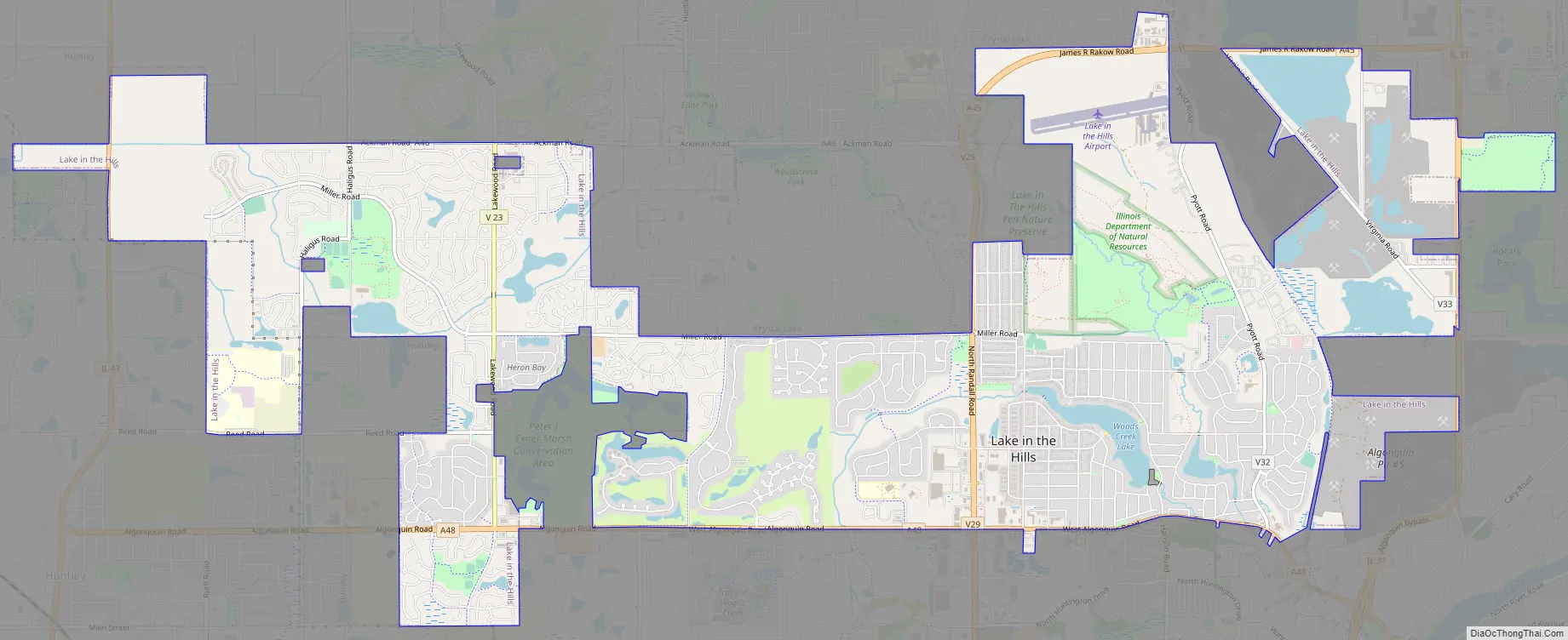
Lake in the Hills Road Map
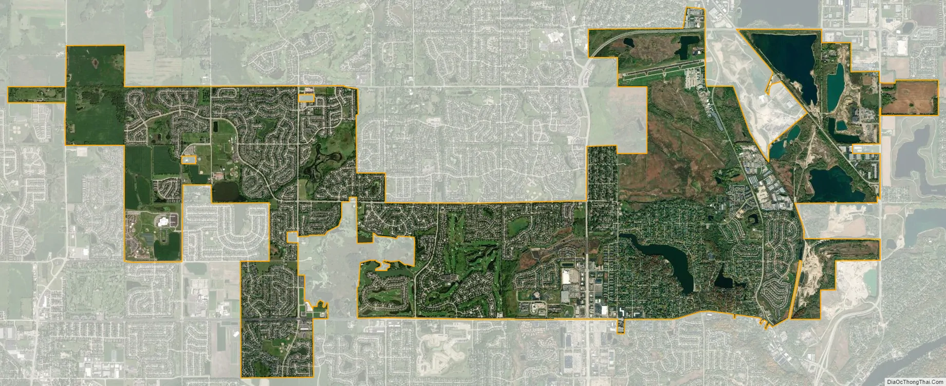
Lake in the Hills city Satellite Map
Geography
Lake in the Hills is located at 42°11′12″N 88°20′51″W / 42.18667°N 88.34750°W / 42.18667; -88.34750 (42.186729, -88.347429).
According to the 2010 census, Lake in the Hills has a total area of 10.614 square miles (27.49 km), of which 10.38 square miles (26.88 km) (or 97.8%) is land and 0.234 square miles (0.61 km) (or 2.2%) is water.
See also
Map of Illinois State and its subdivision:- Adams
- Alexander
- Bond
- Boone
- Brown
- Bureau
- Calhoun
- Carroll
- Cass
- Champaign
- Christian
- Clark
- Clay
- Clinton
- Coles
- Cook
- Crawford
- Cumberland
- De Kalb
- De Witt
- Douglas
- Dupage
- Edgar
- Edwards
- Effingham
- Fayette
- Ford
- Franklin
- Fulton
- Gallatin
- Greene
- Grundy
- Hamilton
- Hancock
- Hardin
- Henderson
- Henry
- Iroquois
- Jackson
- Jasper
- Jefferson
- Jersey
- Jo Daviess
- Johnson
- Kane
- Kankakee
- Kendall
- Knox
- La Salle
- Lake
- Lake Michigan
- Lawrence
- Lee
- Livingston
- Logan
- Macon
- Macoupin
- Madison
- Marion
- Marshall
- Mason
- Massac
- McDonough
- McHenry
- McLean
- Menard
- Mercer
- Monroe
- Montgomery
- Morgan
- Moultrie
- Ogle
- Peoria
- Perry
- Piatt
- Pike
- Pope
- Pulaski
- Putnam
- Randolph
- Richland
- Rock Island
- Saint Clair
- Saline
- Sangamon
- Schuyler
- Scott
- Shelby
- Stark
- Stephenson
- Tazewell
- Union
- Vermilion
- Wabash
- Warren
- Washington
- Wayne
- White
- Whiteside
- Will
- Williamson
- Winnebago
- Woodford
- Alabama
- Alaska
- Arizona
- Arkansas
- California
- Colorado
- Connecticut
- Delaware
- District of Columbia
- Florida
- Georgia
- Hawaii
- Idaho
- Illinois
- Indiana
- Iowa
- Kansas
- Kentucky
- Louisiana
- Maine
- Maryland
- Massachusetts
- Michigan
- Minnesota
- Mississippi
- Missouri
- Montana
- Nebraska
- Nevada
- New Hampshire
- New Jersey
- New Mexico
- New York
- North Carolina
- North Dakota
- Ohio
- Oklahoma
- Oregon
- Pennsylvania
- Rhode Island
- South Carolina
- South Dakota
- Tennessee
- Texas
- Utah
- Vermont
- Virginia
- Washington
- West Virginia
- Wisconsin
- Wyoming