Lena is a village in Stephenson County, Illinois. The population was 2,772 at the 2020 census.
Lena was platted in 1853, and named after a place mentioned in a poem by Ossian.
| Name: | Lena village |
|---|---|
| LSAD Code: | 47 |
| LSAD Description: | village (suffix) |
| State: | Illinois |
| County: | Stephenson County |
| Founded: | 1834 |
| Elevation: | 948 ft (289 m) |
| Total Area: | 2.65 sq mi (6.87 km²) |
| Land Area: | 2.65 sq mi (6.87 km²) |
| Water Area: | 0.00 sq mi (0.00 km²) |
| Total Population: | 2,772 |
| Population Density: | 1,045.64/sq mi (403.71/km²) |
| Area code: | 815 |
| FIPS code: | 1742834 |
| Website: | http://www.villageoflena.com/ |
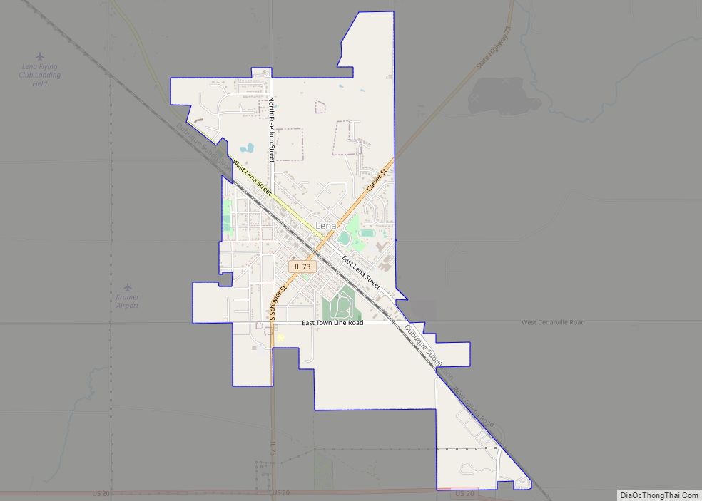
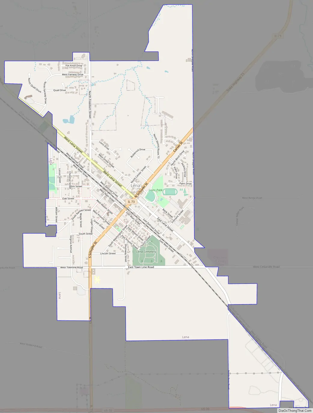
Online Interactive Map
Click on ![]() to view map in "full screen" mode.
to view map in "full screen" mode.
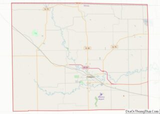
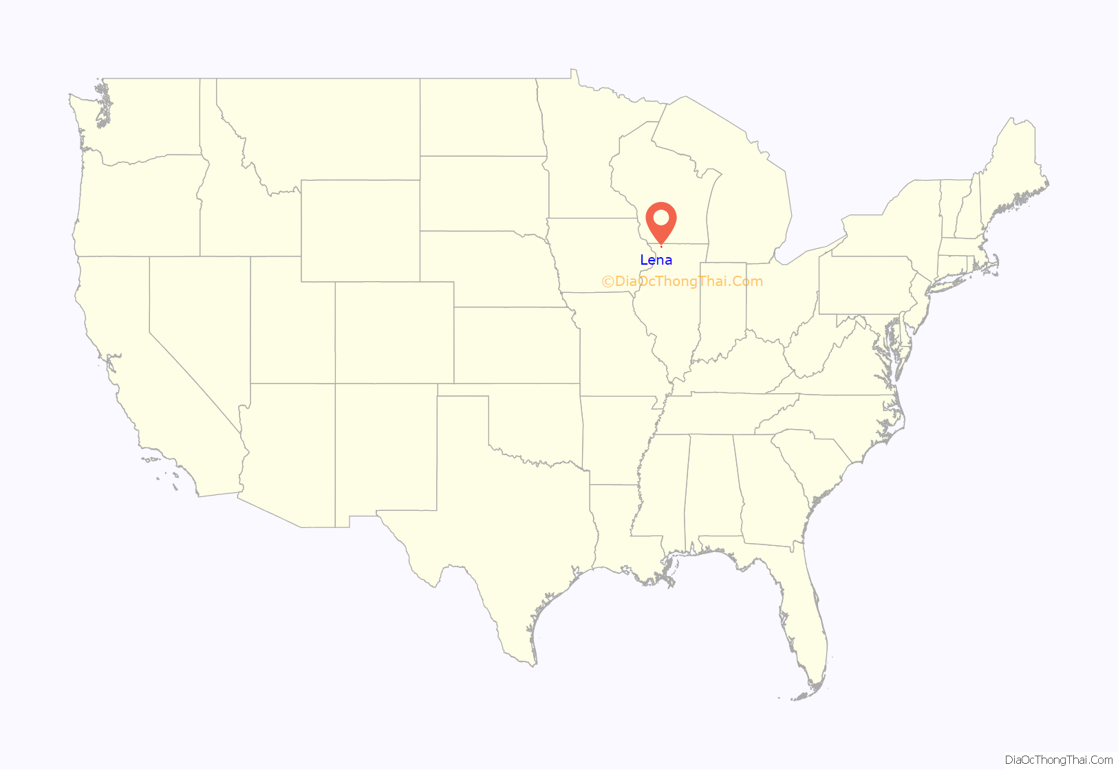
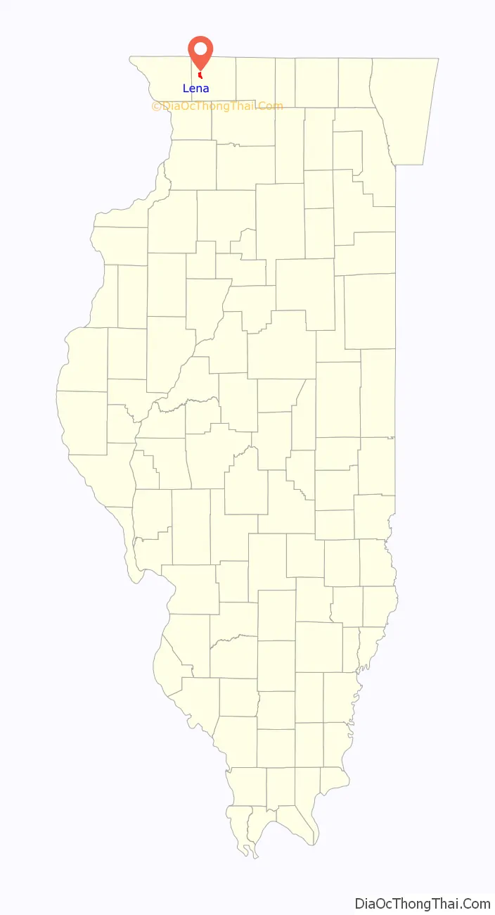
Lena location map. Where is Lena village?
History
In 1853, a railroad survey by Benjamin Dornblazer determined a course through present-day Lena. Samuel F. Dodds, who owned 80 acres (320,000 m) of land in the area, purchased an additional tract of 80 acres (320,000 m) on behalf of the railroad company and grading work was begun. Dodds owned a stone residence which still occupies Lot No. 1 on Lena Street, while Dr. F. Voightheld owned a log home (which has subsequently been demolished) near the train depot. At the time, these two buildings made up the extent of the town.
The town was originally shaped as a parallelogram covering twenty-six blocks for a total of 304 housing lots. During the summer of 1853, lots sold rapidly, commanding prices varying from $50 to $150 each. On New Year’s Day 1854, track was laid, and railway cars began running between Freeport and Warren. The population began to grow, mostly with English and Irish residents. In 1854, there were about a dozen families in Lena.
During the summer of 1855, Reber & Cheney and Dodds erected a three-story brick building at the corner of Railroad and Schuyler streets. It was completed in the fall of 1856 at a cost of about $4,000. The building is still used by local businesses. The Panic of 1857 had little effect on the growth of the town, and rapid expansion continued through 1860.
As growth continued after the Civil War, the first town newspaper called the Lena Star was established in 1867, with Dodds as editor. During its first year, the newspaper reported a local fire and called for a town water pump. Several fires erupted through 1868, and J.M. Shannon (who took over as editor of the newspaper) continued calls for a pump. The Lena Water Tower was finally established on May 15, 1868.
By 1870, Lena’s population had reached 1,295 people and its social and business community continued to grow. The Lena Fire Department was established in 1869 and officially met for the first time in 1870. Despite the presence of the fire department and well, fires continued to plague Lena. During the early 1870s, structure fires consumed a warehouse, a stable, a rural school and several Lena houses. News of the Great Chicago Fire of 1871 was unsettling to the residents of Lena, and a fire of 1874 nearly destroyed the old railway depot and freight houses.
A local opera house, constructed in 1879, was featured on the History Channel show American Pickers in February 2010. The Opera House, now reconstructed, was closed in 1938.
Radio station WQLF (102.1 FM) is licensed to the city of Lena.
Lena Road Map
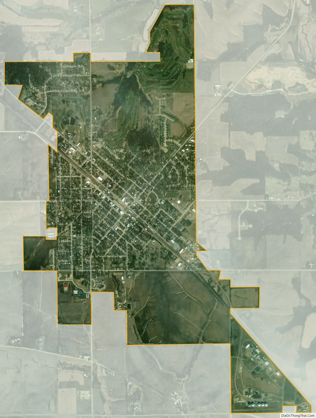
Lena city Satellite Map
Geography
Lena is located at 42°22′43″N 89°49′35″W / 42.37861°N 89.82639°W / 42.37861; -89.82639 (42.378595, -89.826308).
According to the 2010 census, Lena has a total area of 2.61 square miles (6.76 km), all land.
The town of Lena is located in parts of Sections 32 and 33, on the Illinois Central Railroad, twelve miles (19 km) west of Freeport, and is, next to that city, the largest town in the county.
Climate
See also
Map of Illinois State and its subdivision:- Adams
- Alexander
- Bond
- Boone
- Brown
- Bureau
- Calhoun
- Carroll
- Cass
- Champaign
- Christian
- Clark
- Clay
- Clinton
- Coles
- Cook
- Crawford
- Cumberland
- De Kalb
- De Witt
- Douglas
- Dupage
- Edgar
- Edwards
- Effingham
- Fayette
- Ford
- Franklin
- Fulton
- Gallatin
- Greene
- Grundy
- Hamilton
- Hancock
- Hardin
- Henderson
- Henry
- Iroquois
- Jackson
- Jasper
- Jefferson
- Jersey
- Jo Daviess
- Johnson
- Kane
- Kankakee
- Kendall
- Knox
- La Salle
- Lake
- Lake Michigan
- Lawrence
- Lee
- Livingston
- Logan
- Macon
- Macoupin
- Madison
- Marion
- Marshall
- Mason
- Massac
- McDonough
- McHenry
- McLean
- Menard
- Mercer
- Monroe
- Montgomery
- Morgan
- Moultrie
- Ogle
- Peoria
- Perry
- Piatt
- Pike
- Pope
- Pulaski
- Putnam
- Randolph
- Richland
- Rock Island
- Saint Clair
- Saline
- Sangamon
- Schuyler
- Scott
- Shelby
- Stark
- Stephenson
- Tazewell
- Union
- Vermilion
- Wabash
- Warren
- Washington
- Wayne
- White
- Whiteside
- Will
- Williamson
- Winnebago
- Woodford
- Alabama
- Alaska
- Arizona
- Arkansas
- California
- Colorado
- Connecticut
- Delaware
- District of Columbia
- Florida
- Georgia
- Hawaii
- Idaho
- Illinois
- Indiana
- Iowa
- Kansas
- Kentucky
- Louisiana
- Maine
- Maryland
- Massachusetts
- Michigan
- Minnesota
- Mississippi
- Missouri
- Montana
- Nebraska
- Nevada
- New Hampshire
- New Jersey
- New Mexico
- New York
- North Carolina
- North Dakota
- Ohio
- Oklahoma
- Oregon
- Pennsylvania
- Rhode Island
- South Carolina
- South Dakota
- Tennessee
- Texas
- Utah
- Vermont
- Virginia
- Washington
- West Virginia
- Wisconsin
- Wyoming