Mansfield is a village in Piatt County, Illinois in the United States. The population was 906 at the 2010 census.
| Name: | Mansfield village |
|---|---|
| LSAD Code: | 47 |
| LSAD Description: | village (suffix) |
| State: | Illinois |
| County: | Piatt County |
| Elevation: | 725 ft (221 m) |
| Total Area: | 0.54 sq mi (1.39 km²) |
| Land Area: | 0.51 sq mi (1.31 km²) |
| Water Area: | 0.03 sq mi (0.07 km²) |
| Total Population: | 928 |
| Population Density: | 1,826.77/sq mi (705.90/km²) |
| ZIP code: | 61854 |
| Area code: | 217 |
| FIPS code: | 1746487 |
| Website: | villageofmansfield.net |
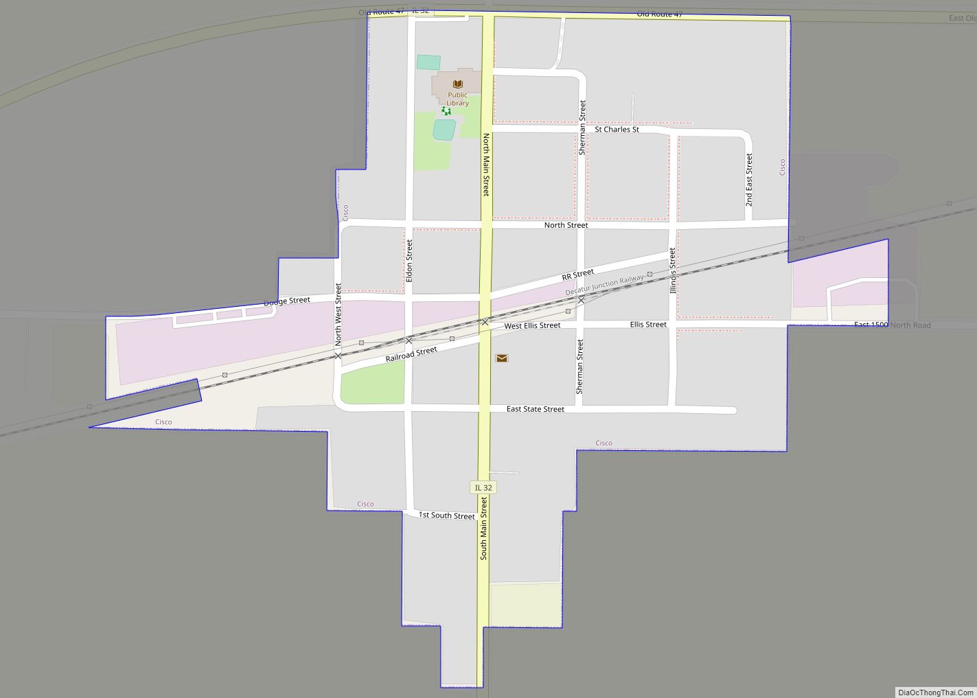
Online Interactive Map
Click on ![]() to view map in "full screen" mode.
to view map in "full screen" mode.
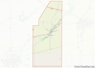
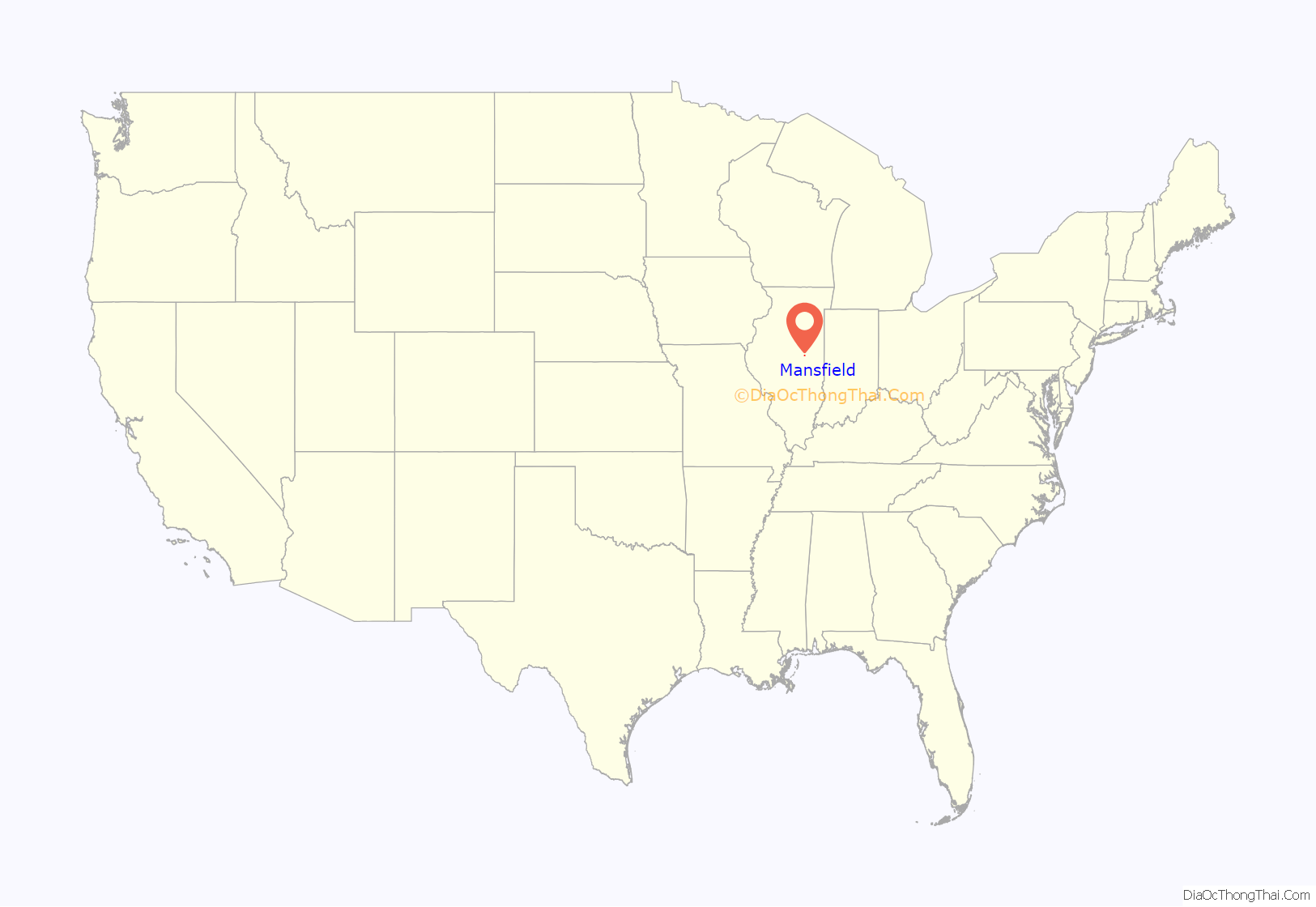
Mansfield location map. Where is Mansfield village?
History
Mansfield was originally incorporated around 1870. The village may have been named for John Mansfield, an officer in the Civil War. Other sources suggest Mansfield was named after a number of other unrelated men named Mansfield, including Jared Mansfield, an early American surveyor, or J.L. Mansfield, a local philanthropist. The village may also have been named after the city of Mansfield, Ohio – which was itself named for the surveyor Jared Mansfield.
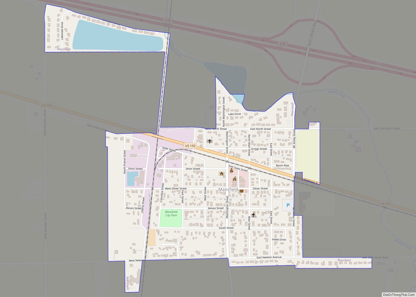
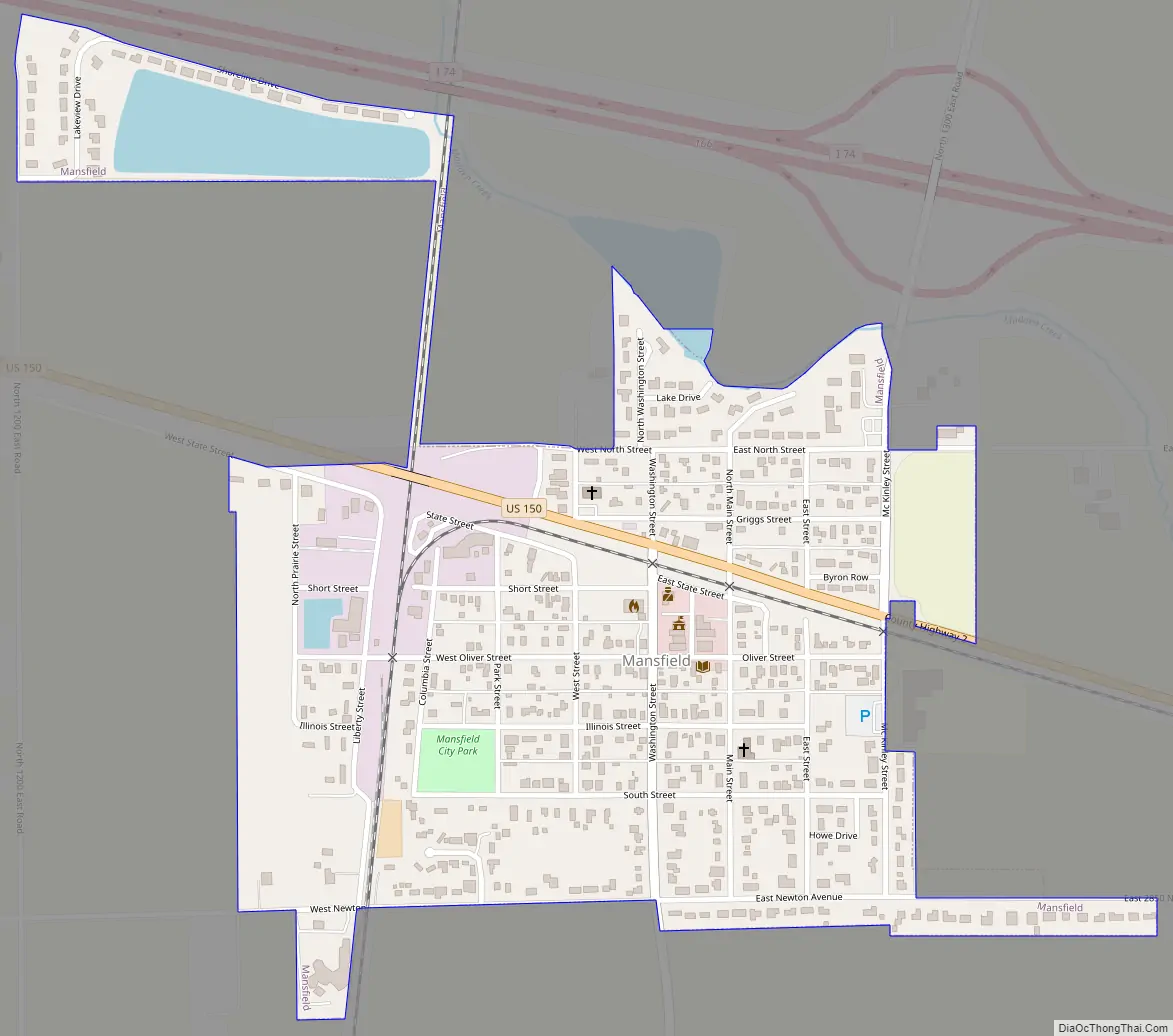
Mansfield Road Map
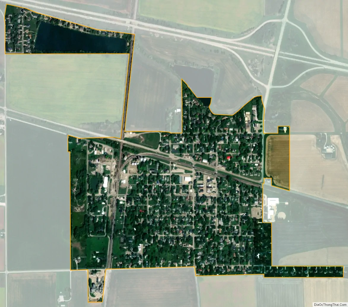
Mansfield city Satellite Map
Geography
Mansfield is located at 40°12′46″N 88°30′27″W / 40.21278°N 88.50750°W / 40.21278; -88.50750 (40.212795, -88.507416).
According to the 2010 census, Mansfield has a total area of 0.555 square miles (1.44 km), of which 0.53 square miles (1.37 km) (or 95.5%) is land and 0.025 square miles (0.06 km) (or 4.5%) is water.
See also
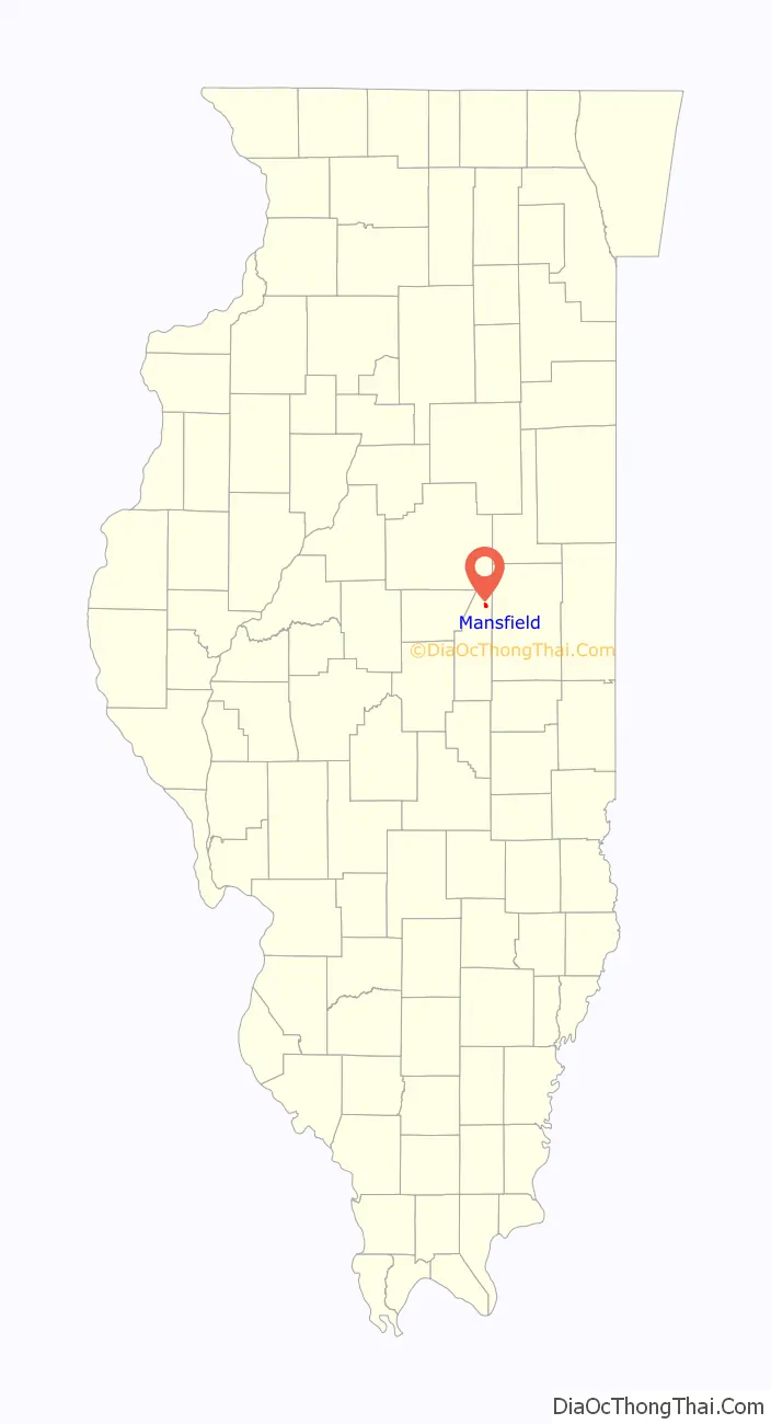
Map of Illinois State and its subdivision:- Adams
- Alexander
- Bond
- Boone
- Brown
- Bureau
- Calhoun
- Carroll
- Cass
- Champaign
- Christian
- Clark
- Clay
- Clinton
- Coles
- Cook
- Crawford
- Cumberland
- De Kalb
- De Witt
- Douglas
- Dupage
- Edgar
- Edwards
- Effingham
- Fayette
- Ford
- Franklin
- Fulton
- Gallatin
- Greene
- Grundy
- Hamilton
- Hancock
- Hardin
- Henderson
- Henry
- Iroquois
- Jackson
- Jasper
- Jefferson
- Jersey
- Jo Daviess
- Johnson
- Kane
- Kankakee
- Kendall
- Knox
- La Salle
- Lake
- Lake Michigan
- Lawrence
- Lee
- Livingston
- Logan
- Macon
- Macoupin
- Madison
- Marion
- Marshall
- Mason
- Massac
- McDonough
- McHenry
- McLean
- Menard
- Mercer
- Monroe
- Montgomery
- Morgan
- Moultrie
- Ogle
- Peoria
- Perry
- Piatt
- Pike
- Pope
- Pulaski
- Putnam
- Randolph
- Richland
- Rock Island
- Saint Clair
- Saline
- Sangamon
- Schuyler
- Scott
- Shelby
- Stark
- Stephenson
- Tazewell
- Union
- Vermilion
- Wabash
- Warren
- Washington
- Wayne
- White
- Whiteside
- Will
- Williamson
- Winnebago
- Woodford
- Alabama
- Alaska
- Arizona
- Arkansas
- California
- Colorado
- Connecticut
- Delaware
- District of Columbia
- Florida
- Georgia
- Hawaii
- Idaho
- Illinois
- Indiana
- Iowa
- Kansas
- Kentucky
- Louisiana
- Maine
- Maryland
- Massachusetts
- Michigan
- Minnesota
- Mississippi
- Missouri
- Montana
- Nebraska
- Nevada
- New Hampshire
- New Jersey
- New Mexico
- New York
- North Carolina
- North Dakota
- Ohio
- Oklahoma
- Oregon
- Pennsylvania
- Rhode Island
- South Carolina
- South Dakota
- Tennessee
- Texas
- Utah
- Vermont
- Virginia
- Washington
- West Virginia
- Wisconsin
- Wyoming