Mark is a village in Putnam County, Illinois, United States. The population was 555 at the 2010 census, up from 491 in 2000. It is part of the Ottawa Micropolitan Statistical Area. It maintains close ties to neighboring Granville, Illinois.
| Name: | Mark village |
|---|---|
| LSAD Code: | 47 |
| LSAD Description: | village (suffix) |
| State: | Illinois |
| County: | Putnam County |
| Total Area: | 1.06 sq mi (2.76 km²) |
| Land Area: | 1.06 sq mi (2.76 km²) |
| Water Area: | 0.00 sq mi (0.00 km²) 0% |
| Total Population: | 519 |
| Population Density: | 487.32/sq mi (188.20/km²) |
| ZIP code: | 61340 |
| FIPS code: | 1746981 |
| Website: | http://www.vil.mark.il.us/ |
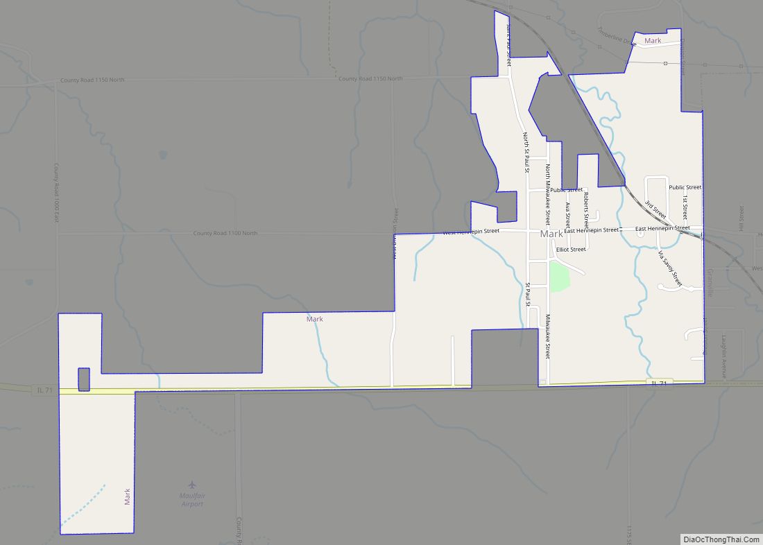
Online Interactive Map
Click on ![]() to view map in "full screen" mode.
to view map in "full screen" mode.
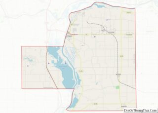
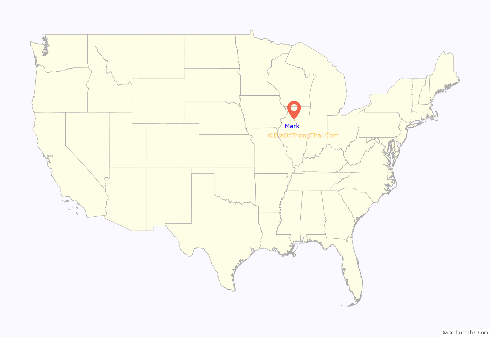
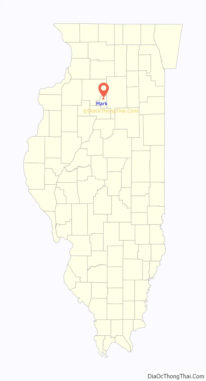
Mark location map. Where is Mark village?
History
The St. Paul Coal Company opened a shaft and founded the village in 1903. Superintendent Jame Cherry was in charge. The mine was sold to Prairie State Coal in 1928 and remained in operation until 1940.
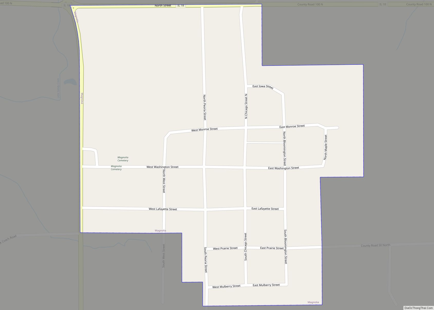
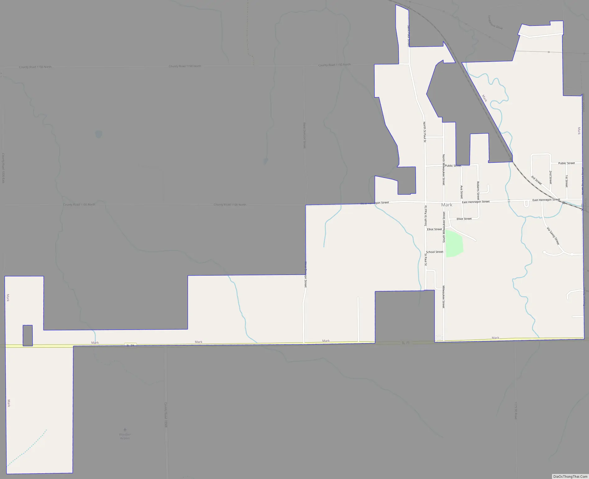
Mark Road Map
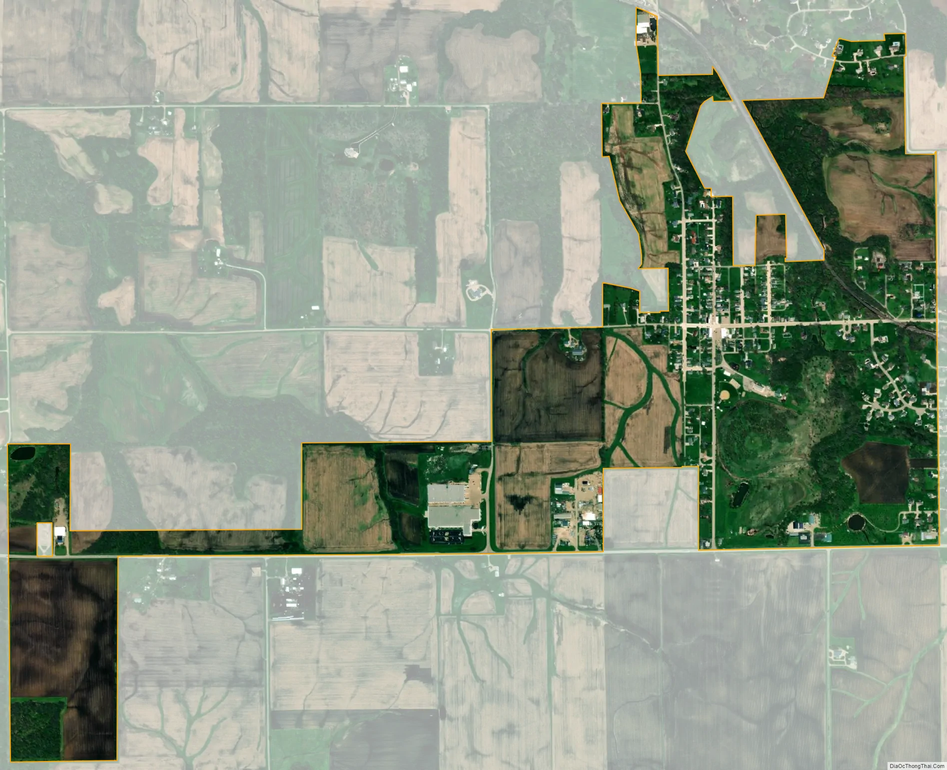
Mark city Satellite Map
Geography
Mark is located at 41°15′56″N 89°14′55″W / 41.265594°N 89.248521°W / 41.265594; -89.248521.
According to the 2010 census, the village has a total area of 1.13 square miles (2.9 km), all land.
See also
Map of Illinois State and its subdivision:- Adams
- Alexander
- Bond
- Boone
- Brown
- Bureau
- Calhoun
- Carroll
- Cass
- Champaign
- Christian
- Clark
- Clay
- Clinton
- Coles
- Cook
- Crawford
- Cumberland
- De Kalb
- De Witt
- Douglas
- Dupage
- Edgar
- Edwards
- Effingham
- Fayette
- Ford
- Franklin
- Fulton
- Gallatin
- Greene
- Grundy
- Hamilton
- Hancock
- Hardin
- Henderson
- Henry
- Iroquois
- Jackson
- Jasper
- Jefferson
- Jersey
- Jo Daviess
- Johnson
- Kane
- Kankakee
- Kendall
- Knox
- La Salle
- Lake
- Lake Michigan
- Lawrence
- Lee
- Livingston
- Logan
- Macon
- Macoupin
- Madison
- Marion
- Marshall
- Mason
- Massac
- McDonough
- McHenry
- McLean
- Menard
- Mercer
- Monroe
- Montgomery
- Morgan
- Moultrie
- Ogle
- Peoria
- Perry
- Piatt
- Pike
- Pope
- Pulaski
- Putnam
- Randolph
- Richland
- Rock Island
- Saint Clair
- Saline
- Sangamon
- Schuyler
- Scott
- Shelby
- Stark
- Stephenson
- Tazewell
- Union
- Vermilion
- Wabash
- Warren
- Washington
- Wayne
- White
- Whiteside
- Will
- Williamson
- Winnebago
- Woodford
- Alabama
- Alaska
- Arizona
- Arkansas
- California
- Colorado
- Connecticut
- Delaware
- District of Columbia
- Florida
- Georgia
- Hawaii
- Idaho
- Illinois
- Indiana
- Iowa
- Kansas
- Kentucky
- Louisiana
- Maine
- Maryland
- Massachusetts
- Michigan
- Minnesota
- Mississippi
- Missouri
- Montana
- Nebraska
- Nevada
- New Hampshire
- New Jersey
- New Mexico
- New York
- North Carolina
- North Dakota
- Ohio
- Oklahoma
- Oregon
- Pennsylvania
- Rhode Island
- South Carolina
- South Dakota
- Tennessee
- Texas
- Utah
- Vermont
- Virginia
- Washington
- West Virginia
- Wisconsin
- Wyoming