Normal is a town in McLean County, Illinois, United States. As of the 2020 census, the town’s population was 52,736. Normal is the smaller of two principal municipalities of the Bloomington–Normal metropolitan area, and Illinois’ seventh most populous community outside the Chicago metropolitan area. Chris Koos has been Normal’s mayor since 2003.
The main campus of Illinois’ oldest public university, Illinois State University, a fully accredited four-year institution, is in Normal, as is Heartland Community College, a fully accredited two-year institution. There was also a satellite campus of Lincoln College, which offered associate degrees as well as four-year programs.
| Name: | Normal town |
|---|---|
| LSAD Code: | 43 |
| LSAD Description: | town (suffix) |
| State: | Illinois |
| County: | McLean County |
| Founded: | February 1865 |
| Incorporated: | February 25, 1867 |
| Elevation: | 830 ft (250 m) |
| Total Area: | 18.03 sq mi (46.70 km²) |
| Land Area: | 17.94 sq mi (46.47 km²) |
| Water Area: | 0.09 sq mi (0.23 km²) 0.33% |
| Total Population: | 52,736 |
| Population Density: | 2,939.25/sq mi (1,134.85/km²) |
| Area code: | 309 |
| FIPS code: | 1753234 |
| Website: | www.normal.org |
Online Interactive Map
Click on ![]() to view map in "full screen" mode.
to view map in "full screen" mode.
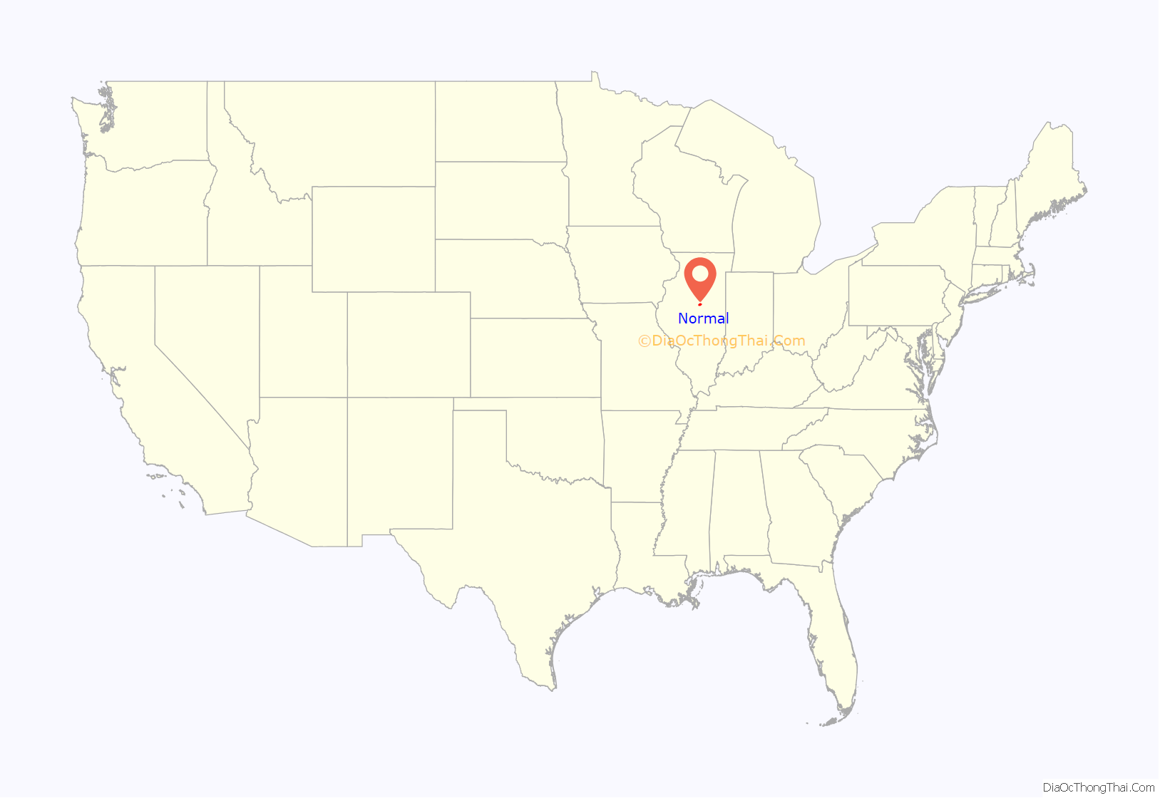
Normal location map. Where is Normal town?
History
The town was laid out with the name North Bloomington on June 7, 1854, by Joseph Parkinson. From its founding, it was generally recognized that Jesse W. Fell was the force behind the creation of the town. He had arranged for the new railroad, which would soon become the Chicago and Alton Railroad, to pass west of Bloomington then curving to cross the Illinois Central Railroad at a point where he owned or controlled land. Most of the original town lies south of these tracks, with Beaufort Street as its northern limit, and some blocks west of the Illinois Central and north of the tracks. Fell, his brothers, and associates quickly laid out many additions to the original town.
The town was renamed Normal in February 1865 and officially incorporated on February 25, 1867. The name was taken from Illinois State Normal University, a normal school (teacher-training institution) located there. The school has since been renamed Illinois State University after becoming a general four-year university. Normal is adjacent to Bloomington, Illinois, and when mentioned together they are known as the “Twin Cities”, “Bloomington-Normal”, “BN”, or “BloNo”.
In 2007, the town council voted to name the downtown area “Uptown Normal”, and, as of 2011, Uptown Normal is home to the Children’s Discovery Museum, Marriott Hotel and Conference Center, Hyatt Place Hotel, Uptown Station and Town Hall, and a variety of local shops and restaurants all centered around a roundabout. The district is also home to the historic and non-profit Normal Theater, a restored Art Deco theater owned by the Town of Normal that runs classic and independent films.
On August 31, 2021, a mass shooting occurred at a mobile home park in Normal that left three people dead and three more injured. The deceased were two women and a man, the latter being the gunman. He was killed by Normal Police Officers.
Normal Road Map
Normal city Satellite Map
Geography
Normal is located near 40°30′44″N 88°59′19″W / 40.512189°N 88.988701°W / 40.512189; -88.988701 (40.512189, −88.988701). According to the 2010 census, Normal has a total area of 18.412 square miles (47.69 km), of which 18.35 square miles (47.53 km) (or 99.66%) is land and 0.062 square miles (0.16 km) (or 0.34%) is water.
Climate
See also
Map of Illinois State and its subdivision:- Adams
- Alexander
- Bond
- Boone
- Brown
- Bureau
- Calhoun
- Carroll
- Cass
- Champaign
- Christian
- Clark
- Clay
- Clinton
- Coles
- Cook
- Crawford
- Cumberland
- De Kalb
- De Witt
- Douglas
- Dupage
- Edgar
- Edwards
- Effingham
- Fayette
- Ford
- Franklin
- Fulton
- Gallatin
- Greene
- Grundy
- Hamilton
- Hancock
- Hardin
- Henderson
- Henry
- Iroquois
- Jackson
- Jasper
- Jefferson
- Jersey
- Jo Daviess
- Johnson
- Kane
- Kankakee
- Kendall
- Knox
- La Salle
- Lake
- Lake Michigan
- Lawrence
- Lee
- Livingston
- Logan
- Macon
- Macoupin
- Madison
- Marion
- Marshall
- Mason
- Massac
- McDonough
- McHenry
- McLean
- Menard
- Mercer
- Monroe
- Montgomery
- Morgan
- Moultrie
- Ogle
- Peoria
- Perry
- Piatt
- Pike
- Pope
- Pulaski
- Putnam
- Randolph
- Richland
- Rock Island
- Saint Clair
- Saline
- Sangamon
- Schuyler
- Scott
- Shelby
- Stark
- Stephenson
- Tazewell
- Union
- Vermilion
- Wabash
- Warren
- Washington
- Wayne
- White
- Whiteside
- Will
- Williamson
- Winnebago
- Woodford
- Alabama
- Alaska
- Arizona
- Arkansas
- California
- Colorado
- Connecticut
- Delaware
- District of Columbia
- Florida
- Georgia
- Hawaii
- Idaho
- Illinois
- Indiana
- Iowa
- Kansas
- Kentucky
- Louisiana
- Maine
- Maryland
- Massachusetts
- Michigan
- Minnesota
- Mississippi
- Missouri
- Montana
- Nebraska
- Nevada
- New Hampshire
- New Jersey
- New Mexico
- New York
- North Carolina
- North Dakota
- Ohio
- Oklahoma
- Oregon
- Pennsylvania
- Rhode Island
- South Carolina
- South Dakota
- Tennessee
- Texas
- Utah
- Vermont
- Virginia
- Washington
- West Virginia
- Wisconsin
- Wyoming
