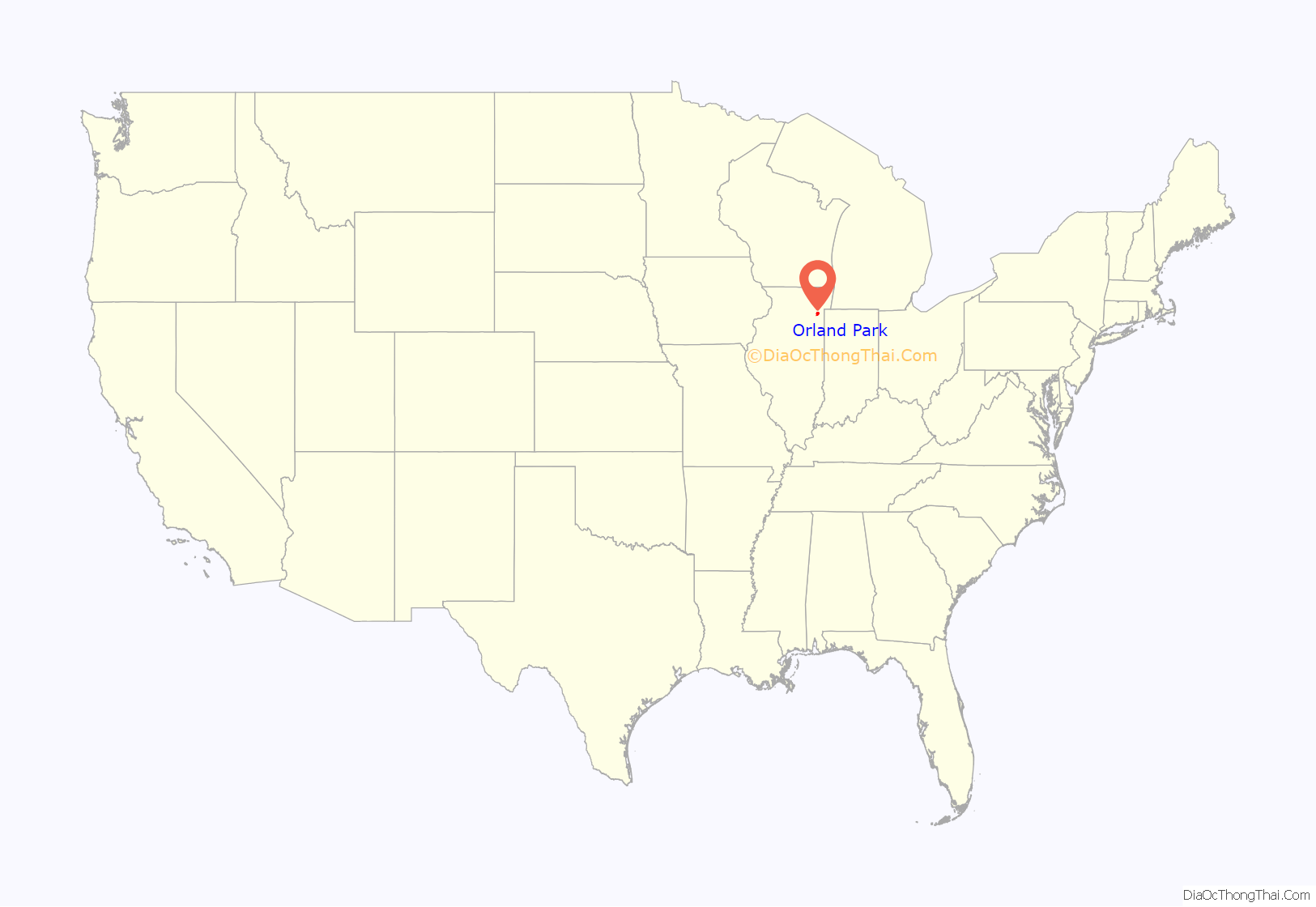
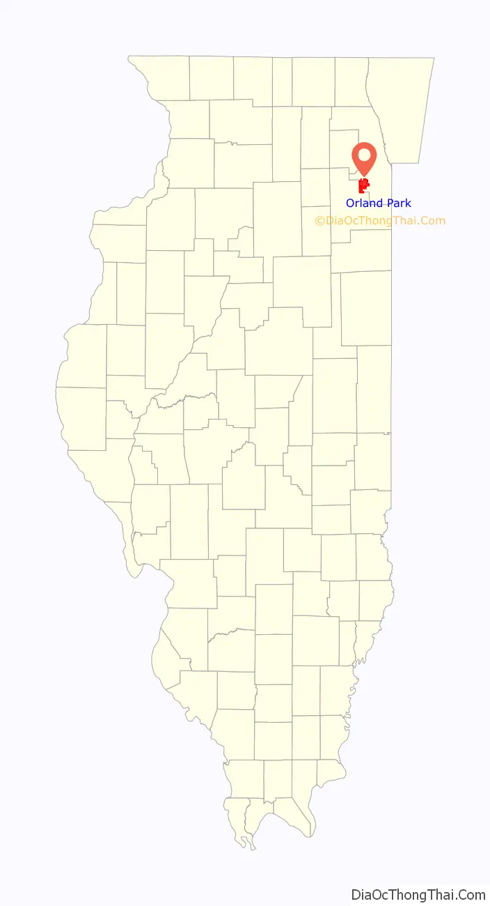
Orland Park is a village in Cook County, Illinois, United States, with a small portion in Will County. The village is a suburb of Chicago. Per the 2020 census, Orland Park had a population of 58,703.
Located 25 miles (40 km) southwest of Chicago, Orland Park is close to several interstate highways, with the I-80 east-west coast connector as its southern border. The Metra commuter rail system links it to the Chicago Loop and from there to O’Hare and Midway airports.
| Name: | Orland Park village |
|---|---|
| LSAD Code: | 47 |
| LSAD Description: | village (suffix) |
| State: | Illinois |
| County: | Cook County, Will County |
| Incorporated: | May 31, 1892 |
| Elevation: | 686 ft (209 m) |
| Total Area: | 22.31 sq mi (57.79 km²) |
| Land Area: | 22.03 sq mi (57.05 km²) |
| Water Area: | 0.28 sq mi (0.74 km²) 1.31% |
| Total Population: | 58,703 |
| Population Density: | 2,664.93/sq mi (1,028.92/km²) |
| Area code: | 708 |
| FIPS code: | 1756640 |
| Website: | www.orlandpark.org |
Online Interactive Map
Click on ![]() to view map in "full screen" mode.
to view map in "full screen" mode.
Orland Park location map. Where is Orland Park village?
History
Orland Park was first settled as “Orland” in 1834, with Henry Taylor being the area’s first settler. Other original settlers include Ichabod and William Myrick, Jacob and Bernard Hostert, Thomas Cooper and John Humphrey. The Hostert brothers built log cabins for their families, which became some of the first homes built in Orland Park. In 1879 the railroad was extended to Orland Park, leading way for the towns first train station, “Sedgwick Station.” This development took the town from an agrarian society to a commercial hub that provides shipping services to local farms. The village was incorporated on May 31, 1892. A mall named Orland Square Mall opened at the central part of the village in 1976.
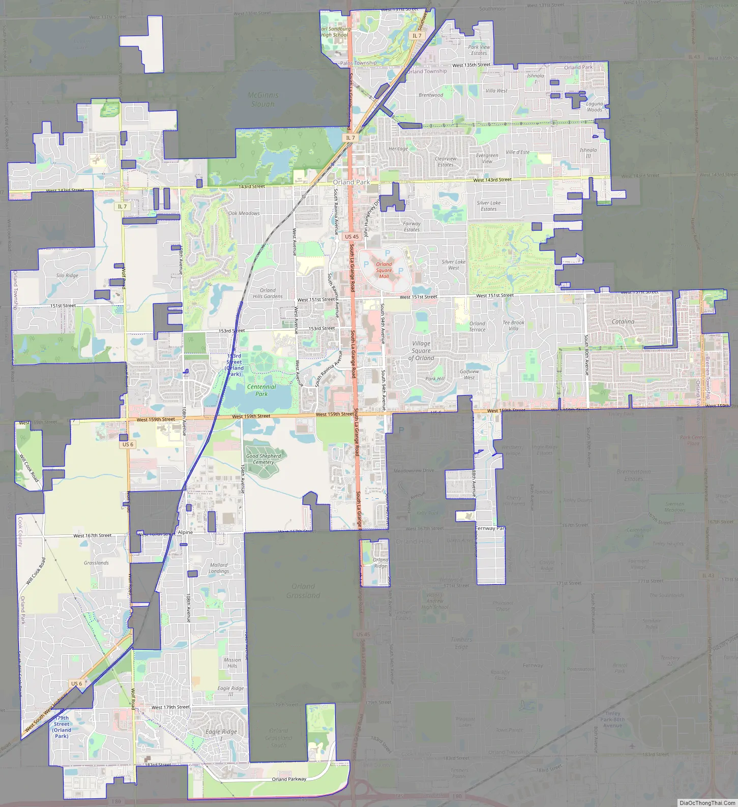
Orland Park Road Map
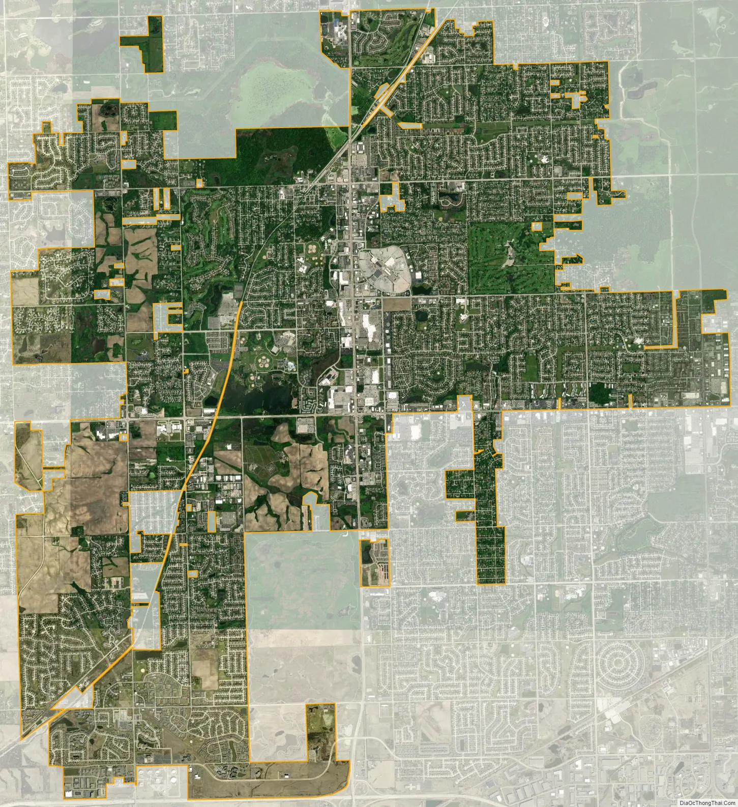
Orland Park city Satellite Map
Geography
According to the 2021 census gazetteer files, Orland Park has a total area of 22.31 square miles (57.78 km), of which 22.03 square miles (57.06 km) (or 98.72%) is land and 0.29 square miles (0.75 km) (or 1.28%) is water.
The main bodies of water in Orland are two lakes: Lake Sedgewick and McGinnis Slough.
Communities bordering Orland Park include Homer Glen (in Will County) to the west, Orland Hills and Mokena (also in Will County but Orland Hills is in Cook County) to the south, Tinley Park to the southeast, Oak Forest to the east, and Palos Park and Palos Heights to the north.
See also
Map of Illinois State and its subdivision:- Adams
- Alexander
- Bond
- Boone
- Brown
- Bureau
- Calhoun
- Carroll
- Cass
- Champaign
- Christian
- Clark
- Clay
- Clinton
- Coles
- Cook
- Crawford
- Cumberland
- De Kalb
- De Witt
- Douglas
- Dupage
- Edgar
- Edwards
- Effingham
- Fayette
- Ford
- Franklin
- Fulton
- Gallatin
- Greene
- Grundy
- Hamilton
- Hancock
- Hardin
- Henderson
- Henry
- Iroquois
- Jackson
- Jasper
- Jefferson
- Jersey
- Jo Daviess
- Johnson
- Kane
- Kankakee
- Kendall
- Knox
- La Salle
- Lake
- Lake Michigan
- Lawrence
- Lee
- Livingston
- Logan
- Macon
- Macoupin
- Madison
- Marion
- Marshall
- Mason
- Massac
- McDonough
- McHenry
- McLean
- Menard
- Mercer
- Monroe
- Montgomery
- Morgan
- Moultrie
- Ogle
- Peoria
- Perry
- Piatt
- Pike
- Pope
- Pulaski
- Putnam
- Randolph
- Richland
- Rock Island
- Saint Clair
- Saline
- Sangamon
- Schuyler
- Scott
- Shelby
- Stark
- Stephenson
- Tazewell
- Union
- Vermilion
- Wabash
- Warren
- Washington
- Wayne
- White
- Whiteside
- Will
- Williamson
- Winnebago
- Woodford
- Alabama
- Alaska
- Arizona
- Arkansas
- California
- Colorado
- Connecticut
- Delaware
- District of Columbia
- Florida
- Georgia
- Hawaii
- Idaho
- Illinois
- Indiana
- Iowa
- Kansas
- Kentucky
- Louisiana
- Maine
- Maryland
- Massachusetts
- Michigan
- Minnesota
- Mississippi
- Missouri
- Montana
- Nebraska
- Nevada
- New Hampshire
- New Jersey
- New Mexico
- New York
- North Carolina
- North Dakota
- Ohio
- Oklahoma
- Oregon
- Pennsylvania
- Rhode Island
- South Carolina
- South Dakota
- Tennessee
- Texas
- Utah
- Vermont
- Virginia
- Washington
- West Virginia
- Wisconsin
- Wyoming


