Palestine is a village in Crawford County, Illinois, United States. The population was 1,233 at the 2020 Census.
| Name: | Palestine village |
|---|---|
| LSAD Code: | 47 |
| LSAD Description: | village (suffix) |
| State: | Illinois |
| County: | Crawford County |
| Incorporated: | February 15, 1855 |
| Elevation: | 449 ft (137 m) |
| Total Area: | 0.79 sq mi (2.04 km²) |
| Land Area: | 0.79 sq mi (2.04 km²) |
| Water Area: | 0.00 sq mi (0.00 km²) |
| Total Population: | 1,233 |
| Population Density: | 1,562.74/sq mi (603.15/km²) |
| Area code: | 618 |
| FIPS code: | 1757277 |
| GNISfeature ID: | 2399610 |
| Website: | www.villageofpalestine.net |
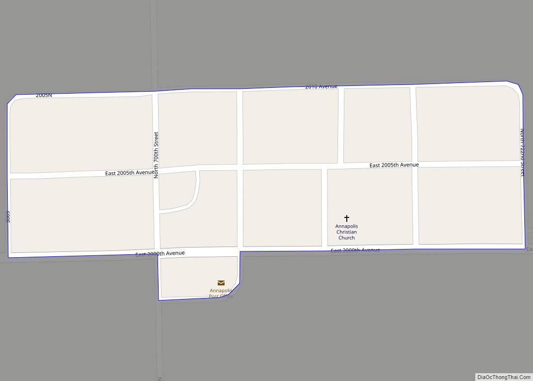
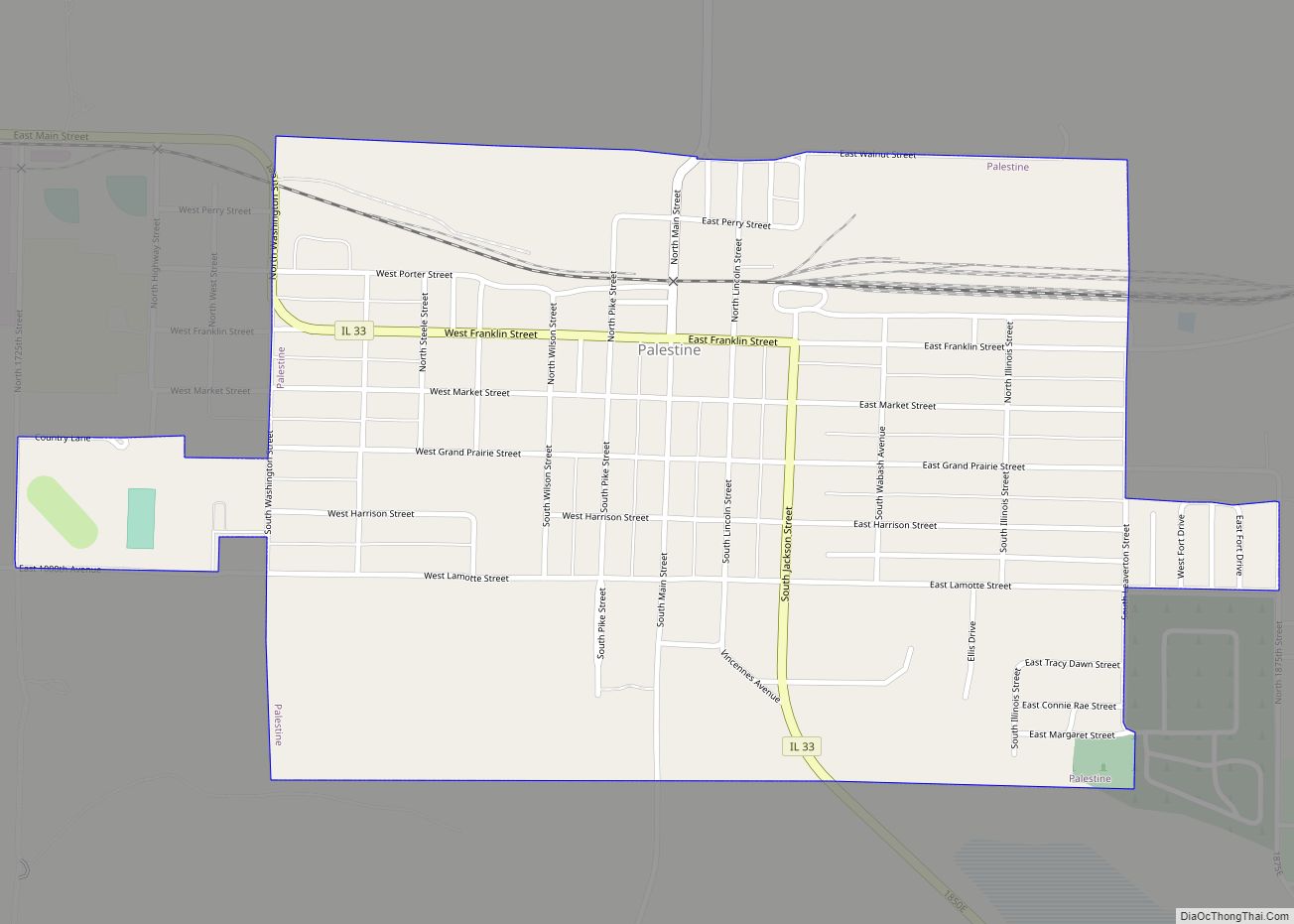
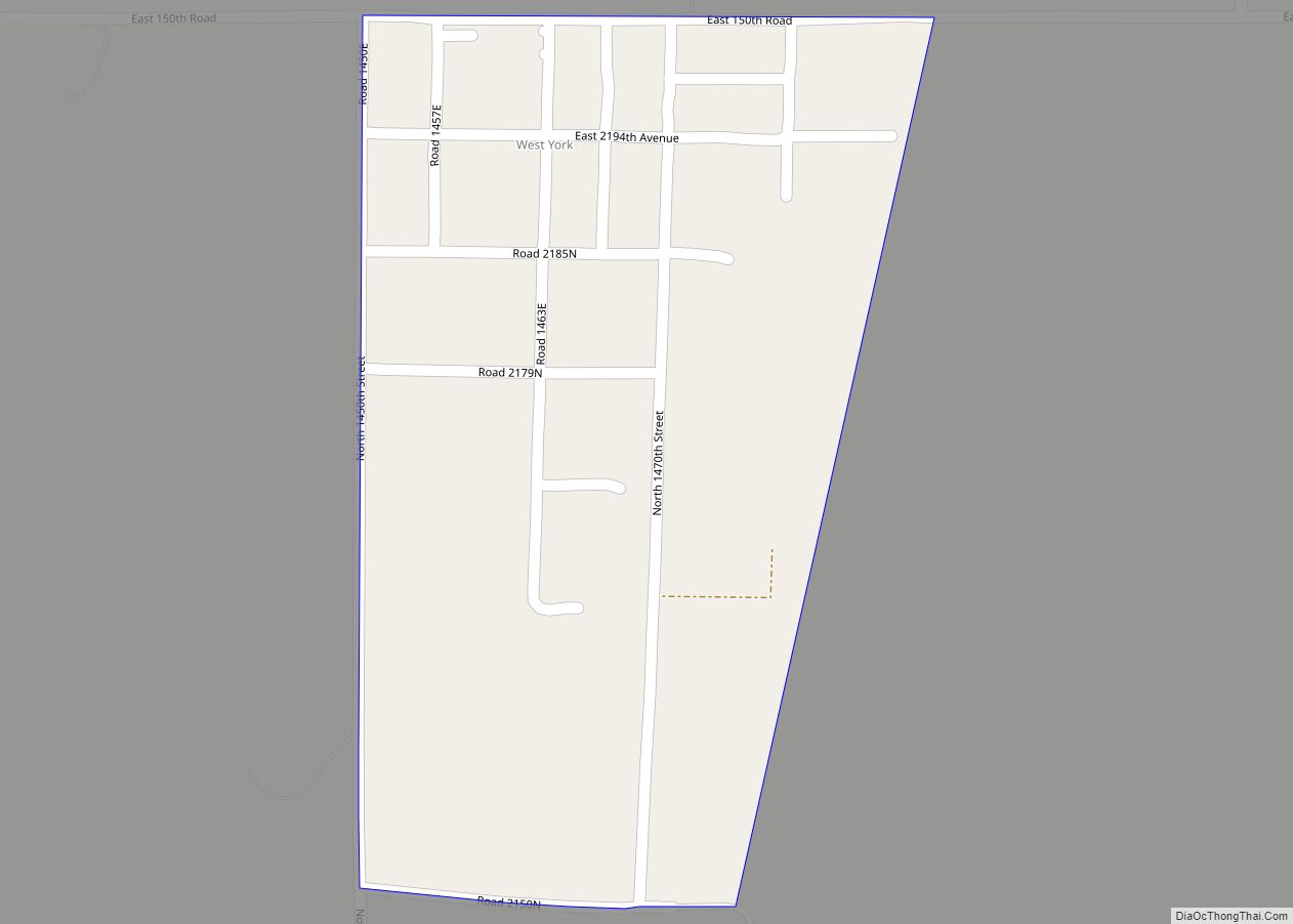
Online Interactive Map
Click on ![]() to view map in "full screen" mode.
to view map in "full screen" mode.
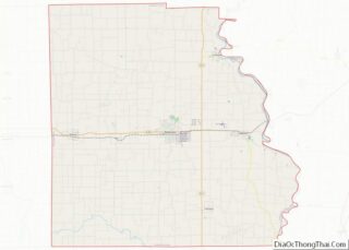
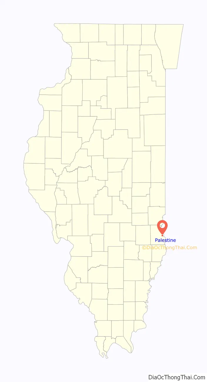
Palestine location map. Where is Palestine village?

History
It is said that French explorer Jean Lamotte first gazed upon this region in 1678. He gave it the name Palestine, as it reminded him of Palestine, the Biblical land of milk and honey.
Palestine was chartered in 1811, while the area still belonged to Virginia, and is one of the oldest towns in the State of Illinois. It was named the seat of Crawford County in 1818. Elections in 1843 moved the county seat to a new site, which would become the town of Robinson. It was officially incorporated as an Illinois town in 1855.
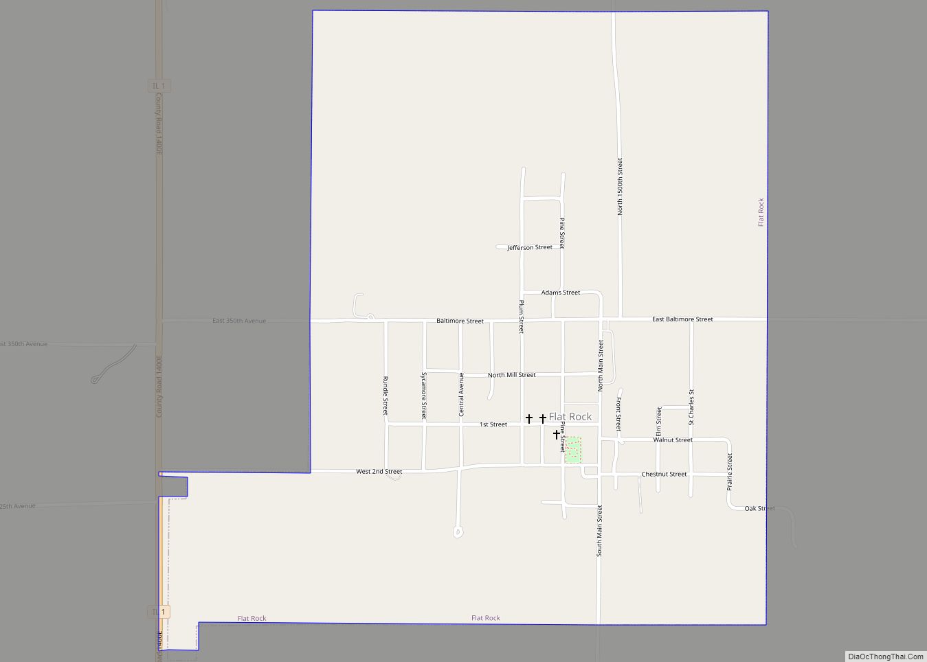
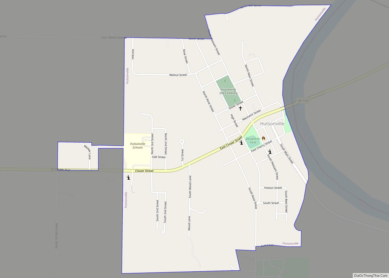
Palestine Road Map
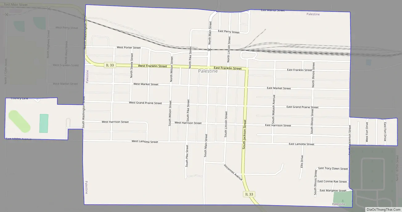
Palestine city Satellite Map

Geography
According to the 2010 census, Palestine has a total area of 0.79 square miles (2.05 km), all land.
See also
Map of Illinois State and its subdivision:- Adams
- Alexander
- Bond
- Boone
- Brown
- Bureau
- Calhoun
- Carroll
- Cass
- Champaign
- Christian
- Clark
- Clay
- Clinton
- Coles
- Cook
- Crawford
- Cumberland
- De Kalb
- De Witt
- Douglas
- Dupage
- Edgar
- Edwards
- Effingham
- Fayette
- Ford
- Franklin
- Fulton
- Gallatin
- Greene
- Grundy
- Hamilton
- Hancock
- Hardin
- Henderson
- Henry
- Iroquois
- Jackson
- Jasper
- Jefferson
- Jersey
- Jo Daviess
- Johnson
- Kane
- Kankakee
- Kendall
- Knox
- La Salle
- Lake
- Lake Michigan
- Lawrence
- Lee
- Livingston
- Logan
- Macon
- Macoupin
- Madison
- Marion
- Marshall
- Mason
- Massac
- McDonough
- McHenry
- McLean
- Menard
- Mercer
- Monroe
- Montgomery
- Morgan
- Moultrie
- Ogle
- Peoria
- Perry
- Piatt
- Pike
- Pope
- Pulaski
- Putnam
- Randolph
- Richland
- Rock Island
- Saint Clair
- Saline
- Sangamon
- Schuyler
- Scott
- Shelby
- Stark
- Stephenson
- Tazewell
- Union
- Vermilion
- Wabash
- Warren
- Washington
- Wayne
- White
- Whiteside
- Will
- Williamson
- Winnebago
- Woodford
- Alabama
- Alaska
- Arizona
- Arkansas
- California
- Colorado
- Connecticut
- Delaware
- District of Columbia
- Florida
- Georgia
- Hawaii
- Idaho
- Illinois
- Indiana
- Iowa
- Kansas
- Kentucky
- Louisiana
- Maine
- Maryland
- Massachusetts
- Michigan
- Minnesota
- Mississippi
- Missouri
- Montana
- Nebraska
- Nevada
- New Hampshire
- New Jersey
- New Mexico
- New York
- North Carolina
- North Dakota
- Ohio
- Oklahoma
- Oregon
- Pennsylvania
- Rhode Island
- South Carolina
- South Dakota
- Tennessee
- Texas
- Utah
- Vermont
- Virginia
- Washington
- West Virginia
- Wisconsin
- Wyoming