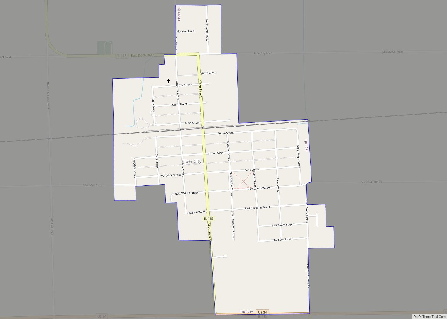
Piper City is a village in Ford County, Illinois, United States. The population was 826 at the 2010 census.
| Name: | Piper City village |
|---|---|
| LSAD Code: | 47 |
| LSAD Description: | village (suffix) |
| State: | Illinois |
| County: | Ford County |
| Elevation: | 672 ft (205 m) |
| Total Area: | 0.56 sq mi (1.44 km²) |
| Land Area: | 0.56 sq mi (1.44 km²) |
| Water Area: | 0.00 sq mi (0.00 km²) |
| Total Population: | 745 |
| Population Density: | 1,342.34/sq mi (518.52/km²) |
| ZIP code: | 60959 |
| Area code: | 815 |
| FIPS code: | 1760079 |
| Website: | pipercity.com |
Online Interactive Map
Click on ![]() to view map in "full screen" mode.
to view map in "full screen" mode.
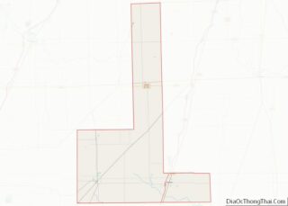
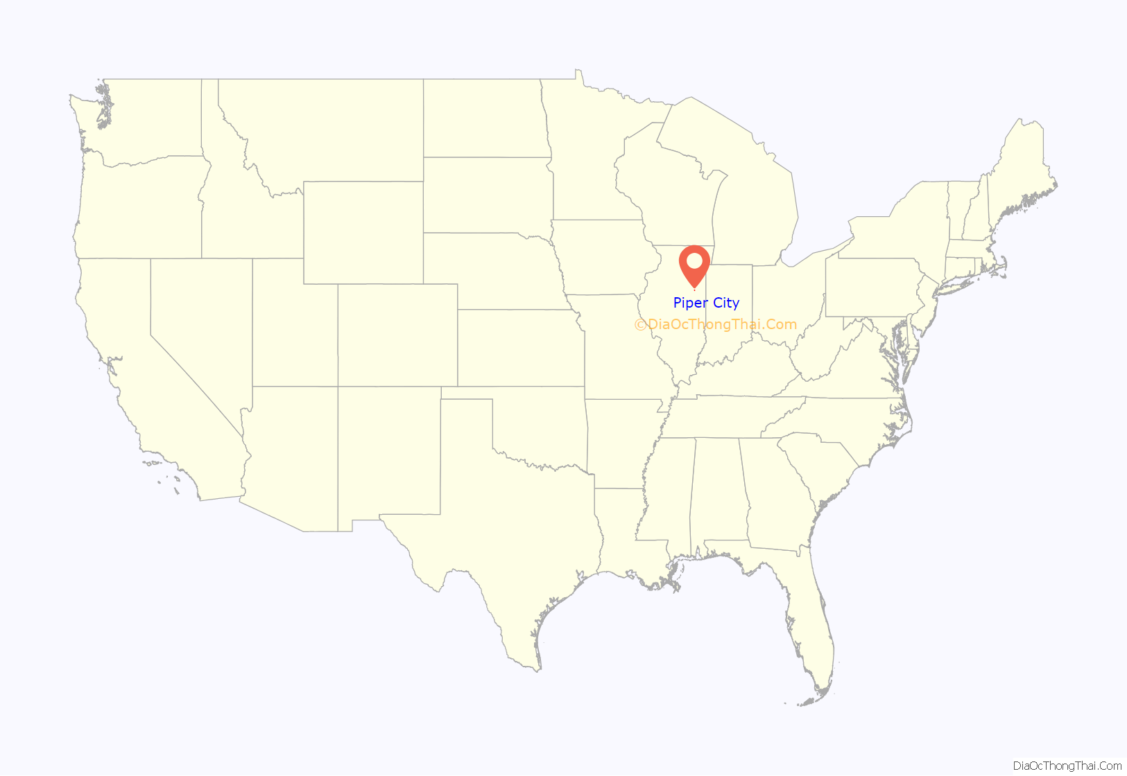
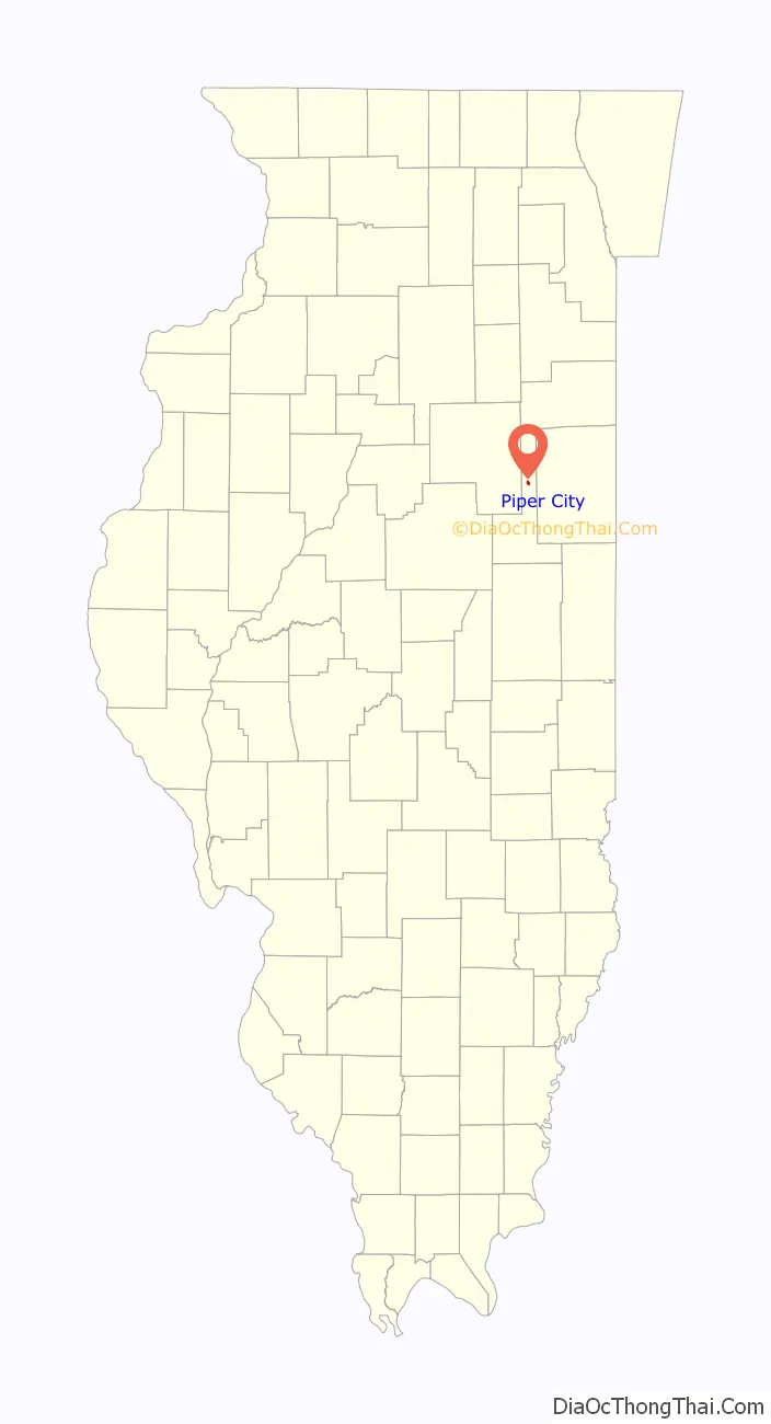
Piper City location map. Where is Piper City village?
History
Piper City was laid out in 1867 by Samuel Cross of New York and William A. Piper (5 March 1820 – 6 July 1896) of Philadelphia. The original plat was named Brenton. It was a station on the Toledo Peoria and Western Railroad, which had been completed ten years earlier. The present name of the town, which was adapted soon after the town was founded, comes from Piper who had extensive land holdings in the area. Cross lived briefly in the township, but little is known of his life. An earlier railroad siding and grain station known as Brenton had been established two miles to the east of the eventual location of the town. The new station was therefore briefly known as New Brenton. The Original Town lay on both sides of the railroad and the streets were aligned with the railroad, which was angled slightly away from true north–south. John Allen and W. C. Jones opened the first store in Piper City the summer of 1867. A second store called Piper, Montelius and Company was operated by J.A. Montelius, Piper’s nephew, but it is unclear if Piper was actually a resident in the new town. The first Post Office was in the home of John R. Lewis, who had been a land agent for the Illinois Central Railroad. A Presbyterian Church was established in 1869, a Catholic church in 1880 and a Methodist church in 1881. In 1870, Montelius established a bank and was, for many years, the leading citizen of Piper City. In 1887, B.W. Kensey began the Piper City Journal. In 1924, when the people of Piper City learned that a new highway, soon to be known as U.S. 24, would pass a quarter mile south of the town, a delegation was sent to the governor to protest. They were unsuccessful. The town has been an important grain shipping point for the rich agricultural land of the pan handle of Ford County.
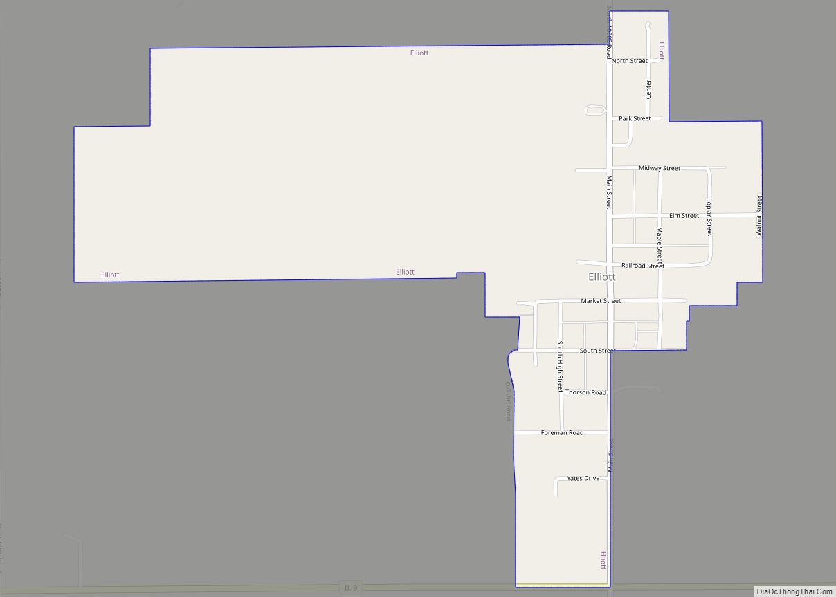
Piper City Road Map
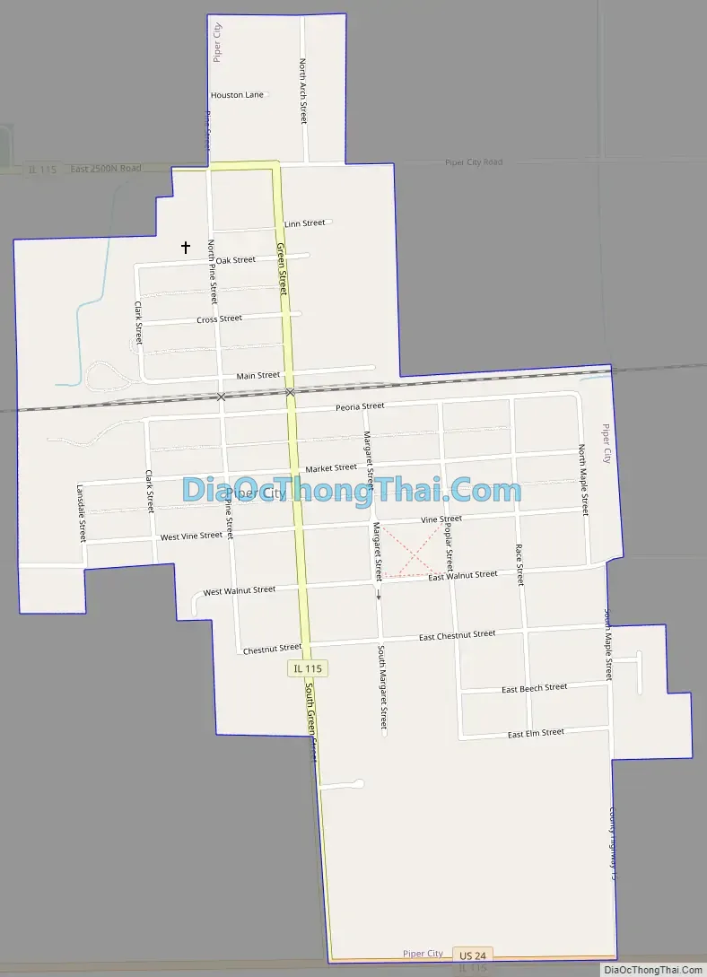
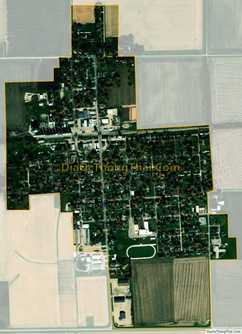
Piper City city Satellite Map
Geography
Piper City is located at 40°45′24″N 88°11′22″W / 40.75667°N 88.18944°W / 40.75667; -88.18944 (40.756749, -88.189560).
According to the 2010 census, Piper City has a total area of 0.55 square miles (1.42 km), all land.
See also
Map of Illinois State and its subdivision:- Adams
- Alexander
- Bond
- Boone
- Brown
- Bureau
- Calhoun
- Carroll
- Cass
- Champaign
- Christian
- Clark
- Clay
- Clinton
- Coles
- Cook
- Crawford
- Cumberland
- De Kalb
- De Witt
- Douglas
- Dupage
- Edgar
- Edwards
- Effingham
- Fayette
- Ford
- Franklin
- Fulton
- Gallatin
- Greene
- Grundy
- Hamilton
- Hancock
- Hardin
- Henderson
- Henry
- Iroquois
- Jackson
- Jasper
- Jefferson
- Jersey
- Jo Daviess
- Johnson
- Kane
- Kankakee
- Kendall
- Knox
- La Salle
- Lake
- Lake Michigan
- Lawrence
- Lee
- Livingston
- Logan
- Macon
- Macoupin
- Madison
- Marion
- Marshall
- Mason
- Massac
- McDonough
- McHenry
- McLean
- Menard
- Mercer
- Monroe
- Montgomery
- Morgan
- Moultrie
- Ogle
- Peoria
- Perry
- Piatt
- Pike
- Pope
- Pulaski
- Putnam
- Randolph
- Richland
- Rock Island
- Saint Clair
- Saline
- Sangamon
- Schuyler
- Scott
- Shelby
- Stark
- Stephenson
- Tazewell
- Union
- Vermilion
- Wabash
- Warren
- Washington
- Wayne
- White
- Whiteside
- Will
- Williamson
- Winnebago
- Woodford
- Alabama
- Alaska
- Arizona
- Arkansas
- California
- Colorado
- Connecticut
- Delaware
- District of Columbia
- Florida
- Georgia
- Hawaii
- Idaho
- Illinois
- Indiana
- Iowa
- Kansas
- Kentucky
- Louisiana
- Maine
- Maryland
- Massachusetts
- Michigan
- Minnesota
- Mississippi
- Missouri
- Montana
- Nebraska
- Nevada
- New Hampshire
- New Jersey
- New Mexico
- New York
- North Carolina
- North Dakota
- Ohio
- Oklahoma
- Oregon
- Pennsylvania
- Rhode Island
- South Carolina
- South Dakota
- Tennessee
- Texas
- Utah
- Vermont
- Virginia
- Washington
- West Virginia
- Wisconsin
- Wyoming