Pleasant Hill is a village in Pike County, Illinois, United States. The population was 966 at the 2010 census.
Pleasant Hill is the site of the annual Pike County Fair, as well as the location of the Bi-State Annual Demolition Derby, which was previously held at Six Flags St. Louis in Eureka, Missouri.
The village also happens to have an annual Fourth of July celebration which attracts many throughout the county. The fireworks display can be seen by many surrounding towns.
| Name: | Pleasant Hill village |
|---|---|
| LSAD Code: | 47 |
| LSAD Description: | village (suffix) |
| State: | Illinois |
| County: | Pike County |
| Elevation: | 459 ft (140 m) |
| Total Area: | 0.79 sq mi (2.05 km²) |
| Land Area: | 0.77 sq mi (1.98 km²) |
| Water Area: | 0.03 sq mi (0.06 km²) |
| Total Population: | 924 |
| Population Density: | 1,207.84/sq mi (466.15/km²) |
| Area code: | 217 |
| FIPS code: | 1760534 |
| GNISfeature ID: | 2399692 |
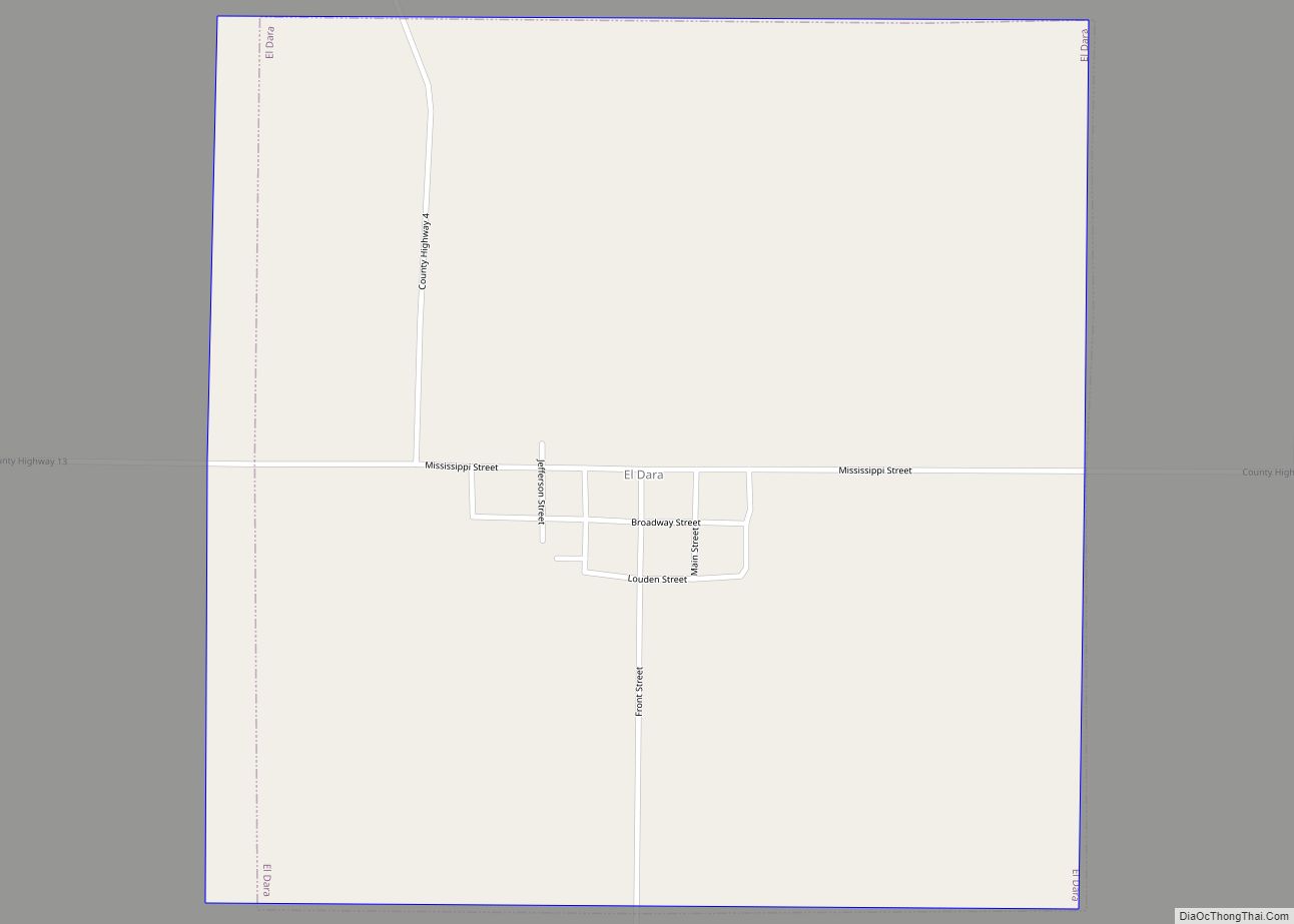
Online Interactive Map
Click on ![]() to view map in "full screen" mode.
to view map in "full screen" mode.
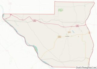
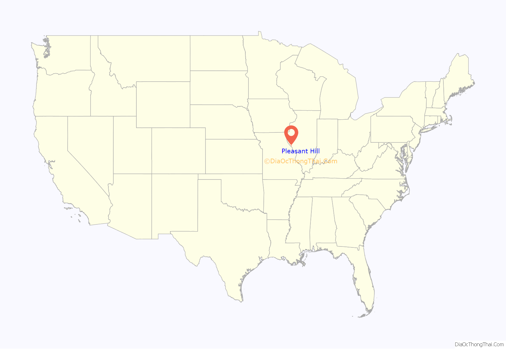
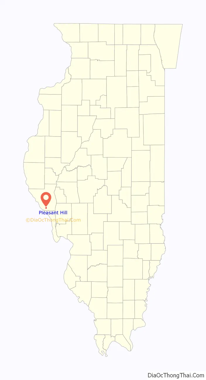
Pleasant Hill location map. Where is Pleasant Hill village?
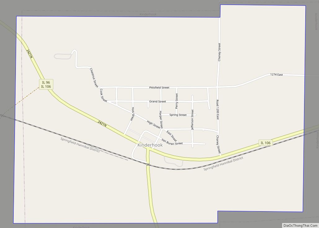
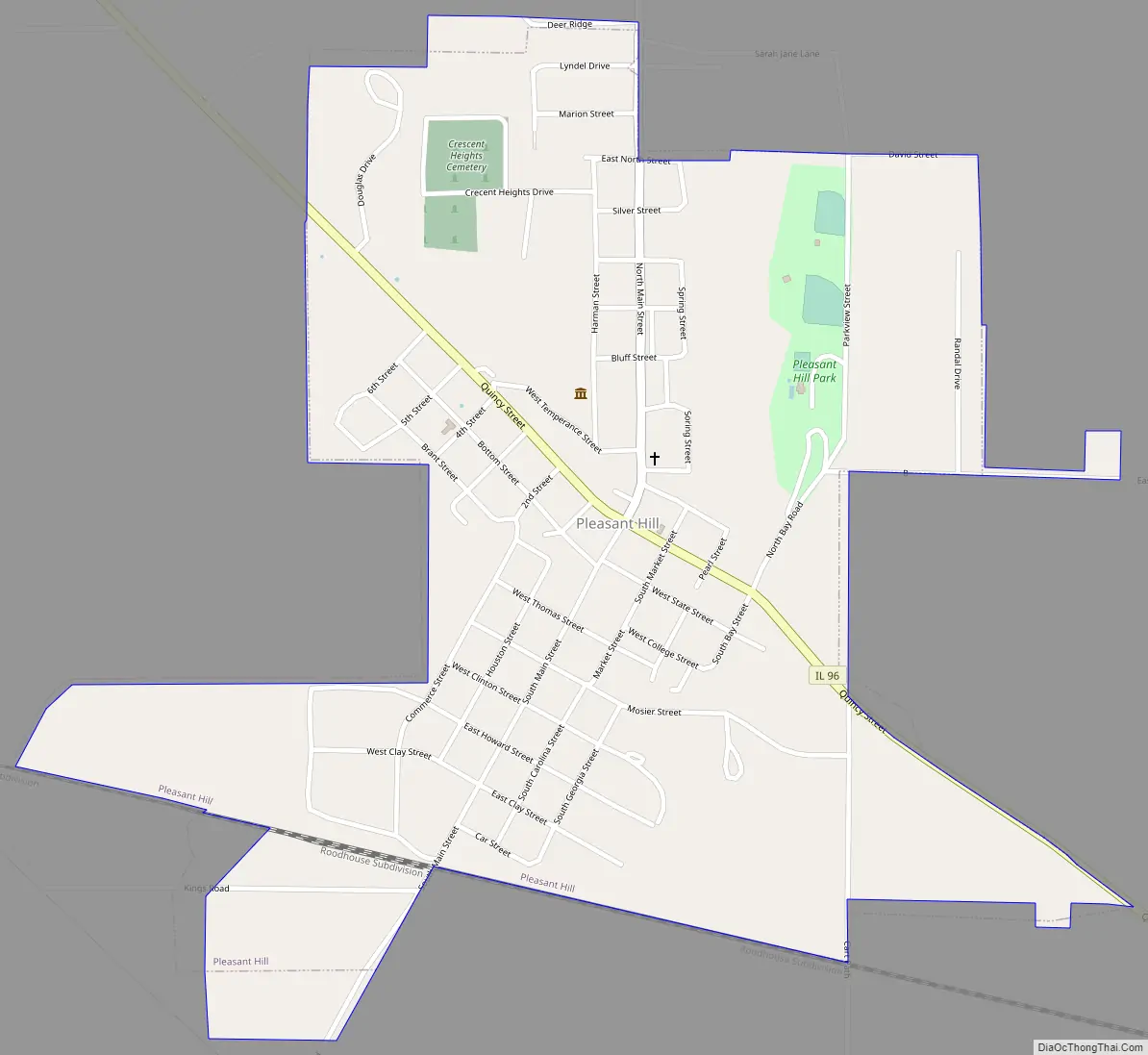
Pleasant Hill Road Map
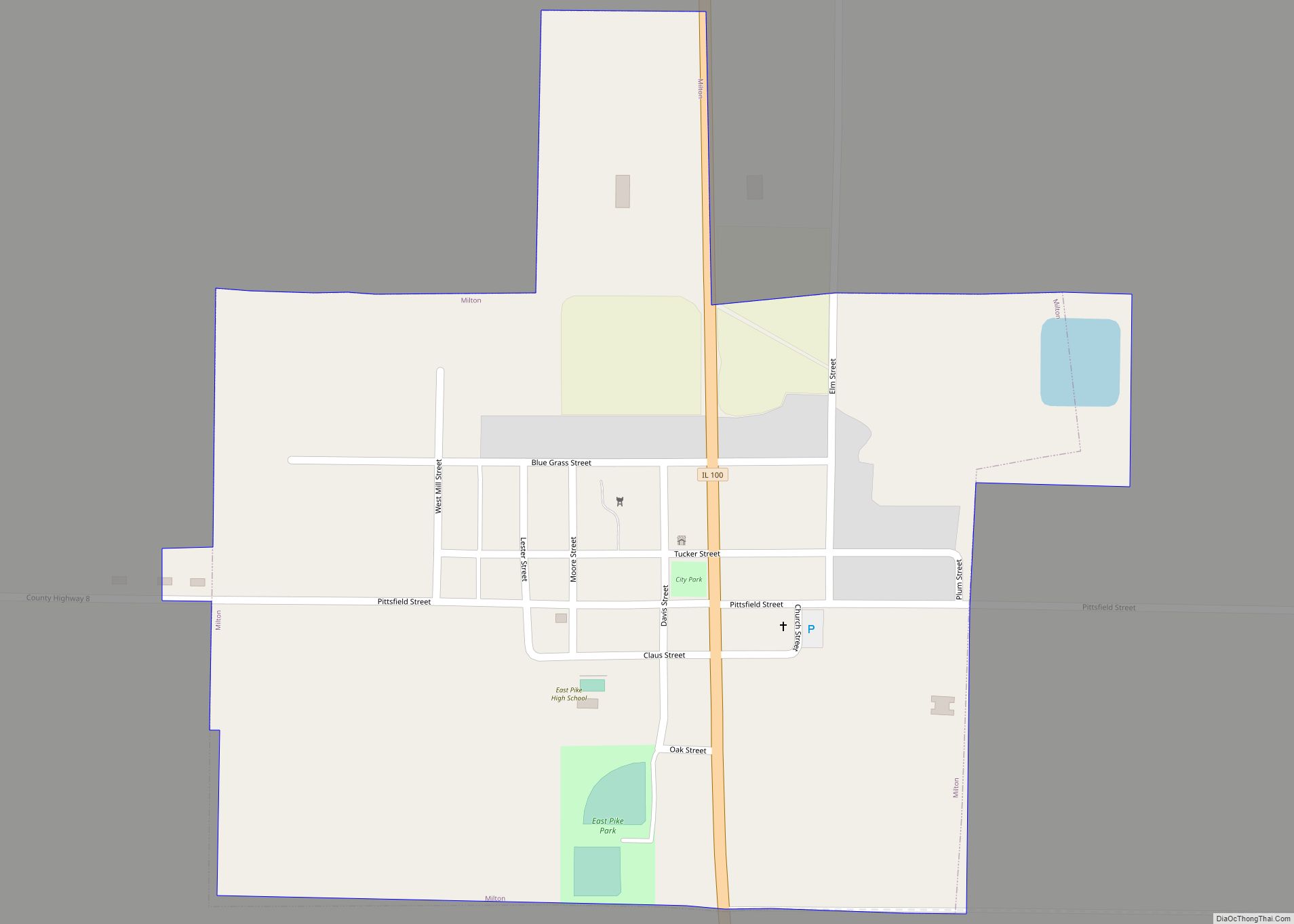
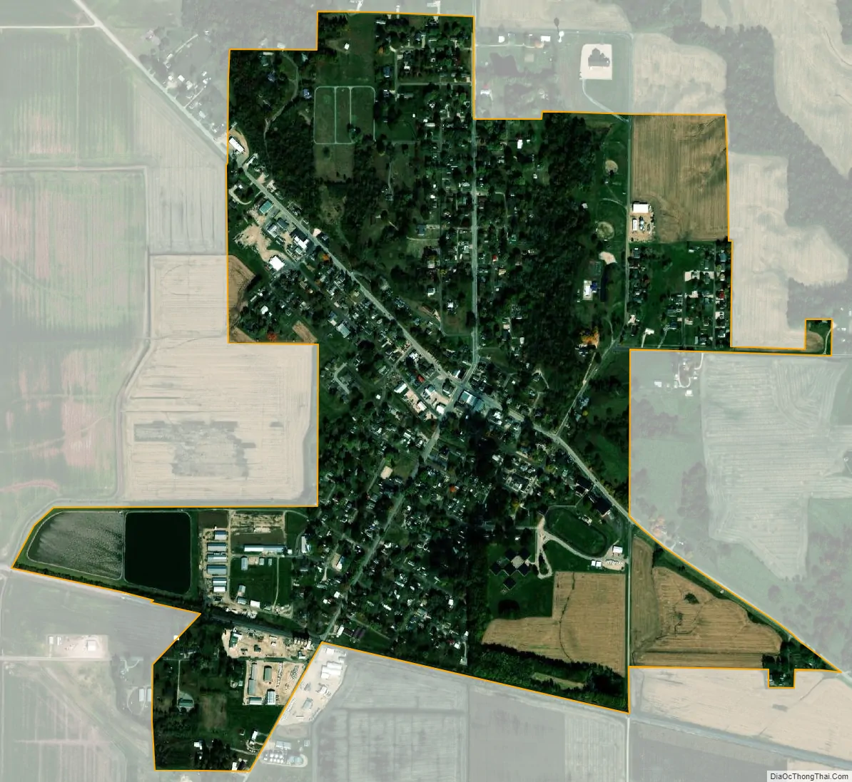
Pleasant Hill city Satellite Map
Geography
Pleasant Hill is located at 39°26′36″N 90°52′23″W / 39.44333°N 90.87306°W / 39.44333; -90.87306 (39.443315, -90.873132).
According to the 2010 census, Pleasant Hill has a total area of 0.805 square miles (2.08 km), of which 0.78 square miles (2.02 km) (or 96.89%) is land and 0.025 square miles (0.06 km) (or 3.11%) is water.
See also
Map of Illinois State and its subdivision:- Adams
- Alexander
- Bond
- Boone
- Brown
- Bureau
- Calhoun
- Carroll
- Cass
- Champaign
- Christian
- Clark
- Clay
- Clinton
- Coles
- Cook
- Crawford
- Cumberland
- De Kalb
- De Witt
- Douglas
- Dupage
- Edgar
- Edwards
- Effingham
- Fayette
- Ford
- Franklin
- Fulton
- Gallatin
- Greene
- Grundy
- Hamilton
- Hancock
- Hardin
- Henderson
- Henry
- Iroquois
- Jackson
- Jasper
- Jefferson
- Jersey
- Jo Daviess
- Johnson
- Kane
- Kankakee
- Kendall
- Knox
- La Salle
- Lake
- Lake Michigan
- Lawrence
- Lee
- Livingston
- Logan
- Macon
- Macoupin
- Madison
- Marion
- Marshall
- Mason
- Massac
- McDonough
- McHenry
- McLean
- Menard
- Mercer
- Monroe
- Montgomery
- Morgan
- Moultrie
- Ogle
- Peoria
- Perry
- Piatt
- Pike
- Pope
- Pulaski
- Putnam
- Randolph
- Richland
- Rock Island
- Saint Clair
- Saline
- Sangamon
- Schuyler
- Scott
- Shelby
- Stark
- Stephenson
- Tazewell
- Union
- Vermilion
- Wabash
- Warren
- Washington
- Wayne
- White
- Whiteside
- Will
- Williamson
- Winnebago
- Woodford
- Alabama
- Alaska
- Arizona
- Arkansas
- California
- Colorado
- Connecticut
- Delaware
- District of Columbia
- Florida
- Georgia
- Hawaii
- Idaho
- Illinois
- Indiana
- Iowa
- Kansas
- Kentucky
- Louisiana
- Maine
- Maryland
- Massachusetts
- Michigan
- Minnesota
- Mississippi
- Missouri
- Montana
- Nebraska
- Nevada
- New Hampshire
- New Jersey
- New Mexico
- New York
- North Carolina
- North Dakota
- Ohio
- Oklahoma
- Oregon
- Pennsylvania
- Rhode Island
- South Carolina
- South Dakota
- Tennessee
- Texas
- Utah
- Vermont
- Virginia
- Washington
- West Virginia
- Wisconsin
- Wyoming