Richmond is a village in McHenry County, Illinois, United States, 46 miles northwest of Chicago. It is a commuter village within the Chicago metropolitan area. The population was 2,089 at the 2020 census.
| Name: | Richmond village |
|---|---|
| LSAD Code: | 47 |
| LSAD Description: | village (suffix) |
| State: | Illinois |
| County: | McHenry County |
| Total Area: | 4.29 sq mi (11.11 km²) |
| Land Area: | 4.29 sq mi (11.11 km²) |
| Water Area: | 0.00 sq mi (0.00 km²) |
| Total Population: | 2,089 |
| Population Density: | 487.17/sq mi (188.09/km²) |
| Area code: | 815 |
| FIPS code: | 1763641 |
| Website: | richmond-il.com |
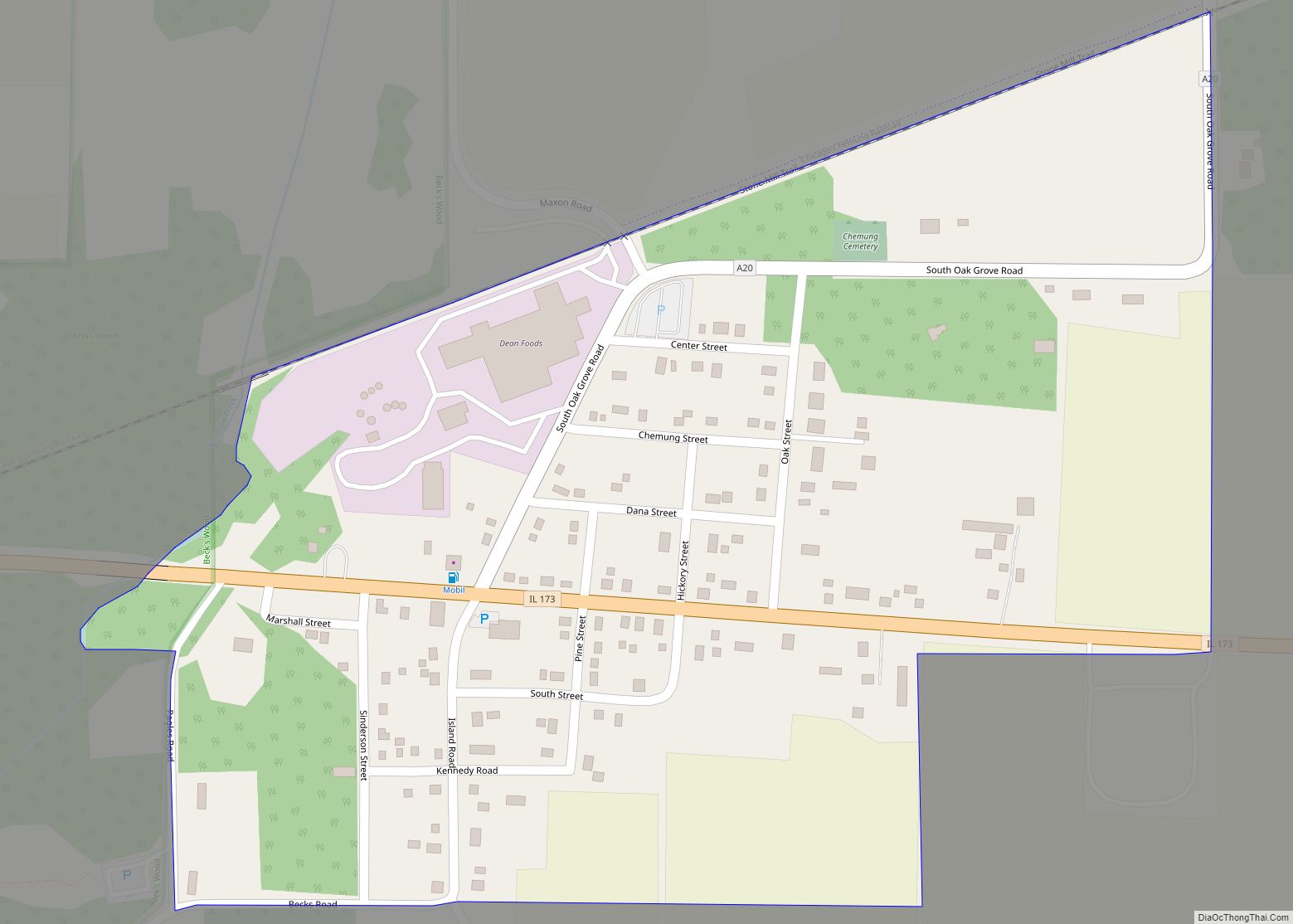
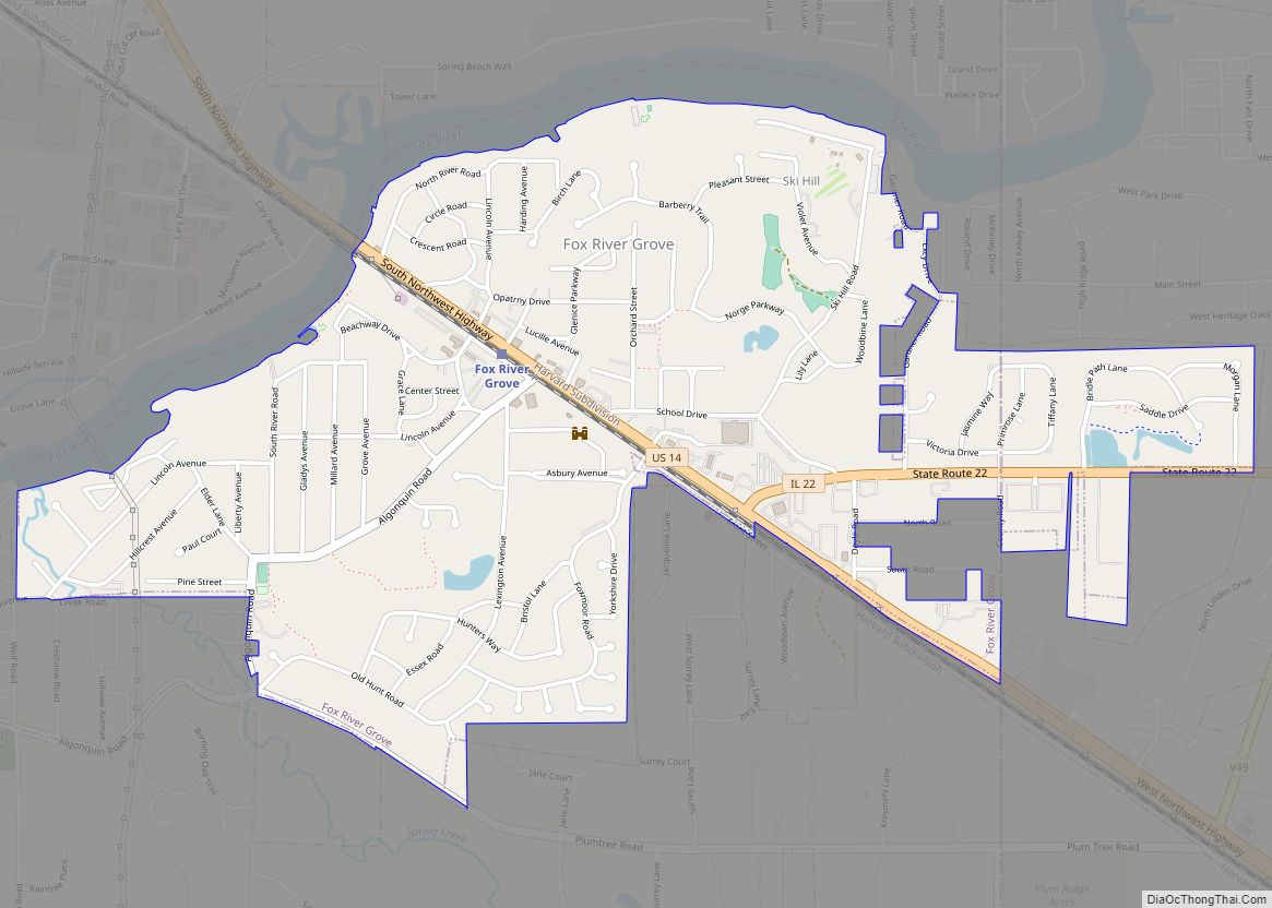
Online Interactive Map
Click on ![]() to view map in "full screen" mode.
to view map in "full screen" mode.
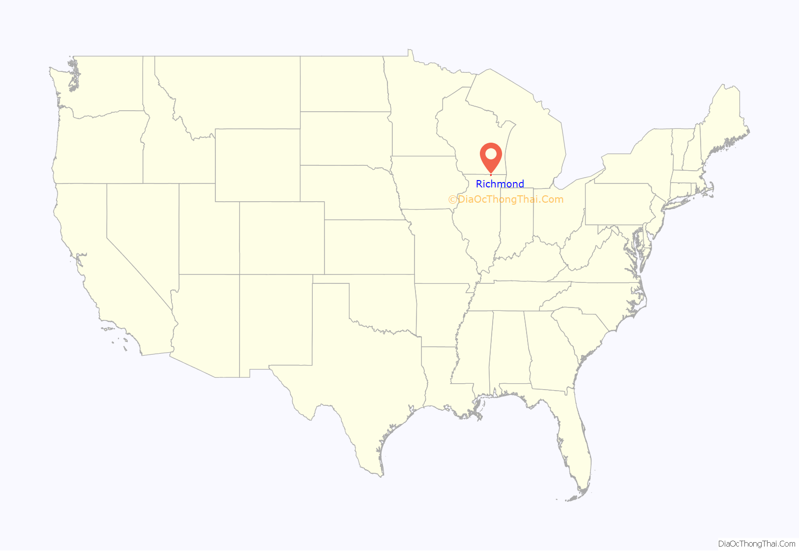
Richmond location map. Where is Richmond village?
History
Carpenter William A. McConnell was Richmond’s first settler, arriving in 1837 and erecting the village’s first building, a log structure. Eight other settlers arrived in 1838 and growth progressed rapidly after that point. The first school was built on McConnell’s farm in 1841 and in 1844 the village was finally platted. The village was named after Richmond, Vermont, the native home of a first settler. McConnell and Dr. R.R. Stone established a cheese factory in Richmond, and a creamery, other cheese factories, a box factory, a wagon works and a pickle factory followed.
Most of Richmond’s original buildings were built from the mid-1840s through the 1860s and consisted of Greek Revival rural farmhouse and Richmond’s commercial district. Houses within the village were built mostly in the Greek Revival style as well with later prominent homes cast in the Italianate or Second Empire styles. The village of Richmond was officially incorporated in 1872.
On Christmas Eve 1902 a devastating fire swept through most of Richmond’s commercial district destroying 20 buildings. The fire was a setback for Richmond’s economic growth as most of the buildings were either uninsured or underinsured. Many business owners did not bother to rebuild at all following the fire. Another building spurt did occur in Richmond between 1903 and 1905.
Richmond was the site for the Chicago Super and Sprint Weekend event, June 11–12, 2017, part of the Reebok Spartan Race.
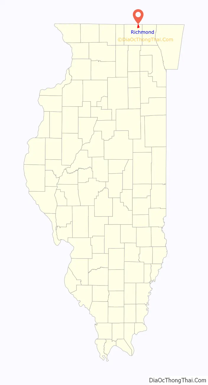
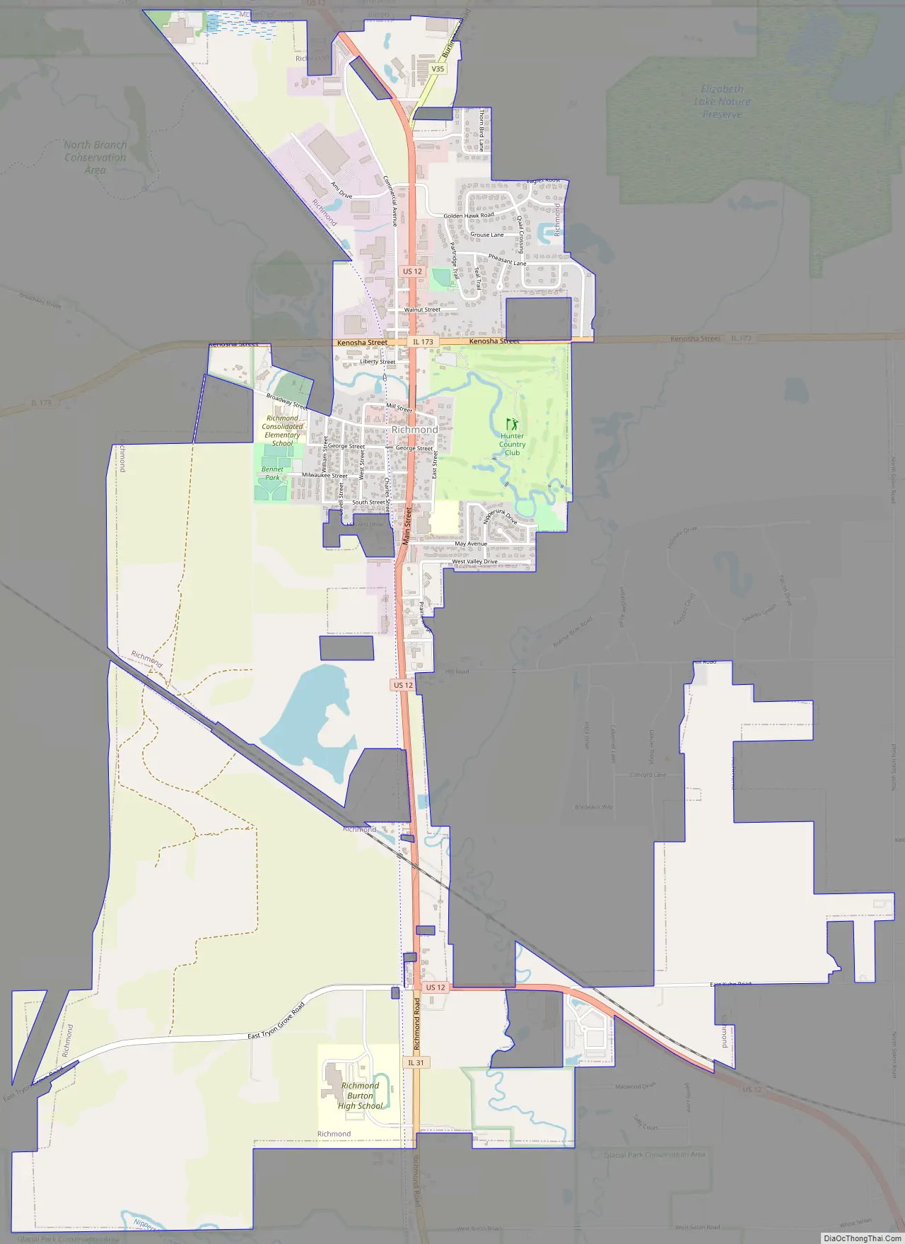
Richmond Road Map
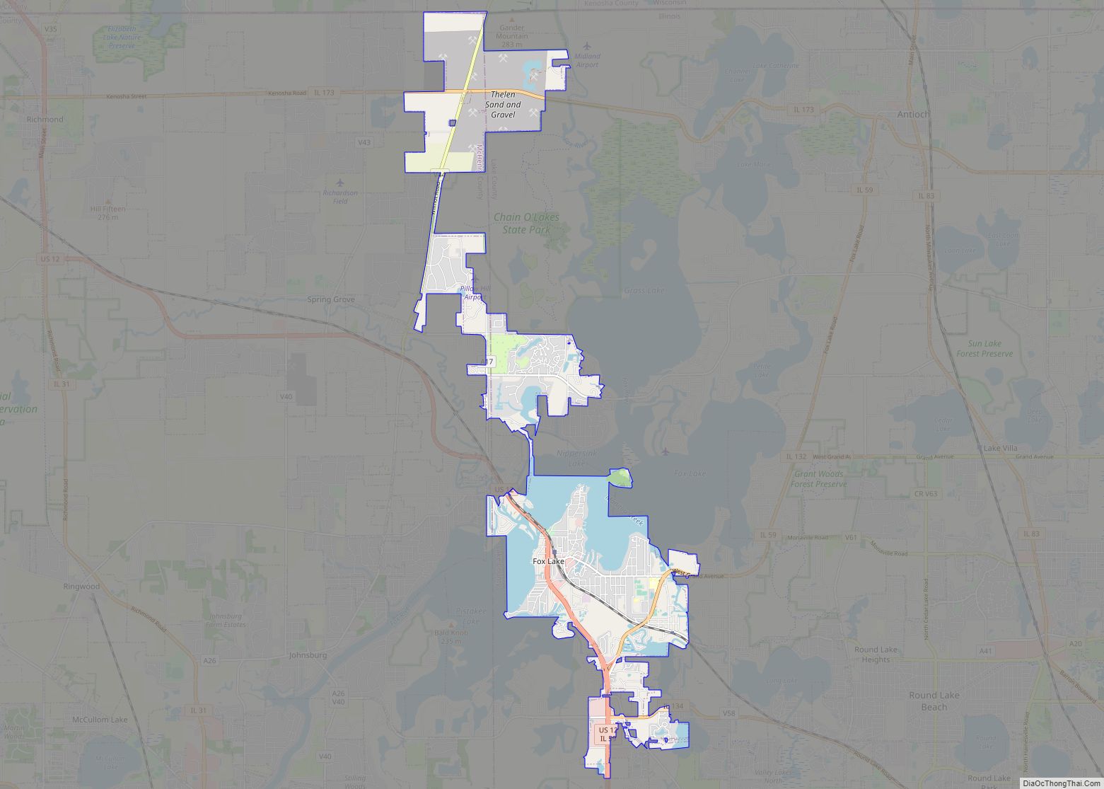
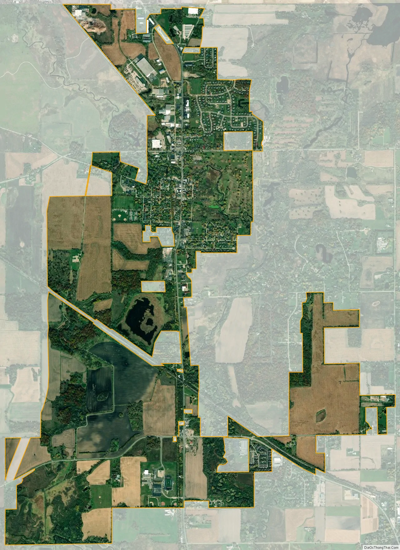
Richmond city Satellite Map
Geography
Richmond is located at 42°28′19″N 88°18′27″W / 42.47194°N 88.30750°W / 42.47194; -88.30750 (42.471868, -88.307431).
According to the 2010 census, Richmond has a total area of 4.22 square miles (10.93 km), all land.
Major streets
- Main Street
- Kenosha Street
- Mill Street
- Broadway Street
- George Street
See also
Map of Illinois State and its subdivision:- Adams
- Alexander
- Bond
- Boone
- Brown
- Bureau
- Calhoun
- Carroll
- Cass
- Champaign
- Christian
- Clark
- Clay
- Clinton
- Coles
- Cook
- Crawford
- Cumberland
- De Kalb
- De Witt
- Douglas
- Dupage
- Edgar
- Edwards
- Effingham
- Fayette
- Ford
- Franklin
- Fulton
- Gallatin
- Greene
- Grundy
- Hamilton
- Hancock
- Hardin
- Henderson
- Henry
- Iroquois
- Jackson
- Jasper
- Jefferson
- Jersey
- Jo Daviess
- Johnson
- Kane
- Kankakee
- Kendall
- Knox
- La Salle
- Lake
- Lake Michigan
- Lawrence
- Lee
- Livingston
- Logan
- Macon
- Macoupin
- Madison
- Marion
- Marshall
- Mason
- Massac
- McDonough
- McHenry
- McLean
- Menard
- Mercer
- Monroe
- Montgomery
- Morgan
- Moultrie
- Ogle
- Peoria
- Perry
- Piatt
- Pike
- Pope
- Pulaski
- Putnam
- Randolph
- Richland
- Rock Island
- Saint Clair
- Saline
- Sangamon
- Schuyler
- Scott
- Shelby
- Stark
- Stephenson
- Tazewell
- Union
- Vermilion
- Wabash
- Warren
- Washington
- Wayne
- White
- Whiteside
- Will
- Williamson
- Winnebago
- Woodford
- Alabama
- Alaska
- Arizona
- Arkansas
- California
- Colorado
- Connecticut
- Delaware
- District of Columbia
- Florida
- Georgia
- Hawaii
- Idaho
- Illinois
- Indiana
- Iowa
- Kansas
- Kentucky
- Louisiana
- Maine
- Maryland
- Massachusetts
- Michigan
- Minnesota
- Mississippi
- Missouri
- Montana
- Nebraska
- Nevada
- New Hampshire
- New Jersey
- New Mexico
- New York
- North Carolina
- North Dakota
- Ohio
- Oklahoma
- Oregon
- Pennsylvania
- Rhode Island
- South Carolina
- South Dakota
- Tennessee
- Texas
- Utah
- Vermont
- Virginia
- Washington
- West Virginia
- Wisconsin
- Wyoming