Roselle is a suburb of Chicago and is a village located in both DuPage County and Cook in Illinois. Roselle was first incorporated in 1922 as a bedroom community, with its train stop attracting residents commuting to Chicago or nearby suburbs for their jobs. As of the 2020 census, the village’s population was 22,897.
| Name: | Roselle village |
|---|---|
| LSAD Code: | 47 |
| LSAD Description: | village (suffix) |
| State: | Illinois |
| County: | Cook County, DuPage County |
| Elevation: | 709–797 ft (216–243 m) |
| Total Area: | 5.61 sq mi (14.52 km²) |
| Land Area: | 5.53 sq mi (14.32 km²) |
| Water Area: | 0.08 sq mi (0.20 km²) |
| Total Population: | 22,897 |
| Population Density: | 4,140.51/sq mi (1,598.80/km²) |
| ZIP code: | 60172 |
| Area code: | 224 and 847 |
| FIPS code: | 1765806 |
| Website: | www.roselle.il.us |
Online Interactive Map
Click on ![]() to view map in "full screen" mode.
to view map in "full screen" mode.
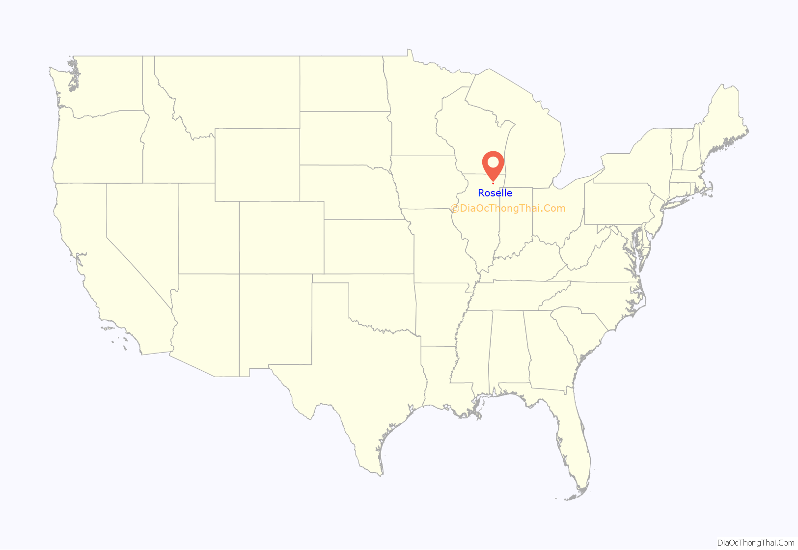
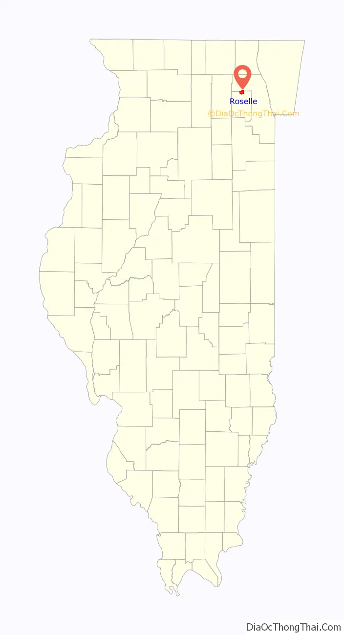
Roselle location map. Where is Roselle village?
History
The area surrounding the current village of Roselle began to be settled in the early 1830s, as settlers moved in next to the native Potawatomi people. Silas L. Meacham and his brothers Harvey and Lyman settled the area now known as Bloomingdale Township. The government had been offering land in the area for around $1.25 / acre. In 1837, Deacon Elijah Hough and his wife settled in the Bloomingdale area, with his sons Oramel, Rosell [sic] and daughter Cornelia.
In 1868, at the age of 48, Rosell Hough returned from a career as an alderman and a businessman in Chicago, and saw that the area had become a farming center for corn and flax. He opened the Illinois Linen Company on the northwest corner off of what is now Roselle Road and Irving Park Road. Hough was also the president of the Chicago and Pacific Railroad Company. It is rumored that because of his position, he spent some money to alter a land survey to show that a railroad line should run through Roselle, Itasca and Wood Dale instead of Addison and Bloomingdale. The train schedule misprinted the name of the town on the rail line, giving Roselle its current name.
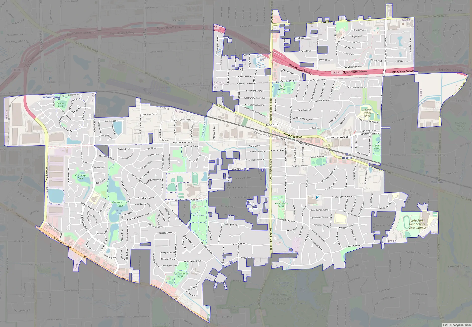
Roselle Road Map
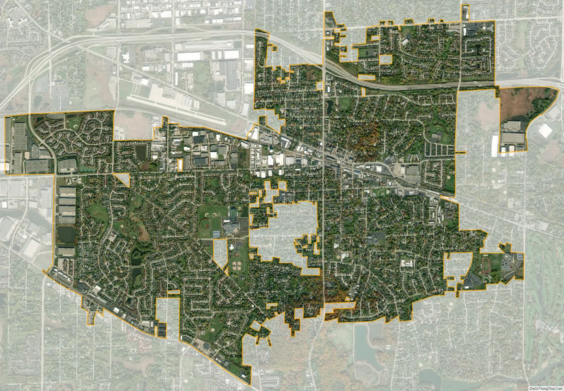
Roselle city Satellite Map
Geography
Roselle is located at 41°58′50″N 88°5′8″W / 41.98056°N 88.08556°W / 41.98056; -88.08556 (41.980569, -88.085438).
According to the 2021 census gazetteer files, Roselle has a total area of 5.61 square miles (14.53 km), of which 5.53 square miles (14.32 km) (or 98.64%) is land and 0.08 square miles (0.21 km) (or 1.36%) is water. Two notable hydrological features are Goose Lake and Spring Creek, a tributary to the East Branch of the DuPage River. Turner Pond is a man-made pond located just north of the town center.
See also
Map of Illinois State and its subdivision:- Adams
- Alexander
- Bond
- Boone
- Brown
- Bureau
- Calhoun
- Carroll
- Cass
- Champaign
- Christian
- Clark
- Clay
- Clinton
- Coles
- Cook
- Crawford
- Cumberland
- De Kalb
- De Witt
- Douglas
- Dupage
- Edgar
- Edwards
- Effingham
- Fayette
- Ford
- Franklin
- Fulton
- Gallatin
- Greene
- Grundy
- Hamilton
- Hancock
- Hardin
- Henderson
- Henry
- Iroquois
- Jackson
- Jasper
- Jefferson
- Jersey
- Jo Daviess
- Johnson
- Kane
- Kankakee
- Kendall
- Knox
- La Salle
- Lake
- Lake Michigan
- Lawrence
- Lee
- Livingston
- Logan
- Macon
- Macoupin
- Madison
- Marion
- Marshall
- Mason
- Massac
- McDonough
- McHenry
- McLean
- Menard
- Mercer
- Monroe
- Montgomery
- Morgan
- Moultrie
- Ogle
- Peoria
- Perry
- Piatt
- Pike
- Pope
- Pulaski
- Putnam
- Randolph
- Richland
- Rock Island
- Saint Clair
- Saline
- Sangamon
- Schuyler
- Scott
- Shelby
- Stark
- Stephenson
- Tazewell
- Union
- Vermilion
- Wabash
- Warren
- Washington
- Wayne
- White
- Whiteside
- Will
- Williamson
- Winnebago
- Woodford
- Alabama
- Alaska
- Arizona
- Arkansas
- California
- Colorado
- Connecticut
- Delaware
- District of Columbia
- Florida
- Georgia
- Hawaii
- Idaho
- Illinois
- Indiana
- Iowa
- Kansas
- Kentucky
- Louisiana
- Maine
- Maryland
- Massachusetts
- Michigan
- Minnesota
- Mississippi
- Missouri
- Montana
- Nebraska
- Nevada
- New Hampshire
- New Jersey
- New Mexico
- New York
- North Carolina
- North Dakota
- Ohio
- Oklahoma
- Oregon
- Pennsylvania
- Rhode Island
- South Carolina
- South Dakota
- Tennessee
- Texas
- Utah
- Vermont
- Virginia
- Washington
- West Virginia
- Wisconsin
- Wyoming


