Scales Mound is a village in Jo Daviess County, Illinois, United States. The population was 436 at the 2020 census.
| Name: | Scales Mound village |
|---|---|
| LSAD Code: | 47 |
| LSAD Description: | village (suffix) |
| State: | Illinois |
| County: | Jo Daviess County |
| Elevation: | 955 ft (291 m) |
| Total Area: | 0.63 sq mi (1.63 km²) |
| Land Area: | 0.63 sq mi (1.63 km²) |
| Water Area: | 0.00 sq mi (0.00 km²) |
| Total Population: | 436 |
| Population Density: | 694.27/sq mi (267.89/km²) |
| Area code: | 815 |
| FIPS code: | 1767925 |
| Website: | http://scalesmound.com |
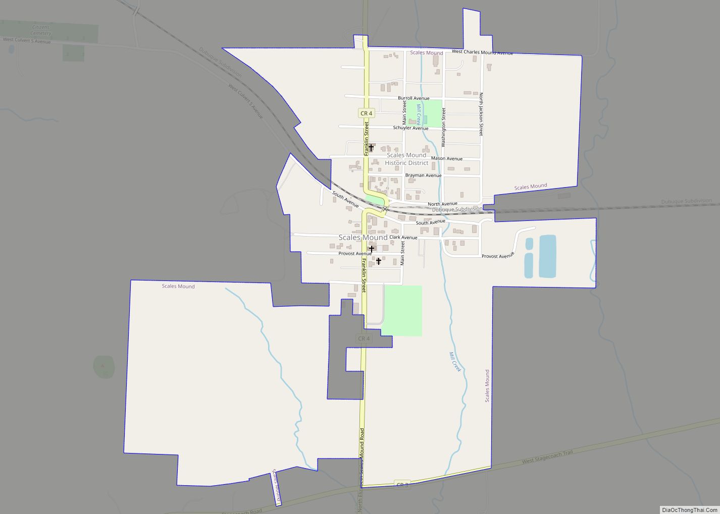
Online Interactive Map
Click on ![]() to view map in "full screen" mode.
to view map in "full screen" mode.
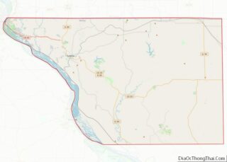
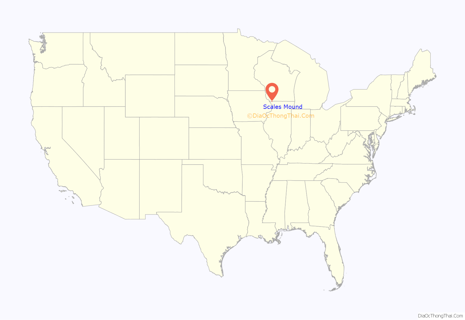
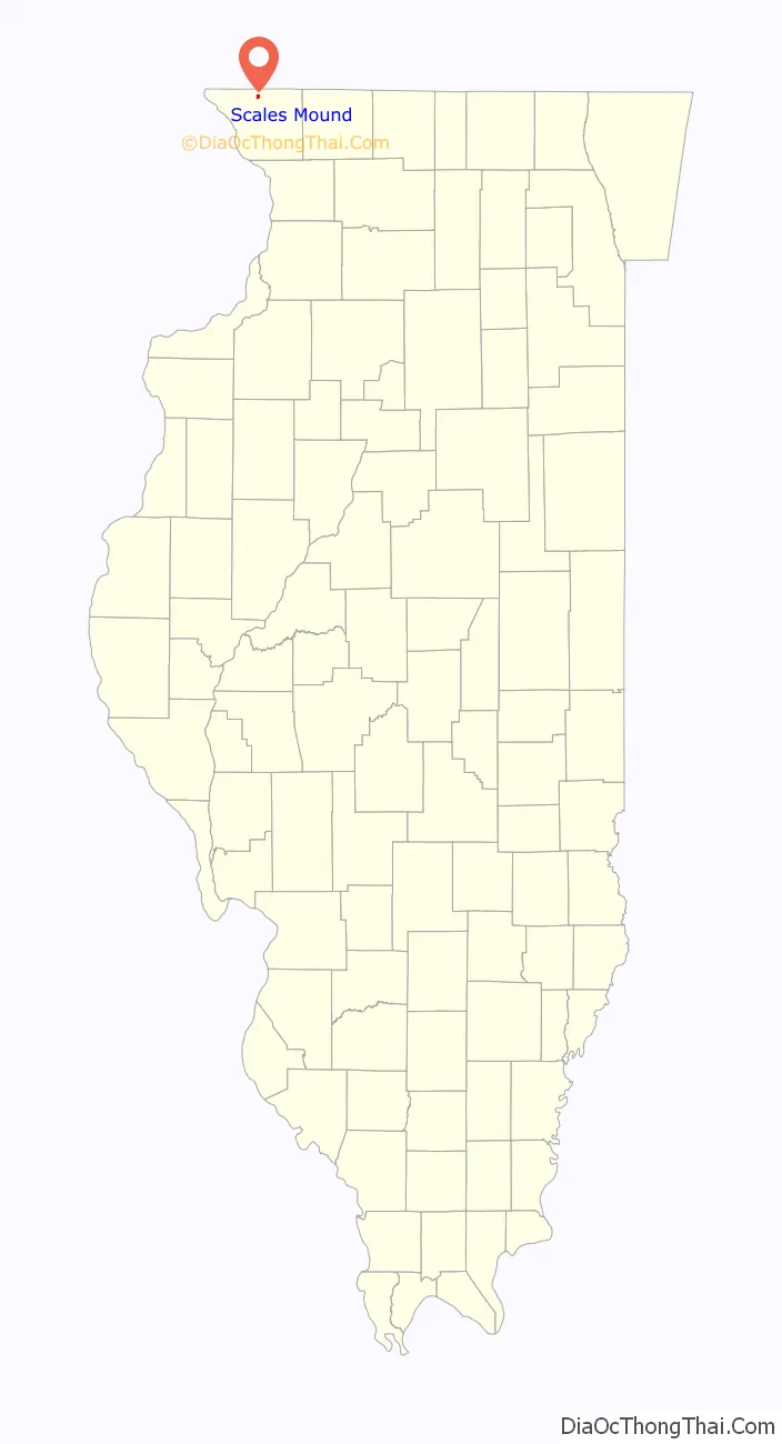
Scales Mound location map. Where is Scales Mound village?
History
The original town of Scales Mound was located at the base of an erosional remnant similar to Charles Mound, about a mile southwest of the present-day village. In 1830 Samuel Scales purchased the original village site from John Sole and built a tavern at the base of the mound along Sucker Trail, a major east-west corridor. The land that the present-day village of Scales Mound is on was purchased from the U.S. government in 1848 by a man named Dunning. Little is known about Dunning or the use of the land until the 1850s.
In 1851 the Illinois Central Railroad (ICRR) was established and it would become a major factor in the settlement of much of rural Illinois, including Scales Mound. In September 1853, anticipating the arrival of the railroad, the village of Scales Mound was platted by Josiah Conlee and B.B. Provost. During the summer of 1854 track crews from ICRR laid out 20 miles (32 km) of track between Scales Mound and Apple River and trains were running the line the day after completion. With the arrival of the railroad, Scales Mound’s first building was constructed in the late fall 1854; a store built by Sherman Eddy.
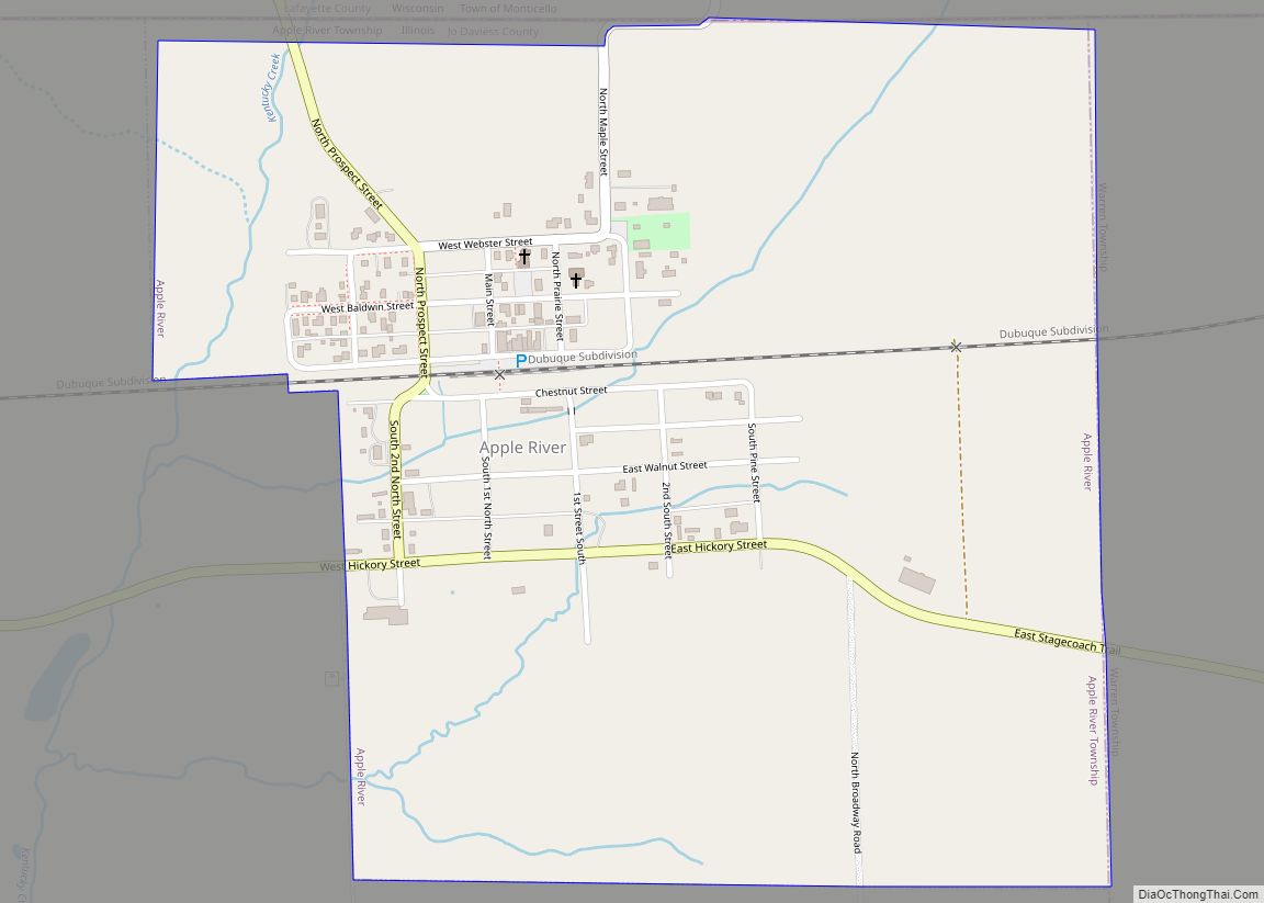
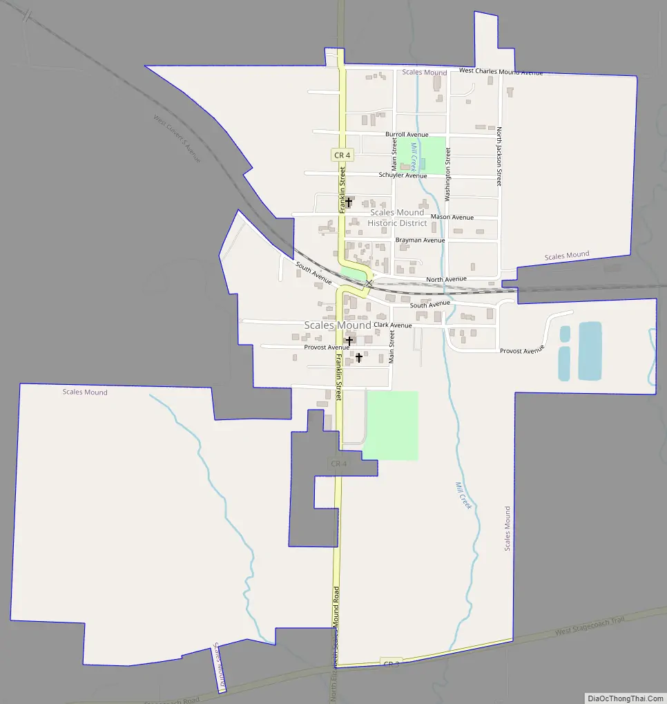
Scales Mound Road Map
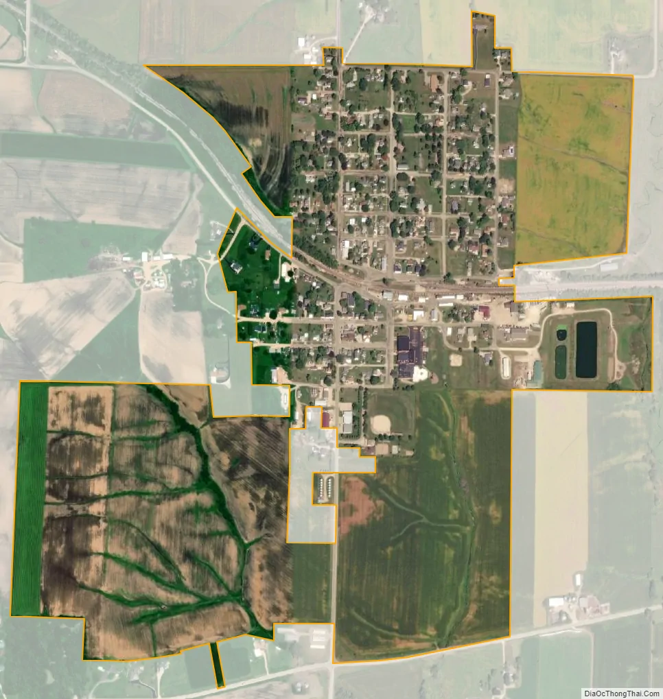
Scales Mound city Satellite Map
Geography
Location
Scales Mound lies at the northwestern tip of Illinois in Jo Daviess County, part of the Driftless Area. Scales Mound is located at 42°28′41″N 90°15′2″W / 42.47806°N 90.25056°W / 42.47806; -90.25056 (42.478098, −90.250544) near the highest point in Illinois, Charles Mound, and on the Stagecoach Trail. It has an annual festival, Stagecoach Trail days. According to the 2010 census, Scales Mound has a total area of 0.23 square miles (0.60 km), all land.
Topography
Scales Mound is located in a region of the U.S. Midwest known as the Driftless Area, so called because it escaped glaciation during the last ice age. It covers parts of Illinois, Wisconsin, Minnesota and Iowa. The Illinois section is mostly limited to Jo Daviess County and small parts of Whiteside and Carroll County in northwest Illinois. The topography of the area is characterized by hilly terrain and wooded ridges. Common features found in the Scales Mound area include canyons, bluffs, ravines and palisades. Near Charles Mound, the highest point in Illinois at 1235 feet, Scales Mound is said to be “At the Top of Illinois”.
Climate
See also
Map of Illinois State and its subdivision:- Adams
- Alexander
- Bond
- Boone
- Brown
- Bureau
- Calhoun
- Carroll
- Cass
- Champaign
- Christian
- Clark
- Clay
- Clinton
- Coles
- Cook
- Crawford
- Cumberland
- De Kalb
- De Witt
- Douglas
- Dupage
- Edgar
- Edwards
- Effingham
- Fayette
- Ford
- Franklin
- Fulton
- Gallatin
- Greene
- Grundy
- Hamilton
- Hancock
- Hardin
- Henderson
- Henry
- Iroquois
- Jackson
- Jasper
- Jefferson
- Jersey
- Jo Daviess
- Johnson
- Kane
- Kankakee
- Kendall
- Knox
- La Salle
- Lake
- Lake Michigan
- Lawrence
- Lee
- Livingston
- Logan
- Macon
- Macoupin
- Madison
- Marion
- Marshall
- Mason
- Massac
- McDonough
- McHenry
- McLean
- Menard
- Mercer
- Monroe
- Montgomery
- Morgan
- Moultrie
- Ogle
- Peoria
- Perry
- Piatt
- Pike
- Pope
- Pulaski
- Putnam
- Randolph
- Richland
- Rock Island
- Saint Clair
- Saline
- Sangamon
- Schuyler
- Scott
- Shelby
- Stark
- Stephenson
- Tazewell
- Union
- Vermilion
- Wabash
- Warren
- Washington
- Wayne
- White
- Whiteside
- Will
- Williamson
- Winnebago
- Woodford
- Alabama
- Alaska
- Arizona
- Arkansas
- California
- Colorado
- Connecticut
- Delaware
- District of Columbia
- Florida
- Georgia
- Hawaii
- Idaho
- Illinois
- Indiana
- Iowa
- Kansas
- Kentucky
- Louisiana
- Maine
- Maryland
- Massachusetts
- Michigan
- Minnesota
- Mississippi
- Missouri
- Montana
- Nebraska
- Nevada
- New Hampshire
- New Jersey
- New Mexico
- New York
- North Carolina
- North Dakota
- Ohio
- Oklahoma
- Oregon
- Pennsylvania
- Rhode Island
- South Carolina
- South Dakota
- Tennessee
- Texas
- Utah
- Vermont
- Virginia
- Washington
- West Virginia
- Wisconsin
- Wyoming