Smithboro is a village in Bond County, Illinois, United States. The population was 154 at the 2020 census.
| Name: | Smithboro village |
|---|---|
| LSAD Code: | 47 |
| LSAD Description: | village (suffix) |
| State: | Illinois |
| County: | Bond County |
| Elevation: | 551 ft (168 m) |
| Total Area: | 0.93 sq mi (2.41 km²) |
| Land Area: | 0.93 sq mi (2.41 km²) |
| Water Area: | 0.00 sq mi (0.00 km²) 0% |
| Total Population: | 154 |
| Population Density: | 165.24/sq mi (63.82/km²) |
| Area code: | 618 |
| FIPS code: | 1770213 |
| GNISfeature ID: | 2399829 |
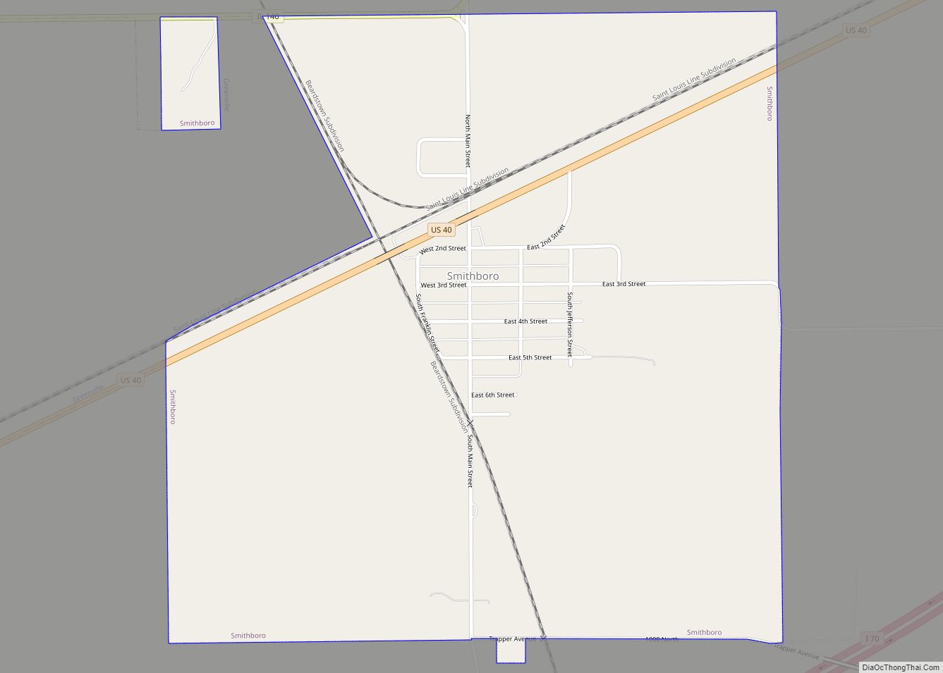
Online Interactive Map
Click on ![]() to view map in "full screen" mode.
to view map in "full screen" mode.
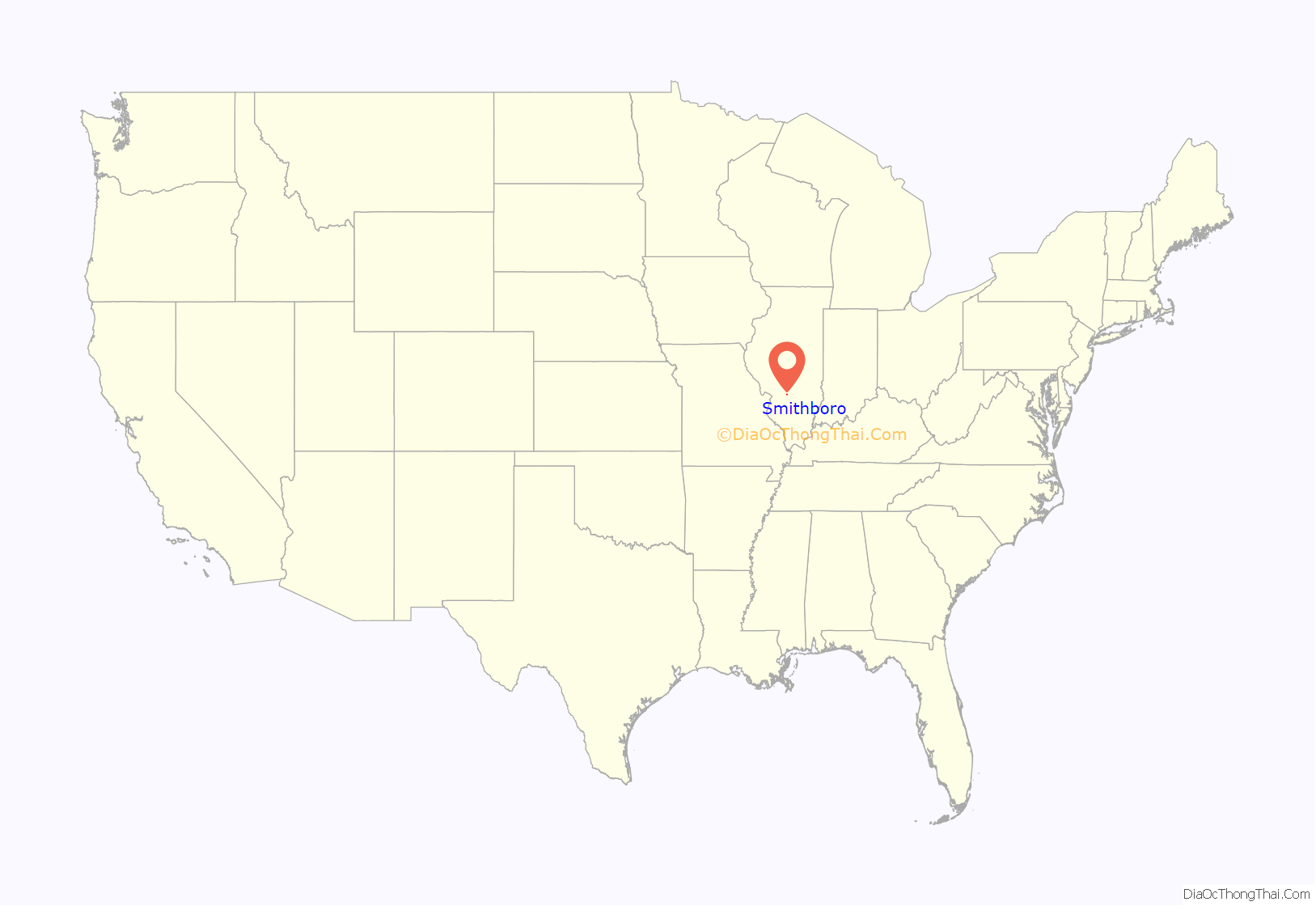
Smithboro location map. Where is Smithboro village?
History
Smithboro was once called “Henderson Station” and was renamed after Henry H. Smith, the town’s postmaster. The town name was spelled “Smithborough” until 1893. The town was incorporated as a village in 1889.
Smithboro and its immediate area was evacuated on December 27, 1981 for a day after a train derailment, affecting 200 people. 22 of 84 trail cars derailed; dichlorodifluromethane and phosphoryl chloride were leaked. Residents were able to return the next day, after cleanup and rail traffic was redirected to a temporary track.
Smithboro Road Map
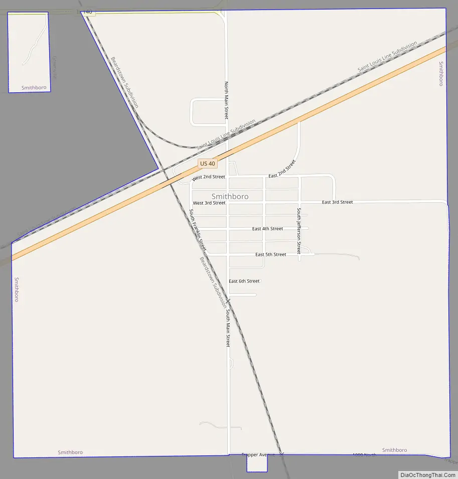
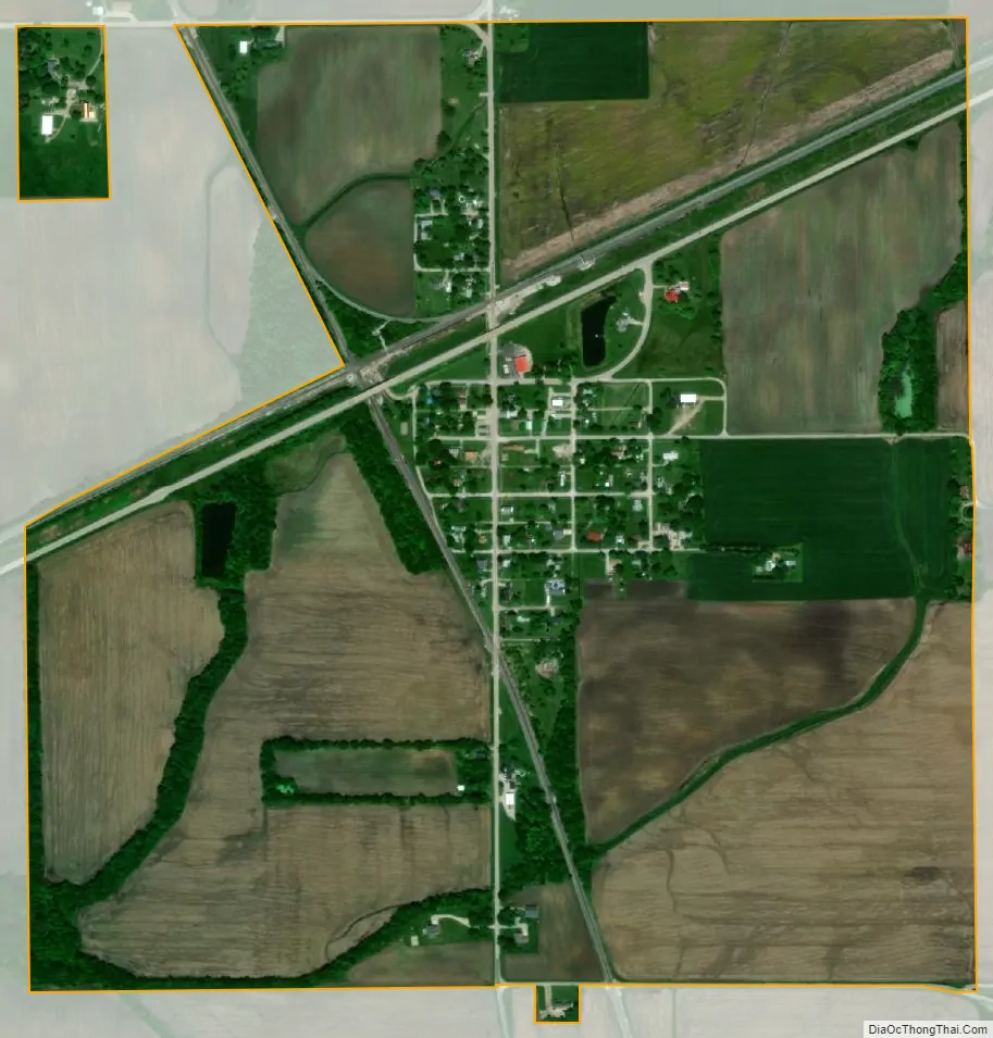
Smithboro city Satellite Map
Geography
Smithboro is located at 38°53′47″N 89°20′29″W / 38.89639°N 89.34139°W / 38.89639; -89.34139 (38.896290, -89.341451).
According to the 2021 census gazetteer files, Smithboro has a total area of 0.93 square miles (2.41 km), all land.
See also
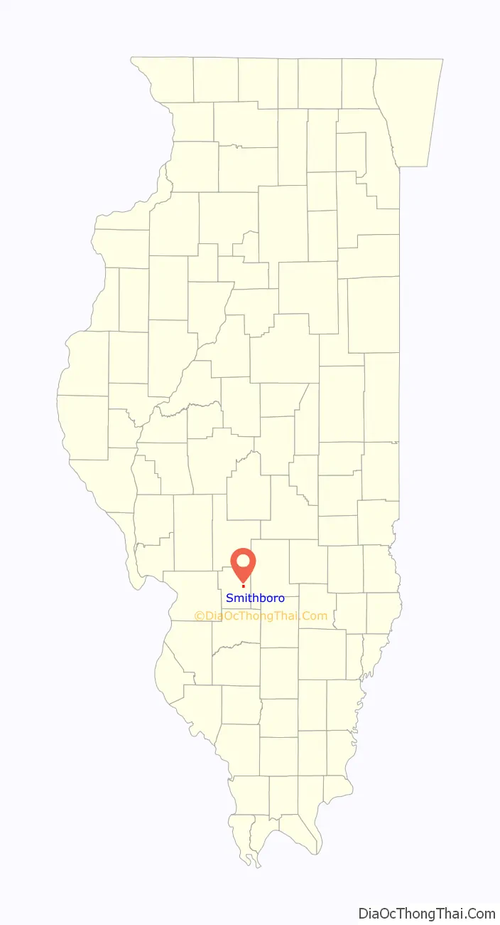
Map of Illinois State and its subdivision:- Adams
- Alexander
- Bond
- Boone
- Brown
- Bureau
- Calhoun
- Carroll
- Cass
- Champaign
- Christian
- Clark
- Clay
- Clinton
- Coles
- Cook
- Crawford
- Cumberland
- De Kalb
- De Witt
- Douglas
- Dupage
- Edgar
- Edwards
- Effingham
- Fayette
- Ford
- Franklin
- Fulton
- Gallatin
- Greene
- Grundy
- Hamilton
- Hancock
- Hardin
- Henderson
- Henry
- Iroquois
- Jackson
- Jasper
- Jefferson
- Jersey
- Jo Daviess
- Johnson
- Kane
- Kankakee
- Kendall
- Knox
- La Salle
- Lake
- Lake Michigan
- Lawrence
- Lee
- Livingston
- Logan
- Macon
- Macoupin
- Madison
- Marion
- Marshall
- Mason
- Massac
- McDonough
- McHenry
- McLean
- Menard
- Mercer
- Monroe
- Montgomery
- Morgan
- Moultrie
- Ogle
- Peoria
- Perry
- Piatt
- Pike
- Pope
- Pulaski
- Putnam
- Randolph
- Richland
- Rock Island
- Saint Clair
- Saline
- Sangamon
- Schuyler
- Scott
- Shelby
- Stark
- Stephenson
- Tazewell
- Union
- Vermilion
- Wabash
- Warren
- Washington
- Wayne
- White
- Whiteside
- Will
- Williamson
- Winnebago
- Woodford
- Alabama
- Alaska
- Arizona
- Arkansas
- California
- Colorado
- Connecticut
- Delaware
- District of Columbia
- Florida
- Georgia
- Hawaii
- Idaho
- Illinois
- Indiana
- Iowa
- Kansas
- Kentucky
- Louisiana
- Maine
- Maryland
- Massachusetts
- Michigan
- Minnesota
- Mississippi
- Missouri
- Montana
- Nebraska
- Nevada
- New Hampshire
- New Jersey
- New Mexico
- New York
- North Carolina
- North Dakota
- Ohio
- Oklahoma
- Oregon
- Pennsylvania
- Rhode Island
- South Carolina
- South Dakota
- Tennessee
- Texas
- Utah
- Vermont
- Virginia
- Washington
- West Virginia
- Wisconsin
- Wyoming