Spring Grove is a village in McHenry County. Portions of unincorporated Lake County, Illinois also utilize Spring Grove postal addresses. It is a commuter village within the Chicago metropolitan area. Per the 2020 census, the population was 5,487. It is also home to Chain O’Lakes State Park.
The current village president is Mark Eisenberg.
The first tower grain silo was built in Spring Grove in 1873.
| Name: | Spring Grove village |
|---|---|
| LSAD Code: | 47 |
| LSAD Description: | village (suffix) |
| State: | Illinois |
| County: | McHenry County |
| Incorporated: | October 6, 1902 |
| Total Area: | 9.08 sq mi (23.52 km²) |
| Land Area: | 9.05 sq mi (23.44 km²) |
| Water Area: | 0.03 sq mi (0.08 km²) |
| Total Population: | 5,487 |
| Population Density: | 606.23/sq mi (234.07/km²) |
| Area code: | 815 |
| FIPS code: | 1772052 |
| Website: | http://www.springgrovevillage.com/ |
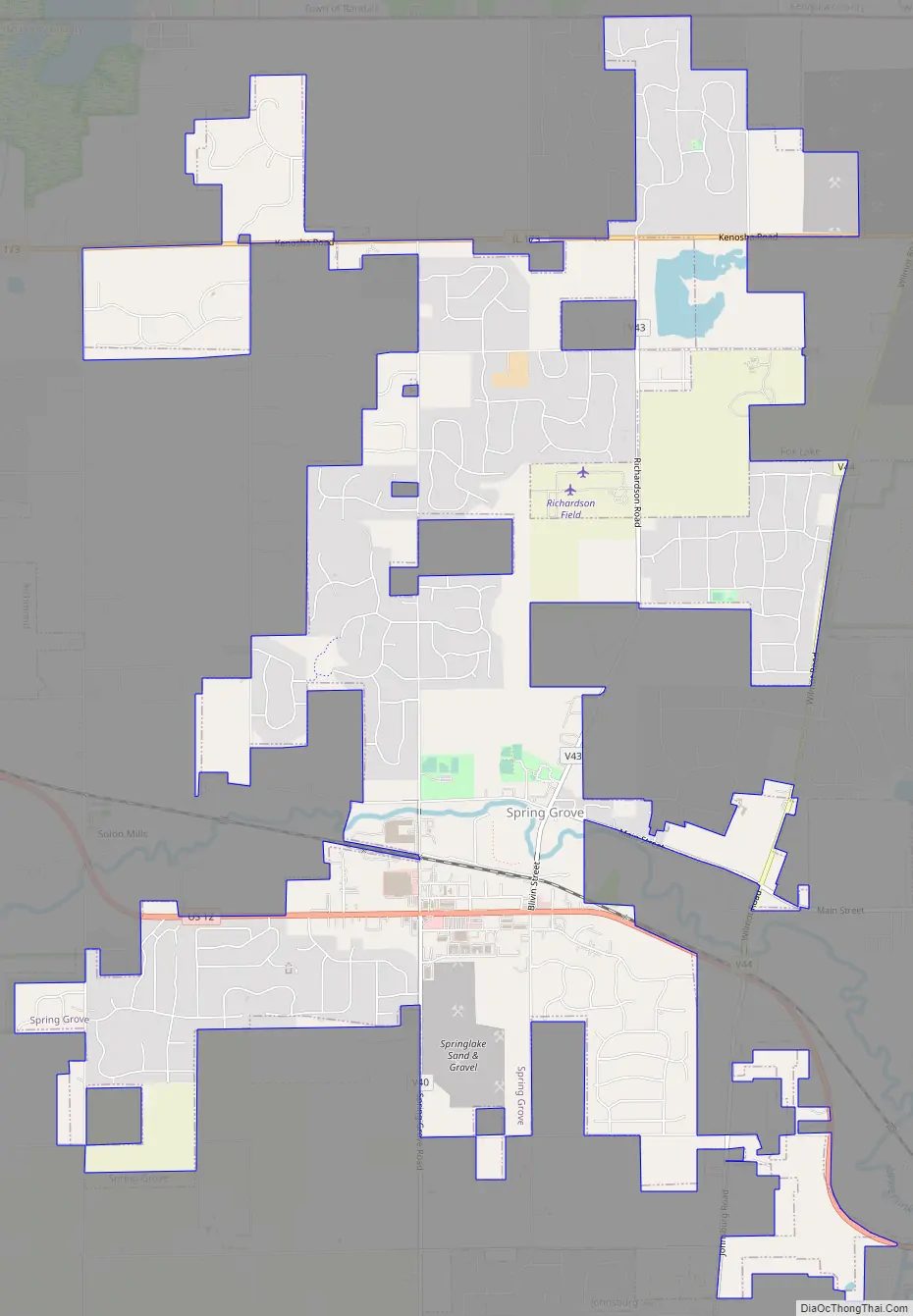
Online Interactive Map
Click on ![]() to view map in "full screen" mode.
to view map in "full screen" mode.
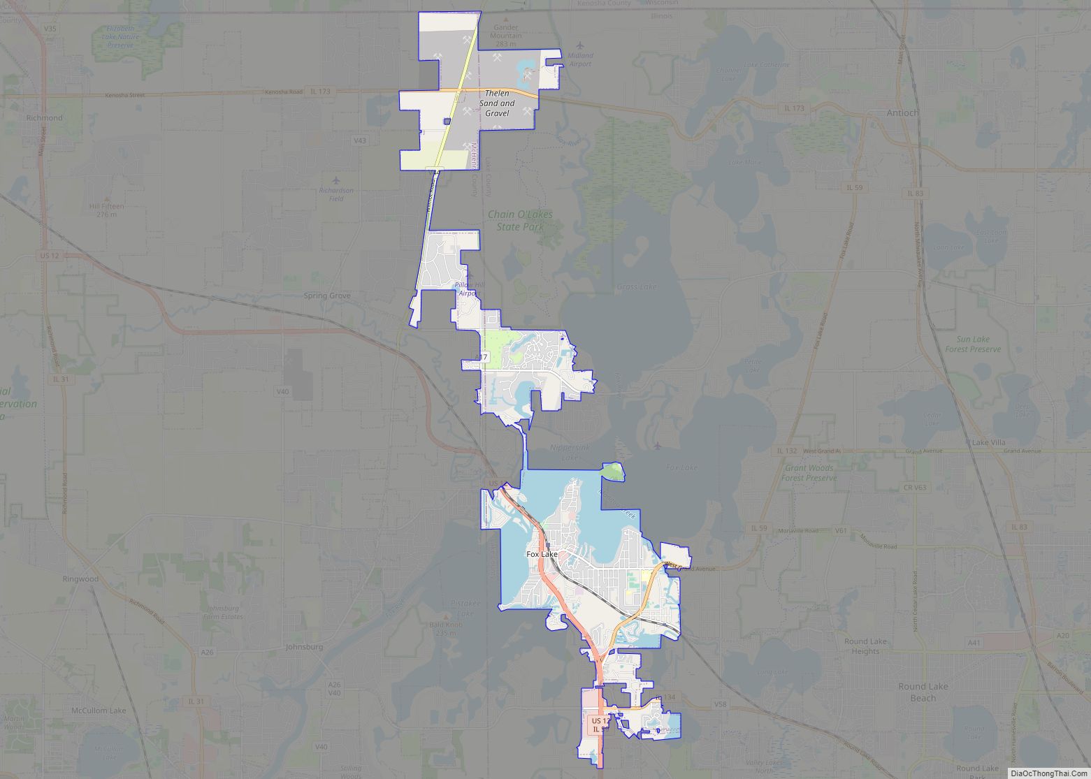
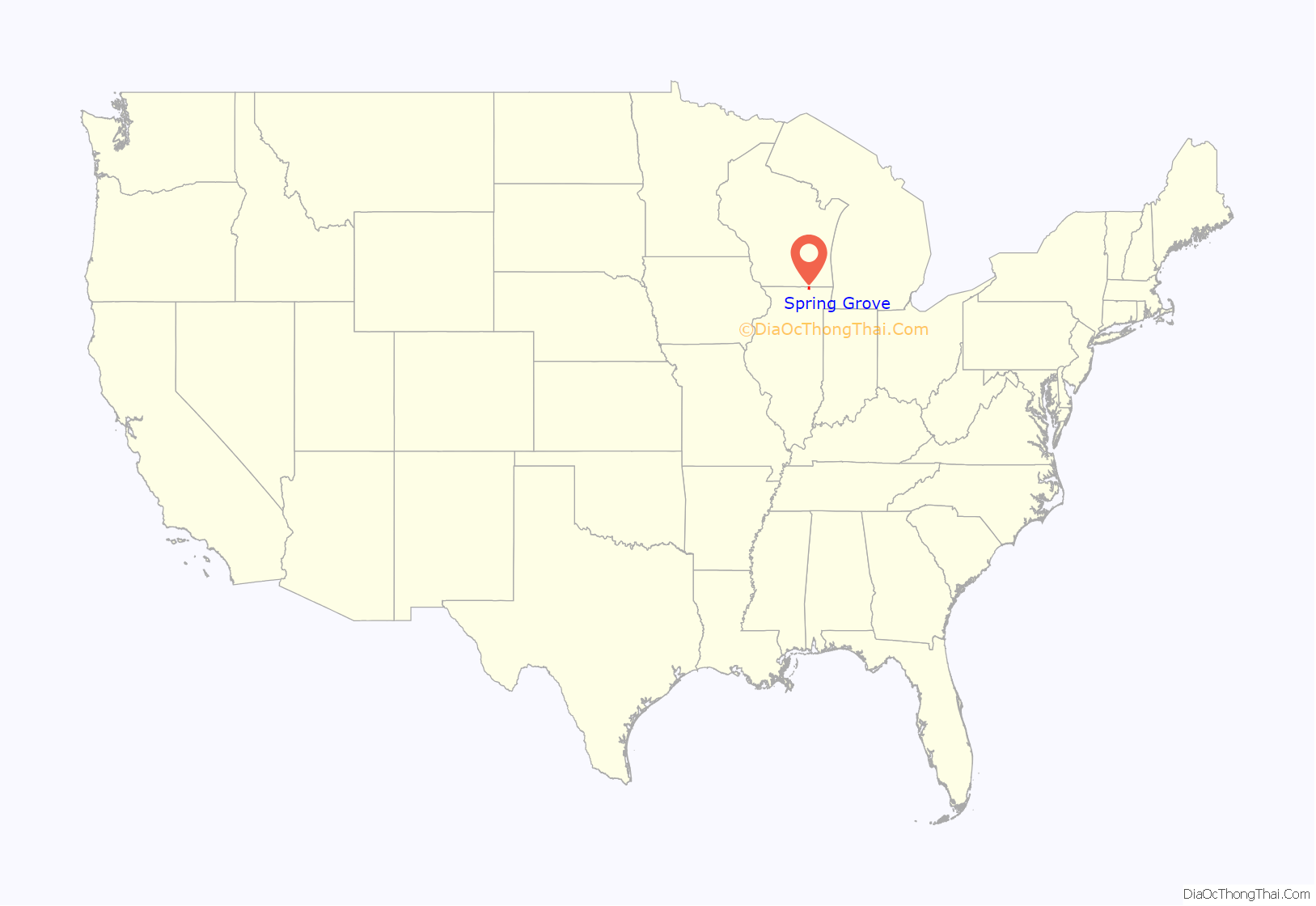
Spring Grove location map. Where is Spring Grove village?
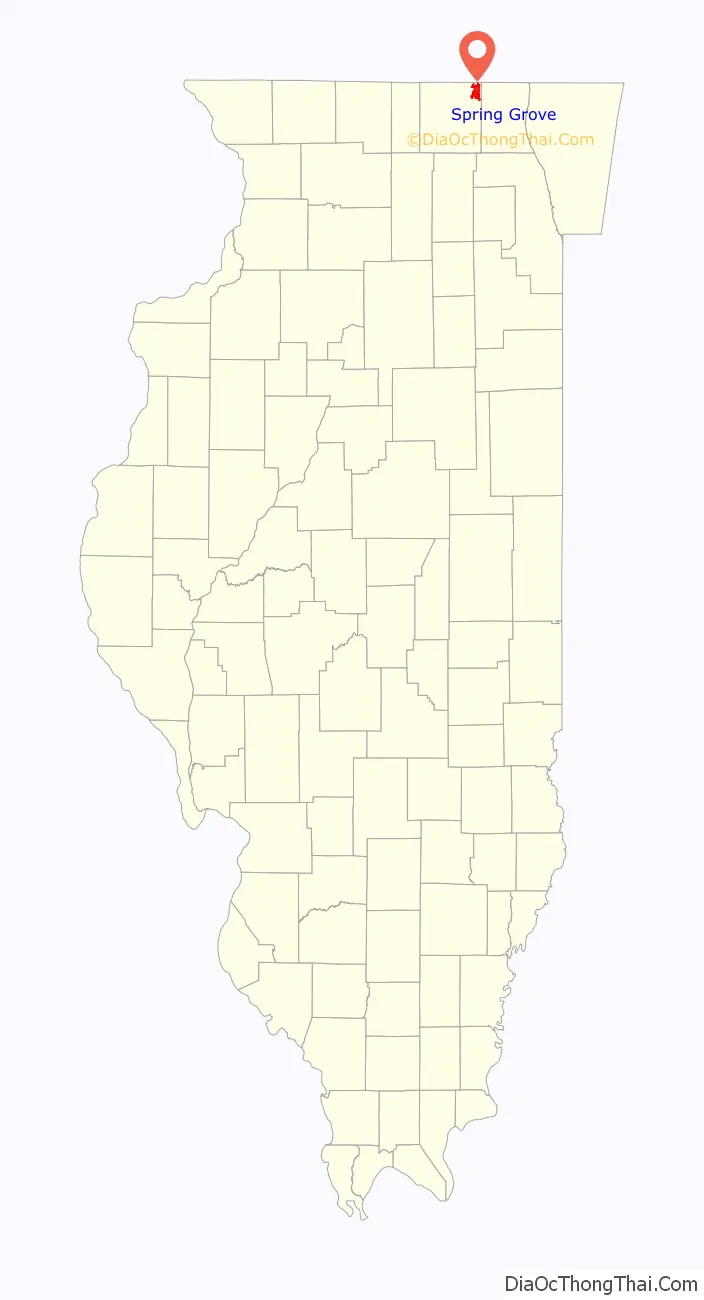
Spring Grove Road Map
Spring Grove city Satellite Map

Geography
Spring Grove is located at 42°27′04″N 88°14′33″W / 42.451031°N 88.242589°W / 42.451031; -88.242589 (42.451031, -88.242589).
According to the 2010 census, Spring Grove has a total area of 8.711 square miles (22.56 km), of which 8.68 square miles (22.48 km) (or 99.64%) is land and 0.031 square miles (0.08 km) (or 0.36%) is water.
Major streets
- S. Hidden Trail
- Kenosha Street
- Rand Road
- Main Street Road
- Winn Road
- Wilmot Road
- Blivin Street/Richardson Road
- English Prairie Road
- Solon Road
- Lakeview Road
- Richardson Road
See also
Map of Illinois State and its subdivision:- Adams
- Alexander
- Bond
- Boone
- Brown
- Bureau
- Calhoun
- Carroll
- Cass
- Champaign
- Christian
- Clark
- Clay
- Clinton
- Coles
- Cook
- Crawford
- Cumberland
- De Kalb
- De Witt
- Douglas
- Dupage
- Edgar
- Edwards
- Effingham
- Fayette
- Ford
- Franklin
- Fulton
- Gallatin
- Greene
- Grundy
- Hamilton
- Hancock
- Hardin
- Henderson
- Henry
- Iroquois
- Jackson
- Jasper
- Jefferson
- Jersey
- Jo Daviess
- Johnson
- Kane
- Kankakee
- Kendall
- Knox
- La Salle
- Lake
- Lake Michigan
- Lawrence
- Lee
- Livingston
- Logan
- Macon
- Macoupin
- Madison
- Marion
- Marshall
- Mason
- Massac
- McDonough
- McHenry
- McLean
- Menard
- Mercer
- Monroe
- Montgomery
- Morgan
- Moultrie
- Ogle
- Peoria
- Perry
- Piatt
- Pike
- Pope
- Pulaski
- Putnam
- Randolph
- Richland
- Rock Island
- Saint Clair
- Saline
- Sangamon
- Schuyler
- Scott
- Shelby
- Stark
- Stephenson
- Tazewell
- Union
- Vermilion
- Wabash
- Warren
- Washington
- Wayne
- White
- Whiteside
- Will
- Williamson
- Winnebago
- Woodford
- Alabama
- Alaska
- Arizona
- Arkansas
- California
- Colorado
- Connecticut
- Delaware
- District of Columbia
- Florida
- Georgia
- Hawaii
- Idaho
- Illinois
- Indiana
- Iowa
- Kansas
- Kentucky
- Louisiana
- Maine
- Maryland
- Massachusetts
- Michigan
- Minnesota
- Mississippi
- Missouri
- Montana
- Nebraska
- Nevada
- New Hampshire
- New Jersey
- New Mexico
- New York
- North Carolina
- North Dakota
- Ohio
- Oklahoma
- Oregon
- Pennsylvania
- Rhode Island
- South Carolina
- South Dakota
- Tennessee
- Texas
- Utah
- Vermont
- Virginia
- Washington
- West Virginia
- Wisconsin
- Wyoming