Sumner is a city in Lawrence County, Illinois, United States. The population was 3,174 at the 2010 census, with approximately 2,000 of that population being inmates at the Lawrence Correctional Center.
| Name: | Sumner city |
|---|---|
| LSAD Code: | 25 |
| LSAD Description: | city (suffix) |
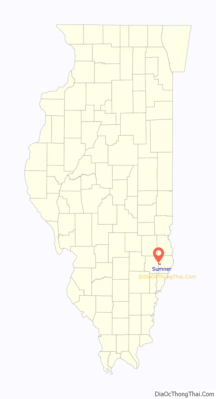
| State: | Illinois |
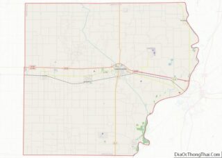
| County: | Lawrence County |
| Founded: | 1855 |
| Elevation: | 453 ft (138 m) |
| Total Area: | 1.40 sq mi (3.62 km²) |
| Land Area: | 1.40 sq mi (3.62 km²) |
| Water Area: | 0.00 sq mi (0.00 km²) |
| Total Population: | 2,631 |
| Population Density: | 1,881.97/sq mi (726.62/km²) |
| Area code: | 618 |
| FIPS code: | 1773703 |
| GNISfeature ID: | 2396003 |
| Website: | http://sumnerillinois.com/ |
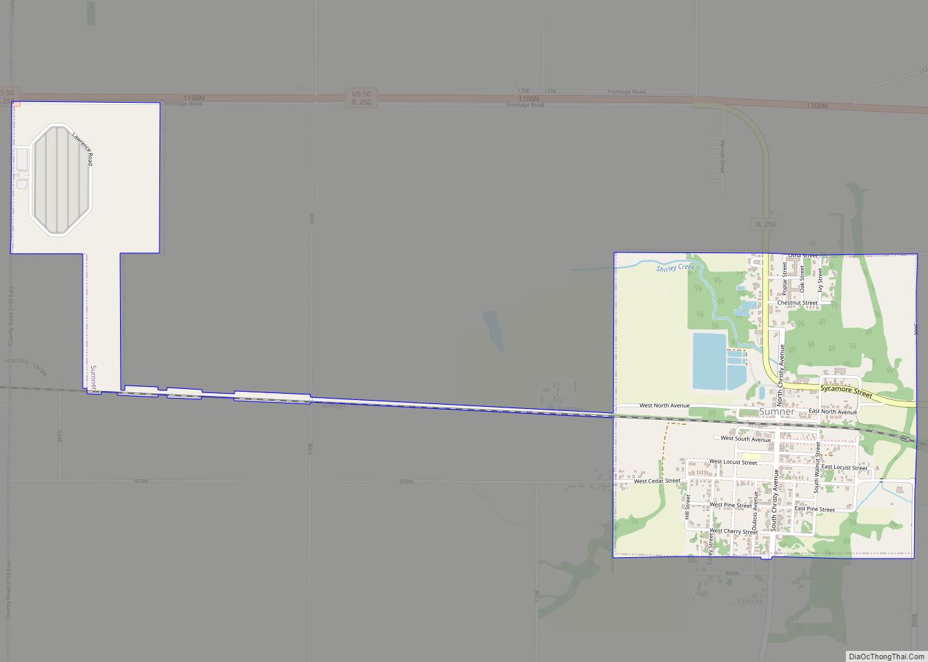
Online Interactive Map
Click on ![]() to view map in "full screen" mode.
to view map in "full screen" mode.
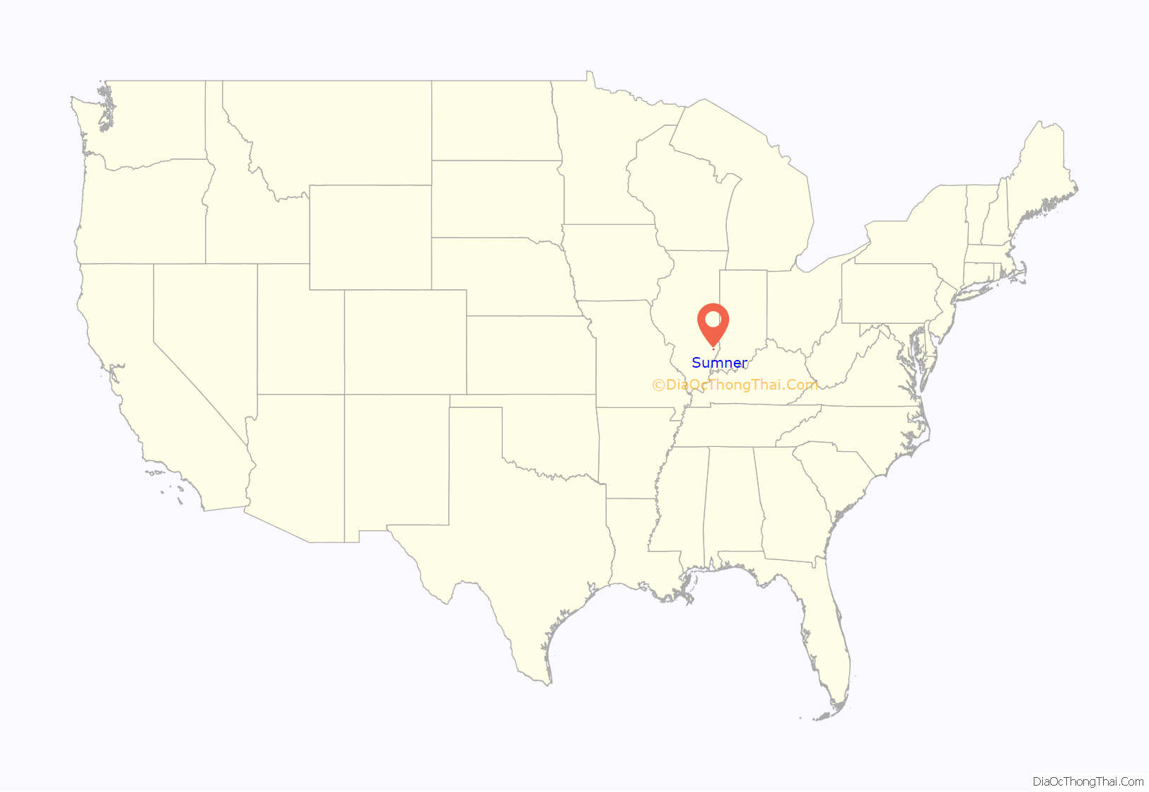
Sumner location map. Where is Sumner city?
History
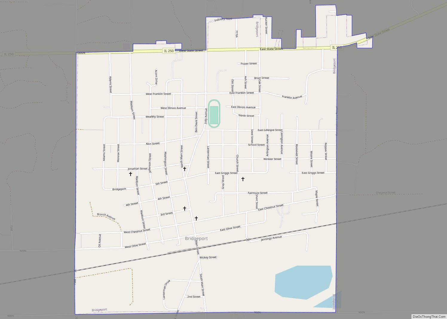
Sumner was established as a stop along the Ohio and Mississippi Railway in the early 1850s. Initially known as “Black Jack” when a post office was opened in 1852, the city was renamed for Benjamin Sumner, an early settler, in 1855. Sumner incorporated in 1887.
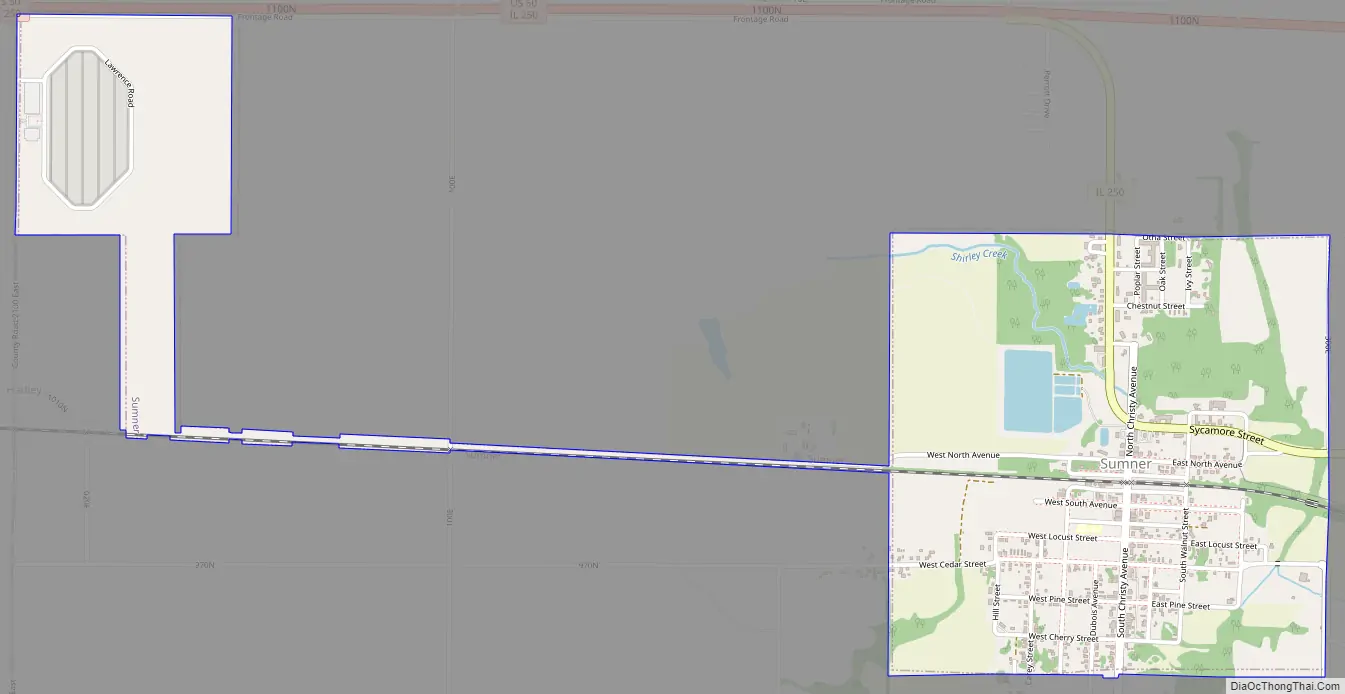
Sumner Road Map
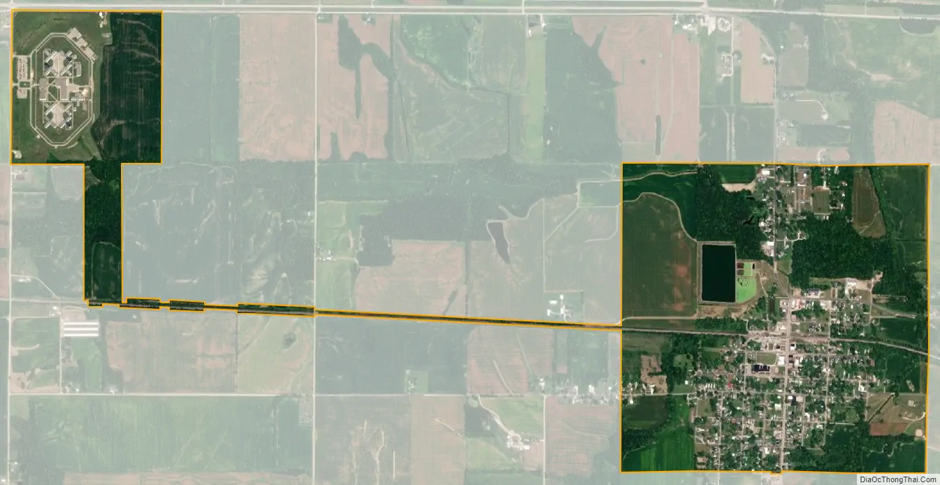
Sumner city Satellite Map
Geography
Sumner lies along Illinois State Route 250, just south of its junction with U.S. Route 50 to the north. Red Hills State Park is located just to the northeast.
According to the 2010 census, Sumner has a total area of 1.37 square miles (3.55 km), all land.
See also
Map of Illinois State and its subdivision:- Adams
- Alexander
- Bond
- Boone
- Brown
- Bureau
- Calhoun
- Carroll
- Cass
- Champaign
- Christian
- Clark
- Clay
- Clinton
- Coles
- Cook
- Crawford
- Cumberland
- De Kalb
- De Witt
- Douglas
- Dupage
- Edgar
- Edwards
- Effingham
- Fayette
- Ford
- Franklin
- Fulton
- Gallatin
- Greene
- Grundy
- Hamilton
- Hancock
- Hardin
- Henderson
- Henry
- Iroquois
- Jackson
- Jasper
- Jefferson
- Jersey
- Jo Daviess
- Johnson
- Kane
- Kankakee
- Kendall
- Knox
- La Salle
- Lake
- Lake Michigan
- Lawrence
- Lee
- Livingston
- Logan
- Macon
- Macoupin
- Madison
- Marion
- Marshall
- Mason
- Massac
- McDonough
- McHenry
- McLean
- Menard
- Mercer
- Monroe
- Montgomery
- Morgan
- Moultrie
- Ogle
- Peoria
- Perry
- Piatt
- Pike
- Pope
- Pulaski
- Putnam
- Randolph
- Richland
- Rock Island
- Saint Clair
- Saline
- Sangamon
- Schuyler
- Scott
- Shelby
- Stark
- Stephenson
- Tazewell
- Union
- Vermilion
- Wabash
- Warren
- Washington
- Wayne
- White
- Whiteside
- Will
- Williamson
- Winnebago
- Woodford
- Alabama
- Alaska
- Arizona
- Arkansas
- California
- Colorado
- Connecticut
- Delaware
- District of Columbia
- Florida
- Georgia
- Hawaii
- Idaho
- Illinois
- Indiana
- Iowa
- Kansas
- Kentucky
- Louisiana
- Maine
- Maryland
- Massachusetts
- Michigan
- Minnesota
- Mississippi
- Missouri
- Montana
- Nebraska
- Nevada
- New Hampshire
- New Jersey
- New Mexico
- New York
- North Carolina
- North Dakota
- Ohio
- Oklahoma
- Oregon
- Pennsylvania
- Rhode Island
- South Carolina
- South Dakota
- Tennessee
- Texas
- Utah
- Vermont
- Virginia
- Washington
- West Virginia
- Wisconsin
- Wyoming