Twin Grove is an unincorporated community and census-designated place (CDP) in McLean County, Illinois, United States. As of the 2020 census, Twin Grove had a population of 1,524.
| Name: | Twin Grove CDP |
|---|---|
| LSAD Code: | 57 |
| LSAD Description: | CDP (suffix) |
| State: | Illinois |
| County: | McLean County |
| Elevation: | 817 ft (249 m) |
| Total Area: | 3.97 sq mi (10.29 km²) |
| Land Area: | 3.96 sq mi (10.27 km²) |
| Water Area: | 0.01 sq mi (0.02 km²) |
| Total Population: | 1,524 |
| Population Density: | 384.46/sq mi (148.46/km²) |
| ZIP code: | 61705 (Bloomington) |
| Area code: | 309 |
| FIPS code: | 1776511 |
| GNISfeature ID: | 423261 |
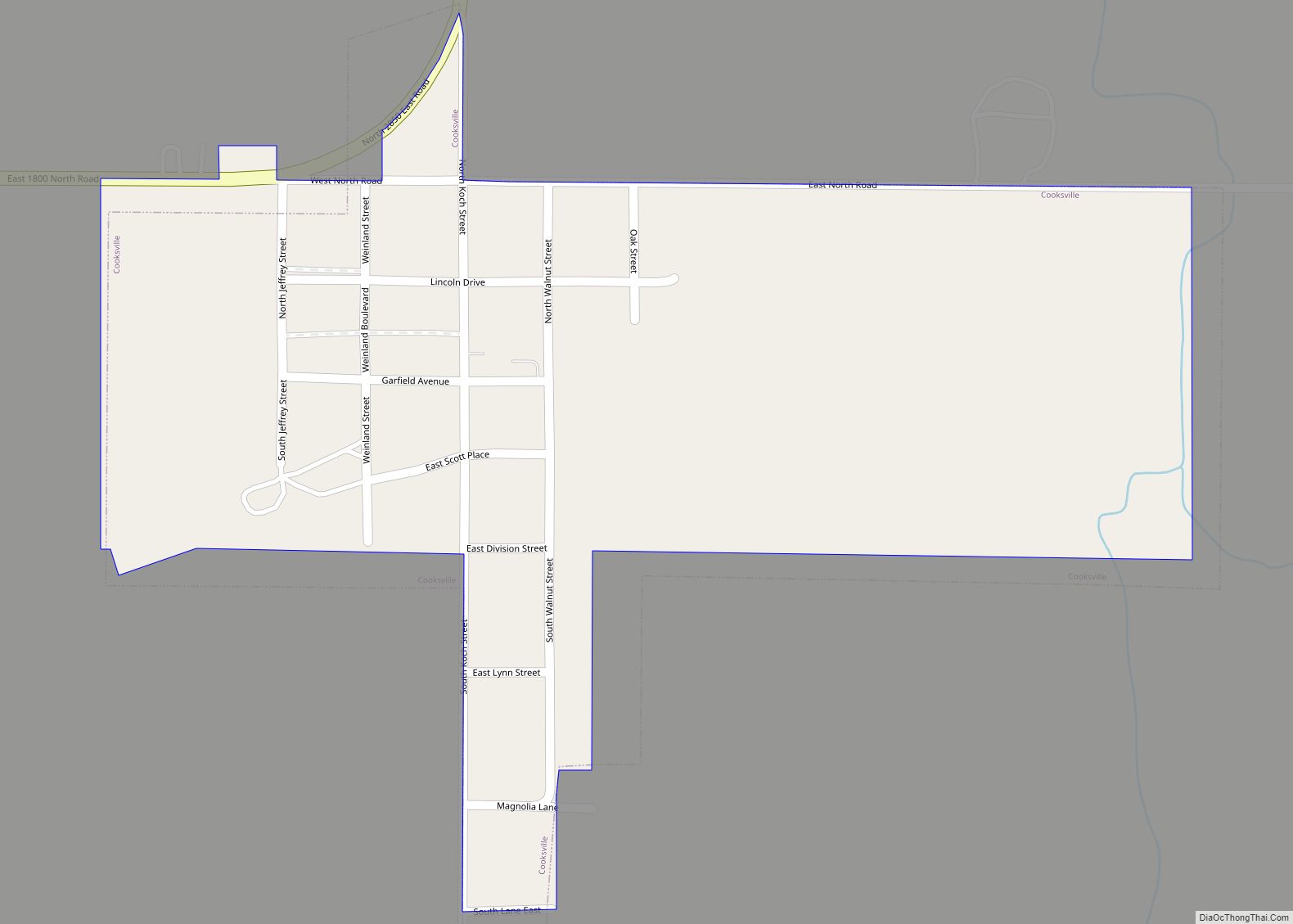
Online Interactive Map
Click on ![]() to view map in "full screen" mode.
to view map in "full screen" mode.
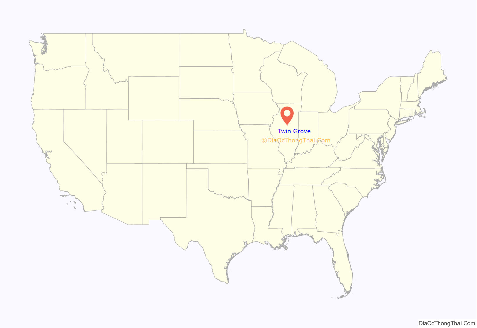
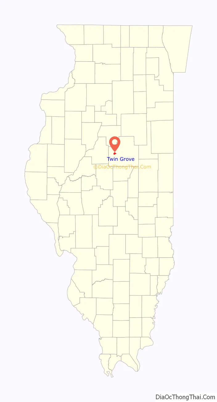
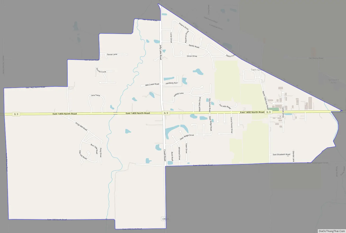
Twin Grove location map. Where is Twin Grove CDP?
Twin Grove Road Map
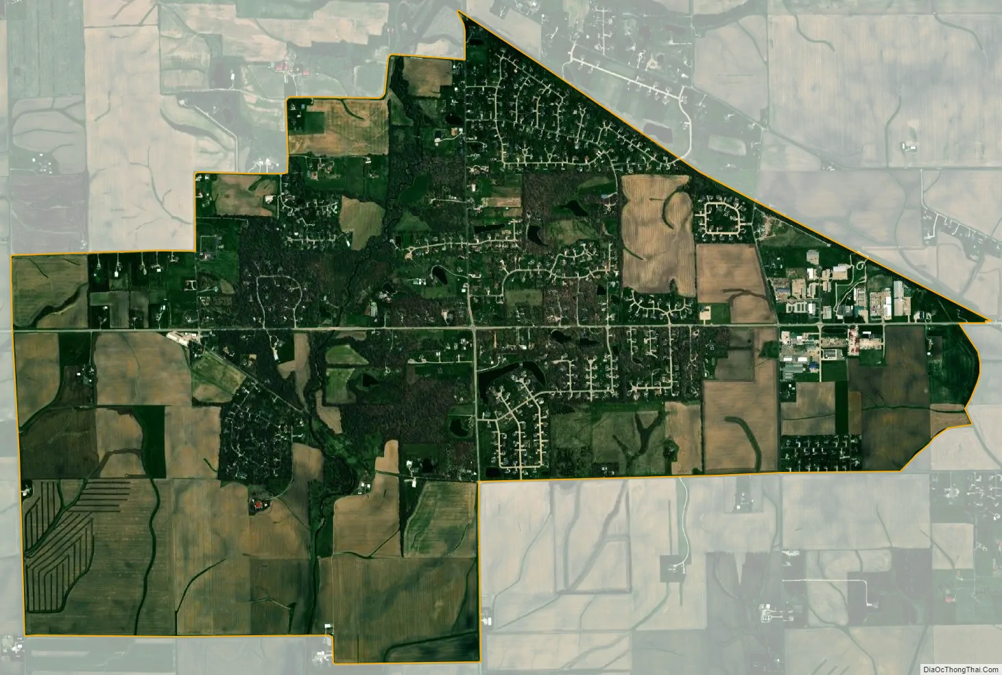
Twin Grove city Satellite Map
Geography
Twin Grove is in western McLean County on both sides of Illinois Route 9. It is 5 miles (8 km) west of Bloomington, the county seat.
According to the U.S. Census Bureau, the Twin Grove CDP has an area of 3.97 square miles (10.28 km), of which 0.01 square miles (0.03 km), or 0.25%, are water. Kings Mill Creek flows southward through the western part of the community, leading to the Middle Fork of Sugar Creek, part of the Sangamon River watershed flowing west to the Illinois River.
See also
Map of Illinois State and its subdivision:- Adams
- Alexander
- Bond
- Boone
- Brown
- Bureau
- Calhoun
- Carroll
- Cass
- Champaign
- Christian
- Clark
- Clay
- Clinton
- Coles
- Cook
- Crawford
- Cumberland
- De Kalb
- De Witt
- Douglas
- Dupage
- Edgar
- Edwards
- Effingham
- Fayette
- Ford
- Franklin
- Fulton
- Gallatin
- Greene
- Grundy
- Hamilton
- Hancock
- Hardin
- Henderson
- Henry
- Iroquois
- Jackson
- Jasper
- Jefferson
- Jersey
- Jo Daviess
- Johnson
- Kane
- Kankakee
- Kendall
- Knox
- La Salle
- Lake
- Lake Michigan
- Lawrence
- Lee
- Livingston
- Logan
- Macon
- Macoupin
- Madison
- Marion
- Marshall
- Mason
- Massac
- McDonough
- McHenry
- McLean
- Menard
- Mercer
- Monroe
- Montgomery
- Morgan
- Moultrie
- Ogle
- Peoria
- Perry
- Piatt
- Pike
- Pope
- Pulaski
- Putnam
- Randolph
- Richland
- Rock Island
- Saint Clair
- Saline
- Sangamon
- Schuyler
- Scott
- Shelby
- Stark
- Stephenson
- Tazewell
- Union
- Vermilion
- Wabash
- Warren
- Washington
- Wayne
- White
- Whiteside
- Will
- Williamson
- Winnebago
- Woodford
- Alabama
- Alaska
- Arizona
- Arkansas
- California
- Colorado
- Connecticut
- Delaware
- District of Columbia
- Florida
- Georgia
- Hawaii
- Idaho
- Illinois
- Indiana
- Iowa
- Kansas
- Kentucky
- Louisiana
- Maine
- Maryland
- Massachusetts
- Michigan
- Minnesota
- Mississippi
- Missouri
- Montana
- Nebraska
- Nevada
- New Hampshire
- New Jersey
- New Mexico
- New York
- North Carolina
- North Dakota
- Ohio
- Oklahoma
- Oregon
- Pennsylvania
- Rhode Island
- South Carolina
- South Dakota
- Tennessee
- Texas
- Utah
- Vermont
- Virginia
- Washington
- West Virginia
- Wisconsin
- Wyoming