University Park is a village in Will County with a small portion in Cook County in the U.S. state of Illinois. It is a south suburb of Chicago. The village is one of the region’s few planned communities; it was developed in the 1960s as Wood Hill, then Park Forest South, and finally University Park. Governors State University was established in the village in 1969. The village population was 7,145 at the 2020 census.
| Name: | University Park village |
|---|---|
| LSAD Code: | 47 |
| LSAD Description: | village (suffix) |
| State: | Illinois |
| County: | Cook County, Will County |
| Incorporated: | 1967 |
| Total Area: | 10.73 sq mi (27.79 km²) |
| Land Area: | 10.73 sq mi (27.78 km²) |
| Water Area: | 0.00 sq mi (0.01 km²) 0% |
| Total Population: | 7,145 |
| Population Density: | 666.08/sq mi (257.18/km²) |
| Area code: | 708/464 |
| FIPS code: | 1776935 |
| Website: | university-park-il.com |
Online Interactive Map
Click on ![]() to view map in "full screen" mode.
to view map in "full screen" mode.
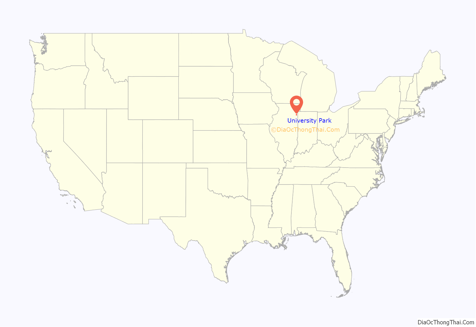
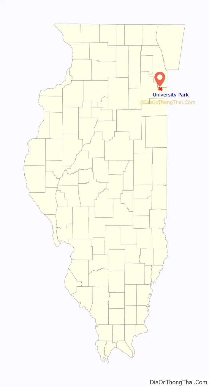
University Park location map. Where is University Park village?
History
In the late 1950s, Woodhill Enterprises purchased land south of Park Forest for a large subdivision. Building began in 1961, but by 1967 Wood Hill had only 240 homes. Residents created a homeowners association, which fostered a community identity.
In 1966, Nathan Manilow, one of the developers of Park Forest, started to purchase land around Wood Hill. Park Forest had been a model for planning in the 1940s, and Lewis Manilow, son of Nathan, formed New Community Enterprises (NCE) to build “a whole new town”. Major partners included Illinois Central Industries and United States Gypsum Company.
NCE supported the incorporation of Park Forest South in 1967 with projections for 100,000 residents. Under the federal New Communities Act of 1968, Park Forest South was designated as one of 15 such “new communities”. Planning included space for residential, commercial, and industrial development and addressed the needs of education, recreation, and faith communities. Racial integration was a goal from the beginning, and Park Forest South became a leader in support of open housing.
Governors State University opened its doors in 1969. The Illinois Central Railroad made its first commuter extension in 40 years there. As a result, it is the last stop on the Metra Electric District line. The city’s initial plan included wooded preserves and recreation areas, building on recreation area set-asides and major land donations by the Manilow organization.
The creativity and energy of the developers and village leadership led to great hopes for their “whole new town”. In 1970, the state of Illinois allocated $24 million for the GSU campus. In 1971, HUD guaranteed $30 million in loans to bring the vision to reality.
The developers modernized the water and sewage treatment facilities and in 1970 initiated the first elementary school, the first apartment complex, and Governors Gateway Industrial Park.
However, difficulties arose in the economy, in the requirements and lack of resources from HUD, in the projections for growth, and in other areas, leading to suspended development in late 1974. For over two years, intense activity at public and private levels untangled many of the problems. The new town, intended for 100,000, adapted to a slow-growth plan anticipating an eventual 20,000 to 25,000 residents. The 2000 population, however, was 6,662, up slightly from the previous decade.
New town planning remains evident. The industrial park next to Interstate 57 is integral to the village, and residential areas continue to offer open space, bikeways, and additional development. The new town heritage includes the Nathan Manilow Sculpture Park, a monumental internationally recognized outdoor sculpture park at GSU developed by Lewis Manilow to honor his father.
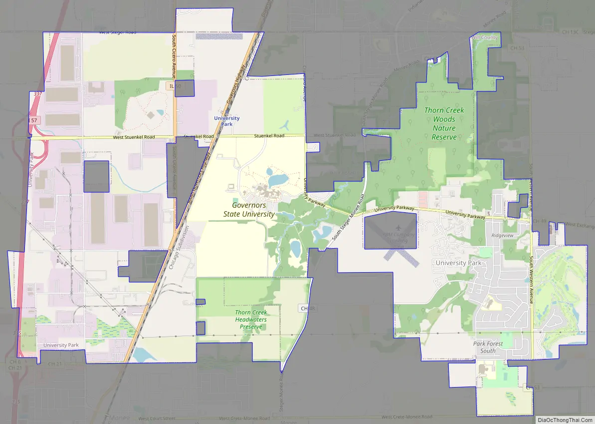
University Park Road Map
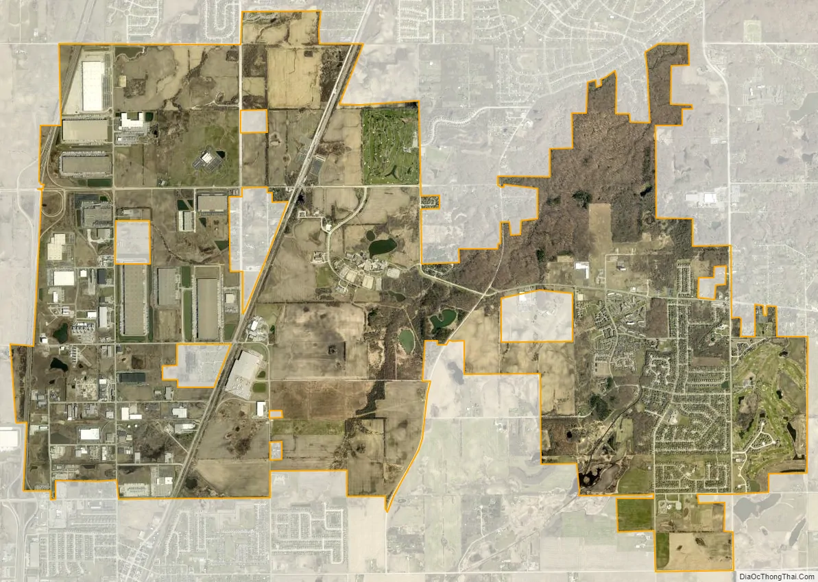
University Park city Satellite Map
Geography
University Park is located at 41°26′22″N 87°41′50″W / 41.43944°N 87.69722°W / 41.43944; -87.69722 (41.439460, -87.697299).
According to the 2021 census gazetteer files, University Park has a total area of 10.73 square miles (27.79 km), of which 10.73 square miles (27.79 km) (or 99.98%) is land and 0.00 square miles (0.00 km) (or 0.02%) is water. The village lies on the Valparaiso Moraine, which is also the Eastern Continental Divide.
Surrounding areas
See also
Map of Illinois State and its subdivision:- Adams
- Alexander
- Bond
- Boone
- Brown
- Bureau
- Calhoun
- Carroll
- Cass
- Champaign
- Christian
- Clark
- Clay
- Clinton
- Coles
- Cook
- Crawford
- Cumberland
- De Kalb
- De Witt
- Douglas
- Dupage
- Edgar
- Edwards
- Effingham
- Fayette
- Ford
- Franklin
- Fulton
- Gallatin
- Greene
- Grundy
- Hamilton
- Hancock
- Hardin
- Henderson
- Henry
- Iroquois
- Jackson
- Jasper
- Jefferson
- Jersey
- Jo Daviess
- Johnson
- Kane
- Kankakee
- Kendall
- Knox
- La Salle
- Lake
- Lake Michigan
- Lawrence
- Lee
- Livingston
- Logan
- Macon
- Macoupin
- Madison
- Marion
- Marshall
- Mason
- Massac
- McDonough
- McHenry
- McLean
- Menard
- Mercer
- Monroe
- Montgomery
- Morgan
- Moultrie
- Ogle
- Peoria
- Perry
- Piatt
- Pike
- Pope
- Pulaski
- Putnam
- Randolph
- Richland
- Rock Island
- Saint Clair
- Saline
- Sangamon
- Schuyler
- Scott
- Shelby
- Stark
- Stephenson
- Tazewell
- Union
- Vermilion
- Wabash
- Warren
- Washington
- Wayne
- White
- Whiteside
- Will
- Williamson
- Winnebago
- Woodford
- Alabama
- Alaska
- Arizona
- Arkansas
- California
- Colorado
- Connecticut
- Delaware
- District of Columbia
- Florida
- Georgia
- Hawaii
- Idaho
- Illinois
- Indiana
- Iowa
- Kansas
- Kentucky
- Louisiana
- Maine
- Maryland
- Massachusetts
- Michigan
- Minnesota
- Mississippi
- Missouri
- Montana
- Nebraska
- Nevada
- New Hampshire
- New Jersey
- New Mexico
- New York
- North Carolina
- North Dakota
- Ohio
- Oklahoma
- Oregon
- Pennsylvania
- Rhode Island
- South Carolina
- South Dakota
- Tennessee
- Texas
- Utah
- Vermont
- Virginia
- Washington
- West Virginia
- Wisconsin
- Wyoming


