Warrenville is a village in DuPage County, Illinois, United States. The population was 13,553 at the 2020 census. Warrenville is a far west suburb of Chicago in the Illinois Technology and Research Corridor, and is just north of I-88.
| Name: | Warrenville city |
|---|---|
| LSAD Code: | 25 |
| LSAD Description: | city (suffix) |
| State: | Illinois |
| County: | DuPage County |
| Incorporated: | 1967 |
| Elevation: | 702 ft (214 m) |
| Total Area: | 5.61 sq mi (14.53 km²) |
| Land Area: | 5.46 sq mi (14.14 km²) |
| Water Area: | 0.15 sq mi (0.39 km²) 2.85% |
| Total Population: | 13,553 |
| Population Density: | 2,482.23/sq mi (958.46/km²) |
| Area code: | 630 and 331 |
| FIPS code: | 1778929 |
| GNISfeature ID: | 2397197 |
| Website: | www.warrenville.il.us |
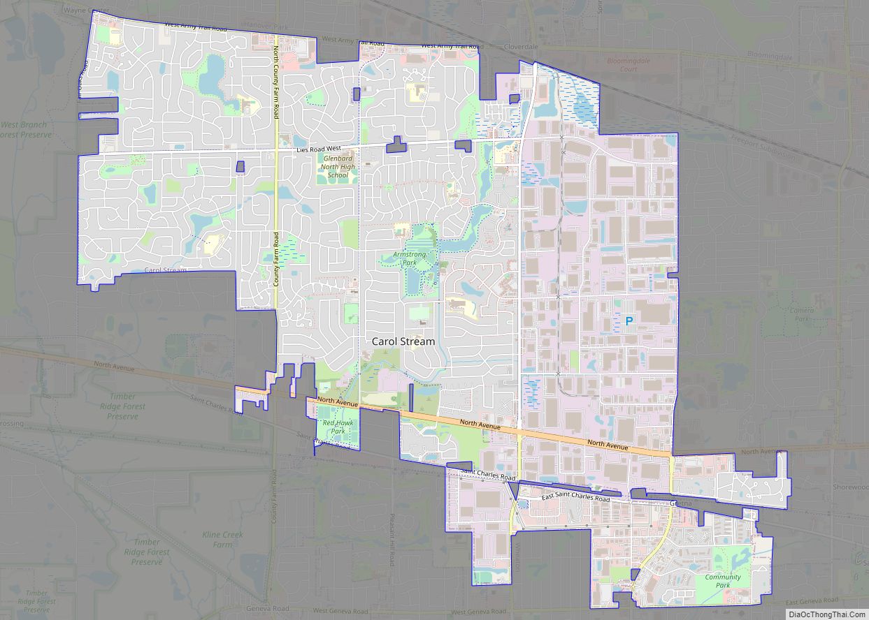
Online Interactive Map
Click on ![]() to view map in "full screen" mode.
to view map in "full screen" mode.
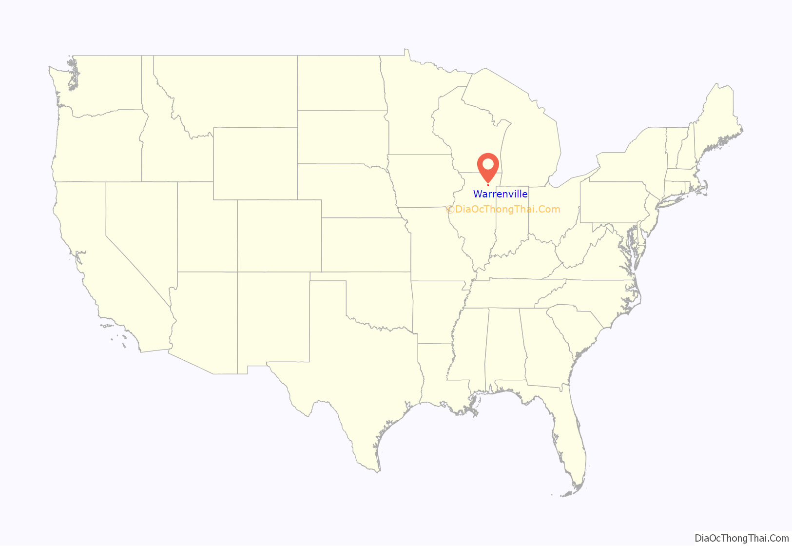
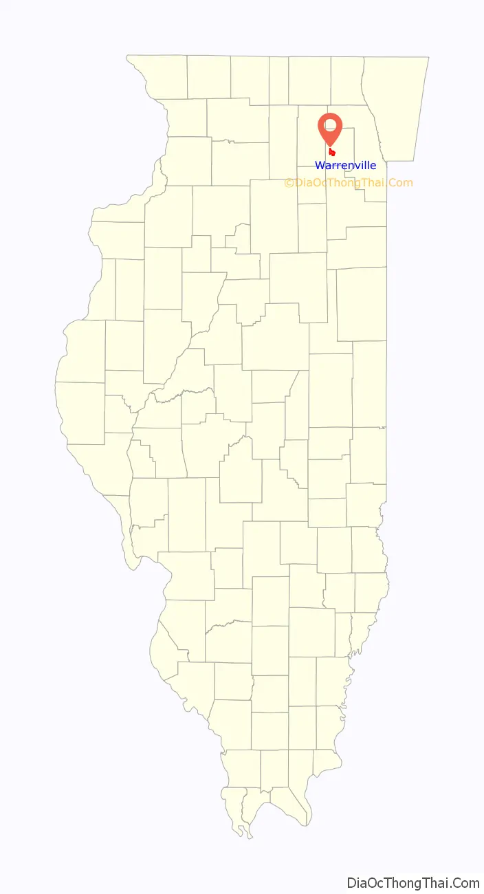
Warrenville location map. Where is Warrenville city?
History
Warrenville was founded in 1833 when Julius Warren and his family moved west from New York to seek a fresh start from a failing gristmill and distillery. Daniel Warren, Julius’ father, claimed land at what is now McDowell Woods and Julius claimed land at what is now the Warrenville Grove Forest Preserve. The first major establishment, an inn and tavern, was built in 1838 by Julius Warren himself, as the family was skilled in timber and grain. The inn still stands today and was renovated in 2002.
The town quickly blossomed with two mills and a plank road connecting it with Naperville and Winfield, on which Julius operated a stagecoach line. The town failed at its bid to have the railroad come through the town. However, in 1902, the Chicago Aurora and Elgin Railroad came through town, which lasted until the late 1950s.
With a population of 4,000, Warrenville was finally incorporated as a city in 1967, following six unsuccessful attempts. The 1970s and 1980s brought westward expansion from the city of Chicago, causing the small farming community’s population to nearly double to 7,800.
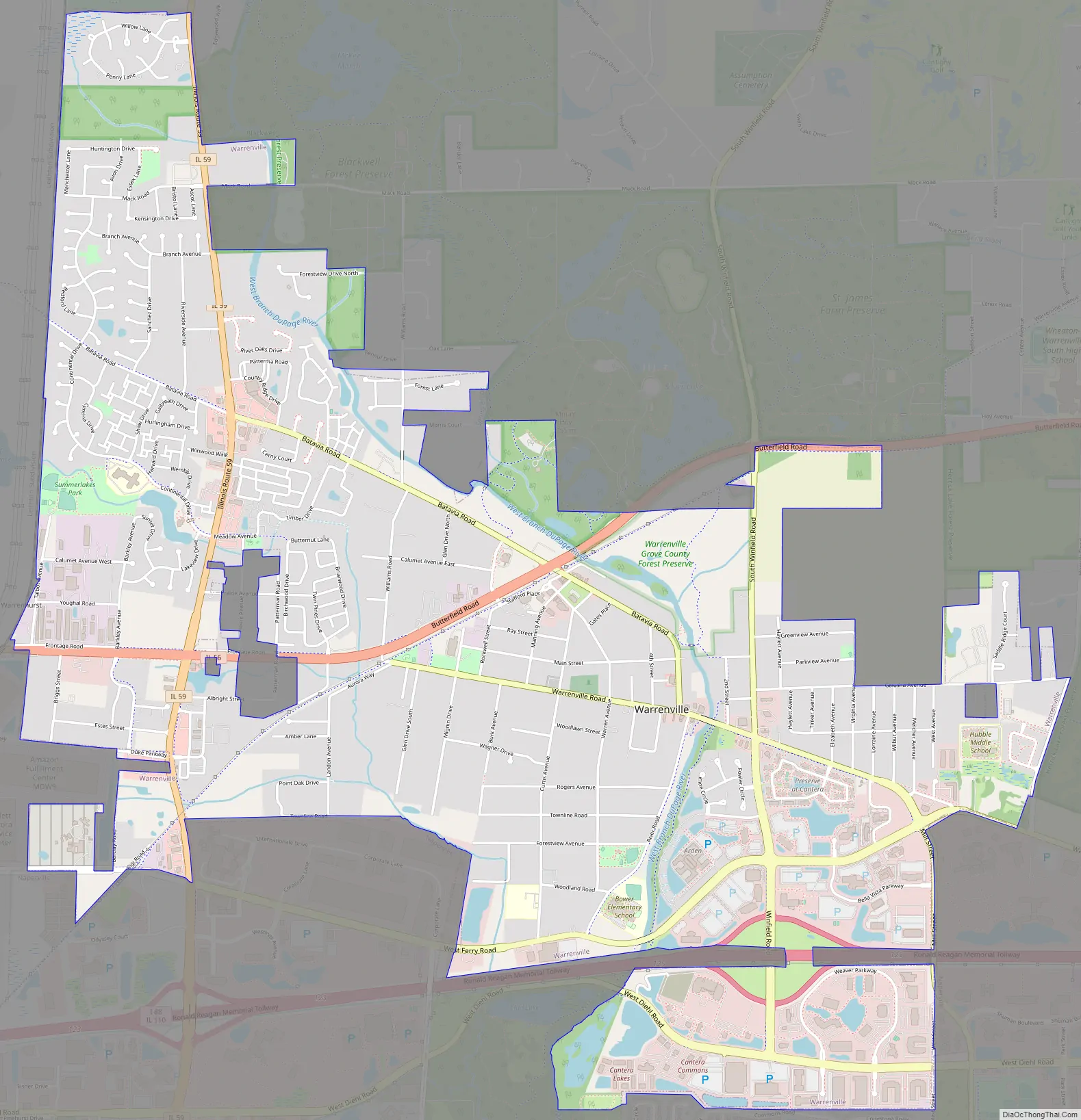
Warrenville Road Map
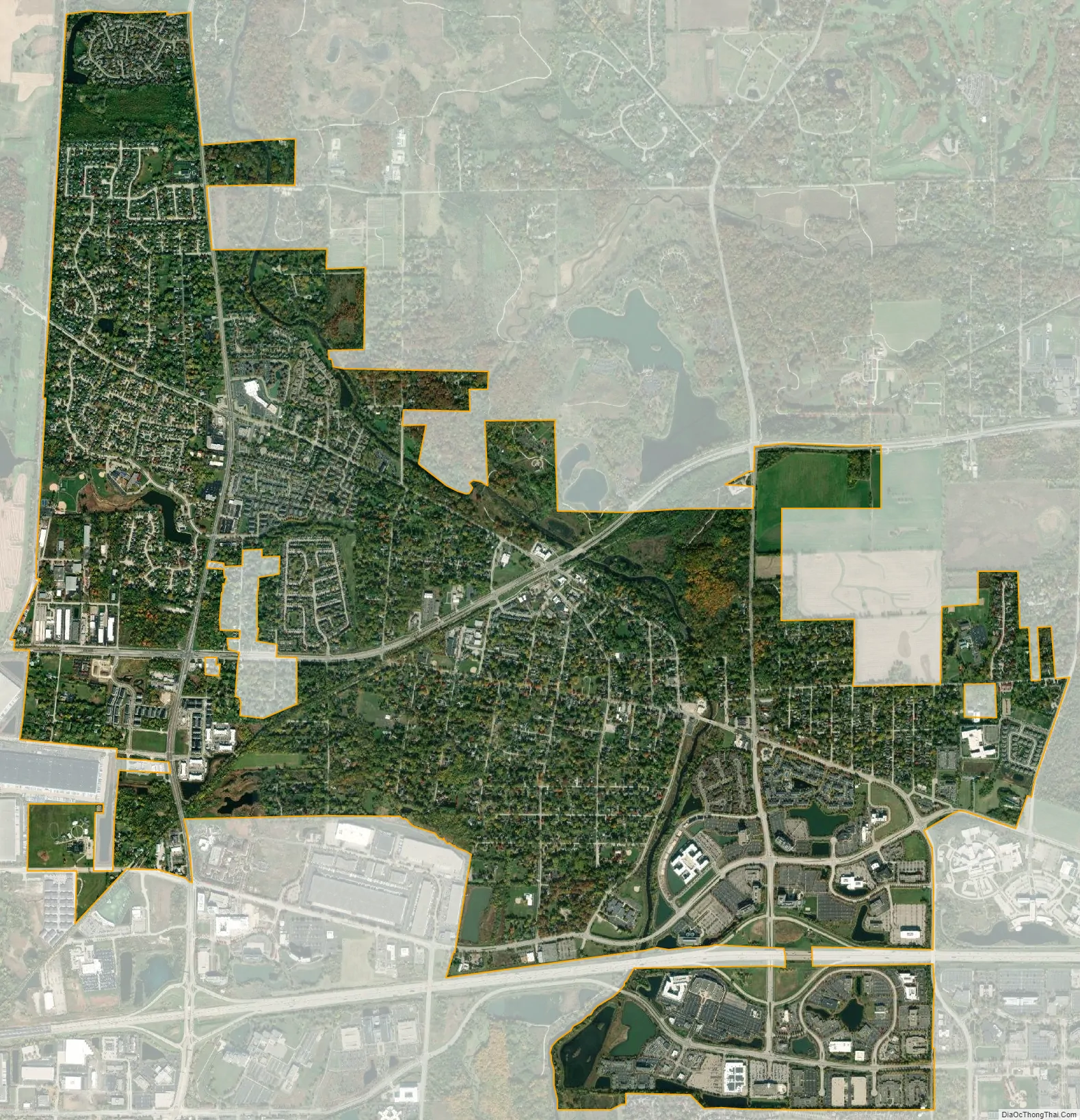
Warrenville city Satellite Map
Geography
Warrenville is located at 41°49′35″N 88°11′22″W / 41.82639°N 88.18944°W / 41.82639; -88.18944 (41.826280, -88.189465).
According to the 2010 census, Warrenville has a total area of 5.618 square miles (14.55 km), of which 5.46 square miles (14.14 km) (or 97.19%) is land and 0.158 square miles (0.41 km) (or 2.81%) is water.
See also
Map of Illinois State and its subdivision:- Adams
- Alexander
- Bond
- Boone
- Brown
- Bureau
- Calhoun
- Carroll
- Cass
- Champaign
- Christian
- Clark
- Clay
- Clinton
- Coles
- Cook
- Crawford
- Cumberland
- De Kalb
- De Witt
- Douglas
- Dupage
- Edgar
- Edwards
- Effingham
- Fayette
- Ford
- Franklin
- Fulton
- Gallatin
- Greene
- Grundy
- Hamilton
- Hancock
- Hardin
- Henderson
- Henry
- Iroquois
- Jackson
- Jasper
- Jefferson
- Jersey
- Jo Daviess
- Johnson
- Kane
- Kankakee
- Kendall
- Knox
- La Salle
- Lake
- Lake Michigan
- Lawrence
- Lee
- Livingston
- Logan
- Macon
- Macoupin
- Madison
- Marion
- Marshall
- Mason
- Massac
- McDonough
- McHenry
- McLean
- Menard
- Mercer
- Monroe
- Montgomery
- Morgan
- Moultrie
- Ogle
- Peoria
- Perry
- Piatt
- Pike
- Pope
- Pulaski
- Putnam
- Randolph
- Richland
- Rock Island
- Saint Clair
- Saline
- Sangamon
- Schuyler
- Scott
- Shelby
- Stark
- Stephenson
- Tazewell
- Union
- Vermilion
- Wabash
- Warren
- Washington
- Wayne
- White
- Whiteside
- Will
- Williamson
- Winnebago
- Woodford
- Alabama
- Alaska
- Arizona
- Arkansas
- California
- Colorado
- Connecticut
- Delaware
- District of Columbia
- Florida
- Georgia
- Hawaii
- Idaho
- Illinois
- Indiana
- Iowa
- Kansas
- Kentucky
- Louisiana
- Maine
- Maryland
- Massachusetts
- Michigan
- Minnesota
- Mississippi
- Missouri
- Montana
- Nebraska
- Nevada
- New Hampshire
- New Jersey
- New Mexico
- New York
- North Carolina
- North Dakota
- Ohio
- Oklahoma
- Oregon
- Pennsylvania
- Rhode Island
- South Carolina
- South Dakota
- Tennessee
- Texas
- Utah
- Vermont
- Virginia
- Washington
- West Virginia
- Wisconsin
- Wyoming