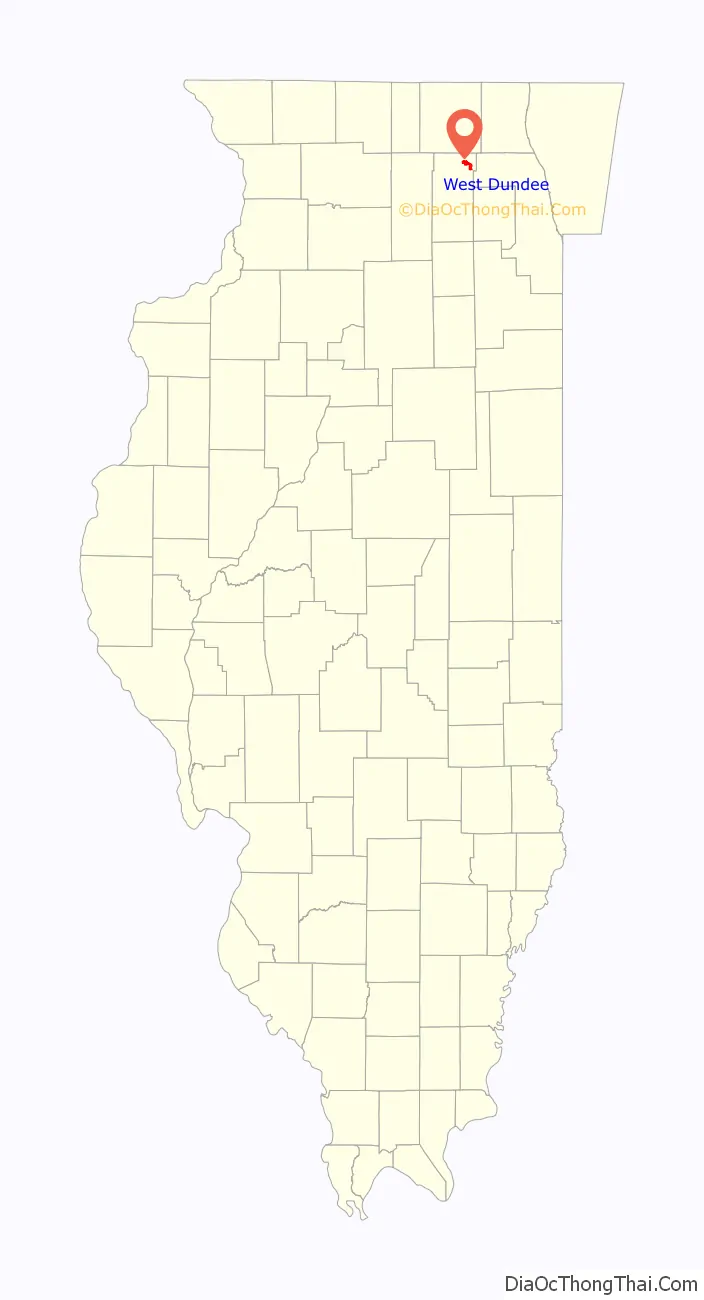
West Dundee is a village in Kane County, Illinois, United States. The population was 7,686 as of the 2020 US Census. It is considered a far northwest Chicago suburb.
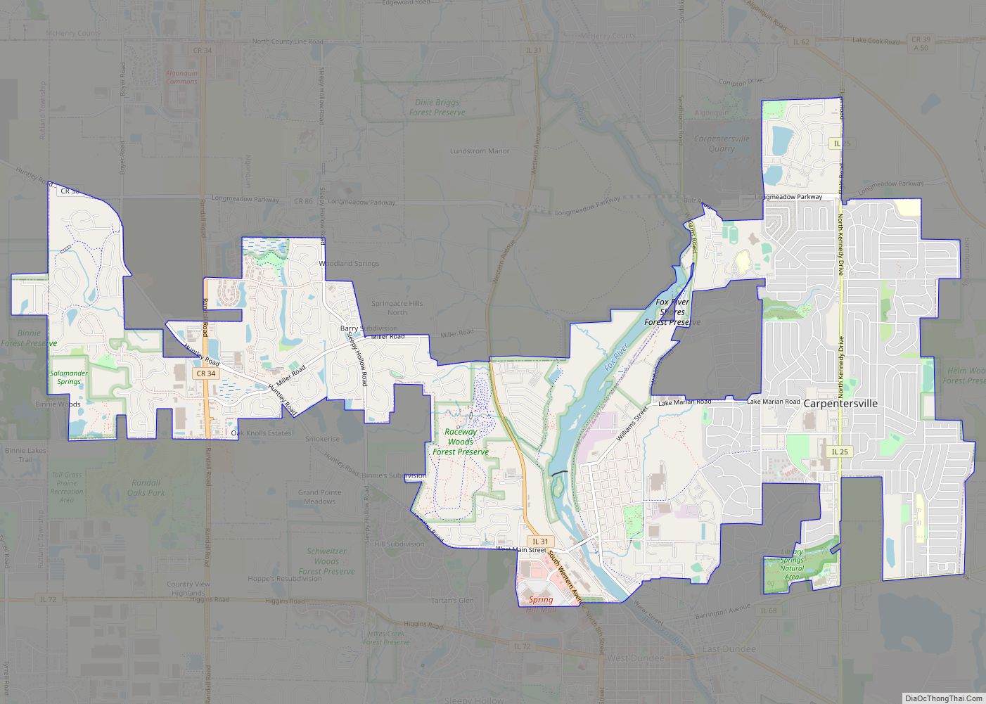
West Dundee lies across the Fox River from East Dundee and Carpentersville.
| Name: | West Dundee village |
|---|---|
| LSAD Code: | 47 |
| LSAD Description: | village (suffix) |
| State: | Illinois |
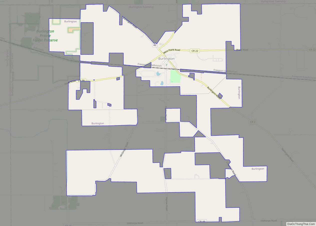
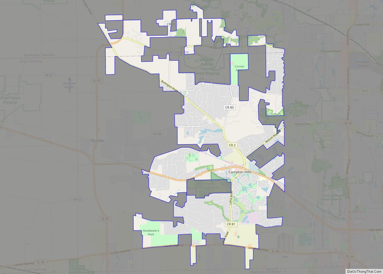
| County: | Kane County |
| Total Area: | 3.87 sq mi (10.01 km²) |
| Land Area: | 3.75 sq mi (9.71 km²) |
| Water Area: | 0.12 sq mi (0.30 km²) |
| Total Population: | 7,686 |
| Population Density: | 2,049.05/sq mi (791.20/km²) |
| Area code: | 847 |
| FIPS code: | 1780125 |
| Website: | www.wdundee.org |
Online Interactive Map
Click on ![]() to view map in "full screen" mode.
to view map in "full screen" mode.
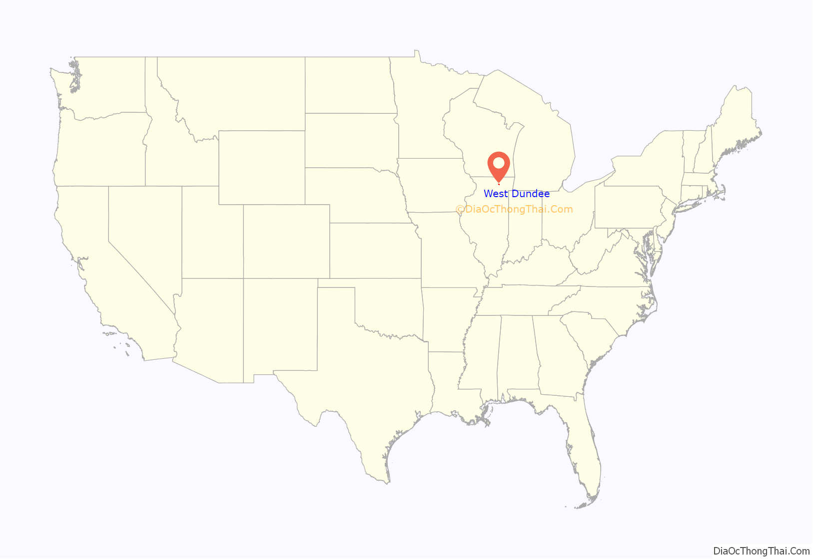
West Dundee location map. Where is West Dundee village?
History
In 1835, Elder John and Nancy Oatman established a tavern and a store that became the core of the community. Others settlers came, and in 1837 they held a lottery to determine who would name the town. Alexander Gardiner won and named the town Dundee in honor of his Scottish hometown, with which West Dundee is now sister cities. In 1843 Scotsman Allan Pinkerton, later the renowned detective, set up business as a cooper. The town was incorporated in 1887.
Dundee was hemmed in from development for years. The Fox River formed a natural eastern barrier. To the north and west, the D. Hill Nursery, founded in 1855 by William Hill, specialized in fruit trees. The business grew to include evergreens, some of which were sent to Chicago for the World’s Columbian Exposition in 1893. Expanding to 900 acres, the nursery survived the Great Depression by running a cattle feed operation that continued through World War II. Some of the thousands of seasonal workers traveled to work from Chicago by electric rail, while the majority lived on the nursery grounds.
In the 1950s, a segment of the Hill property was sold and turned into the Highlands subdivision, which was annexed into West Dundee in 1956. The community also annexed property west of Illinois 31 in 1957, Royal Lane in 1960, and the Old World subdivision in 1966. The nursery eventually sold all of its land and moved to McHenry County. Plans for the Spring Hill Mall on Hill’s land began in 1973 and the project was completed in 1980. The 1.1 million-square-foot mall’s retail sales boosted West Dundee’s economy and created an estimated 1,600 jobs by 1982. New subdivisions were built to the west of Spring Hill Mall.
With a population of 7,331 (2010 Census data), West Dundee has managed to keep its quaintness and small-town feeling intact. Designated historical sites fill the downtown and surrounding residential neighborhood. Restored buildings include structures reported to have provided refuge for slaves on the Underground Railroad. Portions of downtown West Dundee are included with the Dundee Township Historic District on the National Register of Historic Places.
West Dundee Road Map
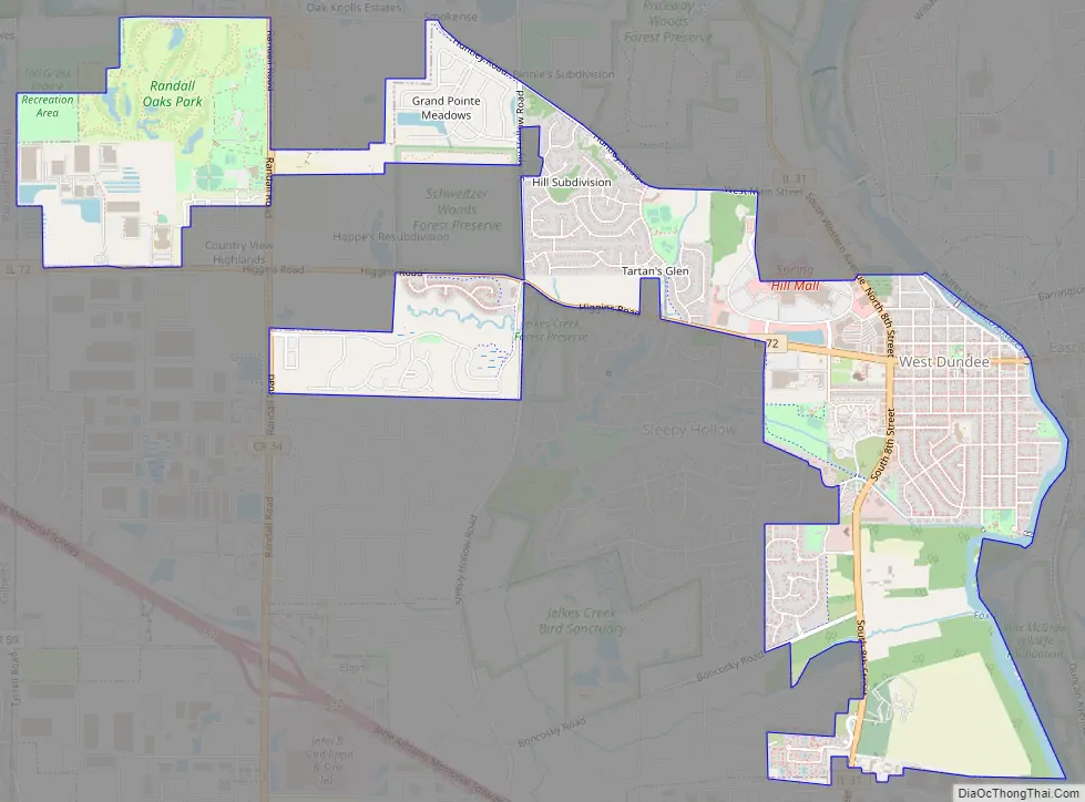
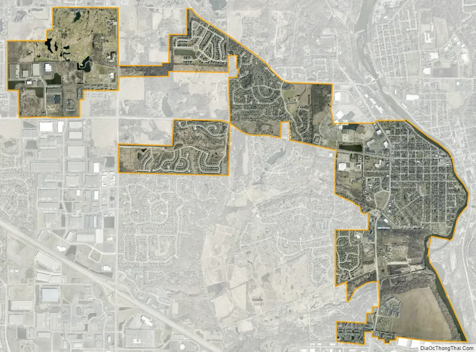
West Dundee city Satellite Map
Geography
West Dundee is located at 42°5′43″N 88°17′9″W / 42.09528°N 88.28583°W / 42.09528; -88.28583 (42.095327, -88.285809).
According to the 2010 census, West Dundee has a total area of 3.811 square miles (9.87 km), of which 3.71 square miles (9.61 km) (or 97.35%) is land and 0.101 square miles (0.26 km) (or 2.65%) is water.
See also
Map of Illinois State and its subdivision:- Adams
- Alexander
- Bond
- Boone
- Brown
- Bureau
- Calhoun
- Carroll
- Cass
- Champaign
- Christian
- Clark
- Clay
- Clinton
- Coles
- Cook
- Crawford
- Cumberland
- De Kalb
- De Witt
- Douglas
- Dupage
- Edgar
- Edwards
- Effingham
- Fayette
- Ford
- Franklin
- Fulton
- Gallatin
- Greene
- Grundy
- Hamilton
- Hancock
- Hardin
- Henderson
- Henry
- Iroquois
- Jackson
- Jasper
- Jefferson
- Jersey
- Jo Daviess
- Johnson
- Kane
- Kankakee
- Kendall
- Knox
- La Salle
- Lake
- Lake Michigan
- Lawrence
- Lee
- Livingston
- Logan
- Macon
- Macoupin
- Madison
- Marion
- Marshall
- Mason
- Massac
- McDonough
- McHenry
- McLean
- Menard
- Mercer
- Monroe
- Montgomery
- Morgan
- Moultrie
- Ogle
- Peoria
- Perry
- Piatt
- Pike
- Pope
- Pulaski
- Putnam
- Randolph
- Richland
- Rock Island
- Saint Clair
- Saline
- Sangamon
- Schuyler
- Scott
- Shelby
- Stark
- Stephenson
- Tazewell
- Union
- Vermilion
- Wabash
- Warren
- Washington
- Wayne
- White
- Whiteside
- Will
- Williamson
- Winnebago
- Woodford
- Alabama
- Alaska
- Arizona
- Arkansas
- California
- Colorado
- Connecticut
- Delaware
- District of Columbia
- Florida
- Georgia
- Hawaii
- Idaho
- Illinois
- Indiana
- Iowa
- Kansas
- Kentucky
- Louisiana
- Maine
- Maryland
- Massachusetts
- Michigan
- Minnesota
- Mississippi
- Missouri
- Montana
- Nebraska
- Nevada
- New Hampshire
- New Jersey
- New Mexico
- New York
- North Carolina
- North Dakota
- Ohio
- Oklahoma
- Oregon
- Pennsylvania
- Rhode Island
- South Carolina
- South Dakota
- Tennessee
- Texas
- Utah
- Vermont
- Virginia
- Washington
- West Virginia
- Wisconsin
- Wyoming