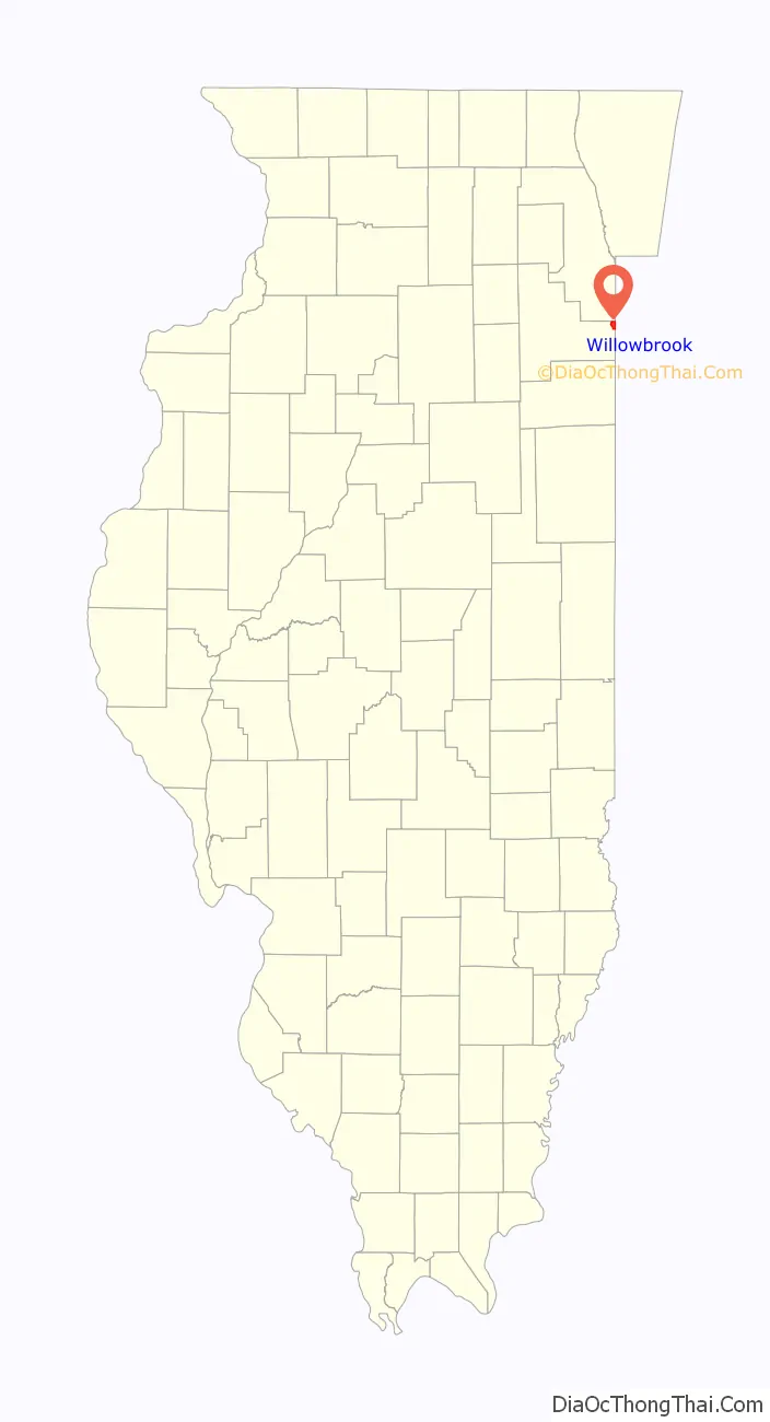
Willow Brook Estates is an unincorporated census-designated place in Will County, Illinois, United States. The population was 1,346 at the 2020 census. it is considered a far south suburb of Chicago.
| Name: | Willowbrook CDP |
|---|---|
| LSAD Code: | 57 |
| LSAD Description: | CDP (suffix) |
| State: | Illinois |
| County: | Will County |
| Elevation: | 715 ft (218 m) |
| Total Area: | 3.4 sq mi (9 km²) |
| Land Area: | 3.4 sq mi (9 km²) |
| Water Area: | 0.04 sq mi (0.1 km²) |
| Total Population: | 1,346 |
| Population Density: | 400/sq mi (150/km²) |
| Area code: | 708 |
| FIPS code: | 1781938 |
| Website: | www.willowbrook123.com |
Online Interactive Map
Click on ![]() to view map in "full screen" mode.
to view map in "full screen" mode.
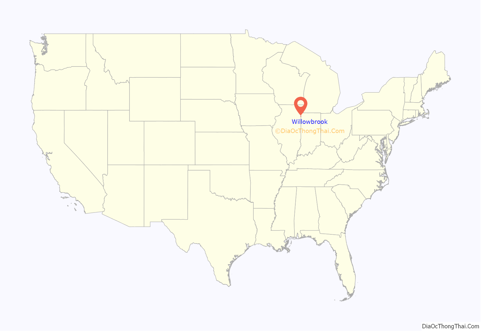
Willowbrook location map. Where is Willowbrook CDP?
History
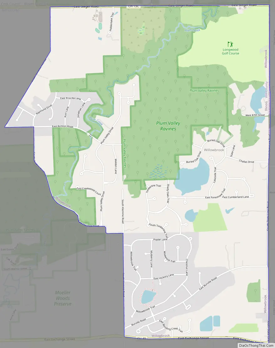
Willow Brook Estates was developed as a subdivision in 1971 by John Parker, Evelyn Parker and Ronald Parker. The community was built in 3 phases from 1971 to 1991 and has 161 lots. There is a large pond in the center of the development known as Park Pond. Willow Brook Estates is known as one of the largest and oldest unincorporated towns in Illinois governed by an HOA. Despite its similar name, Willow Brook Estates is 47 miles south-east of the Village of Willowbrook in DuPage County.
Willowbrook Road Map
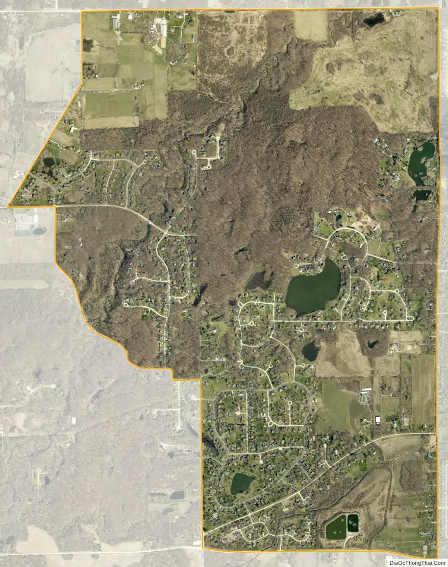
Willowbrook city Satellite Map
Geography
Willow Brook Estates is located at 41°27′00″N 87°32′28″W / 41.449925°N 87.541120°W / 41.449925; -87.541120.
Willow Brook Estates is located north-east of the intersection at East Exchange Street and Stateline Road. It borders the State of Indiana to the east. The town of Crete, Illinois is 8 miles to the west.
According to the United States Census Bureau, the CDP has a total area of 3.4 square miles (8.8 km), of which 3.4 square miles (8.8 km) is land and 0.04 square miles (0.10 km) (0.59%) is water.
See also
Map of Illinois State and its subdivision:- Adams
- Alexander
- Bond
- Boone
- Brown
- Bureau
- Calhoun
- Carroll
- Cass
- Champaign
- Christian
- Clark
- Clay
- Clinton
- Coles
- Cook
- Crawford
- Cumberland
- De Kalb
- De Witt
- Douglas
- Dupage
- Edgar
- Edwards
- Effingham
- Fayette
- Ford
- Franklin
- Fulton
- Gallatin
- Greene
- Grundy
- Hamilton
- Hancock
- Hardin
- Henderson
- Henry
- Iroquois
- Jackson
- Jasper
- Jefferson
- Jersey
- Jo Daviess
- Johnson
- Kane
- Kankakee
- Kendall
- Knox
- La Salle
- Lake
- Lake Michigan
- Lawrence
- Lee
- Livingston
- Logan
- Macon
- Macoupin
- Madison
- Marion
- Marshall
- Mason
- Massac
- McDonough
- McHenry
- McLean
- Menard
- Mercer
- Monroe
- Montgomery
- Morgan
- Moultrie
- Ogle
- Peoria
- Perry
- Piatt
- Pike
- Pope
- Pulaski
- Putnam
- Randolph
- Richland
- Rock Island
- Saint Clair
- Saline
- Sangamon
- Schuyler
- Scott
- Shelby
- Stark
- Stephenson
- Tazewell
- Union
- Vermilion
- Wabash
- Warren
- Washington
- Wayne
- White
- Whiteside
- Will
- Williamson
- Winnebago
- Woodford
- Alabama
- Alaska
- Arizona
- Arkansas
- California
- Colorado
- Connecticut
- Delaware
- District of Columbia
- Florida
- Georgia
- Hawaii
- Idaho
- Illinois
- Indiana
- Iowa
- Kansas
- Kentucky
- Louisiana
- Maine
- Maryland
- Massachusetts
- Michigan
- Minnesota
- Mississippi
- Missouri
- Montana
- Nebraska
- Nevada
- New Hampshire
- New Jersey
- New Mexico
- New York
- North Carolina
- North Dakota
- Ohio
- Oklahoma
- Oregon
- Pennsylvania
- Rhode Island
- South Carolina
- South Dakota
- Tennessee
- Texas
- Utah
- Vermont
- Virginia
- Washington
- West Virginia
- Wisconsin
- Wyoming