Woodson is a village in Morgan County, Illinois, United States. The population was 498 at the 2020 census. It is part of the Jacksonville Micropolitan Statistical Area.
| Name: | Woodson village |
|---|---|
| LSAD Code: | 47 |
| LSAD Description: | village (suffix) |
| State: | Illinois |
| County: | Morgan County |
| Incorporated: | April 9, 1894 |
| Elevation: | 673 ft (205 m) |
| Total Area: | 0.39 sq mi (1.02 km²) |
| Land Area: | 0.39 sq mi (1.02 km²) |
| Water Area: | 0.00 sq mi (0.00 km²) |
| Total Population: | 498 |
| Population Density: | 1,263.96/sq mi (488.62/km²) |
| ZIP code: | 62695 |
| Area code: | 217 |
| FIPS code: | 1783336 |
| GNISfeature ID: | 2399737 |
| Website: | woodsonillinois.com |
Online Interactive Map
Click on ![]() to view map in "full screen" mode.
to view map in "full screen" mode.
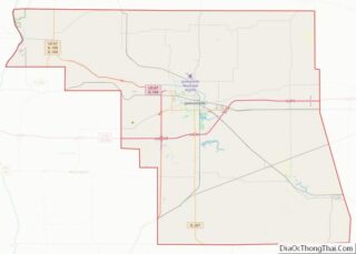
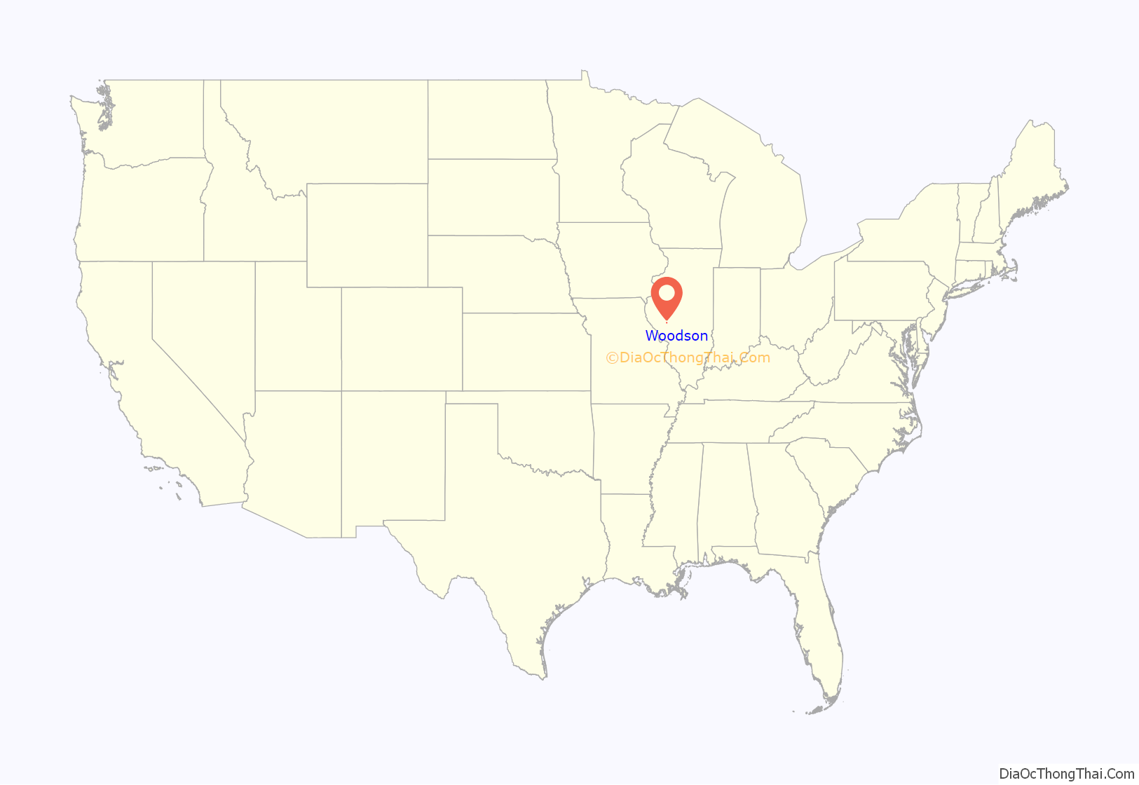
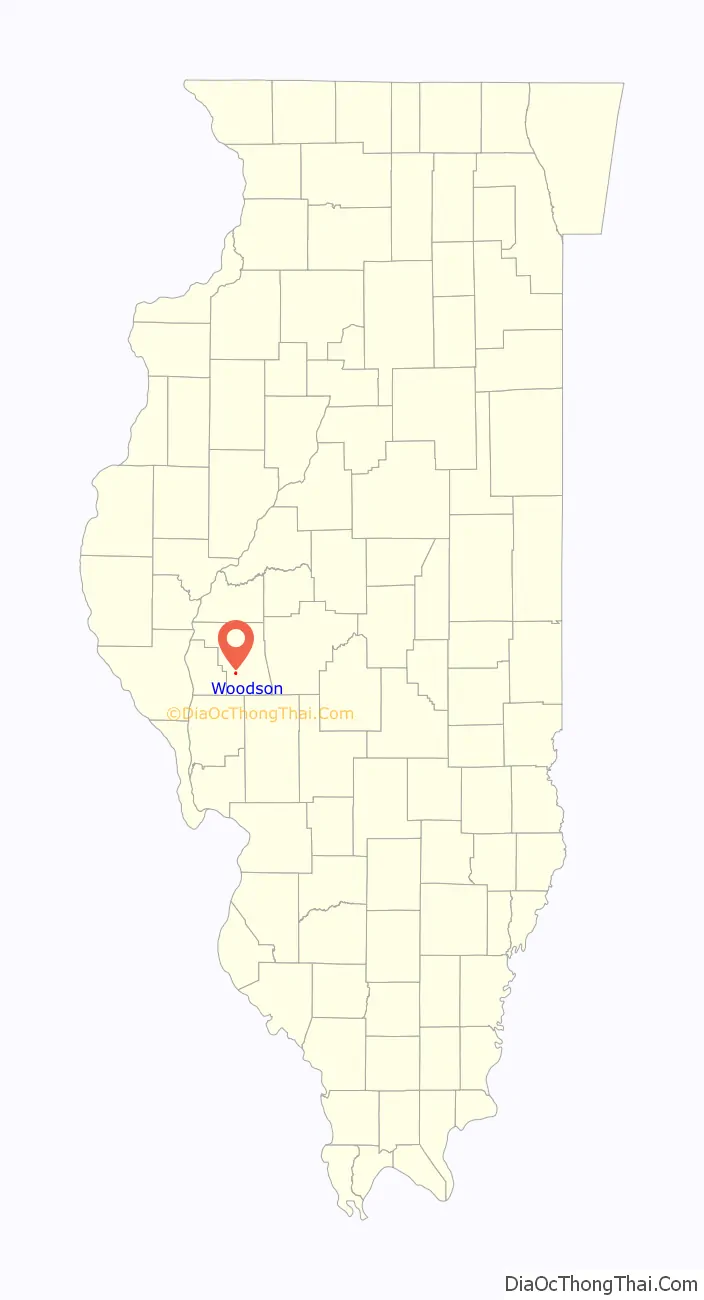
Woodson location map. Where is Woodson village?
History
The village was platted on May 2, 1859, and incorporated on April 9, 1894. The village is named after Judge David M. Woodson.
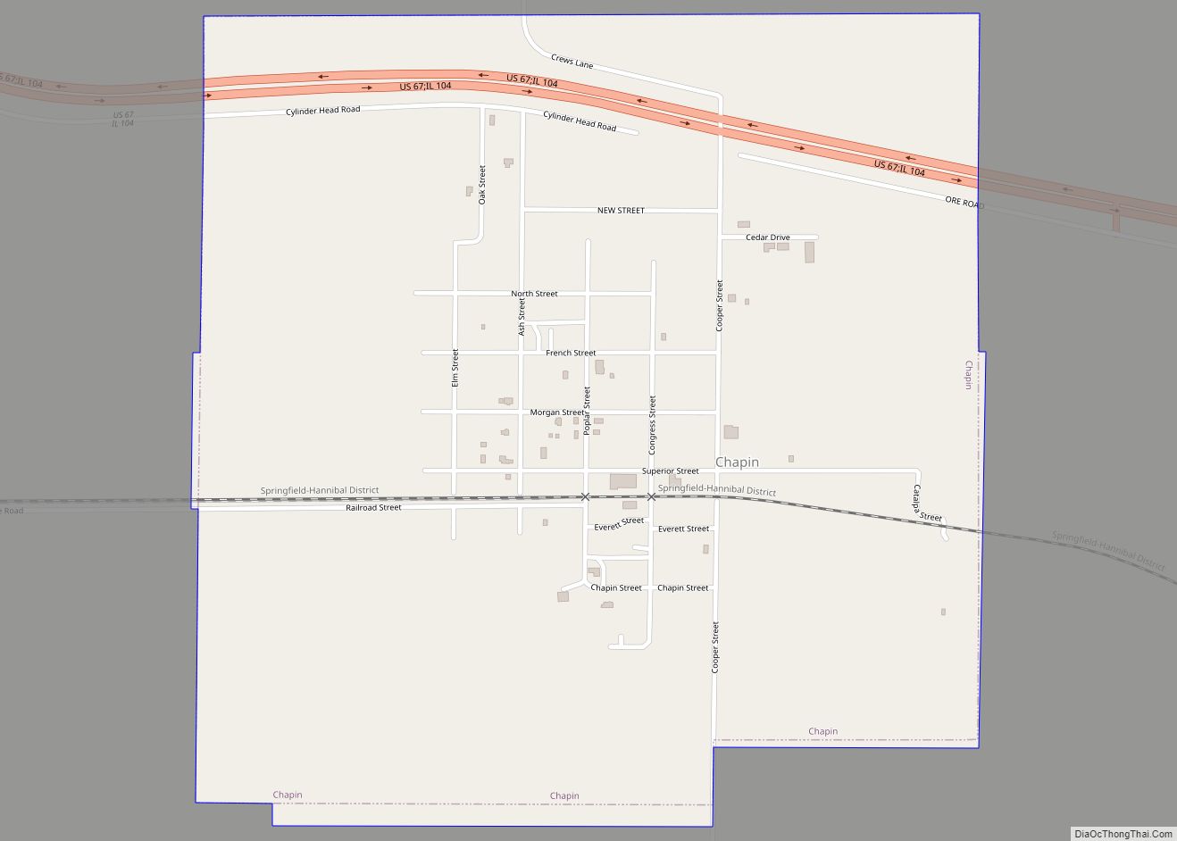
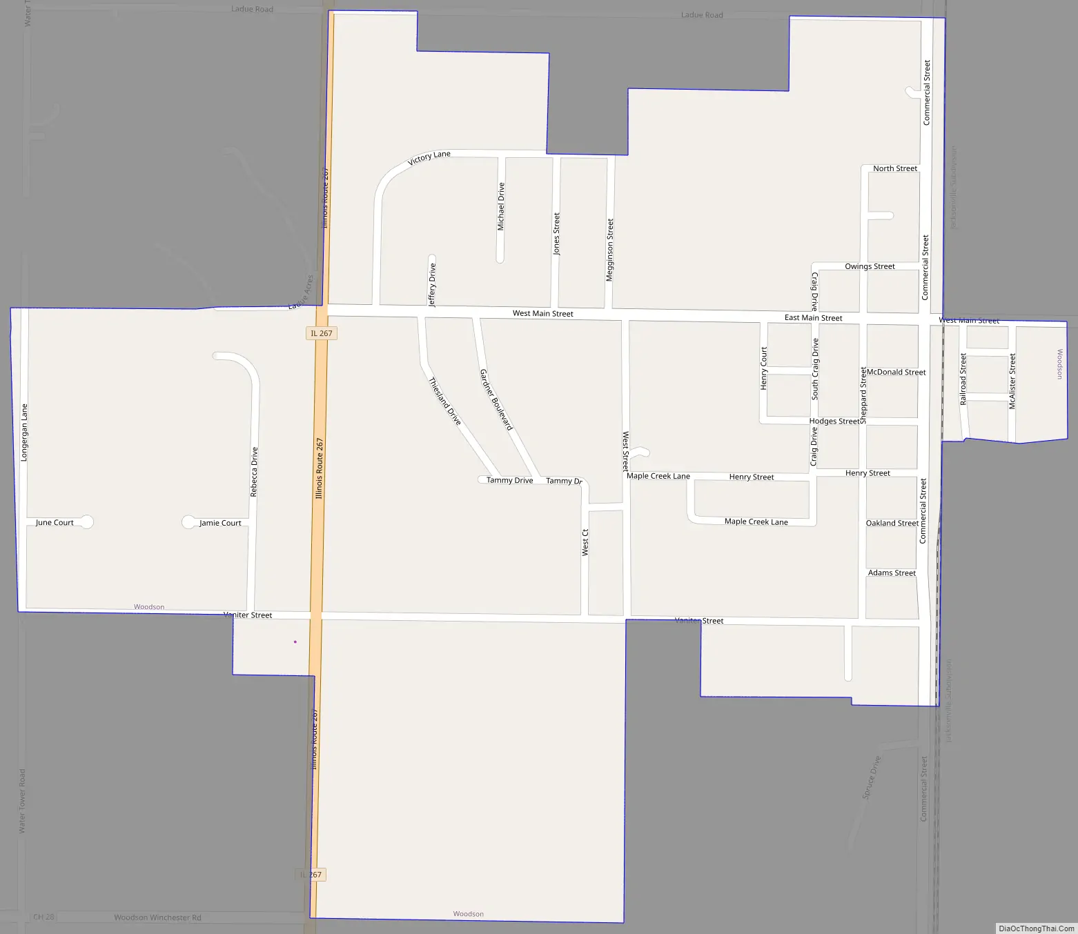
Woodson Road Map
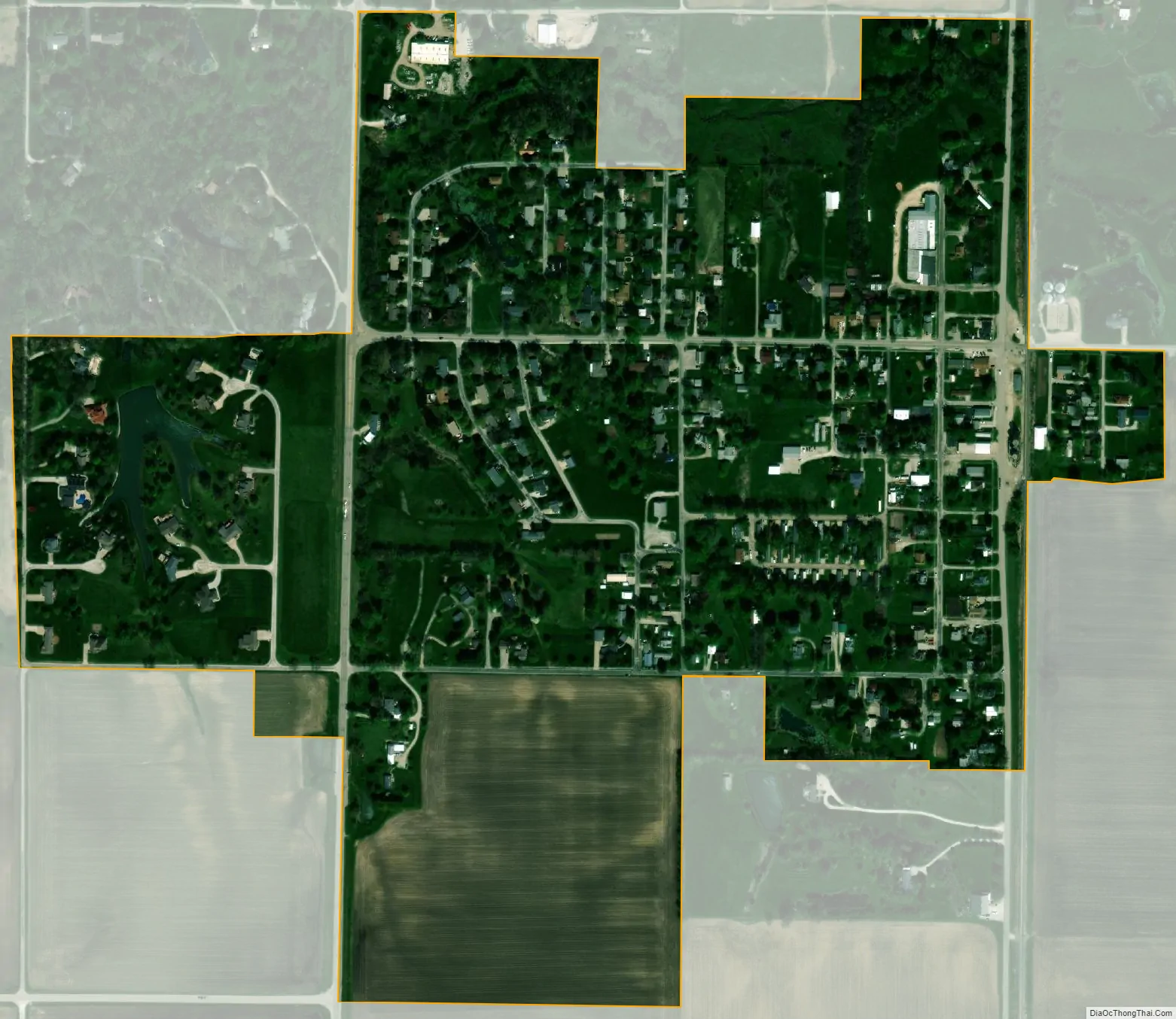
Woodson city Satellite Map
Geography
Woodson is located south of Lake Jacksonville and south of combined U.S. Route 36 and Interstate 72. It lies mainly on the east side of State Highway 267, which leads north 7 miles (11 km) to Jacksonville, the Morgan county seat, and south 20 miles (32 km) to Greenfield.
According to the U.S. Census Bureau, Woodson has a total area of 0.39 square miles (1.01 km), all land. Spoon Creek runs along the northern edge of the village, flowing west toward Sandy Creek, a southwest-flowing tributary of the Illinois River.
See also
Map of Illinois State and its subdivision:- Adams
- Alexander
- Bond
- Boone
- Brown
- Bureau
- Calhoun
- Carroll
- Cass
- Champaign
- Christian
- Clark
- Clay
- Clinton
- Coles
- Cook
- Crawford
- Cumberland
- De Kalb
- De Witt
- Douglas
- Dupage
- Edgar
- Edwards
- Effingham
- Fayette
- Ford
- Franklin
- Fulton
- Gallatin
- Greene
- Grundy
- Hamilton
- Hancock
- Hardin
- Henderson
- Henry
- Iroquois
- Jackson
- Jasper
- Jefferson
- Jersey
- Jo Daviess
- Johnson
- Kane
- Kankakee
- Kendall
- Knox
- La Salle
- Lake
- Lake Michigan
- Lawrence
- Lee
- Livingston
- Logan
- Macon
- Macoupin
- Madison
- Marion
- Marshall
- Mason
- Massac
- McDonough
- McHenry
- McLean
- Menard
- Mercer
- Monroe
- Montgomery
- Morgan
- Moultrie
- Ogle
- Peoria
- Perry
- Piatt
- Pike
- Pope
- Pulaski
- Putnam
- Randolph
- Richland
- Rock Island
- Saint Clair
- Saline
- Sangamon
- Schuyler
- Scott
- Shelby
- Stark
- Stephenson
- Tazewell
- Union
- Vermilion
- Wabash
- Warren
- Washington
- Wayne
- White
- Whiteside
- Will
- Williamson
- Winnebago
- Woodford
- Alabama
- Alaska
- Arizona
- Arkansas
- California
- Colorado
- Connecticut
- Delaware
- District of Columbia
- Florida
- Georgia
- Hawaii
- Idaho
- Illinois
- Indiana
- Iowa
- Kansas
- Kentucky
- Louisiana
- Maine
- Maryland
- Massachusetts
- Michigan
- Minnesota
- Mississippi
- Missouri
- Montana
- Nebraska
- Nevada
- New Hampshire
- New Jersey
- New Mexico
- New York
- North Carolina
- North Dakota
- Ohio
- Oklahoma
- Oregon
- Pennsylvania
- Rhode Island
- South Carolina
- South Dakota
- Tennessee
- Texas
- Utah
- Vermont
- Virginia
- Washington
- West Virginia
- Wisconsin
- Wyoming