New Market is a town in Montgomery County, Indiana, in the United States. The population was 559 at the 2020 census, down from 636 in 2010.
| Name: | New Market town |
|---|---|
| LSAD Code: | 43 |
| LSAD Description: | town (suffix) |
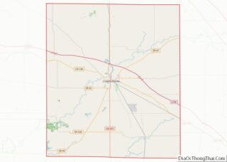
| State: | Indiana |
| County: | Montgomery County |
| Elevation: | 807 ft (246 m) |
| Total Area: | 0.27 sq mi (0.71 km²) |
| Land Area: | 0.27 sq mi (0.71 km²) |
| Water Area: | 0.00 sq mi (0.00 km²) |
| Total Population: | 559 |
| Population Density: | 2,055.15/sq mi (792.60/km²) |
| ZIP code: | 47965 |
| Area code: | 765 |
| FIPS code: | 1853262 |
| GNISfeature ID: | 449700 |
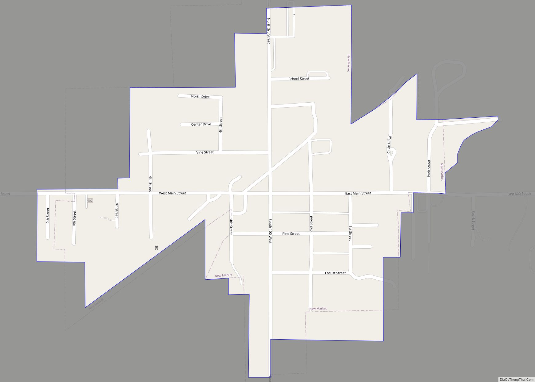
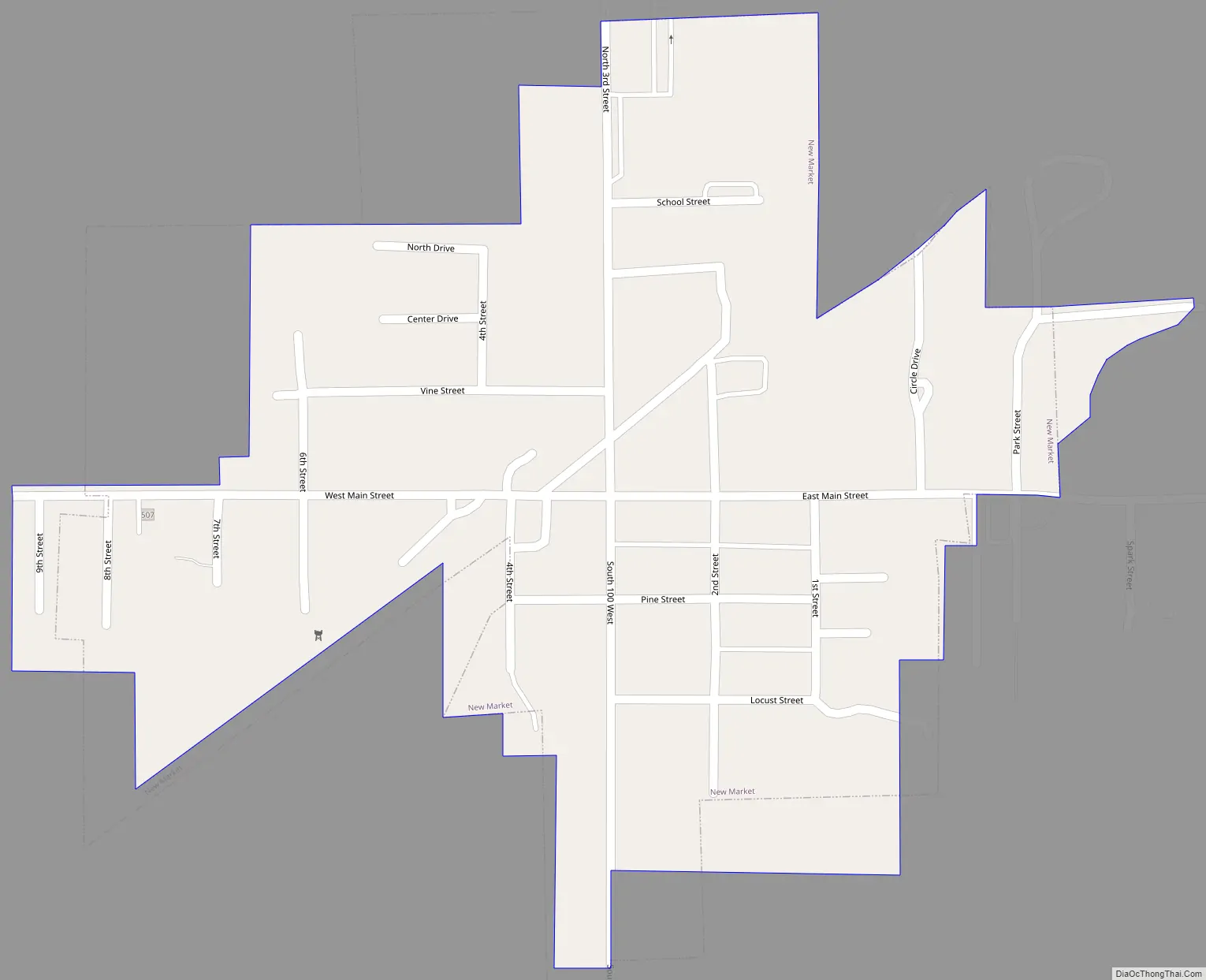
Online Interactive Map
Click on ![]() to view map in "full screen" mode.
to view map in "full screen" mode.
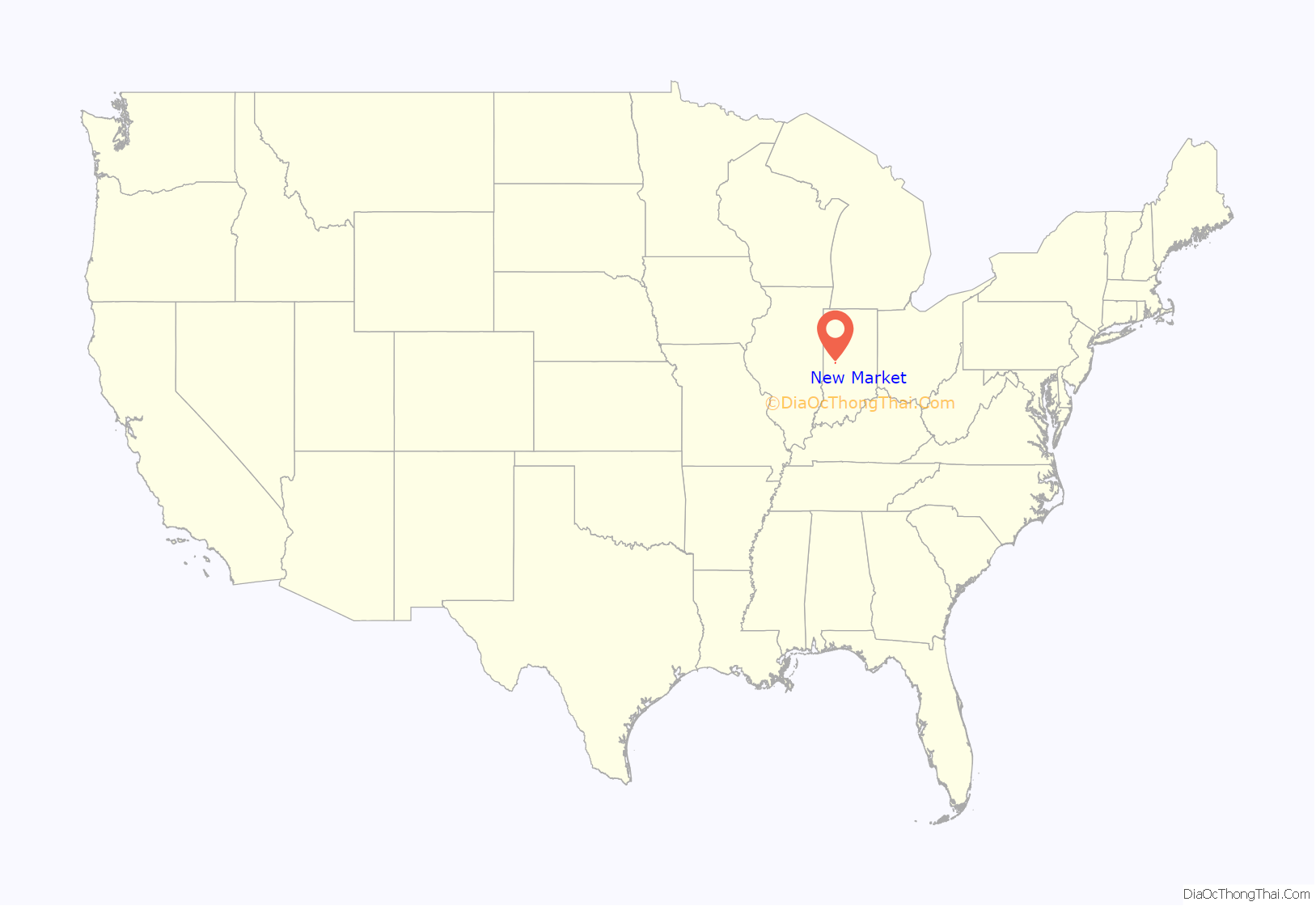
New Market location map. Where is New Market town?

History
The town of New Market was platted in 1872 by Joseph White Sr., Carson Wray Sr., Joseph Kelsey and William K. White, during the construction of the S.C.L & W. Railway through the area. The construction of the line was to serve the cities of Frankfort, Crawfordsville and Terre Haute. In southern Montgomery County it passed through the communities of New Market, Waveland, Browns Valley, Crawfordsville, and Lake Holiday. The line was later sold to the Pennsylvania Railroad and abandoned in the 1970s. The post office at New Market has been in operation since 1872.
In 1893, during the run-up to Prohibition, citizens of New Market burned a saloon owned by Jake Feel; a second saloon, owned by Joe Haskins, was burned in December 1894.
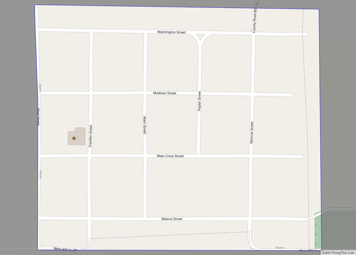
New Market Road Map
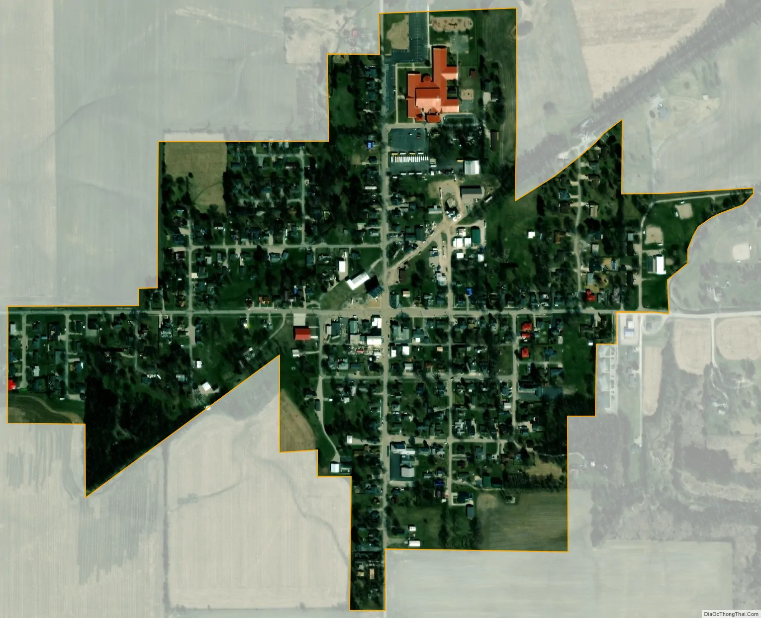
New Market city Satellite Map
Geography
New Market is located in southern Montgomery County at 39°57′7″N 86°55′15″W / 39.95194°N 86.92083°W / 39.95194; -86.92083 (39.951943, -86.920766). The town lies northwest of Indianapolis, just west of U.S. Route 231 and east of State Road 47. It is 7 miles (11 km) south of Crawfordsville, the Montgomery county seat.
According to the U.S. Census Bureau, New Market has a total area of 0.27 square miles (0.70 km), all land. Rattlesnake Creek passes just northeast of the town, flowing northwest to Sugar Creek, a tributary of the Wabash River.
See also
Map of Indiana State and its subdivision:- Adams
- Allen
- Bartholomew
- Benton
- Blackford
- Boone
- Brown
- Carroll
- Cass
- Clark
- Clay
- Clinton
- Crawford
- Daviess
- De Kalb
- Dearborn
- Decatur
- Delaware
- Dubois
- Elkhart
- Fayette
- Floyd
- Fountain
- Franklin
- Fulton
- Gibson
- Grant
- Greene
- Hamilton
- Hancock
- Harrison
- Hendricks
- Henry
- Howard
- Huntington
- Jackson
- Jasper
- Jay
- Jefferson
- Jennings
- Johnson
- Knox
- Kosciusko
- LaGrange
- Lake
- Lake Michigan
- LaPorte
- Lawrence
- Madison
- Marion
- Marshall
- Martin
- Miami
- Monroe
- Montgomery
- Morgan
- Newton
- Noble
- Ohio
- Orange
- Owen
- Parke
- Perry
- Pike
- Porter
- Posey
- Pulaski
- Putnam
- Randolph
- Ripley
- Rush
- Saint Joseph
- Scott
- Shelby
- Spencer
- Starke
- Steuben
- Sullivan
- Switzerland
- Tippecanoe
- Tipton
- Union
- Vanderburgh
- Vermillion
- Vigo
- Wabash
- Warren
- Warrick
- Washington
- Wayne
- Wells
- White
- Whitley
- Alabama
- Alaska
- Arizona
- Arkansas
- California
- Colorado
- Connecticut
- Delaware
- District of Columbia
- Florida
- Georgia
- Hawaii
- Idaho
- Illinois
- Indiana
- Iowa
- Kansas
- Kentucky
- Louisiana
- Maine
- Maryland
- Massachusetts
- Michigan
- Minnesota
- Mississippi
- Missouri
- Montana
- Nebraska
- Nevada
- New Hampshire
- New Jersey
- New Mexico
- New York
- North Carolina
- North Dakota
- Ohio
- Oklahoma
- Oregon
- Pennsylvania
- Rhode Island
- South Carolina
- South Dakota
- Tennessee
- Texas
- Utah
- Vermont
- Virginia
- Washington
- West Virginia
- Wisconsin
- Wyoming