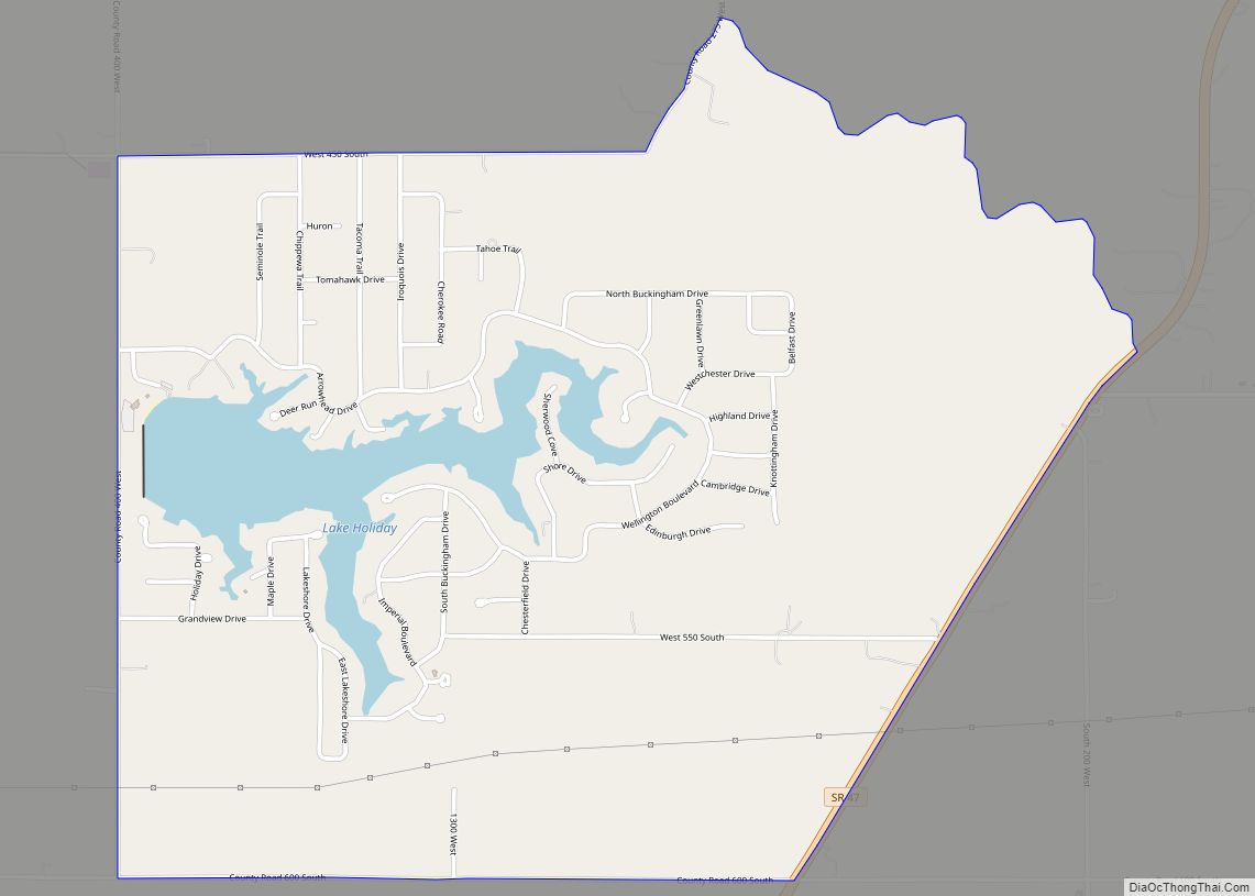
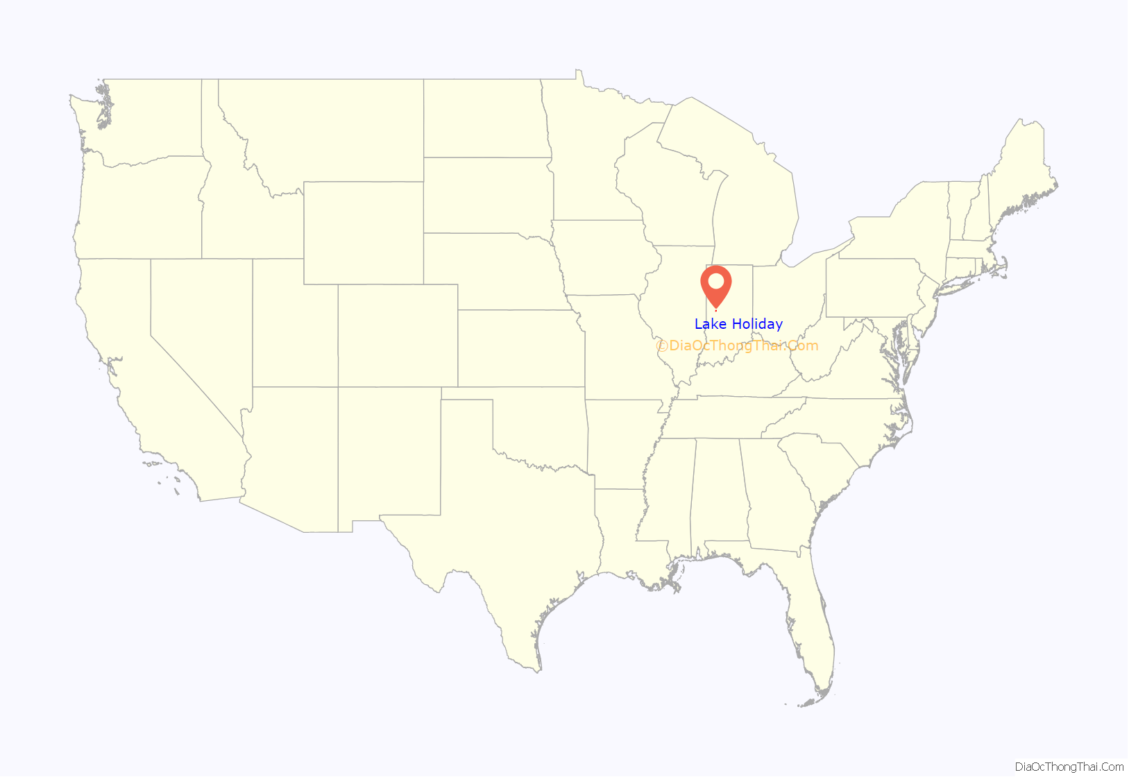
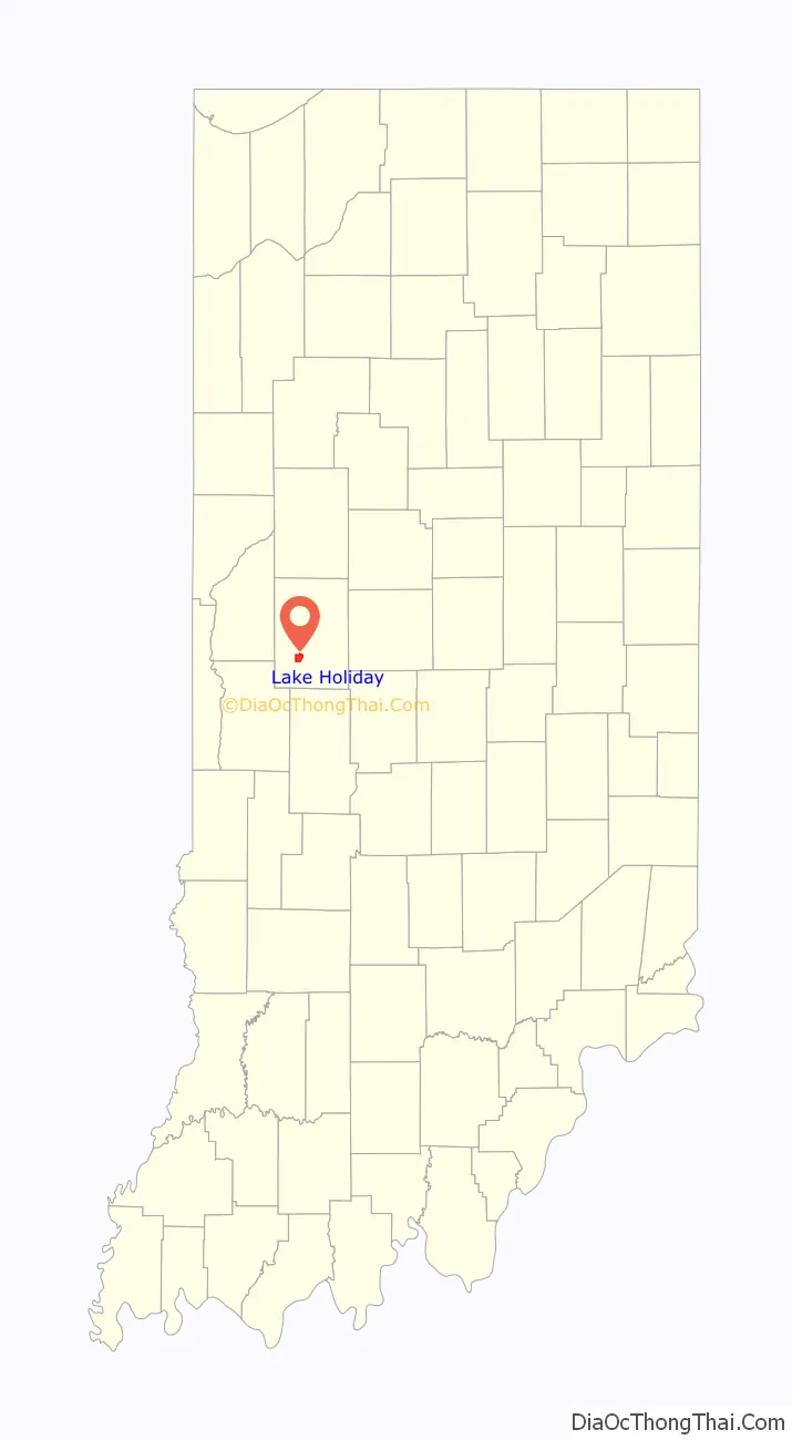
Lake Holiday is an unincorporated community and census-designated place (CDP) in Union Township, Montgomery County, in the U.S. state of Indiana. It is a private community on the banks of its eponymous body of water. As of the 2020 census, the community had a population of 921 residents.
The community contains the subdivisions of Holiday Shores, Royal Hills, Imperial Woods, Wellington Villa, Cambridge Shores, Indian Hills, Sherwood Forest, and Seneca Hills. With more than 360 houses and 1,365 lots, Lake Holiday is larger than several incorporated towns in Montgomery County.
| Name: | Lake Holiday CDP |
|---|---|
| LSAD Code: | 57 |
| LSAD Description: | CDP (suffix) |
| State: | Indiana |
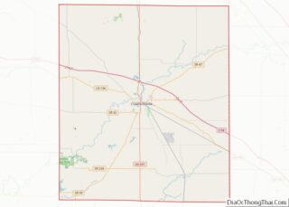
| County: | Montgomery County |
| Elevation: | 774 ft (236 m) |
| Total Area: | 2.78 sq mi (7.20 km²) |
| Land Area: | 2.59 sq mi (6.71 km²) |
| Water Area: | 0.19 sq mi (0.49 km²) |
| Total Population: | 921 |
| Population Density: | 355.60/sq mi (137.32/km²) |
| ZIP code: | 47933 (Crawfordsville) |
| Area code: | 765 |
| FIPS code: | 1841211 |
| GNISfeature ID: | 2629896 |
Online Interactive Map
Click on ![]() to view map in "full screen" mode.
to view map in "full screen" mode.
Lake Holiday location map. Where is Lake Holiday CDP?
History
Many of the older houses in the community were built in the early 1960s, as was the dam that created Lake Holiday. In March 1993, the Montgomery County Circuit Court approved a district plan that reorganized the governance of the community into two major bodies: the Lake Holiday Conservancy District, which owns and is responsible for the lake, dam, boat ramps, parks, clubhouse, drainage, and maintenance building; and the Lake Holiday Property Owners Association, which maintains the roads and is responsible for housing and lot developments. It is a tax-exempt entity.
According to its website, the Lake Holiday area now “covers 750 acres, has 780 property owners, 369 homes, and 1,296 privately owned lots. The lake itself covers 150 acres and has an average depth of 10 feet with depths up to 20 feet near the dam. There are many miles of shoreline along the lake and approximately 16 miles of roadway.”
The clubhouse hosts community breakfasts, regular card-playing events of a social nature, Easter egg hunts, and other seasonal activities. There is a crappie fishing tournament on the lake each May. In summer, bass fishing tournaments are held on Thursdays (weather permitting).
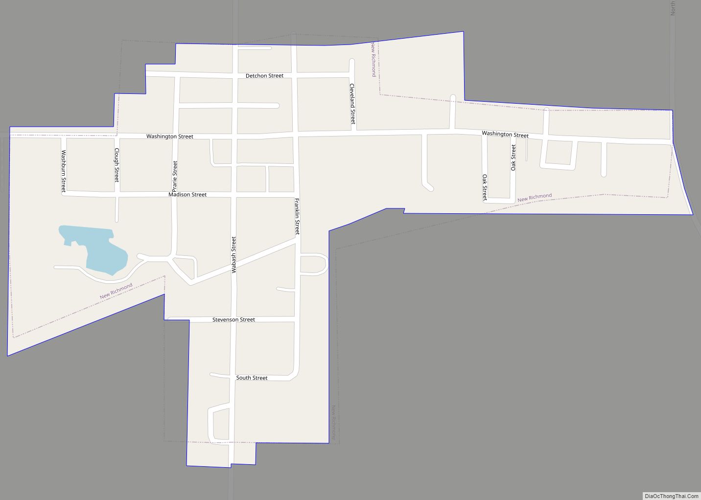
Lake Holiday Road Map

Lake Holiday city Satellite Map

Geography
Lake Holiday is in southwestern Montgomery County, 7 miles (11 km) southwest of Crawfordsville, the county seat. It is on the west side of Indiana State Road 47, between County Roads 400 W & 550 S., and is just west of the town of New Market. Its offices are located in the lake’s clubhouse at 5000 South 400 West, with a Crawfordsville mailing address.
The lake, community, and its various subdivisions are all located in Union Township. It should not be confused with the campground of the same name.
According to the U.S. Census Bureau, the Lake Holiday CDP has a total area of 2.78 square miles (7.20 km), of which 2.59 square miles (6.71 km) are land, while 0.19 square miles (0.49 km), or 6.83% of the CDP area, are water. The lake is built on Corner Creek, which flows west to Sugar Creek at the western edge of Union Township. Sugar Creek flows southwest to the Wabash River south of Newport.
See also
Map of Indiana State and its subdivision:- Adams
- Allen
- Bartholomew
- Benton
- Blackford
- Boone
- Brown
- Carroll
- Cass
- Clark
- Clay
- Clinton
- Crawford
- Daviess
- De Kalb
- Dearborn
- Decatur
- Delaware
- Dubois
- Elkhart
- Fayette
- Floyd
- Fountain
- Franklin
- Fulton
- Gibson
- Grant
- Greene
- Hamilton
- Hancock
- Harrison
- Hendricks
- Henry
- Howard
- Huntington
- Jackson
- Jasper
- Jay
- Jefferson
- Jennings
- Johnson
- Knox
- Kosciusko
- LaGrange
- Lake
- Lake Michigan
- LaPorte
- Lawrence
- Madison
- Marion
- Marshall
- Martin
- Miami
- Monroe
- Montgomery
- Morgan
- Newton
- Noble
- Ohio
- Orange
- Owen
- Parke
- Perry
- Pike
- Porter
- Posey
- Pulaski
- Putnam
- Randolph
- Ripley
- Rush
- Saint Joseph
- Scott
- Shelby
- Spencer
- Starke
- Steuben
- Sullivan
- Switzerland
- Tippecanoe
- Tipton
- Union
- Vanderburgh
- Vermillion
- Vigo
- Wabash
- Warren
- Warrick
- Washington
- Wayne
- Wells
- White
- Whitley
- Alabama
- Alaska
- Arizona
- Arkansas
- California
- Colorado
- Connecticut
- Delaware
- District of Columbia
- Florida
- Georgia
- Hawaii
- Idaho
- Illinois
- Indiana
- Iowa
- Kansas
- Kentucky
- Louisiana
- Maine
- Maryland
- Massachusetts
- Michigan
- Minnesota
- Mississippi
- Missouri
- Montana
- Nebraska
- Nevada
- New Hampshire
- New Jersey
- New Mexico
- New York
- North Carolina
- North Dakota
- Ohio
- Oklahoma
- Oregon
- Pennsylvania
- Rhode Island
- South Carolina
- South Dakota
- Tennessee
- Texas
- Utah
- Vermont
- Virginia
- Washington
- West Virginia
- Wisconsin
- Wyoming