Grass Lake is a village in Jackson County in the U.S. state of Michigan. The population was 1,173 at the 2010 census. The village is located just south of Interstate 94 in Grass Lake Township.
| Name: | Grass Lake village |
|---|---|
| LSAD Code: | 47 |
| LSAD Description: | village (suffix) |
| State: | Michigan |
| County: | Jackson County |
| Elevation: | 991 ft (302 m) |
| Total Area: | 0.94 sq mi (2.44 km²) |
| Land Area: | 0.94 sq mi (2.43 km²) |
| Water Area: | 0.00 sq mi (0.00 km²) |
| Total Population: | 1,105 |
| Population Density: | 1,175.53/sq mi (454.10/km²) |
| Area code: | 517 |
| FIPS code: | 2634480 |
| GNISfeature ID: | 0627210 |
Online Interactive Map
Click on ![]() to view map in "full screen" mode.
to view map in "full screen" mode.
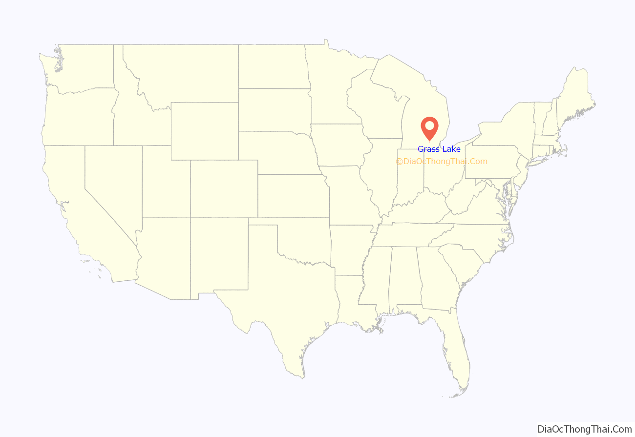
Grass Lake location map. Where is Grass Lake village?
History
In 1842, the Michigan Central Railroad bypassed the original village and built a depot 1.5 miles (2.4 km) to the west when an offer of $1.50 an acre was offered (compared to $2.00 an acre at the previous city center) [1]. The village was relocated to this new location – its current location – to be closer to the rail depot and some of the original buildings were relocated to the new site.
In 1887, Grass Lake was awarded a stone depot designed by the same architects, Spier and Rohns, and with stone from the same quarry as the Ann Arbor station. The historic Romanesque Whistle Stop Depot offers displays of local interest and is available for rental.
The Grass Lake Historical Society also operates the Coe House Museum. The home was constructed in 1871 for Henry Van Winkle, who owned and operated a hardware store and farm equipment dealership in Grass Lake. In 1972 the home was donated to the historical society by Mrs. Myrta Coe. This Tuscan Vernacular home has been furnished to represent a typical home of the Victorian Era.
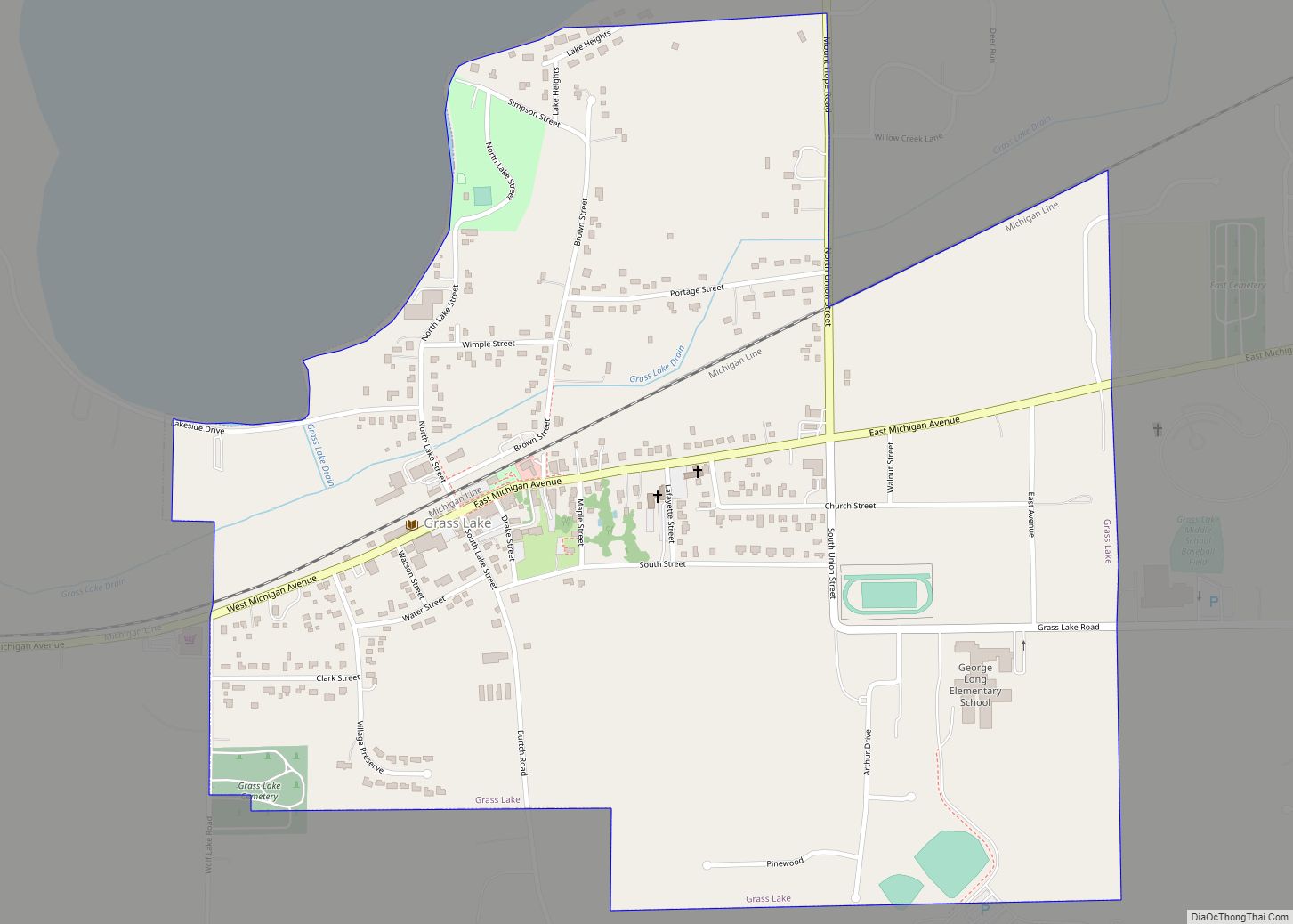
Grass Lake Road Map
Grass Lake city Satellite Map
Geography
According to the United States Census Bureau, the village has a total area of 0.94 square miles (2.43 km), all land.
See also
Map of Michigan State and its subdivision:- Alcona
- Alger
- Allegan
- Alpena
- Antrim
- Arenac
- Baraga
- Barry
- Bay
- Benzie
- Berrien
- Branch
- Calhoun
- Cass
- Charlevoix
- Cheboygan
- Chippewa
- Clare
- Clinton
- Crawford
- Delta
- Dickinson
- Eaton
- Emmet
- Genesee
- Gladwin
- Gogebic
- Grand Traverse
- Gratiot
- Hillsdale
- Houghton
- Huron
- Ingham
- Ionia
- Iosco
- Iron
- Isabella
- Jackson
- Kalamazoo
- Kalkaska
- Kent
- Keweenaw
- Lake
- Lake Hurron
- Lake Michigan
- Lake St. Clair
- Lake Superior
- Lapeer
- Leelanau
- Lenawee
- Livingston
- Luce
- Mackinac
- Macomb
- Manistee
- Marquette
- Mason
- Mecosta
- Menominee
- Midland
- Missaukee
- Monroe
- Montcalm
- Montmorency
- Muskegon
- Newaygo
- Oakland
- Oceana
- Ogemaw
- Ontonagon
- Osceola
- Oscoda
- Otsego
- Ottawa
- Presque Isle
- Roscommon
- Saginaw
- Saint Clair
- Saint Joseph
- Sanilac
- Schoolcraft
- Shiawassee
- Tuscola
- Van Buren
- Washtenaw
- Wayne
- Wexford
- Alabama
- Alaska
- Arizona
- Arkansas
- California
- Colorado
- Connecticut
- Delaware
- District of Columbia
- Florida
- Georgia
- Hawaii
- Idaho
- Illinois
- Indiana
- Iowa
- Kansas
- Kentucky
- Louisiana
- Maine
- Maryland
- Massachusetts
- Michigan
- Minnesota
- Mississippi
- Missouri
- Montana
- Nebraska
- Nevada
- New Hampshire
- New Jersey
- New Mexico
- New York
- North Carolina
- North Dakota
- Ohio
- Oklahoma
- Oregon
- Pennsylvania
- Rhode Island
- South Carolina
- South Dakota
- Tennessee
- Texas
- Utah
- Vermont
- Virginia
- Washington
- West Virginia
- Wisconsin
- Wyoming
