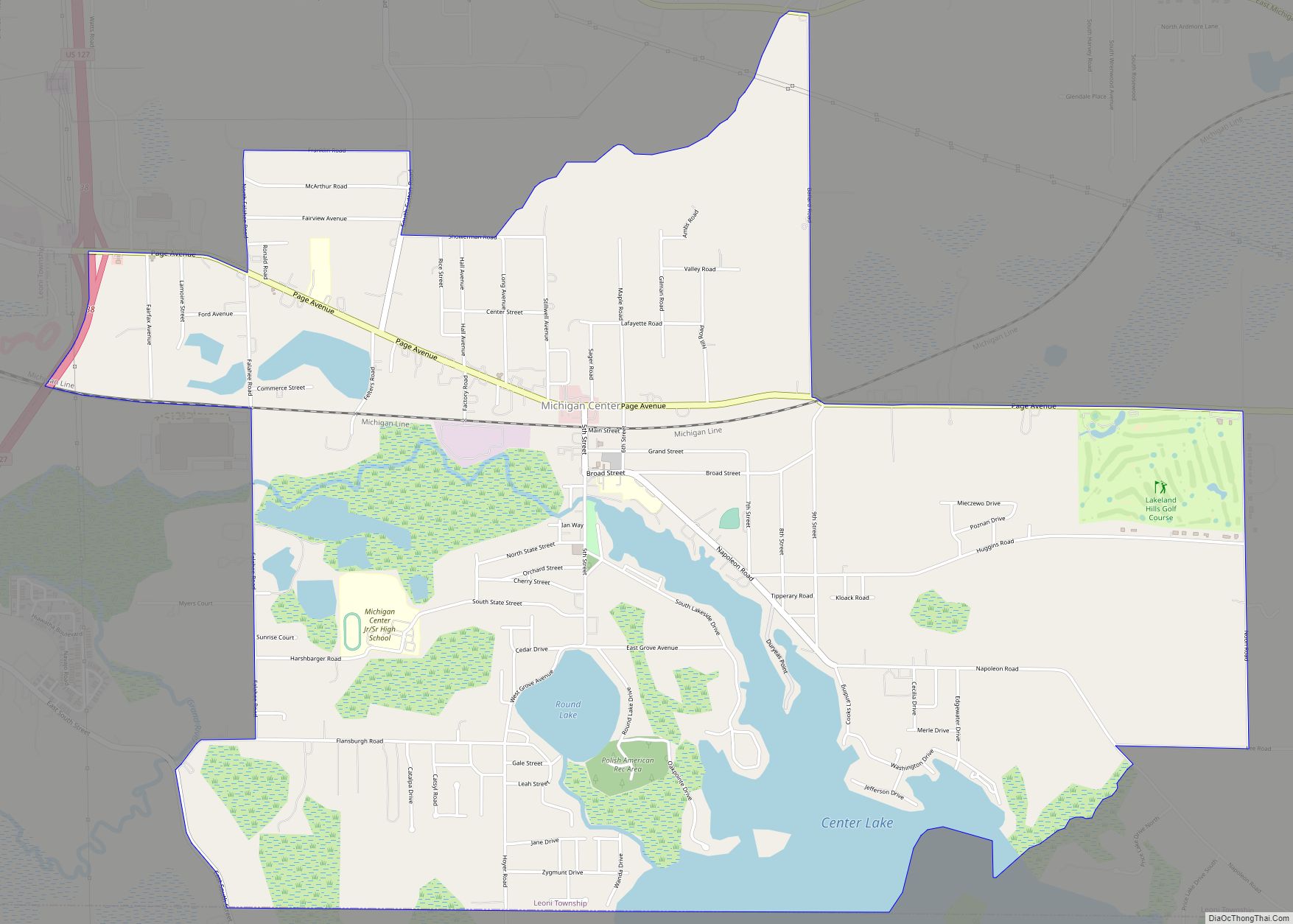
Michigan Center is an unincorporated community and census-designated place (CDP) in Jackson County in the U.S. state of Michigan. The population was 4,672 at the 2010 census. The CDP is located within Leoni Township on the eastern border of the city of Jackson.
Michigan Center was platted as “Michigan Centre” in 1837 by Abel Fitch and Paul Ring, although there were settlements in the area from at least 1834. The name was presumably derived from the proximity to the Michigan meridian which divided the state into eastern and western portions for surveying. The community is not close to any sort of geographical center of the state. Fitch became the first postmaster in 1838.
Michigan Center began developing as a mill town on a tributary of the Grand River. There was a station on the Michigan Central Railroad. However, nearby Jackson rapidly outpaced Michigan Center, which has since become a bedroom community to the city.
| Name: | Michigan Center CDP |
|---|---|
| LSAD Code: | 57 |
| LSAD Description: | CDP (suffix) |
| State: | Michigan |
| County: | Jackson County |
| Elevation: | 945 ft (288 m) |
| Total Area: | 5.70 sq mi (14.76 km²) |
| Land Area: | 5.04 sq mi (13.06 km²) |
| Water Area: | 0.66 sq mi (1.70 km²) |
| Total Population: | 4,609 |
| Population Density: | 914.30/sq mi (353.04/km²) |
| Area code: | 517 |
| FIPS code: | 2653580 |
| GNISfeature ID: | 0632205 |
Online Interactive Map
Click on ![]() to view map in "full screen" mode.
to view map in "full screen" mode.
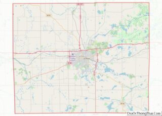
Michigan Center location map. Where is Michigan Center CDP?
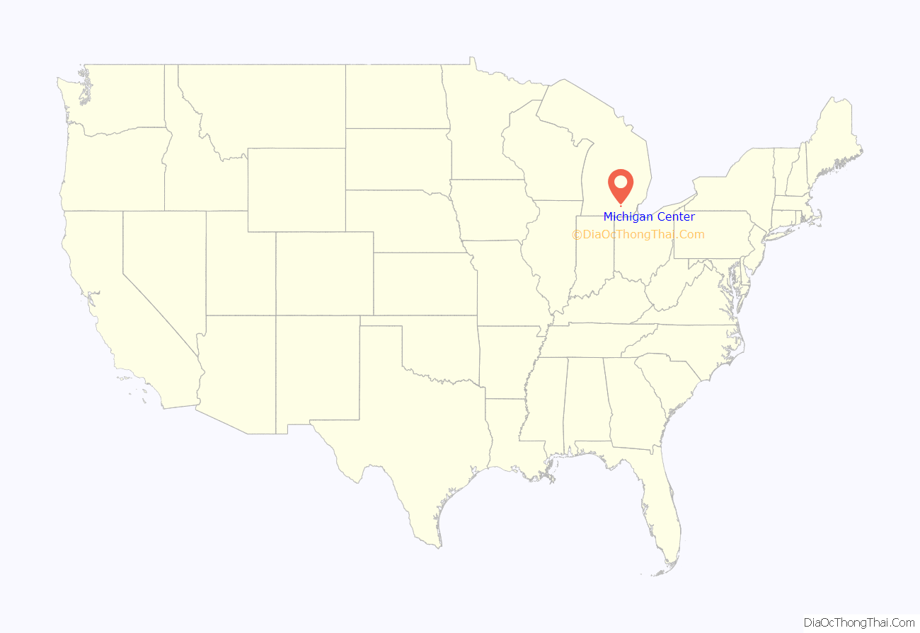
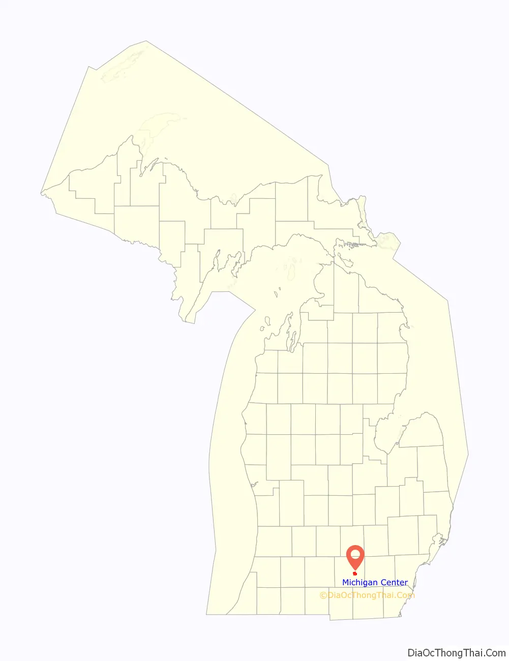
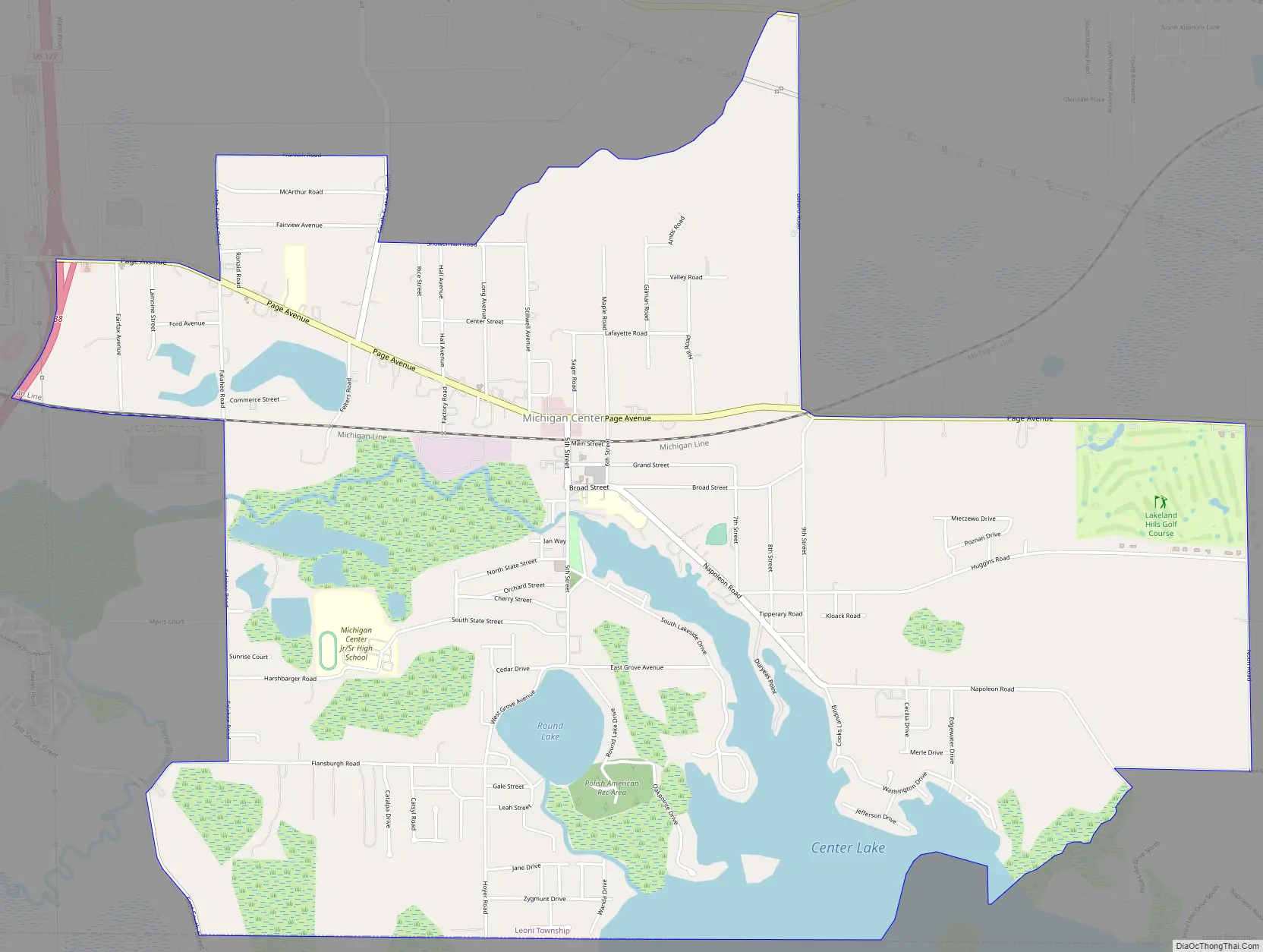
Michigan Center Road Map
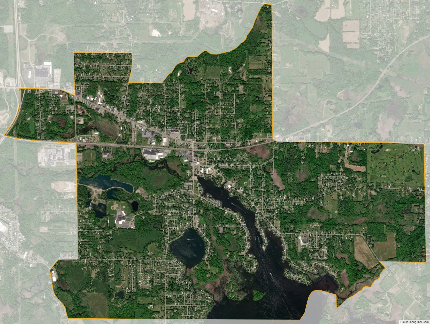
Michigan Center city Satellite Map
Geography
According to the United States Census Bureau, the CDP has a total area of 5.70 square miles (14.76 km), of which 5.04 square miles (13.05 km) is land and 0.66 square miles (1.71 km) (11.58%) is water.
Michigan Center is in eastern Jackson County, in the southern part of Leoni Township. The CDP shares a slight western border with the city of Jackson but is otherwise surrounded by Leoni Township on the north, east, and west with a southern boundary with Napoleon Township.
The community is situated primarily around the northern end of Center Lake, formed by a dam on a tributary of the Grand River. Several other nearby lakes on the same tributary form a connected chain of lakes: Round Lake, Price Lake, Moon Lake, Little Dollar Lake, Dollar Lake, Olcott Lake, Little Olcott Lake, Wolf Lake and Little Wolf Lake. Local residents travel between the first several lakes using small boats or personal watercraft.
See also
Map of Michigan State and its subdivision:- Alcona
- Alger
- Allegan
- Alpena
- Antrim
- Arenac
- Baraga
- Barry
- Bay
- Benzie
- Berrien
- Branch
- Calhoun
- Cass
- Charlevoix
- Cheboygan
- Chippewa
- Clare
- Clinton
- Crawford
- Delta
- Dickinson
- Eaton
- Emmet
- Genesee
- Gladwin
- Gogebic
- Grand Traverse
- Gratiot
- Hillsdale
- Houghton
- Huron
- Ingham
- Ionia
- Iosco
- Iron
- Isabella
- Jackson
- Kalamazoo
- Kalkaska
- Kent
- Keweenaw
- Lake
- Lake Hurron
- Lake Michigan
- Lake St. Clair
- Lake Superior
- Lapeer
- Leelanau
- Lenawee
- Livingston
- Luce
- Mackinac
- Macomb
- Manistee
- Marquette
- Mason
- Mecosta
- Menominee
- Midland
- Missaukee
- Monroe
- Montcalm
- Montmorency
- Muskegon
- Newaygo
- Oakland
- Oceana
- Ogemaw
- Ontonagon
- Osceola
- Oscoda
- Otsego
- Ottawa
- Presque Isle
- Roscommon
- Saginaw
- Saint Clair
- Saint Joseph
- Sanilac
- Schoolcraft
- Shiawassee
- Tuscola
- Van Buren
- Washtenaw
- Wayne
- Wexford
- Alabama
- Alaska
- Arizona
- Arkansas
- California
- Colorado
- Connecticut
- Delaware
- District of Columbia
- Florida
- Georgia
- Hawaii
- Idaho
- Illinois
- Indiana
- Iowa
- Kansas
- Kentucky
- Louisiana
- Maine
- Maryland
- Massachusetts
- Michigan
- Minnesota
- Mississippi
- Missouri
- Montana
- Nebraska
- Nevada
- New Hampshire
- New Jersey
- New Mexico
- New York
- North Carolina
- North Dakota
- Ohio
- Oklahoma
- Oregon
- Pennsylvania
- Rhode Island
- South Carolina
- South Dakota
- Tennessee
- Texas
- Utah
- Vermont
- Virginia
- Washington
- West Virginia
- Wisconsin
- Wyoming