Norway is a city in Dickinson County in the U.S. state of Michigan. The population was 2,845 at the 2010 census. It is part of the Iron Mountain, MI–WI Micropolitan Statistical Area.
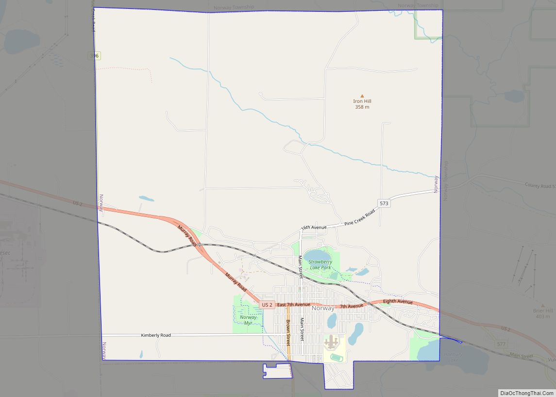
The city is in the southwest of Norway Township, but is politically independent. It is on U.S. Highway 2 (US 2), which connects with M-95 about six miles (ten kilometers) west in Iron Mountain and with US 41 about 21 miles (34 kilometers) to the east. US 141 north merges with US 2 about four miles (six kilometers) west of the city. US 8 has its eastern terminus in the city and crosses the Menominee River to continue west in Wisconsin.
| Name: | Norway city |
|---|---|
| LSAD Code: | 25 |
| LSAD Description: | city (suffix) |
| State: | Michigan |
| County: | Dickinson County |
| Elevation: | 951 ft (290 m) |
| Total Area: | 9.55 sq mi (24.73 km²) |
| Land Area: | 9.46 sq mi (24.51 km²) |
| Water Area: | 0.08 sq mi (0.22 km²) |
| Total Population: | 2,840 |
| Population Density: | 300.05/sq mi (115.85/km²) |
| ZIP code: | 49870 |
| Area code: | 906 |
| FIPS code: | 2659220 |
| GNISfeature ID: | 0633751 |
| Website: | www.norwaymi.com |
Online Interactive Map
Click on ![]() to view map in "full screen" mode.
to view map in "full screen" mode.
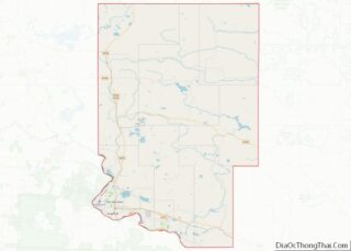
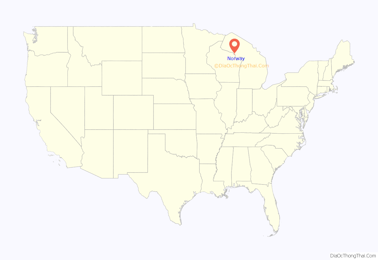
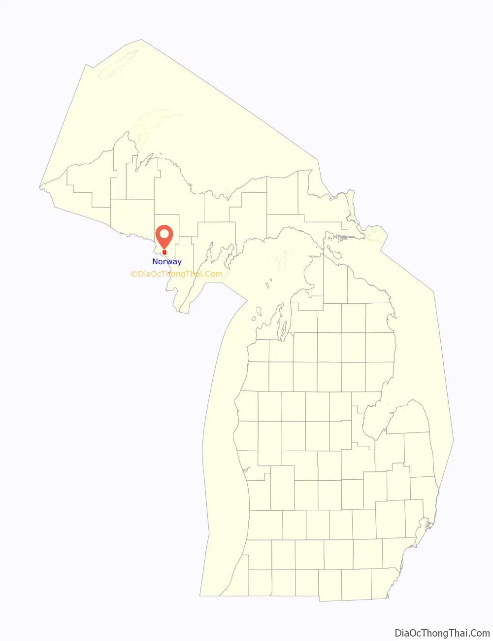
Norway location map. Where is Norway city?
History
A post office called Norway was established in 1891. The city was named from a forest of Norway pines near the original town site.
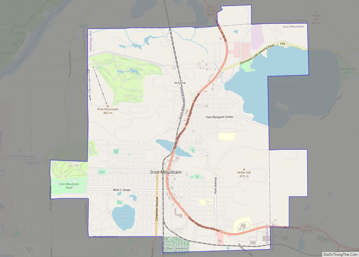
Norway Road Map
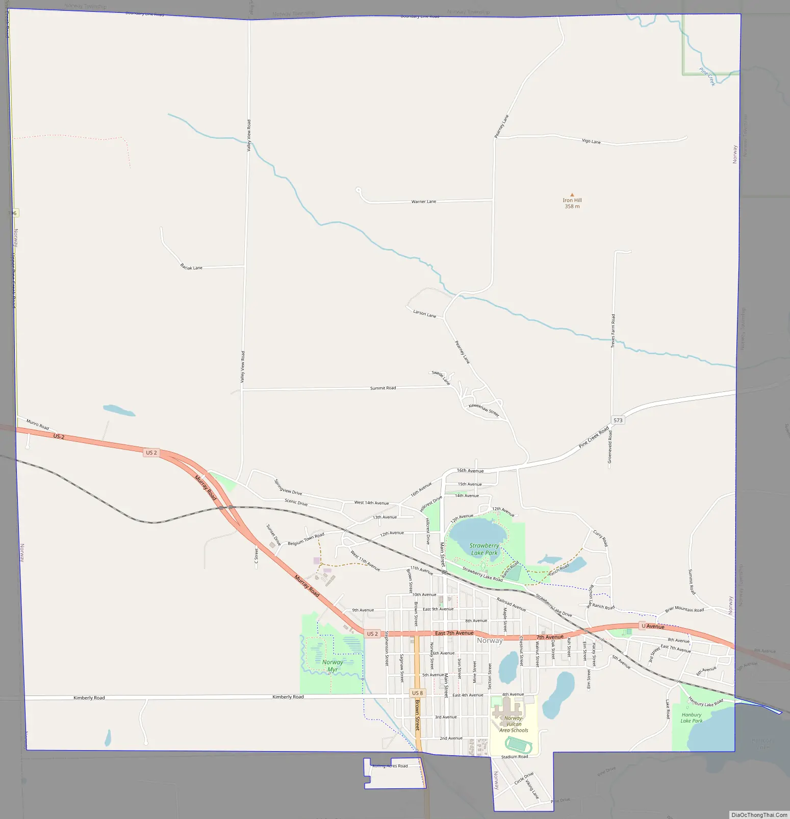
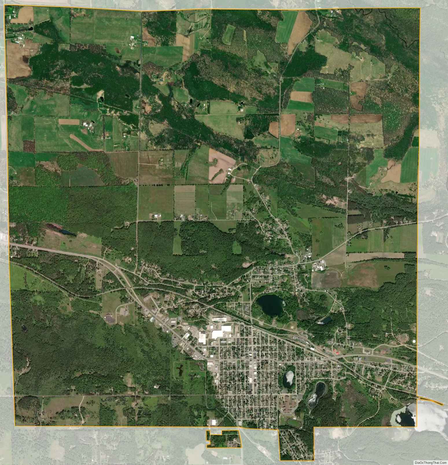
Norway city Satellite Map
Geography
According to the United States Census Bureau, the city has a total area of 8.80 square miles (22.79 km), of which, 8.72 square miles (22.58 km) is land and 0.08 square miles (0.21 km) is water.
See also
Map of Michigan State and its subdivision:- Alcona
- Alger
- Allegan
- Alpena
- Antrim
- Arenac
- Baraga
- Barry
- Bay
- Benzie
- Berrien
- Branch
- Calhoun
- Cass
- Charlevoix
- Cheboygan
- Chippewa
- Clare
- Clinton
- Crawford
- Delta
- Dickinson
- Eaton
- Emmet
- Genesee
- Gladwin
- Gogebic
- Grand Traverse
- Gratiot
- Hillsdale
- Houghton
- Huron
- Ingham
- Ionia
- Iosco
- Iron
- Isabella
- Jackson
- Kalamazoo
- Kalkaska
- Kent
- Keweenaw
- Lake
- Lake Hurron
- Lake Michigan
- Lake St. Clair
- Lake Superior
- Lapeer
- Leelanau
- Lenawee
- Livingston
- Luce
- Mackinac
- Macomb
- Manistee
- Marquette
- Mason
- Mecosta
- Menominee
- Midland
- Missaukee
- Monroe
- Montcalm
- Montmorency
- Muskegon
- Newaygo
- Oakland
- Oceana
- Ogemaw
- Ontonagon
- Osceola
- Oscoda
- Otsego
- Ottawa
- Presque Isle
- Roscommon
- Saginaw
- Saint Clair
- Saint Joseph
- Sanilac
- Schoolcraft
- Shiawassee
- Tuscola
- Van Buren
- Washtenaw
- Wayne
- Wexford
- Alabama
- Alaska
- Arizona
- Arkansas
- California
- Colorado
- Connecticut
- Delaware
- District of Columbia
- Florida
- Georgia
- Hawaii
- Idaho
- Illinois
- Indiana
- Iowa
- Kansas
- Kentucky
- Louisiana
- Maine
- Maryland
- Massachusetts
- Michigan
- Minnesota
- Mississippi
- Missouri
- Montana
- Nebraska
- Nevada
- New Hampshire
- New Jersey
- New Mexico
- New York
- North Carolina
- North Dakota
- Ohio
- Oklahoma
- Oregon
- Pennsylvania
- Rhode Island
- South Carolina
- South Dakota
- Tennessee
- Texas
- Utah
- Vermont
- Virginia
- Washington
- West Virginia
- Wisconsin
- Wyoming