Onaway (/ˈɒnəweɪ/) is a city in Presque Isle County, just east of the Cheboygan–Presque Isle county line in the U.S. state of Michigan. The population was 880 at the 2010 census. Onaway is the Sturgeon Capital of Michigan, and there is a lake sturgeon streamside rearing facility on the nearby Black River, where the fish migrate down to the Cheboygan River and then to Lake Huron.
| Name: | Onaway city |
|---|---|
| LSAD Code: | 25 |
| LSAD Description: | city (suffix) |
| State: | Michigan |
| County: | Presque Isle County |
| Incorporated: | 1899 (village) 1903 (city) |
| Elevation: | 850 ft (259 m) |
| Total Area: | 1.63 sq mi (4.22 km²) |
| Land Area: | 1.63 sq mi (4.22 km²) |
| Water Area: | 0.00 sq mi (0.00 km²) |
| Total Population: | 890 |
| Population Density: | 546.35/sq mi (210.95/km²) |
| Area code: | 989 |
| FIPS code: | 2660680 |
| GNISfeature ID: | 0634060 |
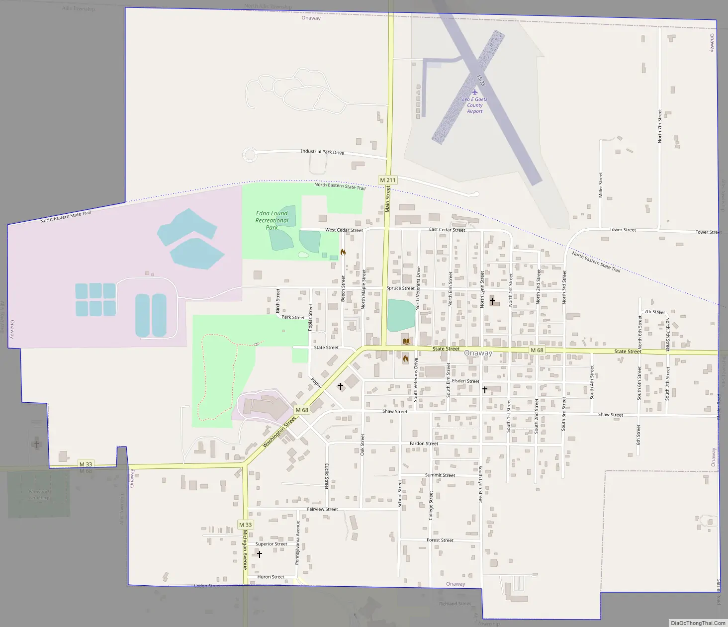
Online Interactive Map
Click on ![]() to view map in "full screen" mode.
to view map in "full screen" mode.
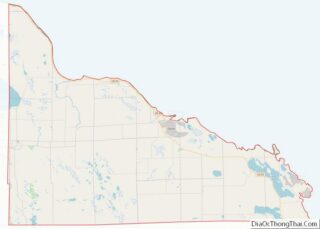
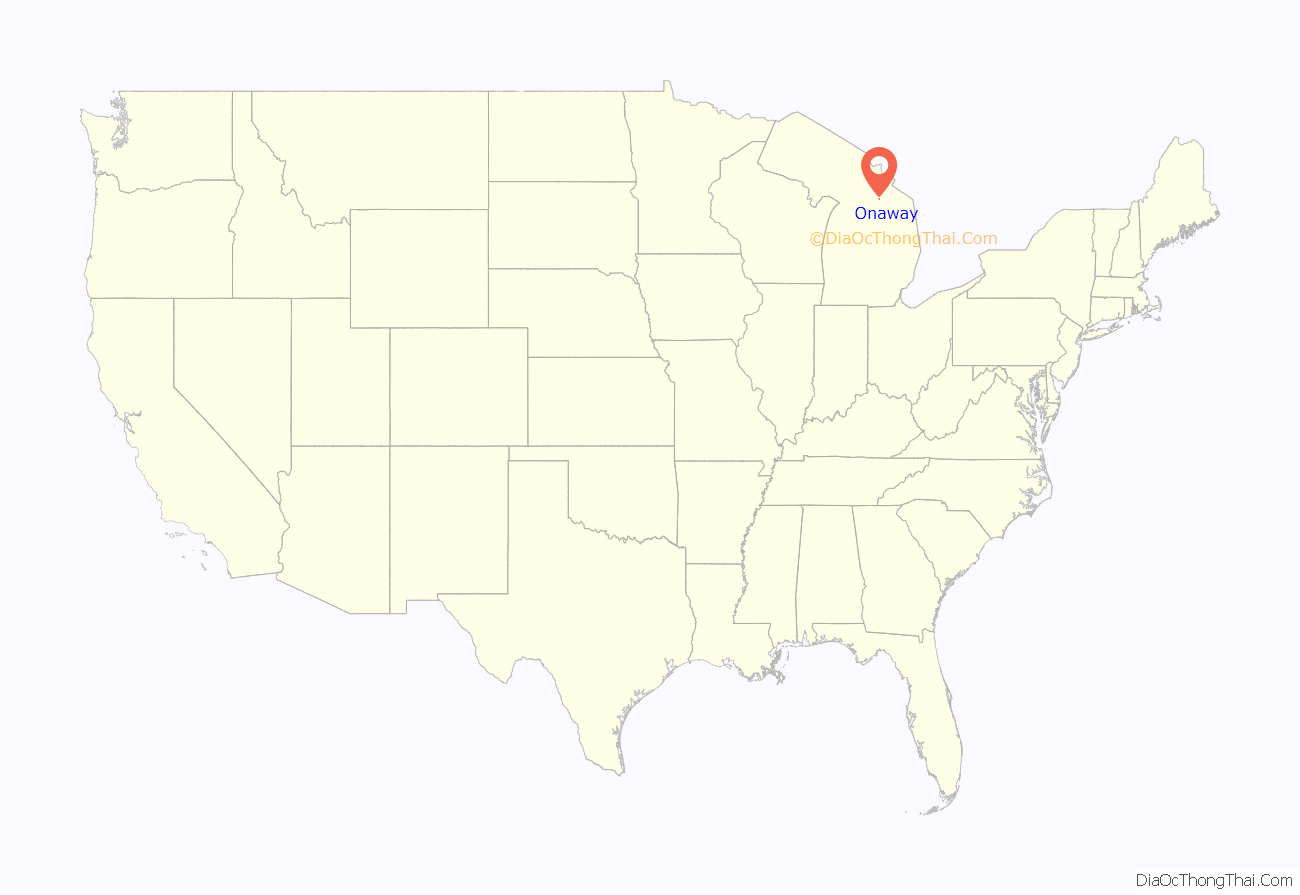
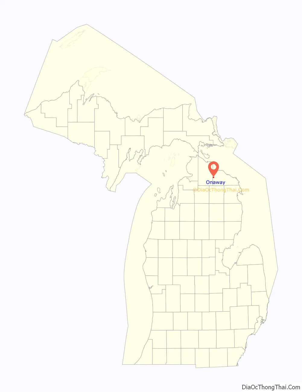
Onaway location map. Where is Onaway city?
History
This farming community received a post office open on October 23, 1882 with civil engineer Thomas E. Shaw as postmaster. This office was named Shaw for him. Arriving in 1886, Merritt Chandler had platted the community under the name of Onaway. Chandler took over as postmaster with it changing its name to Onaway on March 29, 1890. On August 18, 1893, Shaw took back the postmaster position and changed the office’s name to Adalaska. Once again, the post office was renamed back to Onaway on November 15, 1897. Onaway was incorporated as a village in 1899. Onaway soon became a city in 1903. At the beginning of the twentieth century Onaway was home to one of the world’s largest wooden bicycle wheel manufacturers, producing approximately 65% of the world’s wooden bicycle wheels.
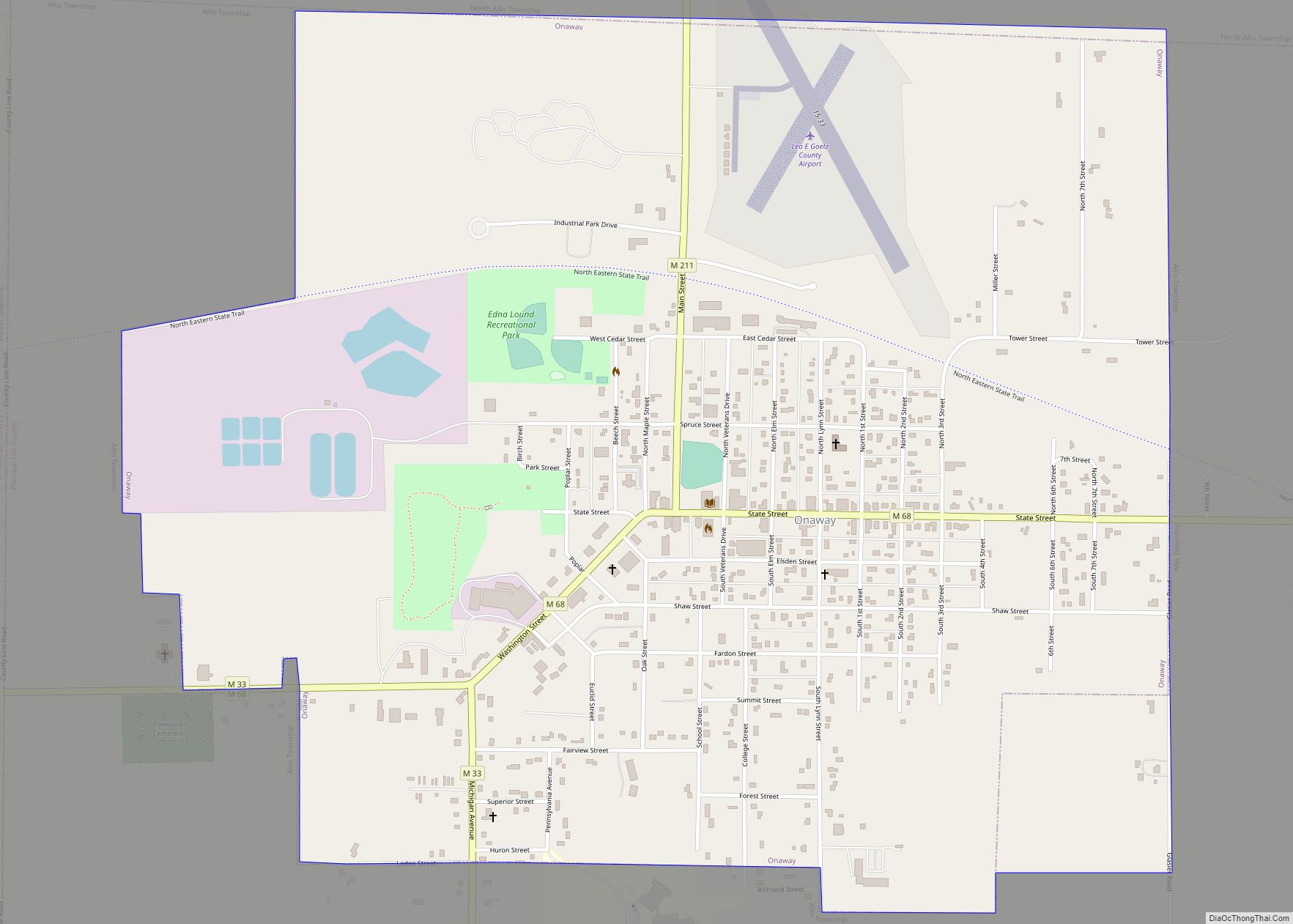
Onaway Road Map
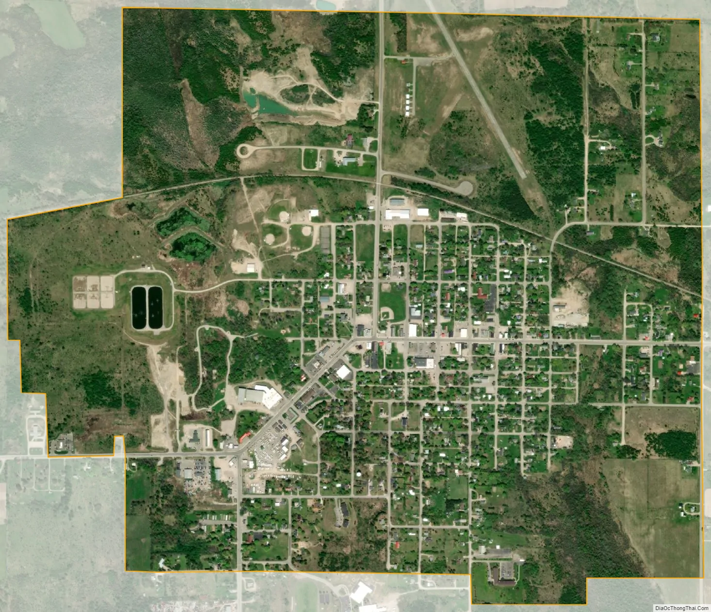
Onaway city Satellite Map
Geography
According to the United States Census Bureau, the city has a total area of 1.57 square miles (4.07 km), all land. The boundary of Cheboygan and Presque Isle counties is just east of the city.
Major highways
- M-33
- M-68
- M-211
Climate
See also
Map of Michigan State and its subdivision:- Alcona
- Alger
- Allegan
- Alpena
- Antrim
- Arenac
- Baraga
- Barry
- Bay
- Benzie
- Berrien
- Branch
- Calhoun
- Cass
- Charlevoix
- Cheboygan
- Chippewa
- Clare
- Clinton
- Crawford
- Delta
- Dickinson
- Eaton
- Emmet
- Genesee
- Gladwin
- Gogebic
- Grand Traverse
- Gratiot
- Hillsdale
- Houghton
- Huron
- Ingham
- Ionia
- Iosco
- Iron
- Isabella
- Jackson
- Kalamazoo
- Kalkaska
- Kent
- Keweenaw
- Lake
- Lake Hurron
- Lake Michigan
- Lake St. Clair
- Lake Superior
- Lapeer
- Leelanau
- Lenawee
- Livingston
- Luce
- Mackinac
- Macomb
- Manistee
- Marquette
- Mason
- Mecosta
- Menominee
- Midland
- Missaukee
- Monroe
- Montcalm
- Montmorency
- Muskegon
- Newaygo
- Oakland
- Oceana
- Ogemaw
- Ontonagon
- Osceola
- Oscoda
- Otsego
- Ottawa
- Presque Isle
- Roscommon
- Saginaw
- Saint Clair
- Saint Joseph
- Sanilac
- Schoolcraft
- Shiawassee
- Tuscola
- Van Buren
- Washtenaw
- Wayne
- Wexford
- Alabama
- Alaska
- Arizona
- Arkansas
- California
- Colorado
- Connecticut
- Delaware
- District of Columbia
- Florida
- Georgia
- Hawaii
- Idaho
- Illinois
- Indiana
- Iowa
- Kansas
- Kentucky
- Louisiana
- Maine
- Maryland
- Massachusetts
- Michigan
- Minnesota
- Mississippi
- Missouri
- Montana
- Nebraska
- Nevada
- New Hampshire
- New Jersey
- New Mexico
- New York
- North Carolina
- North Dakota
- Ohio
- Oklahoma
- Oregon
- Pennsylvania
- Rhode Island
- South Carolina
- South Dakota
- Tennessee
- Texas
- Utah
- Vermont
- Virginia
- Washington
- West Virginia
- Wisconsin
- Wyoming